 |
Monthly Climate Summary - June 2013National Weather Service, Springfield, MO |
 |
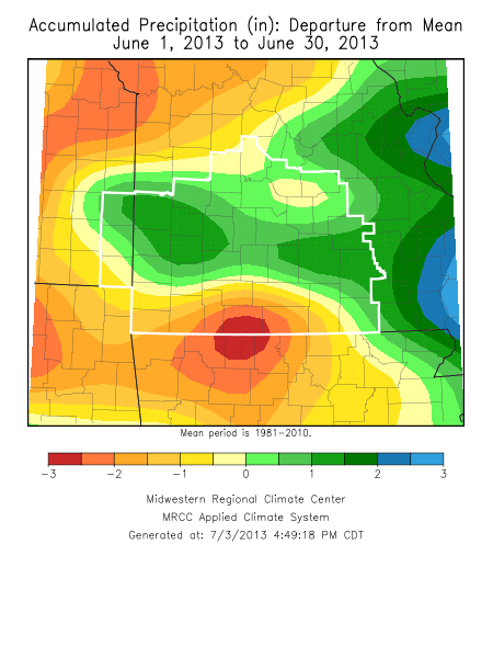
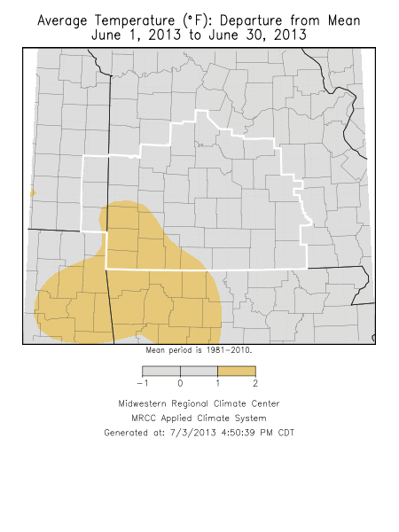
Monthly Climate OverviewThe month of June 2013 was generally wetter than normal over the northern half of the Missouri Ozarks and southeast Kansas with below normal readings in the south. Temperatures were generally around average to slightly above for much of the area. The first third of the month was generally below normal on temperatures...with much of the remainder of the month above normal. Severe storms impact the area May 31st into June 1st Extreme Rainfall and Flash Flooding in South Springfield - June 15th Note: The West Plains climate is incomplete for the month of June 2013 due to maintenence going on at the airport for a couple of weeks during the month. As a result, no monthly data will be displayed here.
|
Monthly Climate Maps
|
Monthly Climate Records
| |||||||||||||||||||||
Monthly Climate Normals
| |||||||||||||||||||||||||||||||||||||||||||||||||||||||||||||||||||||||||||||||||||||||||||||||||||||||||


 Weather Story
 Weather Map
 Local Radar