Prior to every flight, pilots should gather all information vital to the nature of the flight. This site is informational in nature and is designed to assist pilots and aircrews for flight planning and weather familiarization. It may be used in conjunction with other preflight information sources needed to satisfy all the requirements of 14 CFR 91.103 and is not to be considered as a sole source of information to meet all preflight action. Pilots can complete their regulatory-compliant preflight briefing by using other automated resources or from Flight Service at www.1800wxbrief.com or by calling 1-800-WX-BRIEF.


.AVIATION /07Z THURSDAY THROUGH MONDAY/...
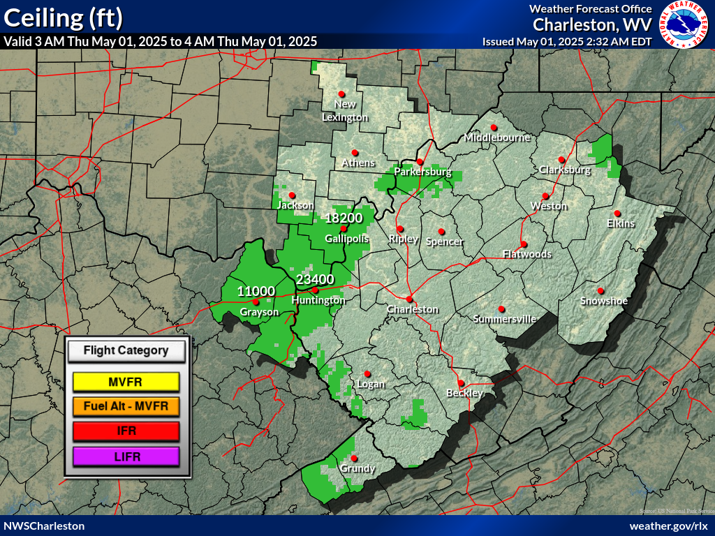
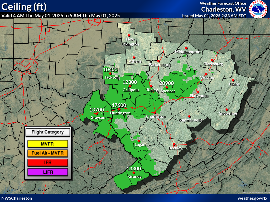
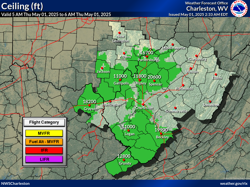
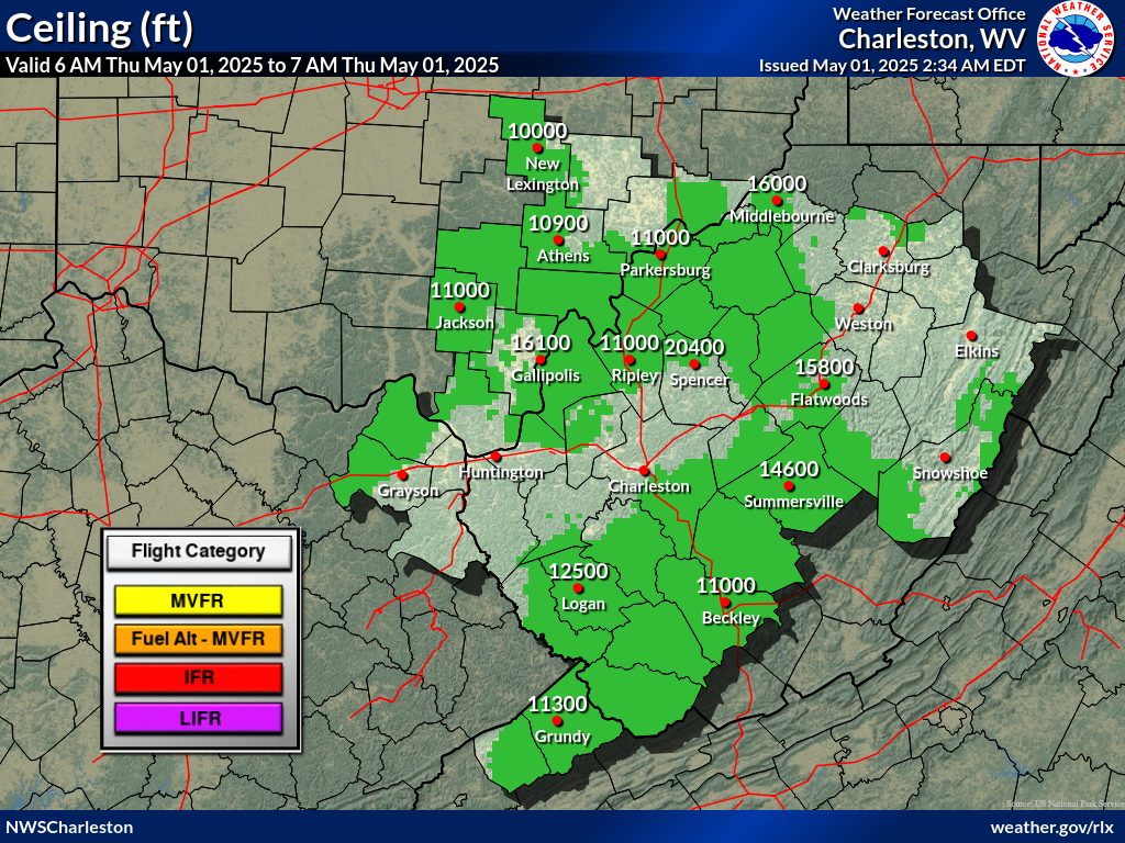
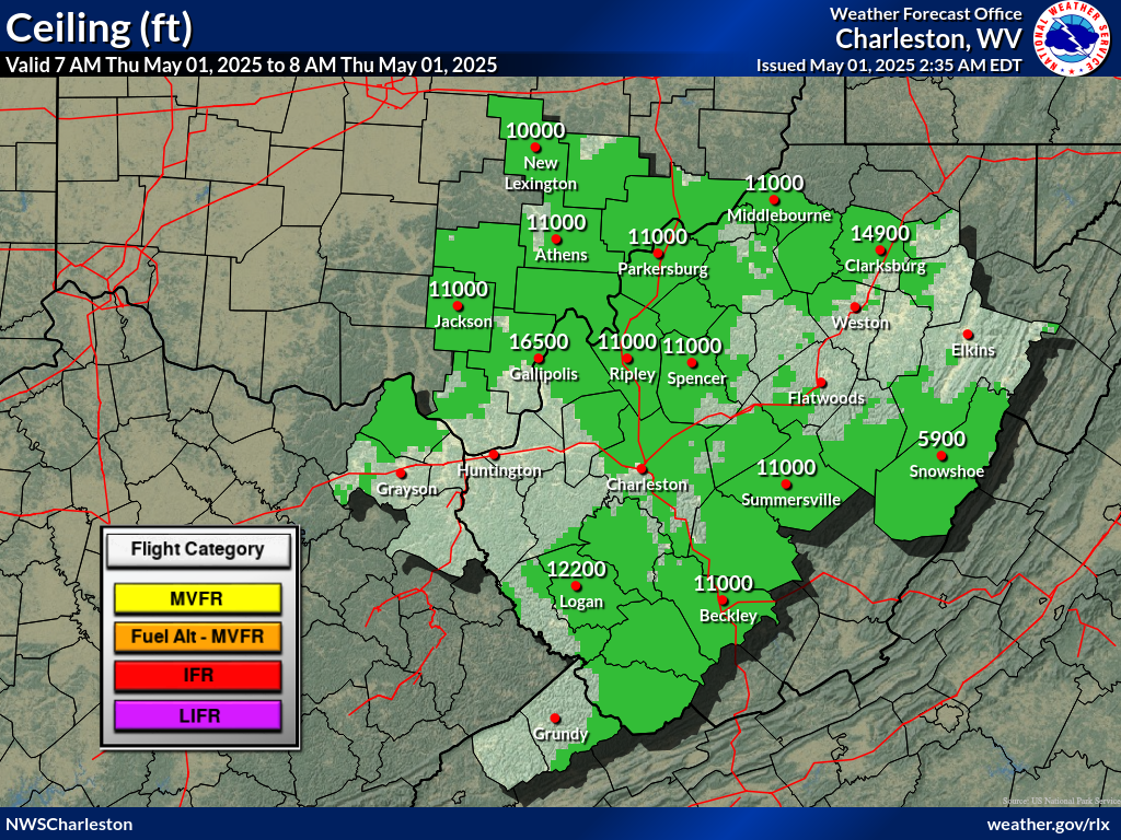
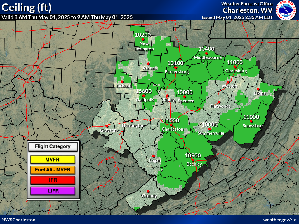
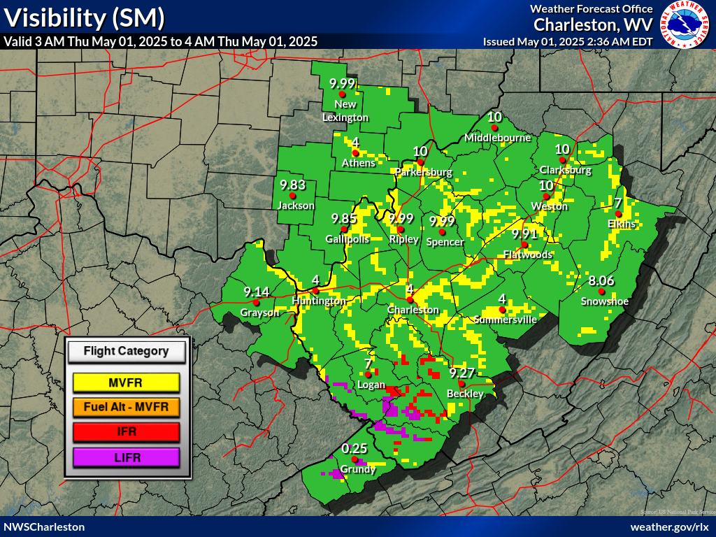
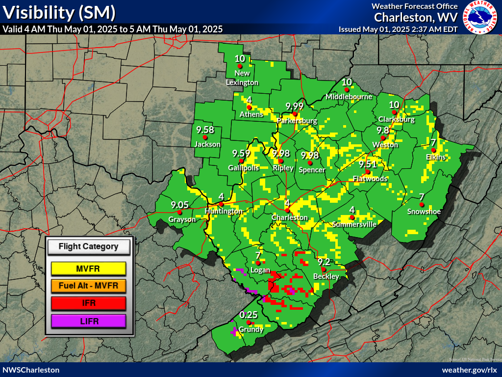
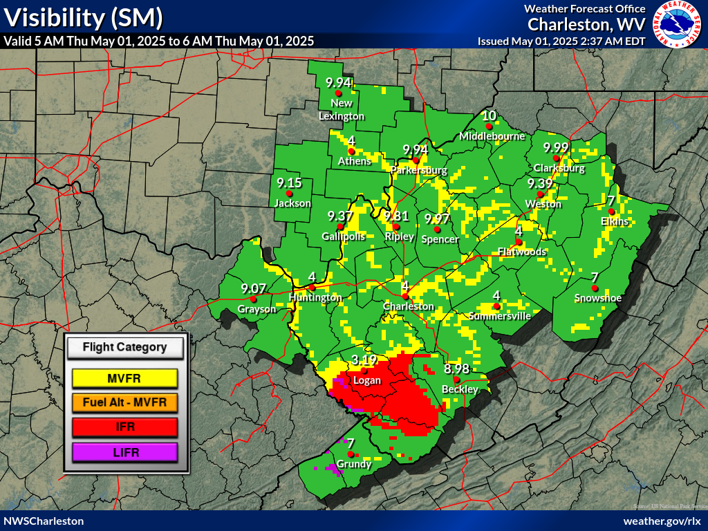
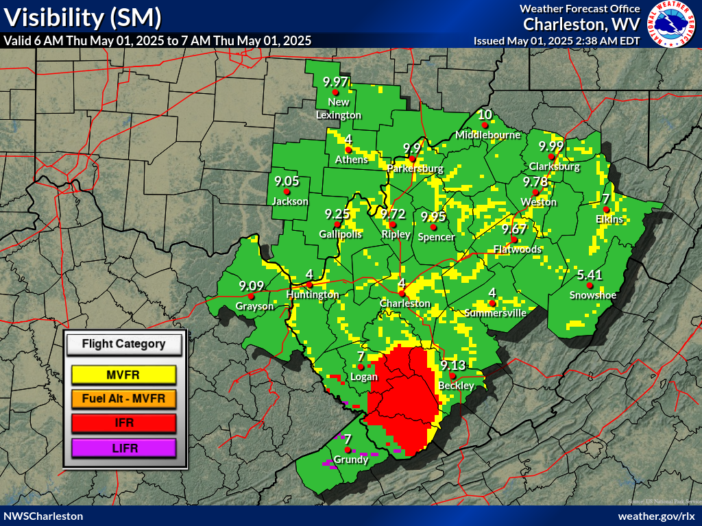
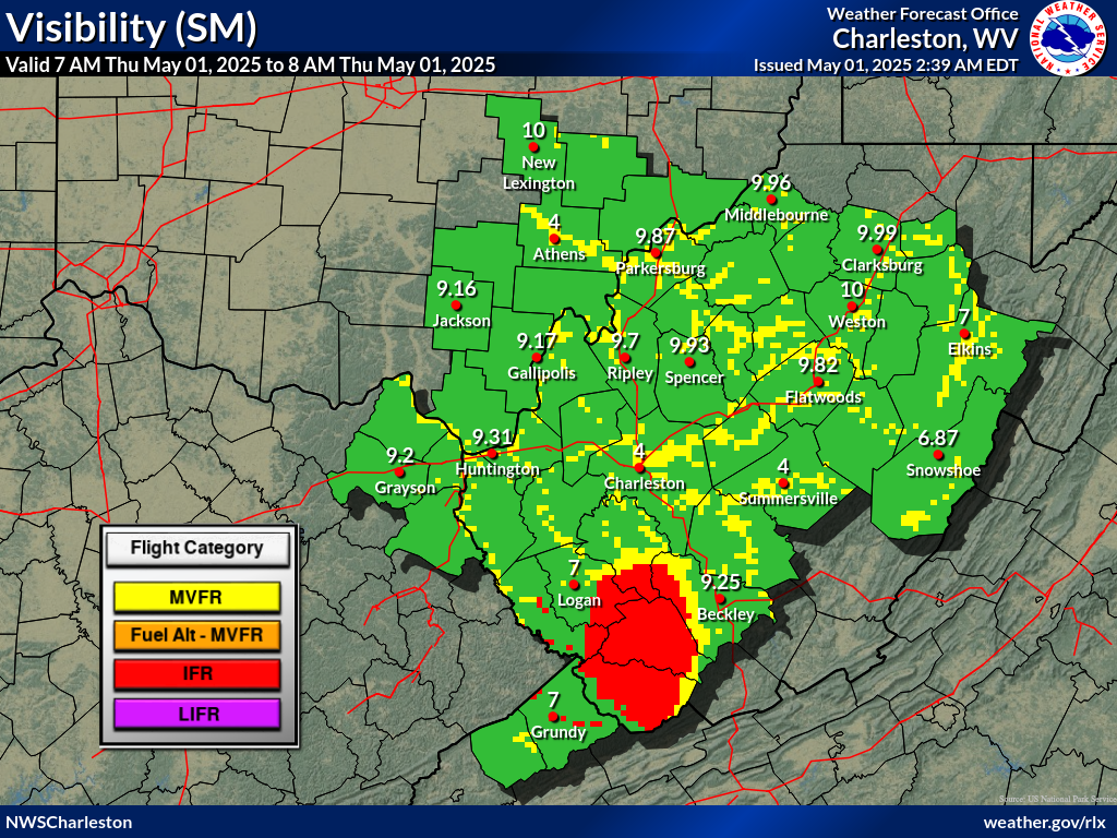
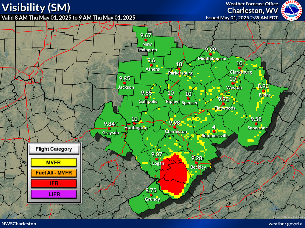
IFR or lower flight conditions are expected for all terminals except
KBKW through sunrise due to river valley fog. Improvements to VFR
are forecast to occur near 13Z, but may be as late as 14Z at EKN
based on observations from the previous morning. Haze is expected
again today, but VSBYs will remain VFR, with smoke possible INVOF
KCKB, KEKN, and KPKB. VSBY restrictions from smoke are less certain
at this time at those terminals. Otherwise, high-altitude CIGs from
the smoke layer will remain SCT-BKN through the TAF period, with
calm winds becoming west-northwesterly later this afternoon.
*GOES-19/East data outage until further notice.
*05Z METAR data has been affected by an outage.
FORECAST CONFIDENCE AND ALTERNATE SCENARIOS THROUGH 06Z FRIDAY...
FORECAST CONFIDENCE: Low for the coverage and extent of valley
fog through sunrise, then high thereafter.
AVIATION FORECAST CONFIDENCE
| Updated: 353 AM EDT Thu Jul 16 2026 |
| UTC | 07 | 08 | 09 | 10 | 11 | 12 | 13 | 14 | 15 | 16 | 17 | 18 |
| EDT | 03 | 04 | 05 | 06 | 07 | 08 | 09 | 10 | 11 | 12 | 13 | 14 |
| CRW | L | L | L | L | L | L | H | H | H | H | H | H |
| HTS | H | H | H | H | M | H | H | H | H | H | H | H |
| BKW | H | M | M | M | M | H | H | H | H | H | H | H |
| EKN | H | L | L | L | L | M | H | H | H | H | H | H |
| PKB | H | L | M | M | M | H | H | H | H | H | H | H |
| CKB | H | H | H | H | H | H | H | H | H | H | H | H |
| 3 AM | 4 AM | 5 AM | 6 AM | 7 AM | 8 AM | |
 |
 |
 |
 |
 |
 |
 |
| 3 AM | 4 AM | 5 AM | 6 AM | 7 AM | 8 AM | |
 |
 |
 |
 |
 |
 |
|
 Airports with TAFs |
  Airports without TAFs
Additional Local Information |
Regional/National Information |

