Severe weather preparedness takes awareness, planning and then action. You can't effectively take action in an imminent hazardous weather event unless you have some sort of plan in place, and you can't develop a robust hazardous weather plan unless you understand the threats you may face.
Weather records in our region date back to the late 1800s and early 1900s and that history is full of floods, severe thunderstorms, tornadoes and crippling winter storms. The resources below are meant to help document and quantify some of these threats in order to help inform the planning stage of severe weather preparedness.
 |
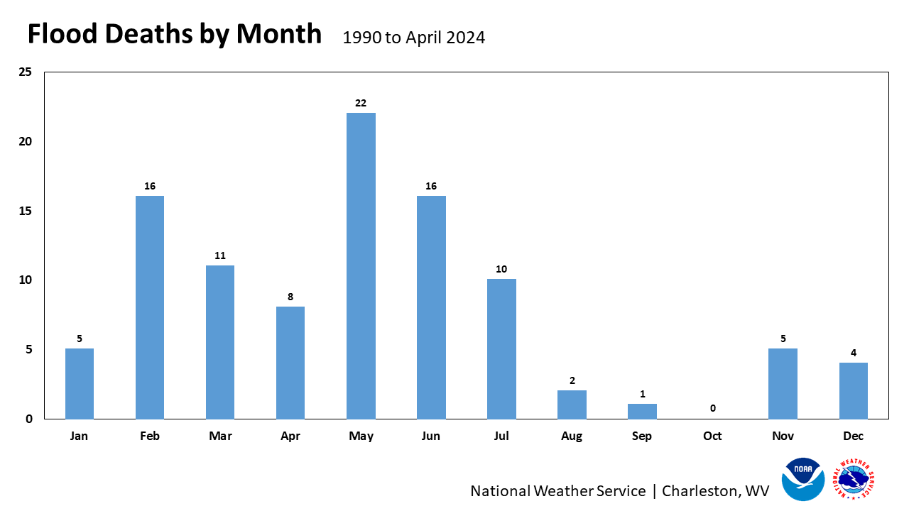
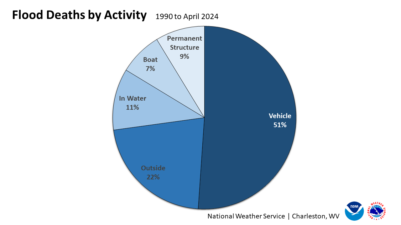
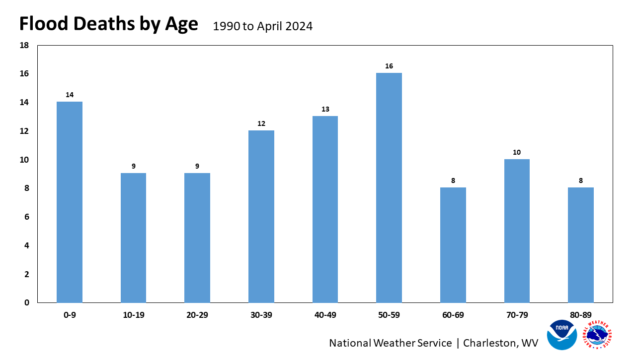
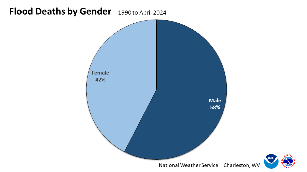
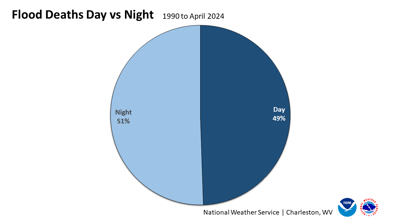
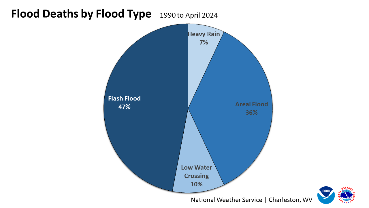
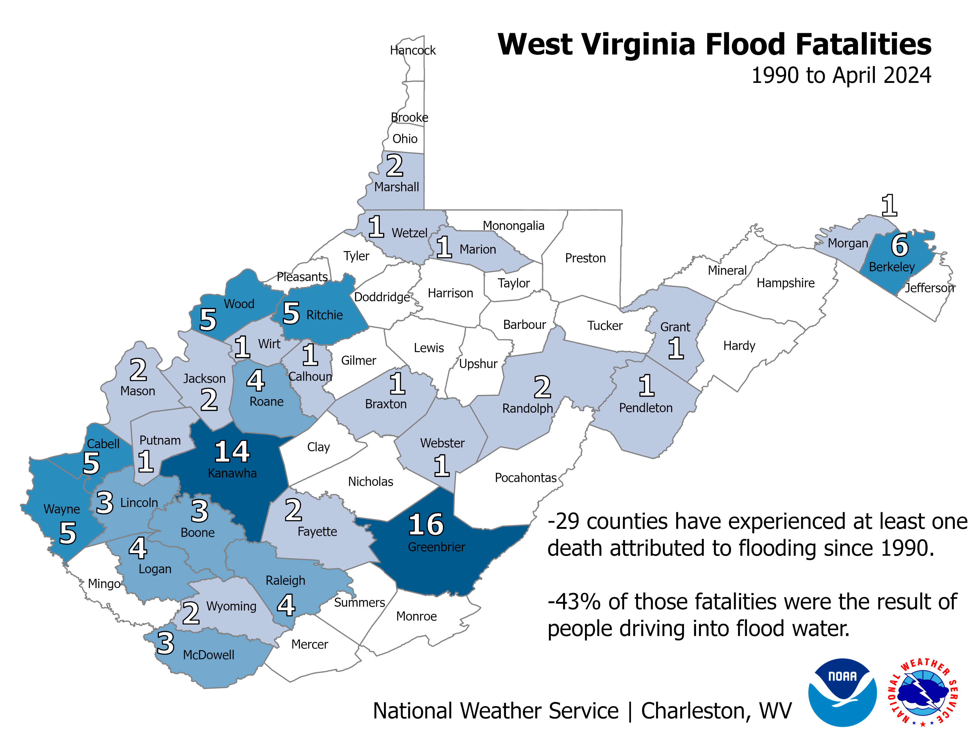
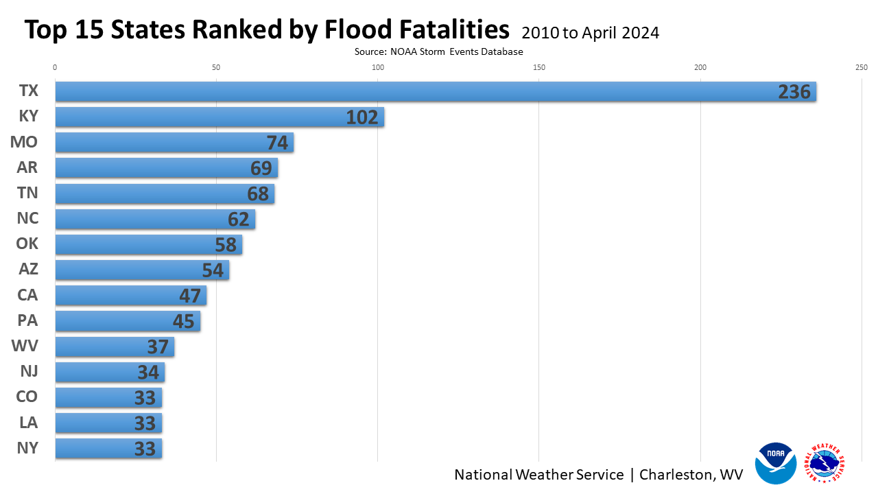
Flood Fatality History Flooding is the biggest overall weather threat in our region with numerous floods and flash floods occurring during any given year. Unfortunately, many people have lost their lives over the years due to flooding in our region. The following information and statistics were gathered from the flood deaths recorded in the NOAA Storm Data database for the 49 counties in the NWS Charleston, WV County Warning Area.
|
|||||||||||
|
||||||||||||
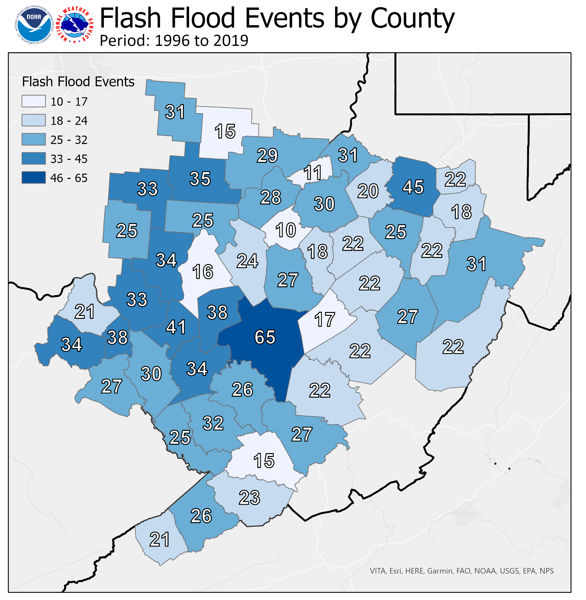 |
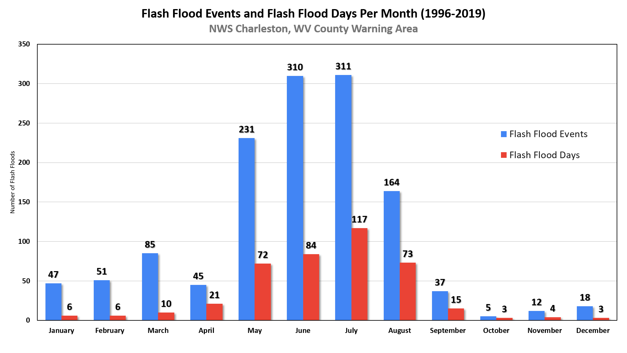
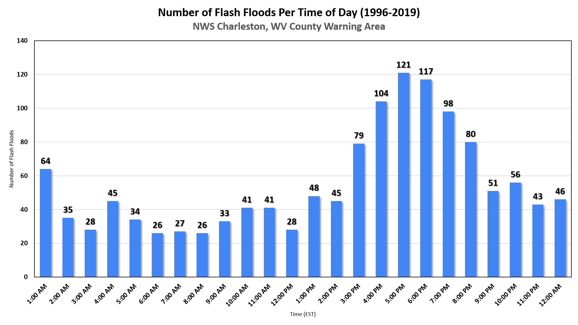
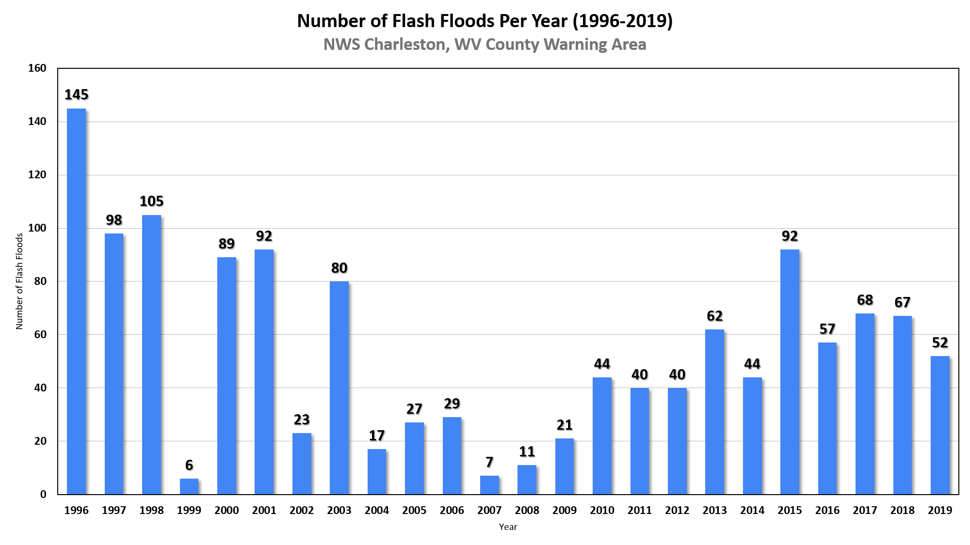
Flash Flood Climatology Flash Flooding is a frequent cause of damage and loss of life in our region. No county is immune. While flash flooding is most frequent during the afternoon and evening hours during the summer months, it can happen in any month of the year and any hour of the day. The following information and statistics were gathered from the NOAA Storm Data database for the 49 counties in the NWS Charleston, WV County Warning Area.
|
||
|
|||
|
|||
|
The Precipitation Frequency Data Server (PFDS) is a point-and-click interface developed to deliver NOAA Atlas 14 precipitation frequency estimates and associated information. The estimates are based on historical data and assign probabilities to rainfall volumes to estimate the likelihood of a rainfall event, like a 100-year storm, occurring in any given year. |
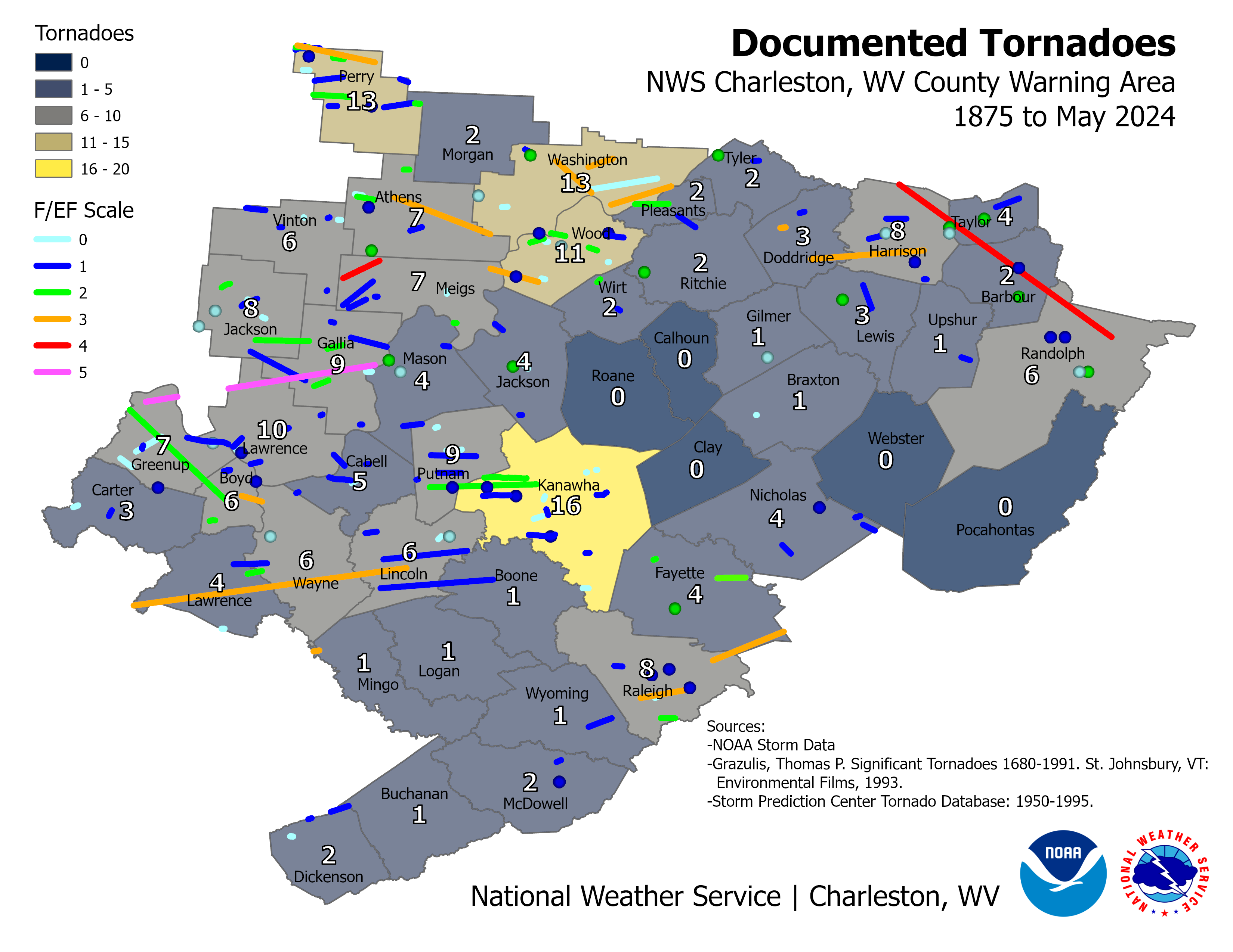 |
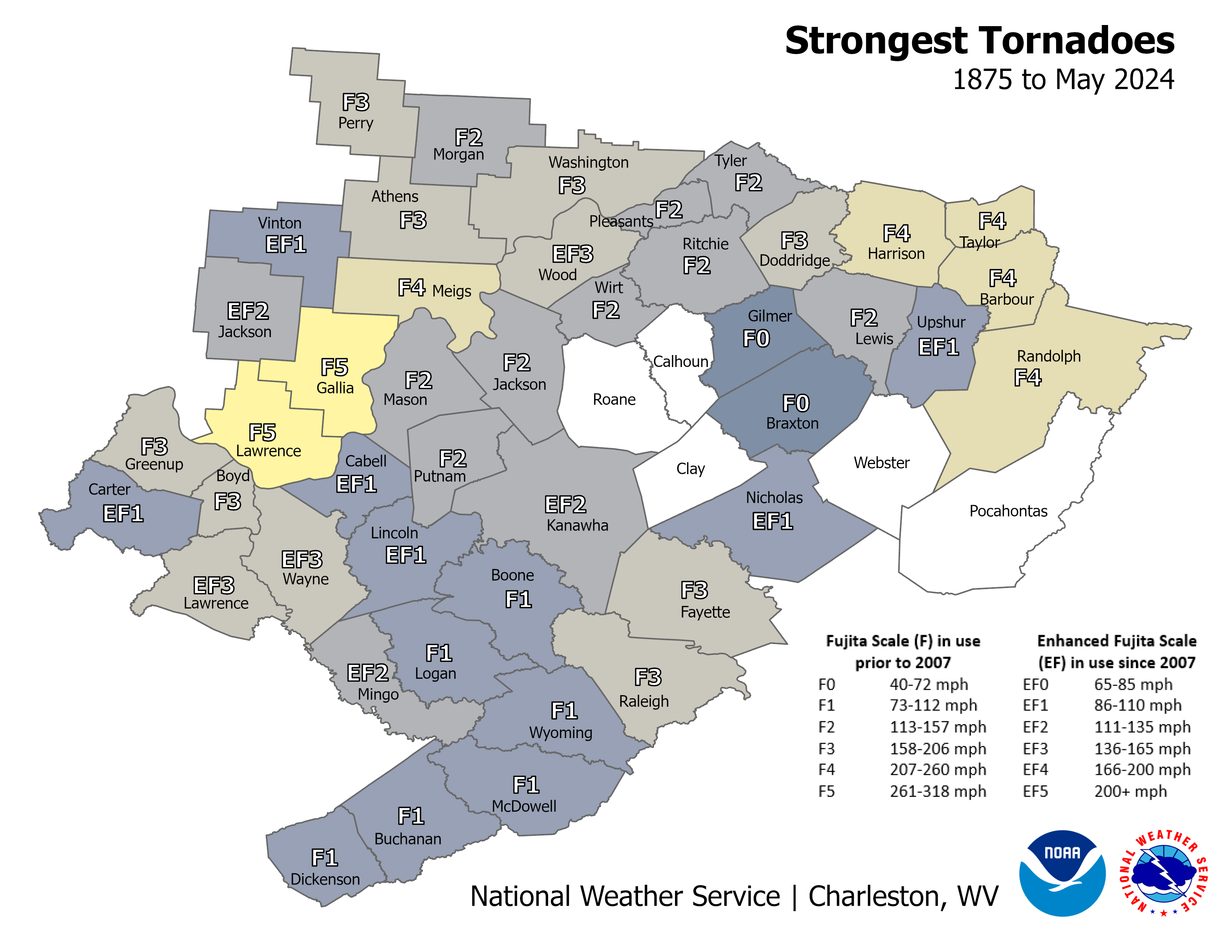
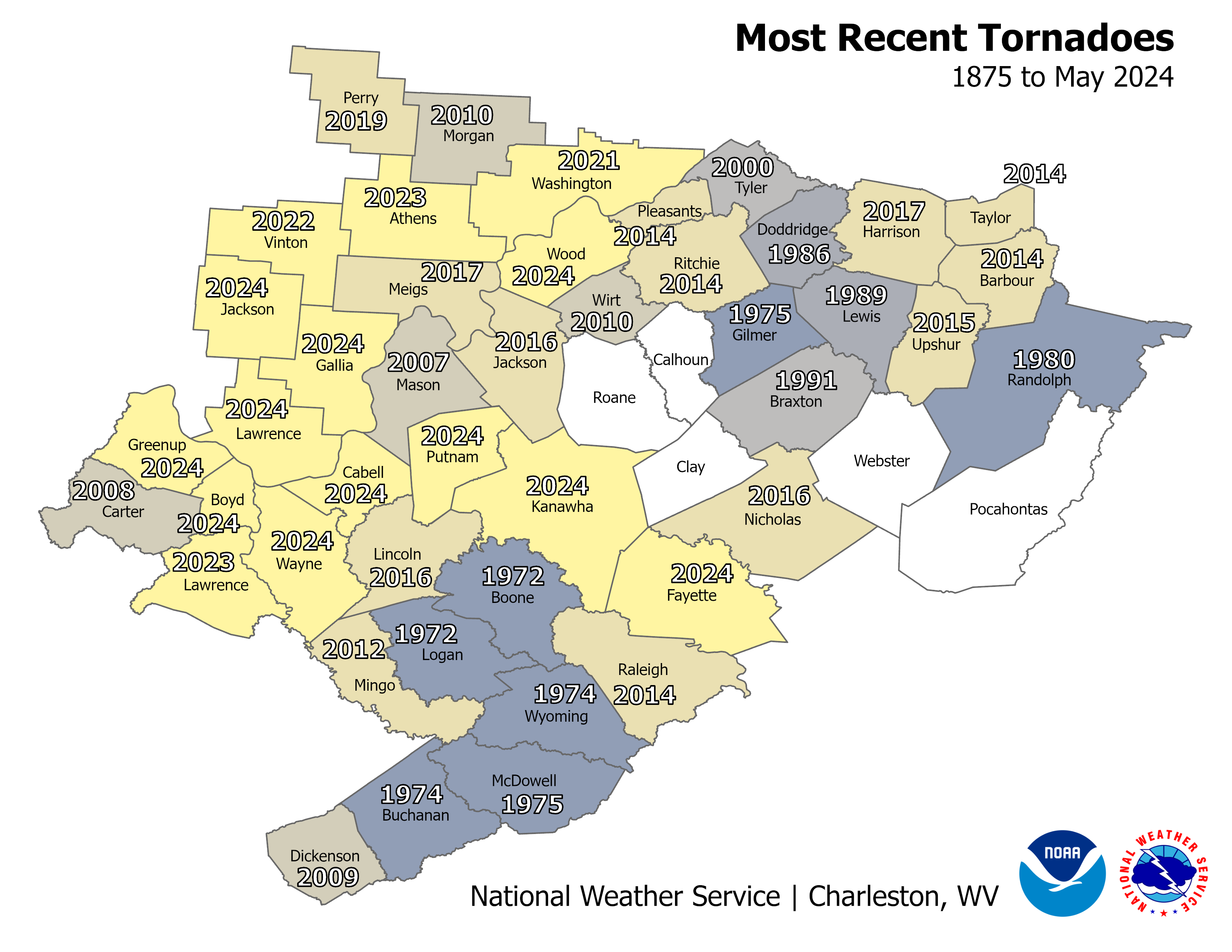
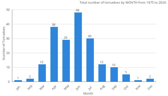
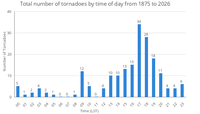
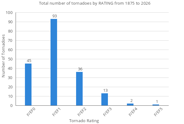
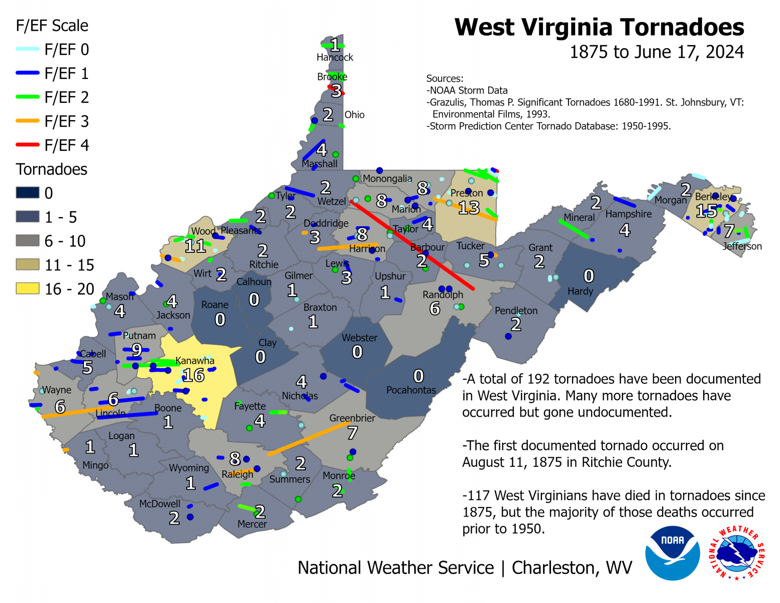
Tornado History Our region has experienced many tornadoes over the years including several intense and long tracked tornadoes. Only five of the 49 counties in the NWS Charleston, WV County Warning Area do not have a documented tornado, and tornadoes have likely occurred in those counties but just not been reported.
|
|||||||||||||||||||||||
|
||||||||||||||||||||||||
|
|
||||||||||||||||||||||||
West Virginia Tornadoes Listed in Chronological Order Since 1875
|
||||||||||||||||||||||||
|
|
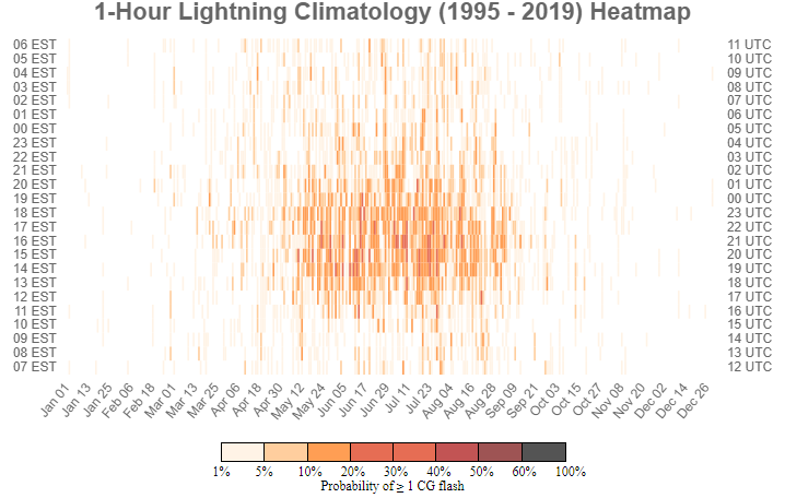
This lightning climatology provides imagery through an online GIS-based web browser interface that allows users to access graphics on the climatologically-based frequency and amount of cloud-to-ground lightning for a given geographic area. This product is intended to provide users, including organizers and/or supporters of outdoor events, the aviation community, etc., with a temporal breakdown of cloud-to-ground lightning flashes across a given geographic area. |
|
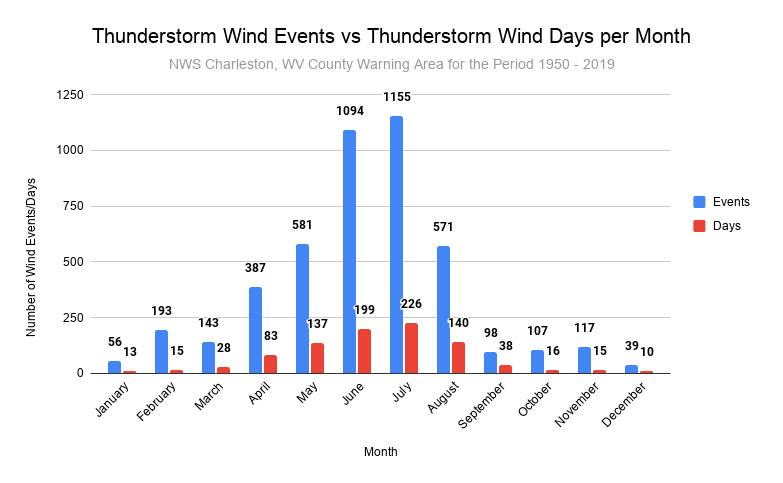
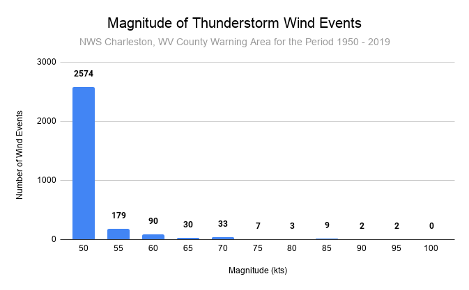
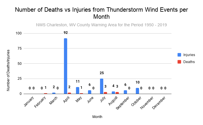
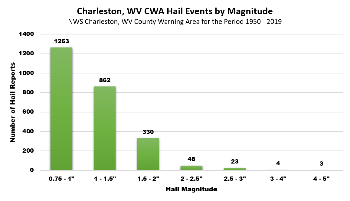
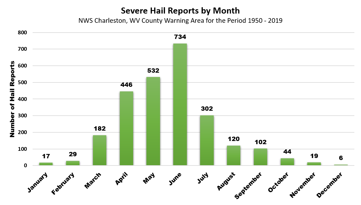
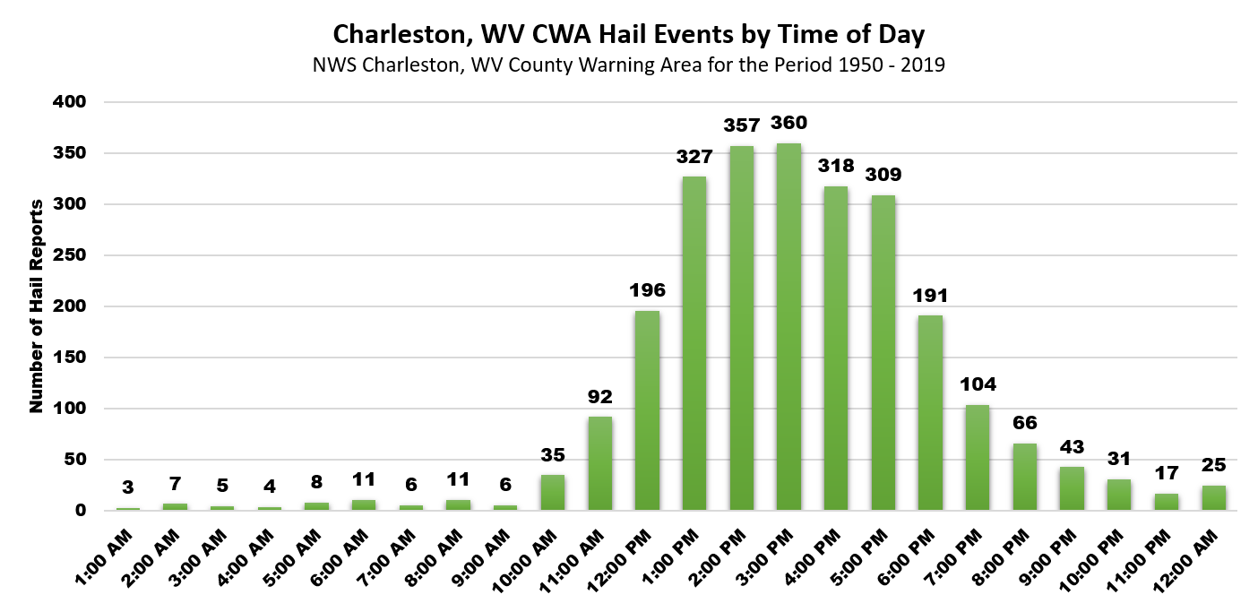
Severe Weather Climatology for the Charleston, WV WFO County Warning Area (1950-2020, pdf) A comprehensive review of the severe weather climatology for the NWS Charleston, WV County Warning Area for the 1950 to 2020 time period. The review includes an in-depth analysis of tornado, severe wind, and hail climatology for the region. |
|
|
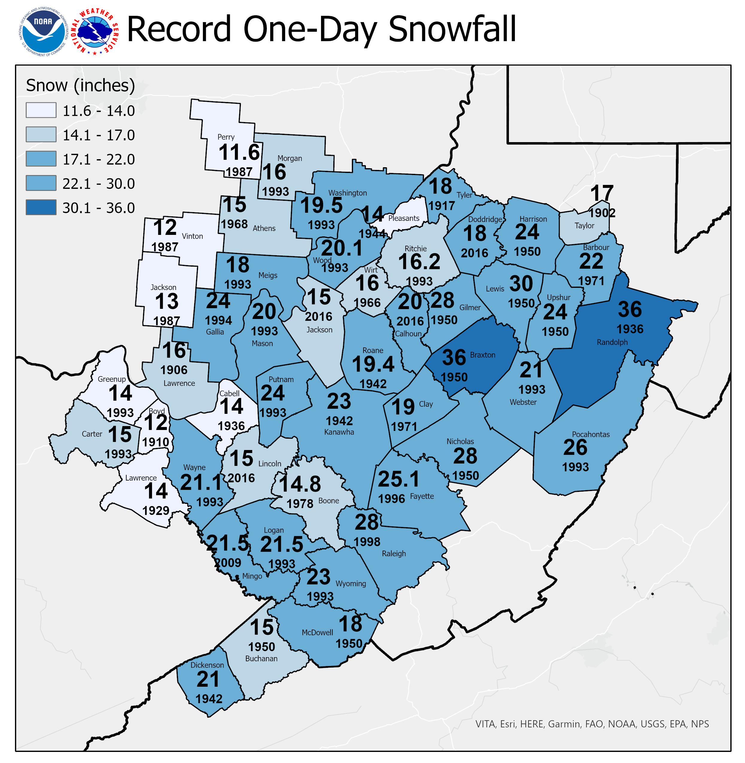
Snowfall Extremes Snowstorms, while not frequent, have paralyzed our region for days and caused major hardships on the population. In fact, the Great Appalachian Storm of November 1950, which is responsible for many of the one-day snowfall records illustrated on this map, persisted for several days and is responsible for the West Virginia state record 3-day snow total of 57.2" from Coeburn Creek in Harrison County.
|
|
|
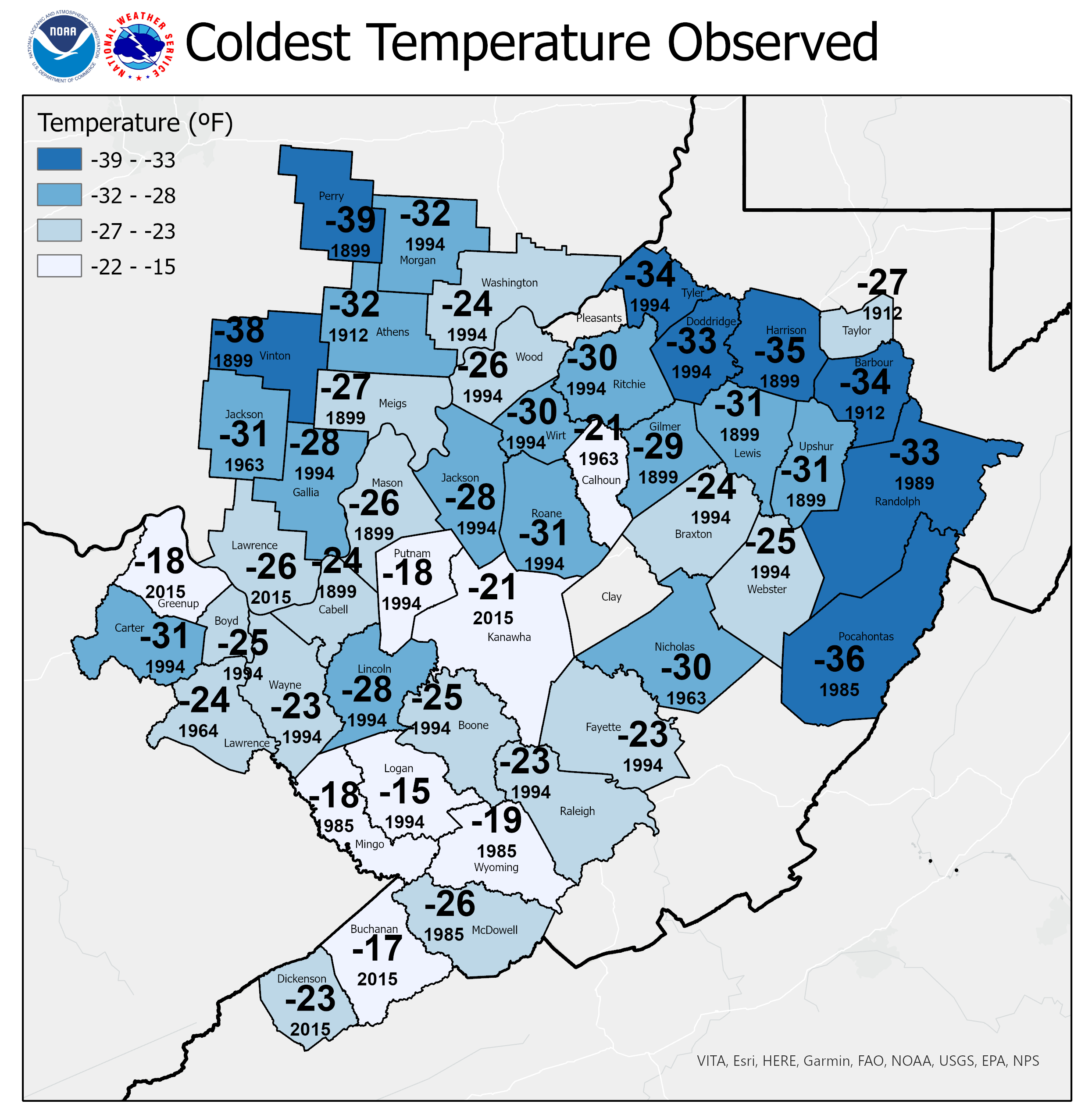
Historical Cold Snaps The coldest temperature observed at observing stations in each county is indicated, along with the year it was set.
|
|
|
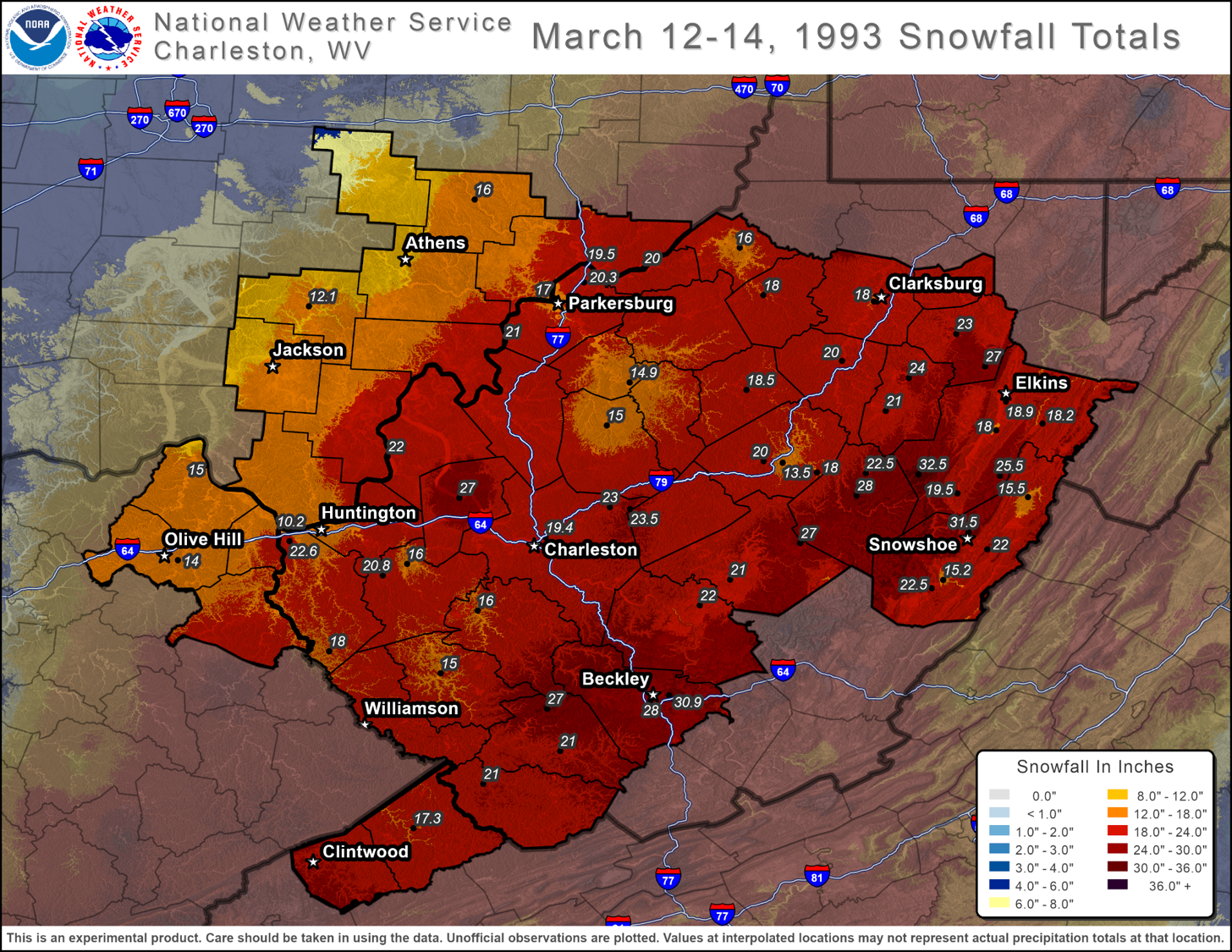
Top Ten Snowstorms on Record We have provided detailed information, including snowfall maps and a detailed meteorological analysis of the top 10 snow storms since 1950 for each official climate site in the NWS Charleston, WV County Warning Area. Also included for each station is a composite surface low chart for the top 10 snow storms for that station. Read More... |
|
|
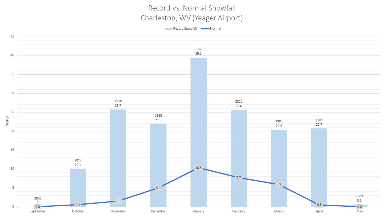
Snowfall Climatology The number of days it snows and the amounts of snow varies widely across NWS Charleston’s area of responsibility due to varied terrain and elevation. This study documents and illustrates this variability for several locations across the NWS Charleston area of responsibility. Read More... |
|
|
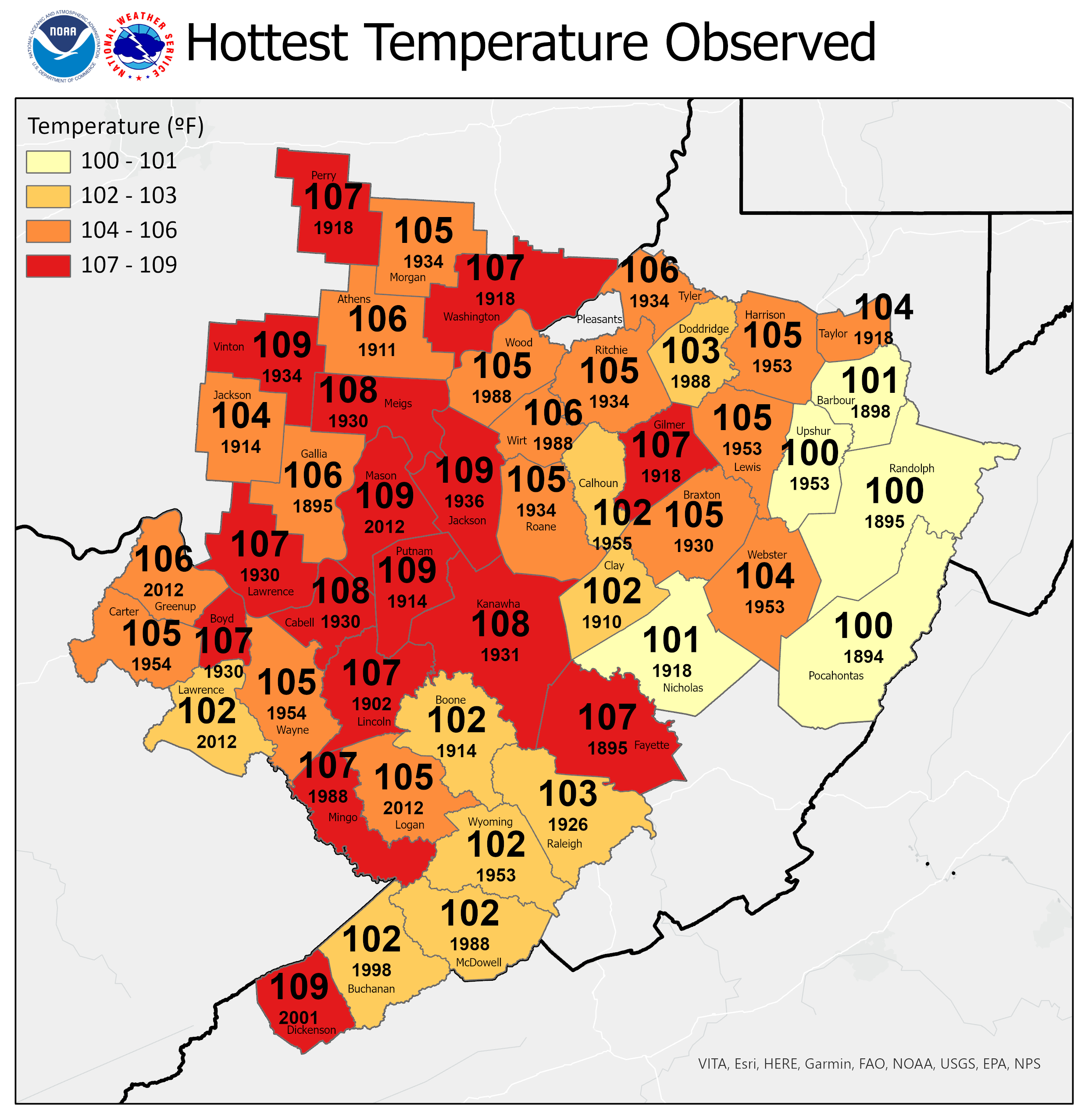
Heat Extremes The hottest temperature observed at observing stations in each county is indicated, along with the year it was set.
|
|
|
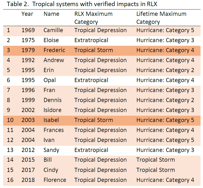
The Impact of Tropical Systems on the NWS Charleston WV County Warning Area Historical hurricane track data shows a total of twenty-nine tropical systems have passed within the vicinity of the NWS Charleston, WV County Warning Area, but only sixteen were verified through NOAA Storm Data to have significant impacts. Read More... |