National Weather Service United States Department of Commerce

Storm Impacting the Northwest U.S.; Fire Weather Conditions in Southern California; Severe Weather in the South

A Pacific storm is bringing areas of low elevation rain, moderate to heavy mountain snow, and high winds to the Northwest. Strong Santa Ana winds and very dry conditions are producing elevated to critical fire weather conditions in southern California. Isolated strong to severe thunderstorms are possible through early Wednesday morning across parts of northeast Texas into western Tennessee. Read More >


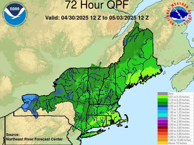
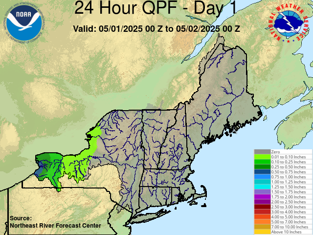
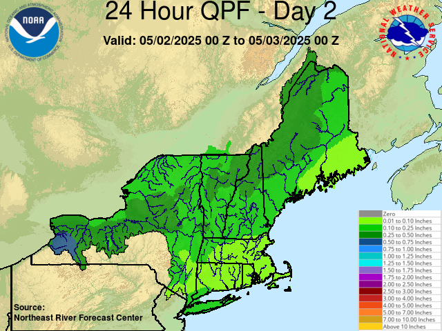
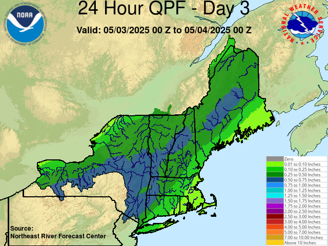
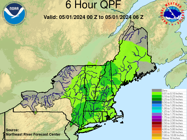
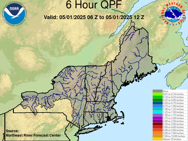
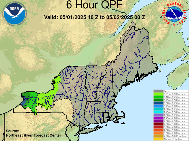
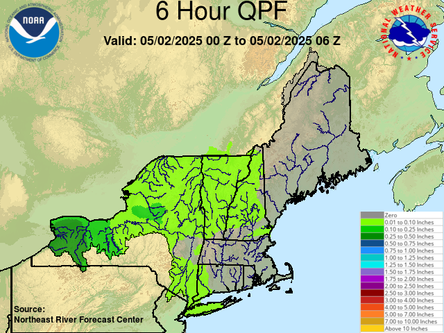
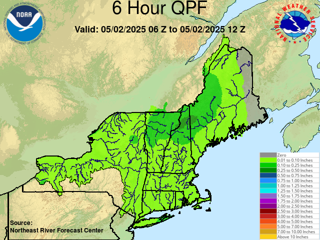
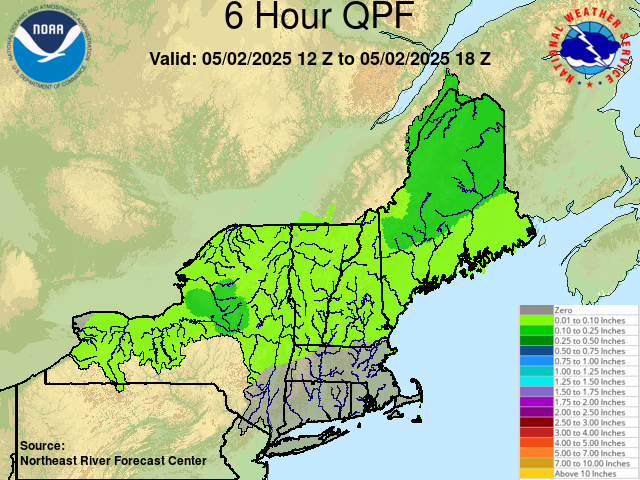
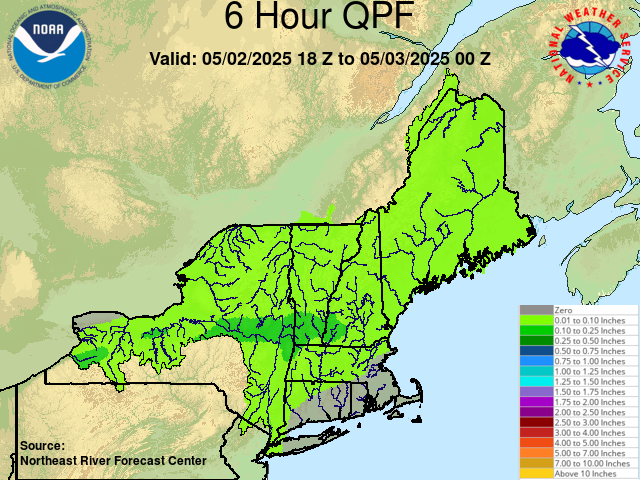
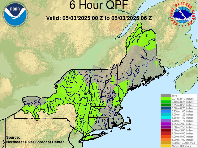
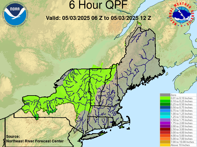
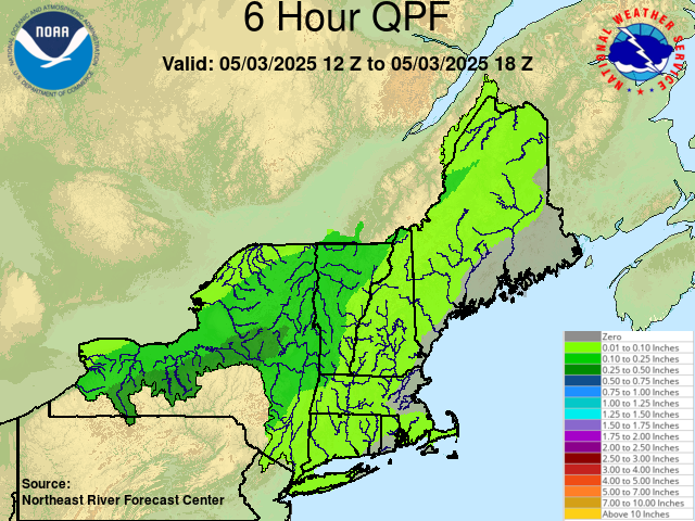
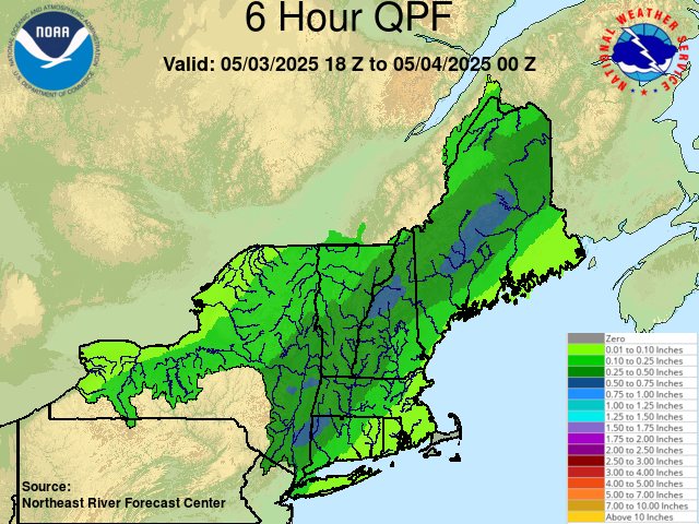
The Northeast River Forecast Center produces river basin averaged Quantitative Precipitation Forecasts (QPF) for New England and much of New York State. QPF forecasts are routinely issued three times daily around 00Z, 12Z and 18Z. They may also be issued around 06Z during times of increased flood potential. The forecasts are normally produced for 72 hours in 6-hour intervals, but may be extended out to as much as 96 hours during significant rainfall events or times of increased flood potential. The QPF forecasts are used as input to the NWS Hydrologic River Models.

Click Images to View a Larger Version

Forecast Precipitation Links


Forecast Precipitation Links

NERFC Quantitative Precipitation Forecast (Text Product)
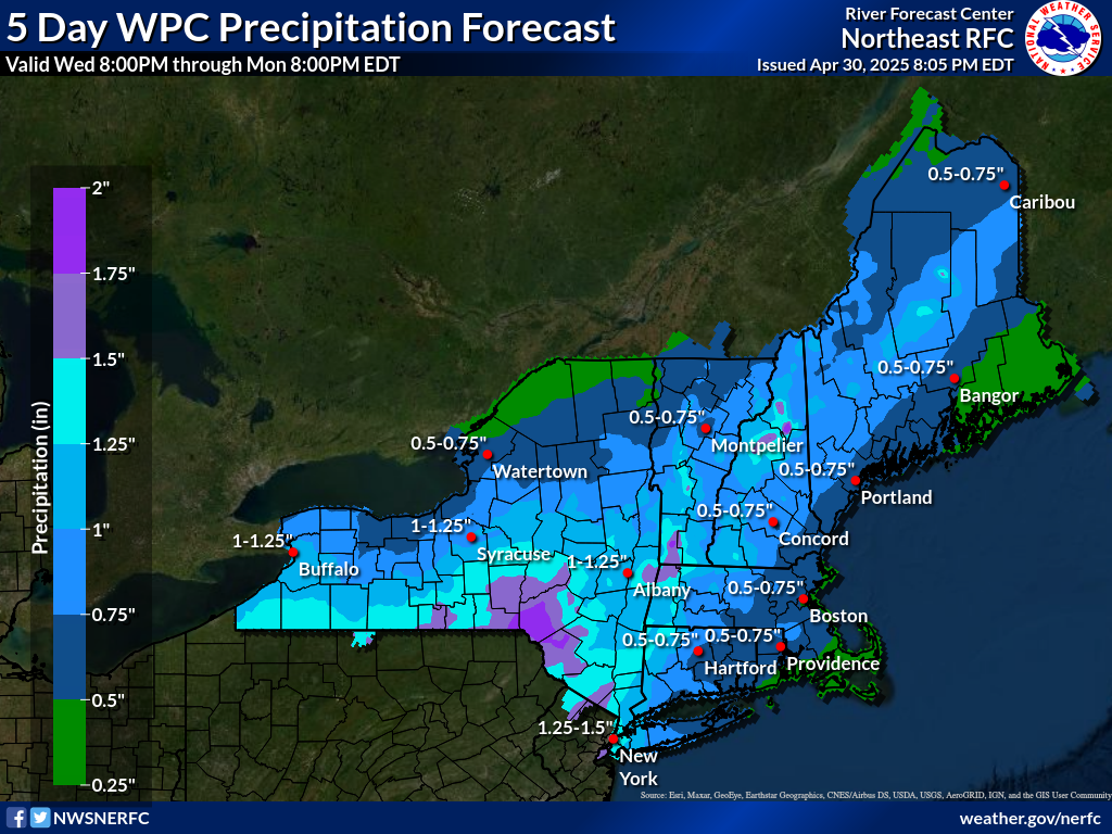
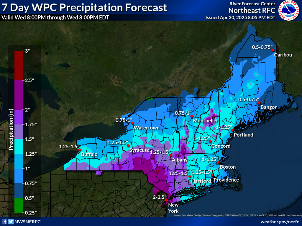
WPC Quantitative Precipitation Forecasts
NWS NDFD Graphics


Total Forecast Precipitation
  Graphic.
 

 NERFC QPF graphic  
 

NERFC QPF graphic  
 

NERFC QPF graphic  
 

 NERFC QPF graphic  
 

NERFC QPF graphic  
 

NERFC QPF graphic  
 

NERFC QPF graphic  
 

NERFC QPF graphic  
 

NERFC QPF graphic  
 

NERFC QPF graphic  
 

NERFC QPF graphic  
 

NERFC QPF graphic  
 

NERFC QPF graphic  
 

NERFC QPF graphic  
 

NERFC QPF graphic  
 

 NERFC QPF graphic  


NERFC QPF graphic  


 NERFC QPF graphic  
 

NERFC QPF graphic  
 

5 Day WPC QPF

7 Day WPC QPF