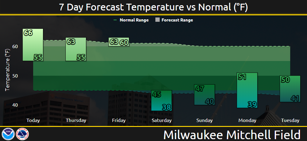
Updated 6 am Wednesday - The pleasant, dry weather will continue for another day across southern Wisconsin. Clear to partly cloudy conditions are expected today and tonight. Daytime temperatures will peak in the 60s to around 70 degrees with cool night time temperatures mostly in the 40s. A few locations may dip into the upper 30s tonight in parts of southeast and east central Wisconsin away from Lake Michigan.
 |
.png) |
A major change to the weather pattern is expected late this week. A strong cold front is expected to sweep through Wisconsin on Friday. The coldest air of the season will then pour across the state Friday night and settle in for the weekend. Daytime temperatures on Saturday and Sunday are expected to be only in the 40s! Some areas may even see a few light snow showers or flurries mixed in with rain showers. Temperatures will likely fall into the mid 30s to around 40 at night. A few spots may even dip down to around freezing, although widespread frost is not expected due to clouds and lingering winds.
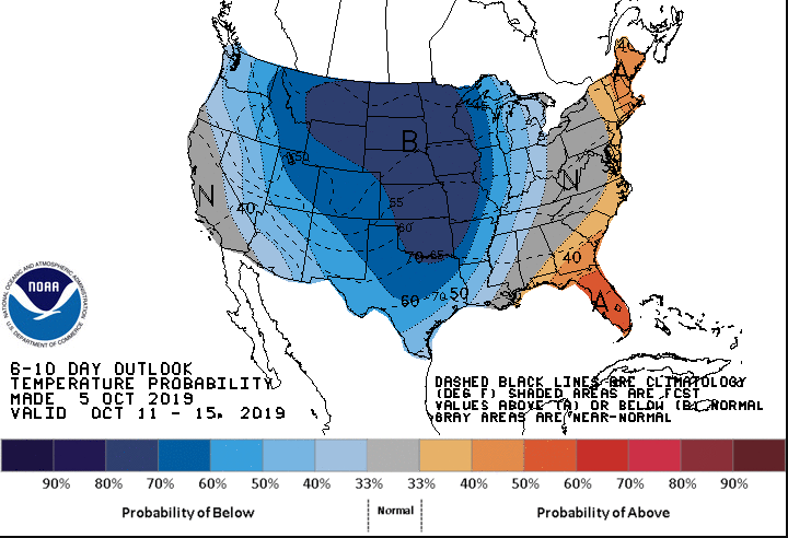
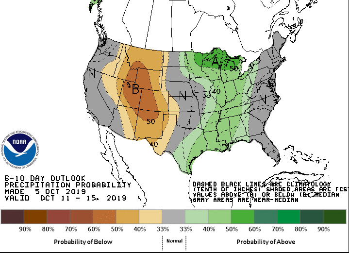
The 6 to 10 Day Outlook from the Climate Prediction Center is showing a good chance for temperatures averaging below normal for the period from October 11th through the 15th, with precipitation for the same period leaning toward above normal as well. Are you ready for the colder weather?
 |
 |
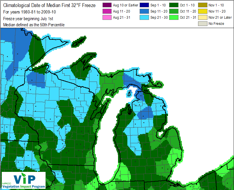
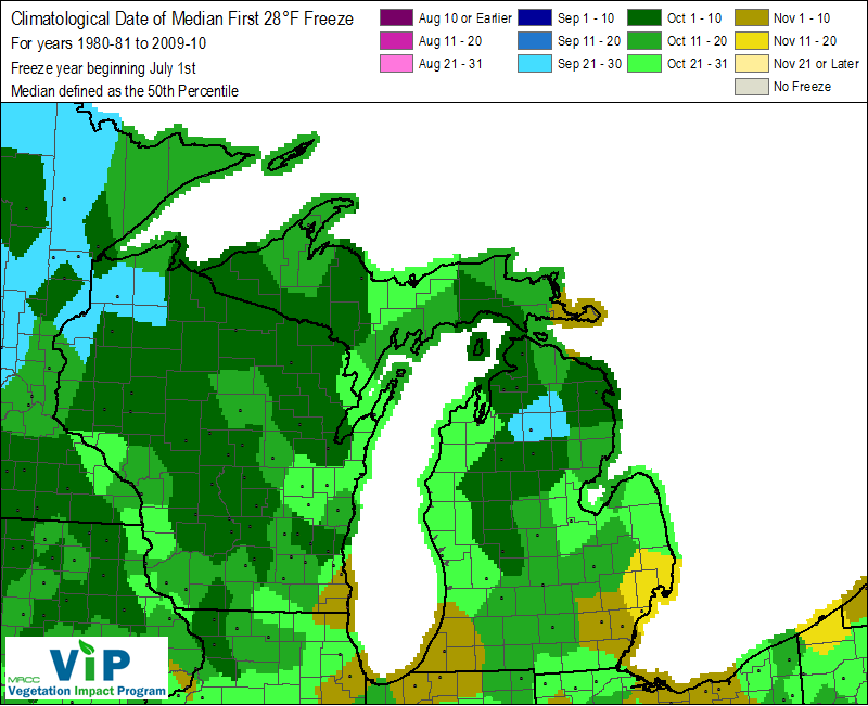
Temperatures will likely fall to around freezing in parts of southern Wisconsin sometime in the period from next weekend into early the following week. This is actually a little later than Climatological normal as most of southern Wisconsin experiences it's first 32 degree or lower temperature in the first 10 days of October. The climatological record runs for the 30 year period from 1980 to 2010.
 |
 |