Record setting heat is expected over the next several days from the Intermountain West through the northern Plains. Furthermore, fire weather concerns increase with dry and breezy conditions. Meanwhile, heavy rainfall and severe thunderstorm threats for the Ohio/Tennessee Valleys, central Appalachians and Southeast today. The threat shifts to central Gulf Coast and across central Texas this week. Read More >
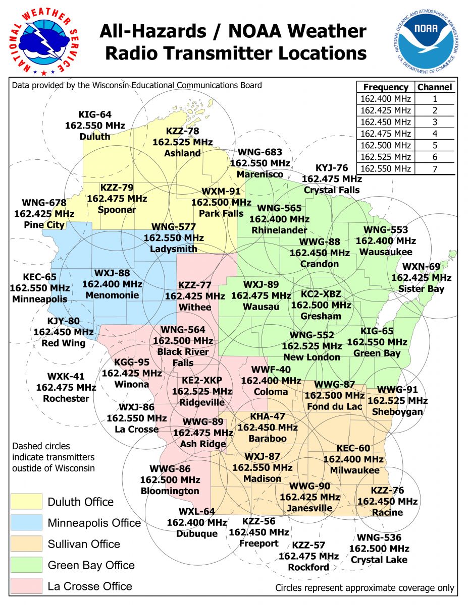
NOAA Weather Radio All-Hazards
| Channel | Station | Frequency (MHz) | Watts | Coverage and S.A.M.E. Codes |
| 1 | KEC-60 | 162.400 | 1000 | Milwaukee/Waukesha Area and Surrounding Counties |
| 2 | WWG-90 | 162.425 | 300 | Janesville Area |
| 3 | KZZ-76 | 162.450 | 300 | Racine and Kenosha Areas |
| 4 | KHA-47 | 162.450 | 300 | Baraboo/Wisconsin Dells Area |
| 5 | WWG-87 | 162.500 | 1000 | Fond du Lac Area and Surrounding Counties |
| 6 | WWG-91 | 162.525 | 300 | Sheboygan Area |
| 7 | WXJ-87 | 162.550 | 1000 | Madison Area and Surrounding Counties |
Use this information to program your S.A.M.E. Weather Radio:
|
|