
Heat expands across the Desert Southwest, Plains, Mississippi Valley and Midwest into Monday. Fire weather concerns continue for portions of the Intermountain West. Active monsoonal moisture fuels thunderstorms over the Southwest with possible flash flooding. Tropical cyclone Fausto in the Pacific, should weaken as it approaches Hawaii; Dangerous surf, swells and rip currents are expected. Read More >
| Severe Thunderstorm Outlook Graphics - Storm Prediction Center | ||
Watches |
Mesoscale Discussion |
Day 1 Outlook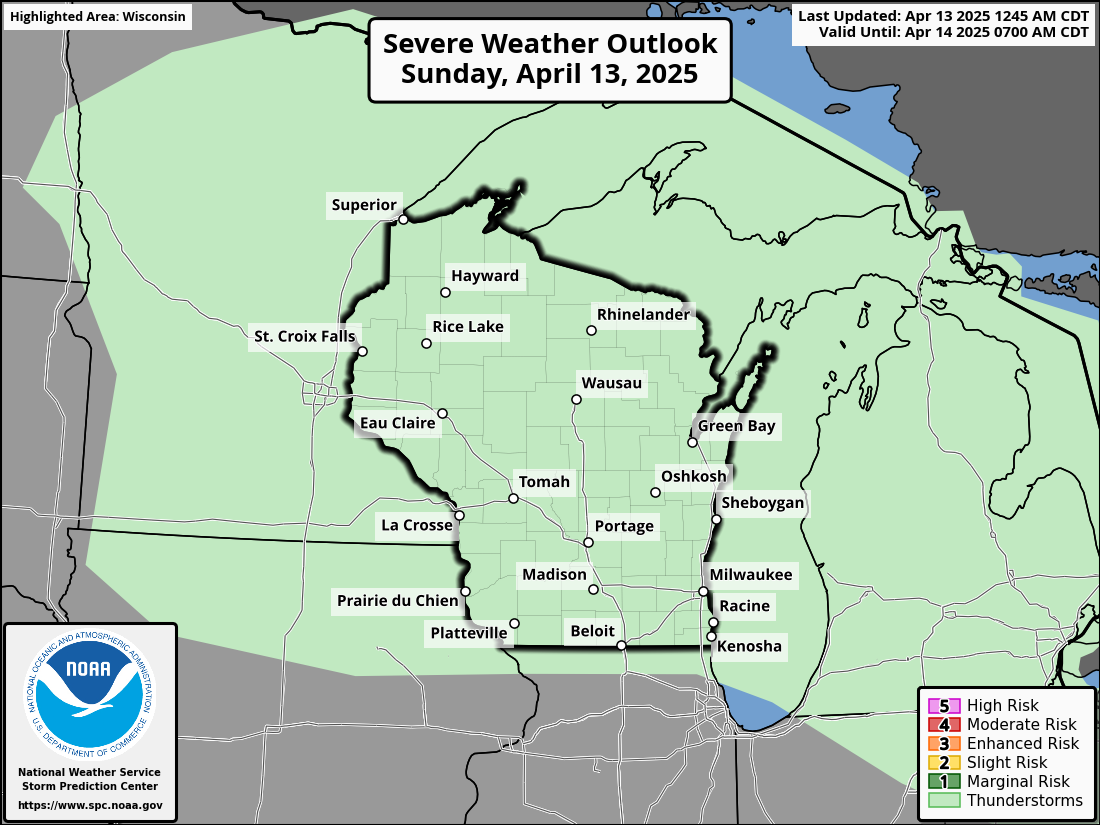 |
Day 2 Outlook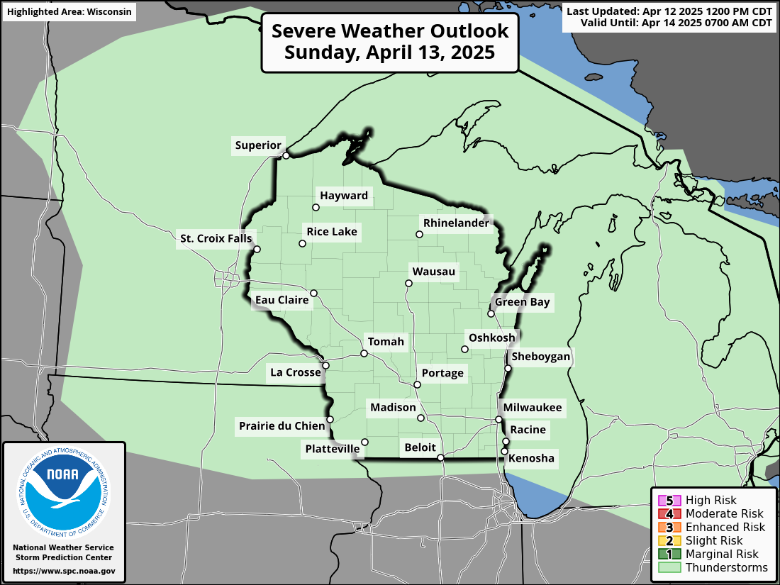 |
Day 3 Outlook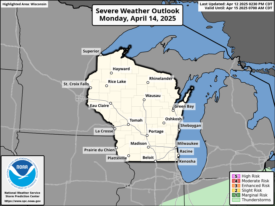 |
Day 4-8 Outlook |
|
Southern Wisconsin Forecast Rainfall |
Wisconsin Forecast Rainfall |
|
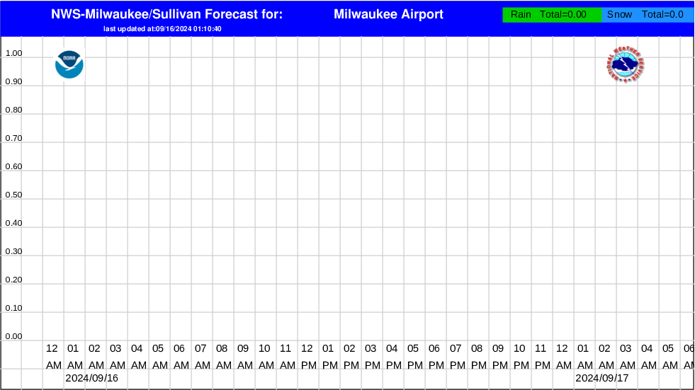
Hourly Precipitation Graphs For Southern Wisconsin
|
|
|
Current Headlines |
|
|
| 6 Hour Weather Type Forecasts: | |||||
 6 Hours |
 |
 |
 |
 |
 36 Hours |
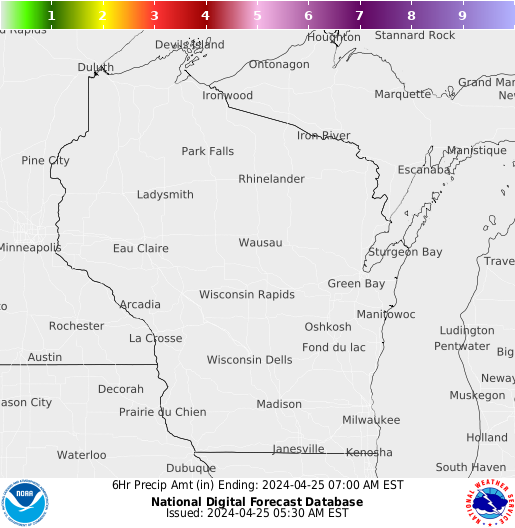
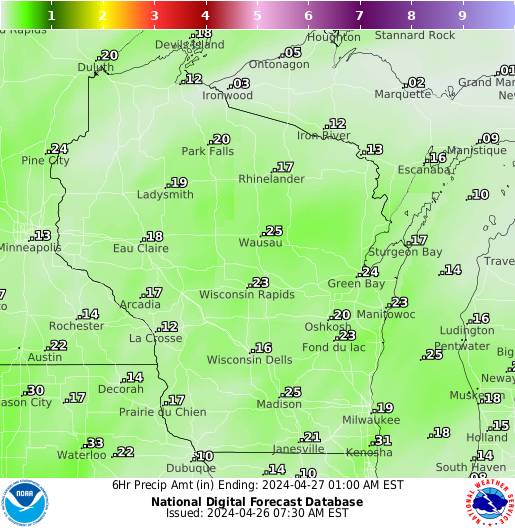
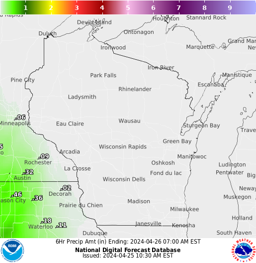
| 6 Hour Precipitation Amount Forecasts: | |||||
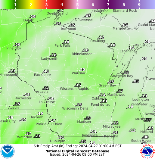 6 Hours |
 |
 |
 |
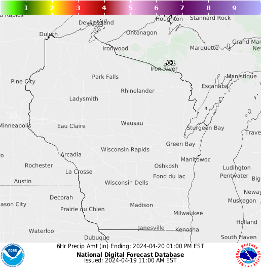 |
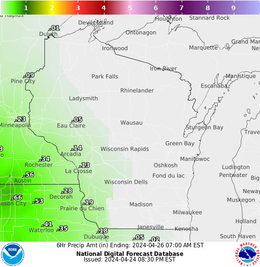 36 Hours |
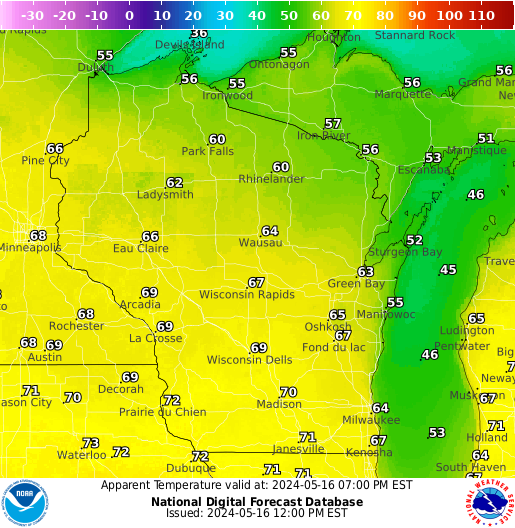
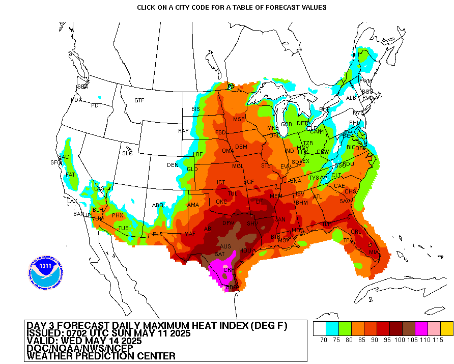
Heat Index: (Click for Heat Index chart) National Outlook Graphics/Forecast
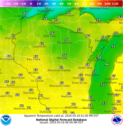
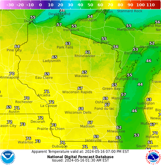
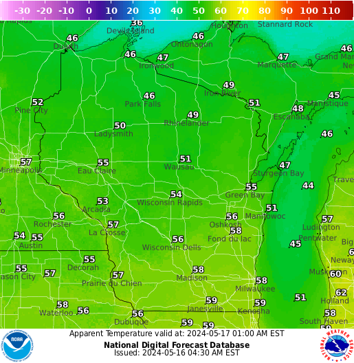
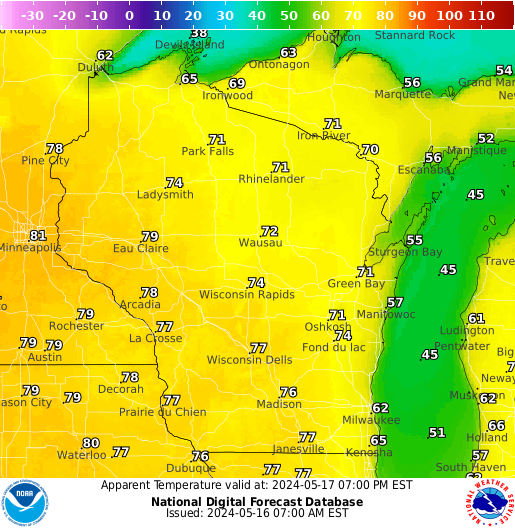
| 6 Hour Apparent Temperature (Heat Index) Forecasts: | |||||
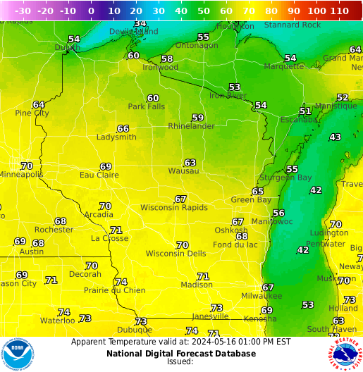 6 Hours |
 |
 |
 |
 |
 36 Hours |
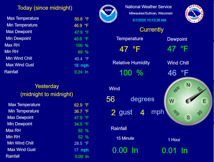
Current Conditions (Click for a Statewide Round-up):
|
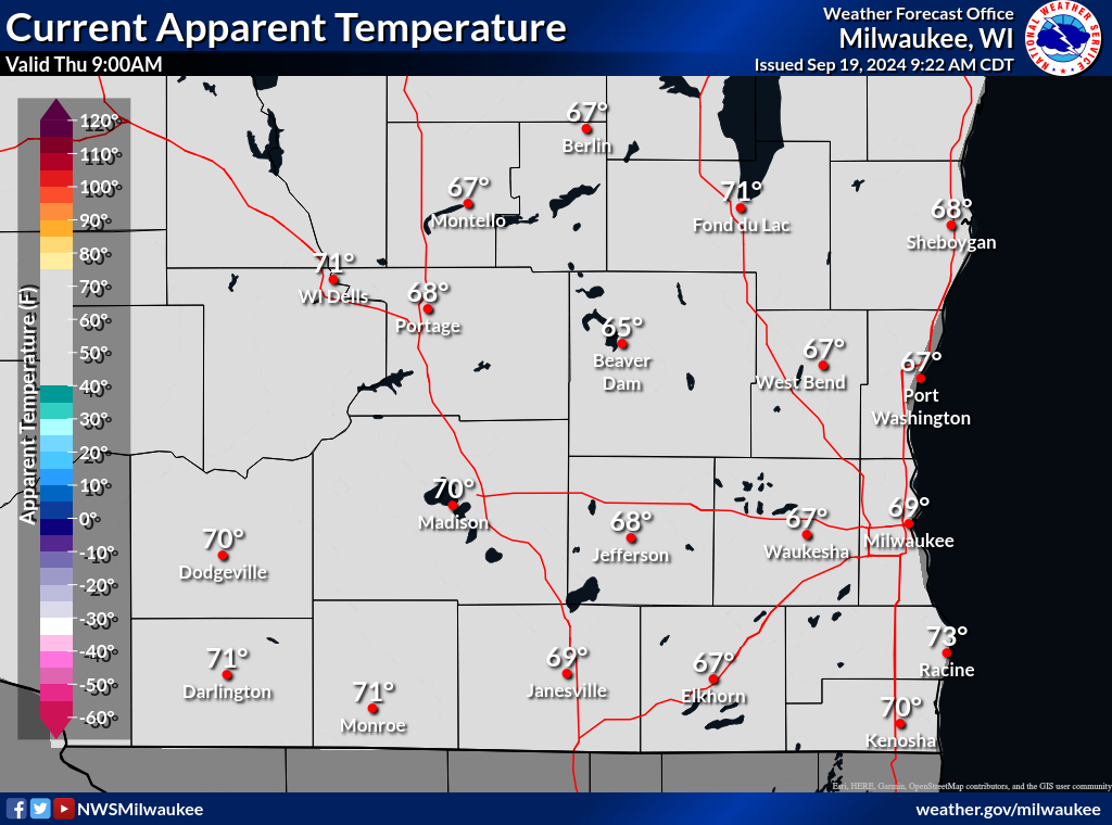
Current ApparentTemperature |
|
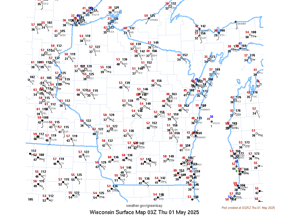
National Observation Plot |
Office Weather Station |
Links:
| Tornadoes, Hail, Lightning, Floods | Heat / UV / Air Quality Info | Other Stuff |
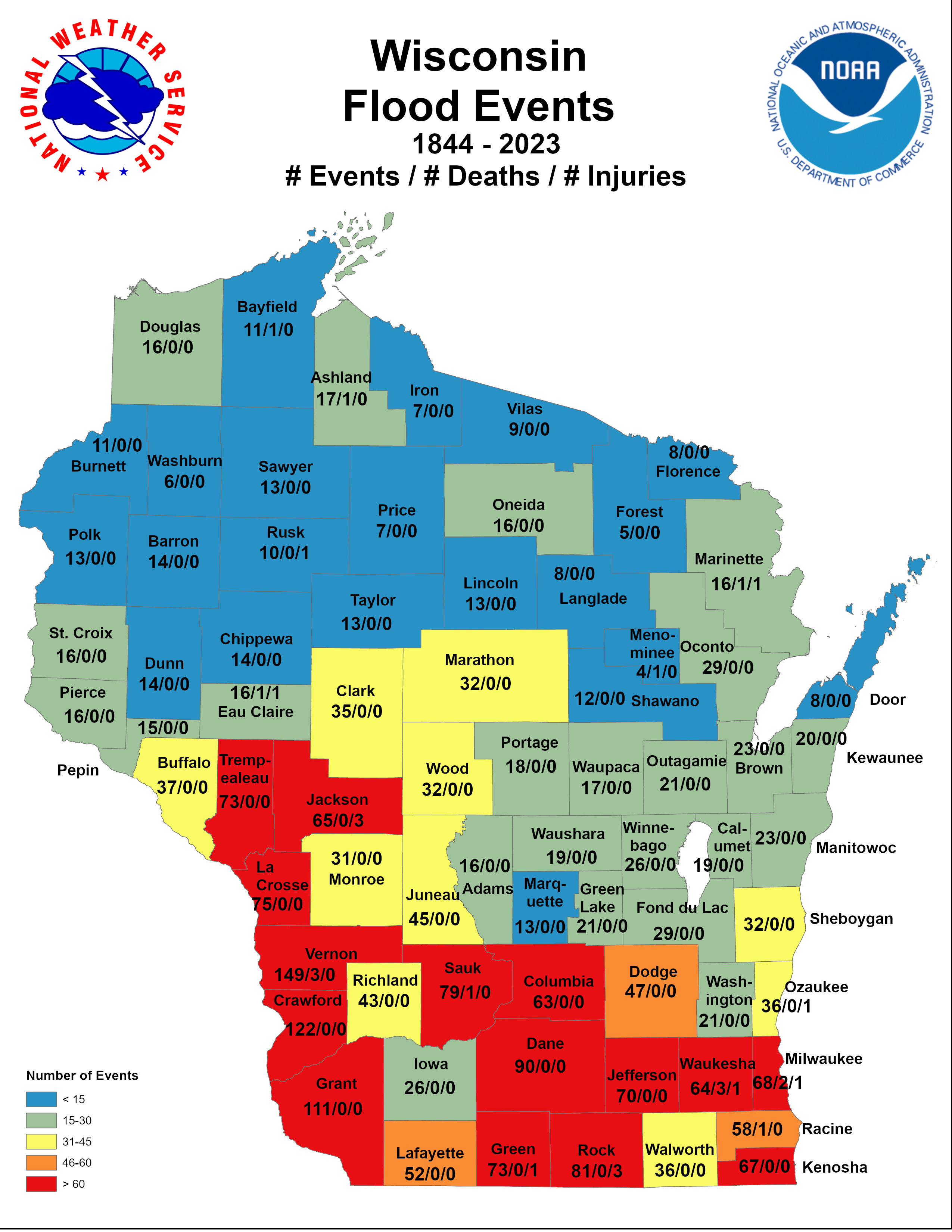
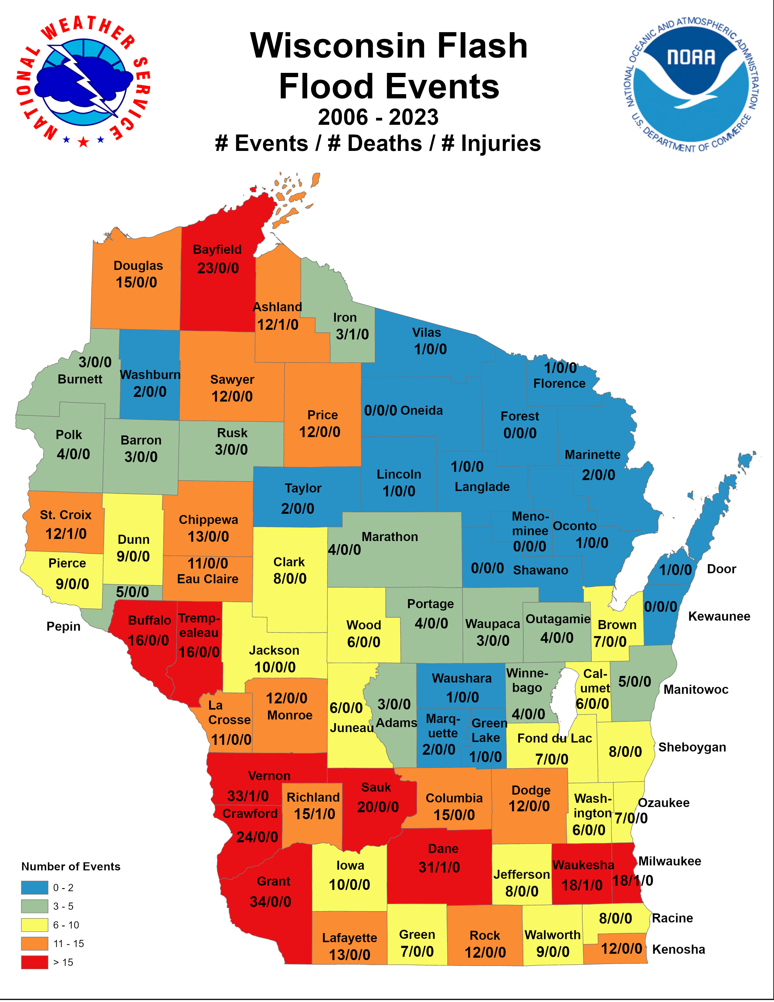
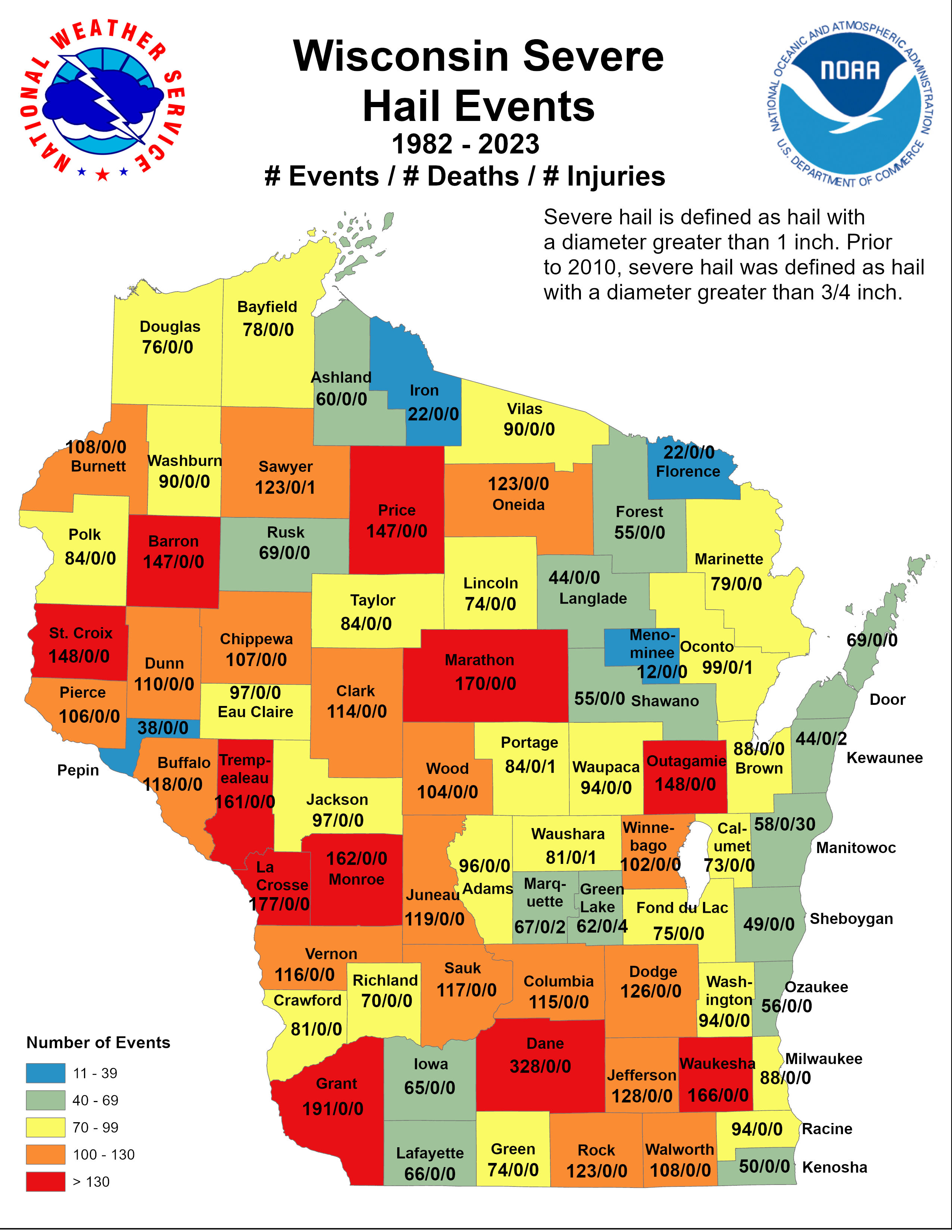
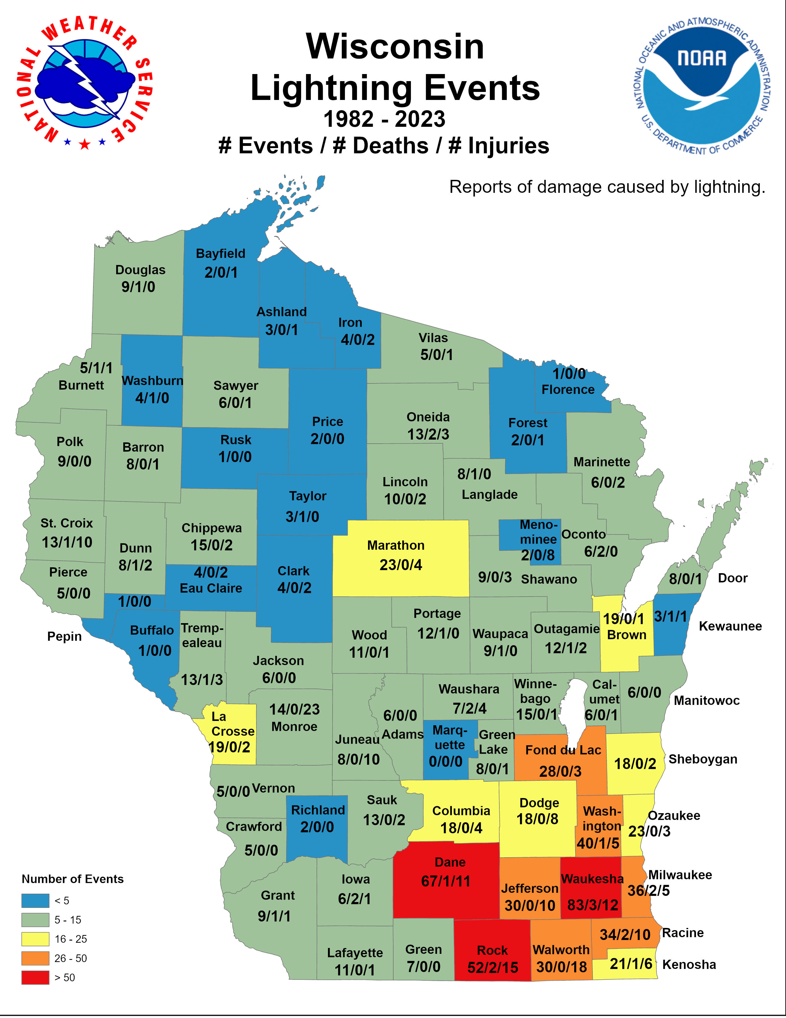
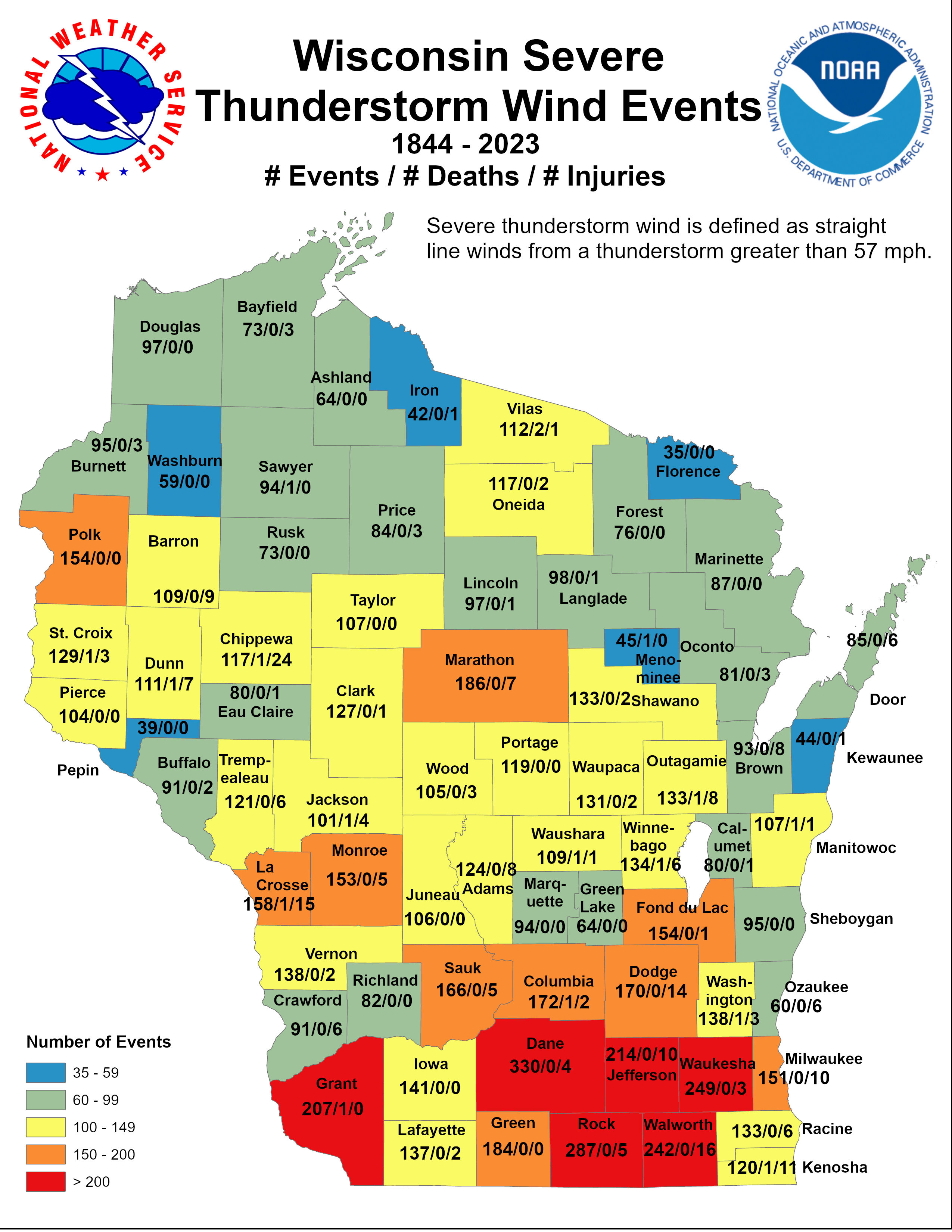
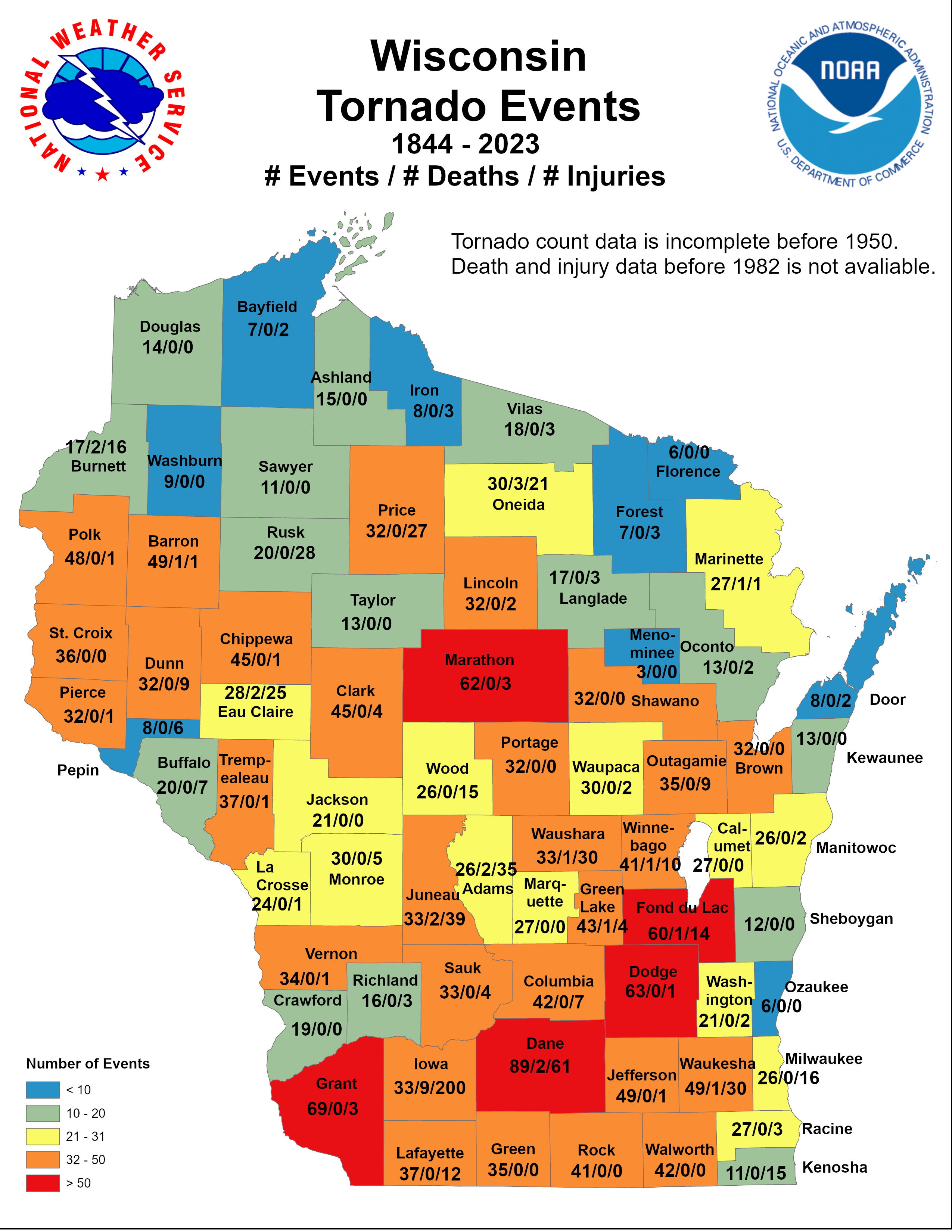
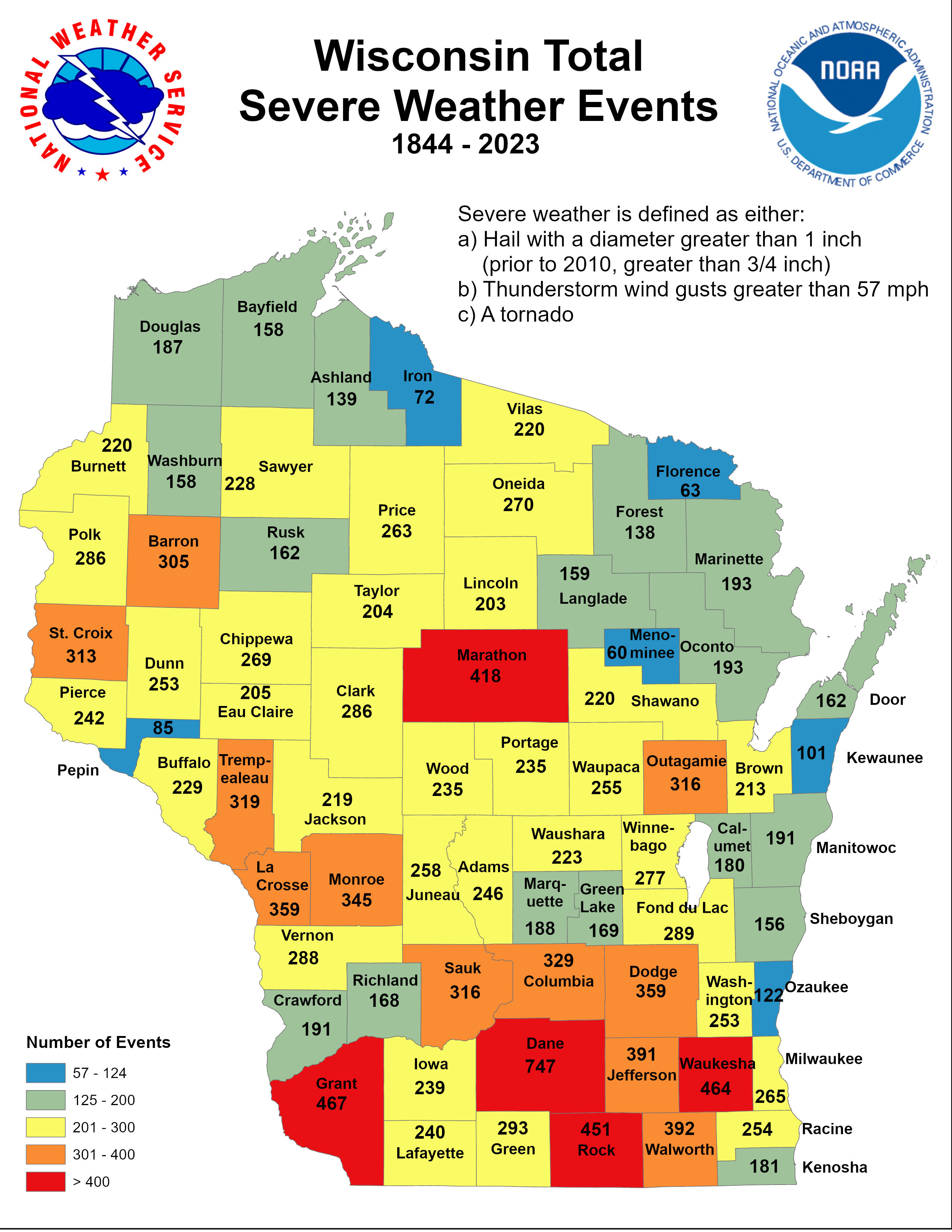
Number of Events / Deaths / Injuries for: |
 |
Media use of NWS Web News Stories is encouraged! Please acknowledge the NWS as the source of any news information accessed from this site. |
|


