
Heat expands across the Desert Southwest, Plains, Mississippi Valley and Midwest into Monday. Fire weather concerns continue for portions of the Intermountain West. Active monsoonal moisture fuels thunderstorms over the Southwest with possible flash flooding. Tropical cyclone Fausto in the Pacific, should weaken as it approaches Hawaii; Dangerous surf, swells and rip currents are expected. Read More >
Milwaukee/Sullivan, WI
Weather Forecast Office
What's New?
Flood Inundation Maps are now available for the Wisconsin River at Portage. These maps were created in partnership with the DNR. These interactive maps will help convey the impacts of flooding for local officials, property owners and motorists. Use these maps to answer questions like, "What roads may be impacted at 17 feet, and where are alternate safer routes?" and "If the river reaches 18 feet, how may my property be affected?".
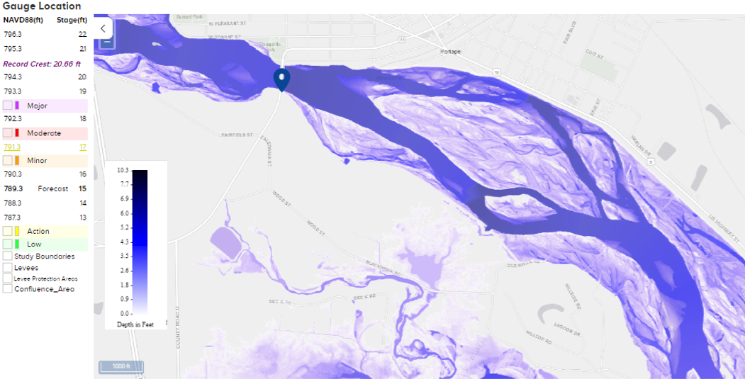
To view all locations with flood inundation mapping click here.
How To Use it
Here is a video demonstration of how to use the maps. Note, graphics and images in the video are not a current forecast and are for demonstration purposes only.
Where are The Maps?
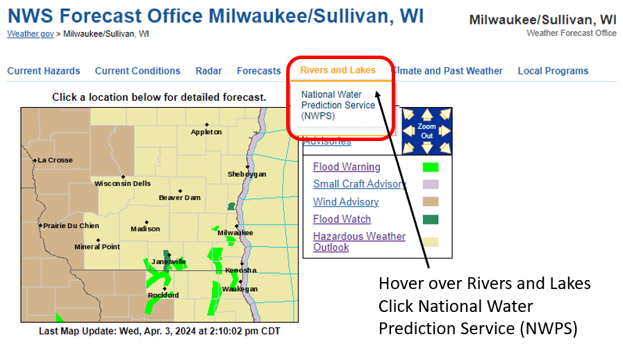
Go to the main NWS Milwaukee webpage (weather.gov/milwaukee) and hover over Rivers and Lakes. Then, click the link that pops up and that is titled National Water Prediction Service (NWPS). (Note, this page is in transition to a newer page. In late May, clicking Rivers and Lakes will go directly to the National Water Prediction Service page.)
weather.gov/milwaukee
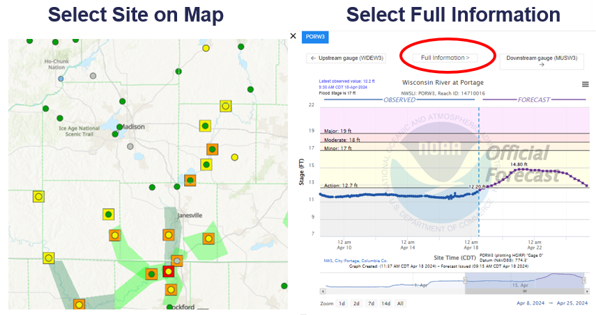
Then select the gauge location where flood inundation mapping is available and Select the Full Information tab:
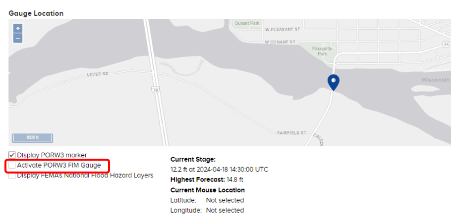
Scroll down on the new page until you see the map. Then select 'Activate FIM Gauge'.
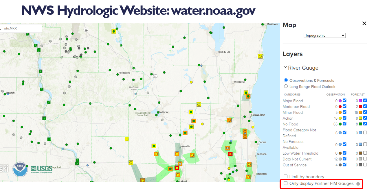
To see all locations where inundation mapping is available select 'Only display Partner FIM Gauges'.
Contact sarah.marquardt@noaa.gov with any questions.
Hazards
National Briefing
Hazardous Weather Outlook
Skywarn
View Local Storm Reports
Submit A Storm Report
Winter Weather
Summer Weather
Beach Hazards
Local Forecasts
Marine
Aviation
Fire
Local Text Products
Local Precip Forecast
Hourly Forecast Graphics
Forecast Discussion
Climate
Daily Climate Graphics
Local Climate Products
Normals/Records MKE/MSN
CoCoRaHS
Historic Events For Srn WI
Lightning Plot Archive
US Dept of Commerce
National Oceanic and Atmospheric Administration
National Weather Service
Milwaukee/Sullivan, WI
N3533 Hardscrabble Road
Dousman, WI 53118
262-965-2074
Comments? Questions? Please Contact Us.

