
Remnant moisture from Tropical Storm Rachel will persist over portions of the Great Basin and Southwest on Monday, bringing a potential heavy to excessive rainfall risk. Well above average and potentially record breaking temperatures will develop across the Plains and Midwest early this week, spreading into the Lower Mississippi Valley and Southeast midweek. Read More >
Overview
|
A historical event unfolded across the central United States as a strong storm system tracked across the central Plains and up across the Upper Mississippi Valley. Record warmth was observed across the state of Wisconsin ahead of this system, as temperatures soared into the mid to upper 60s. A few locations across southwest Wisconsin even saw temperatures warm into the lower 70s. Strong wind gusts of 55 to 65 mph were observed as the weakening line of thunderstorms moved into southwest Wisconsin and large-scale gradient winds increased behind decaying line of thunderstorms. Pockets of tree damage and power outages occurred as a result of the strong winds. The storm system was so powerful, it transported smoke from numerous large wildfires that ignited in western and central Kansas, all the way up into Wisconsin! We had many reports of seeing haze from the smoke and some were even able to smell a hint of smoke in the atmosphere. Visit our neighboring offices Top New Articles: La Crosse, WI |
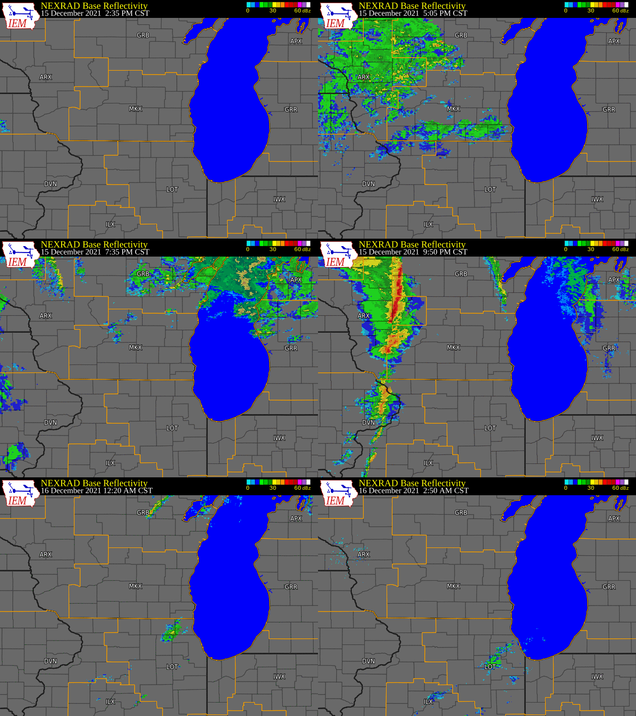 Radar loop showing robust thunderstorms moving into western Wisconsin late on the evening of December 15th, weakening as they passed through southern Wisconsin into the early morning hours of December 16th. |
Wind Damage
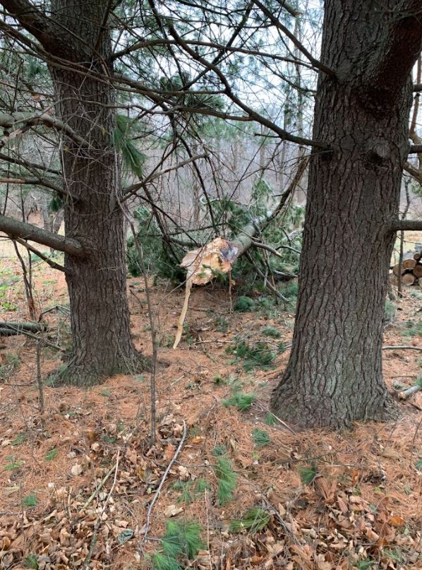
Sporadic tree damage was observed across portions of southern Wisconsin late in the evening on December 15th into the early morning hours of December 16th. Below are photos showing some of the damage.
.png) |
.png) |
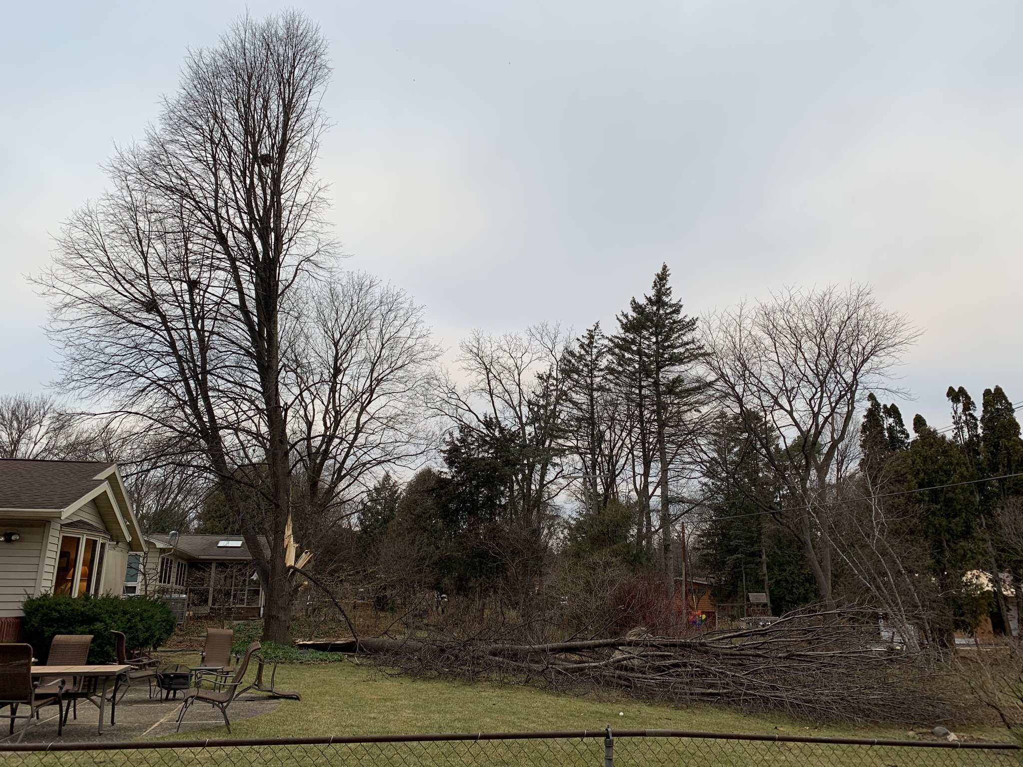 |
| Damage to a barn near Sullivan. Photo courtesy of Brad Ingersoll. | Large tree uprooted in Hartland. Photo courtesy of Andrew Shoaf. | Large tree split in SW Madison. Photo courtesy of @Stanthereindeer |
 |
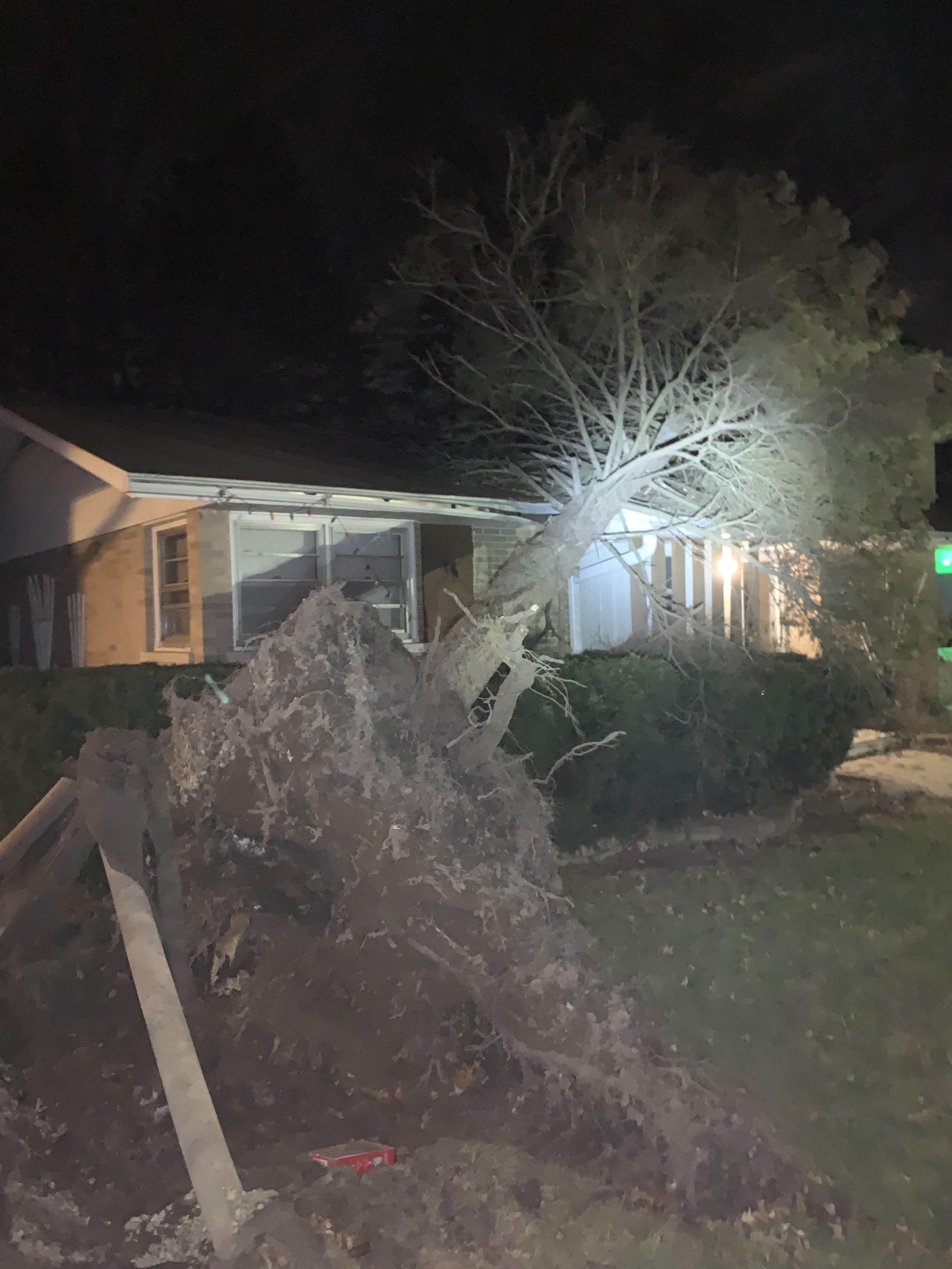 |
| Large limb downed in Delafield. Photo courtesy of Kevin Wagner. | Large uprooted tree in Kenosha. Photo courtesy of Tim Grant. |
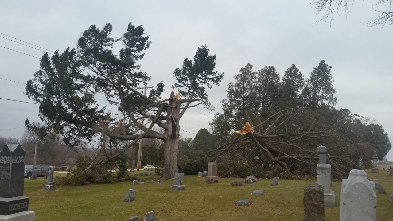 |
| Large pine tree snapped in a Watertown cemetery. Photo relayed by WKOW and courtesy of Michael Chartier. |
Summary of Records
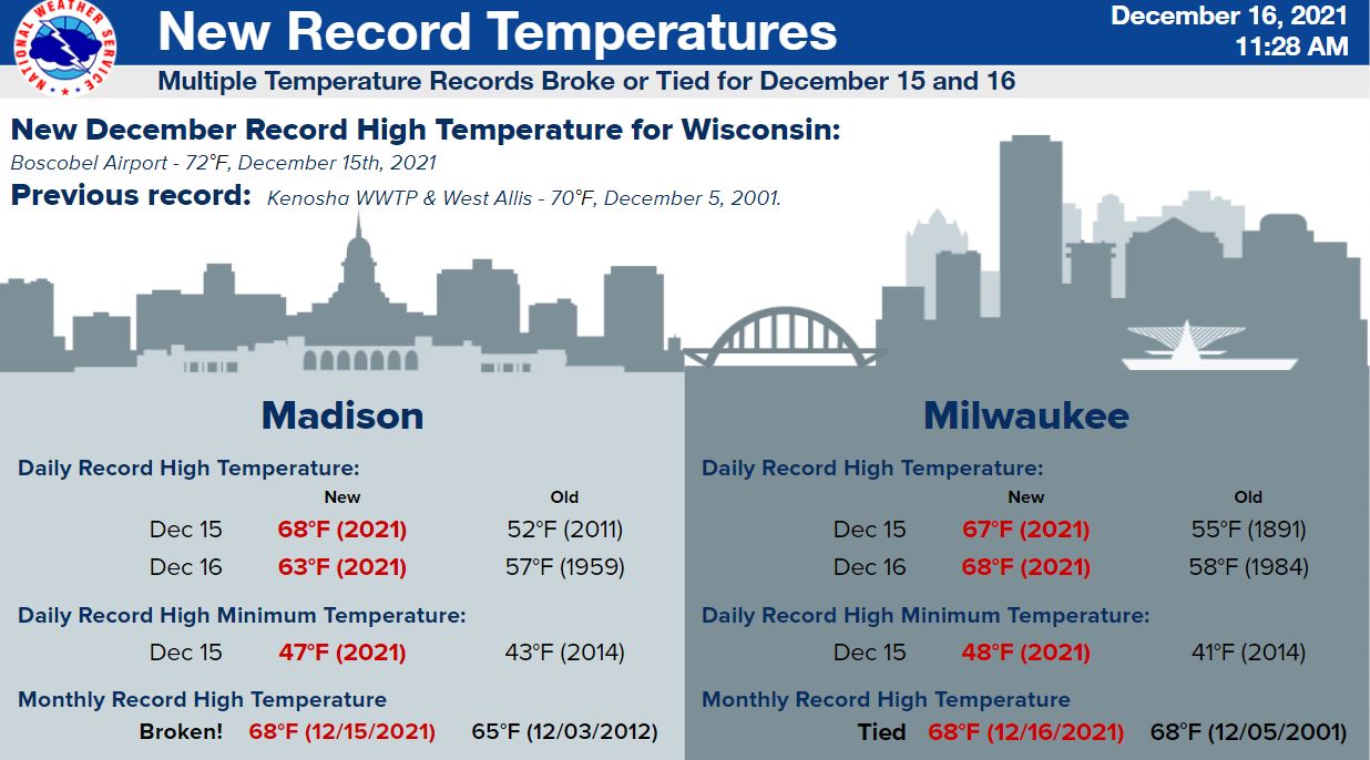
Record warmth spread across Wisconsin ahead of the powerful storm system that tracked across the region. Many climate locations across the state of Wisconsin recorded daily record high temperatures and some set all-time records for high temperatures in the month of December. Below are the temperature stats for the cities of Madison and Milwaukee for December 15th and 16th. The state of Wisconsin also set a new all-time record high for the month of December! See the graphic below for more specific details.
 |
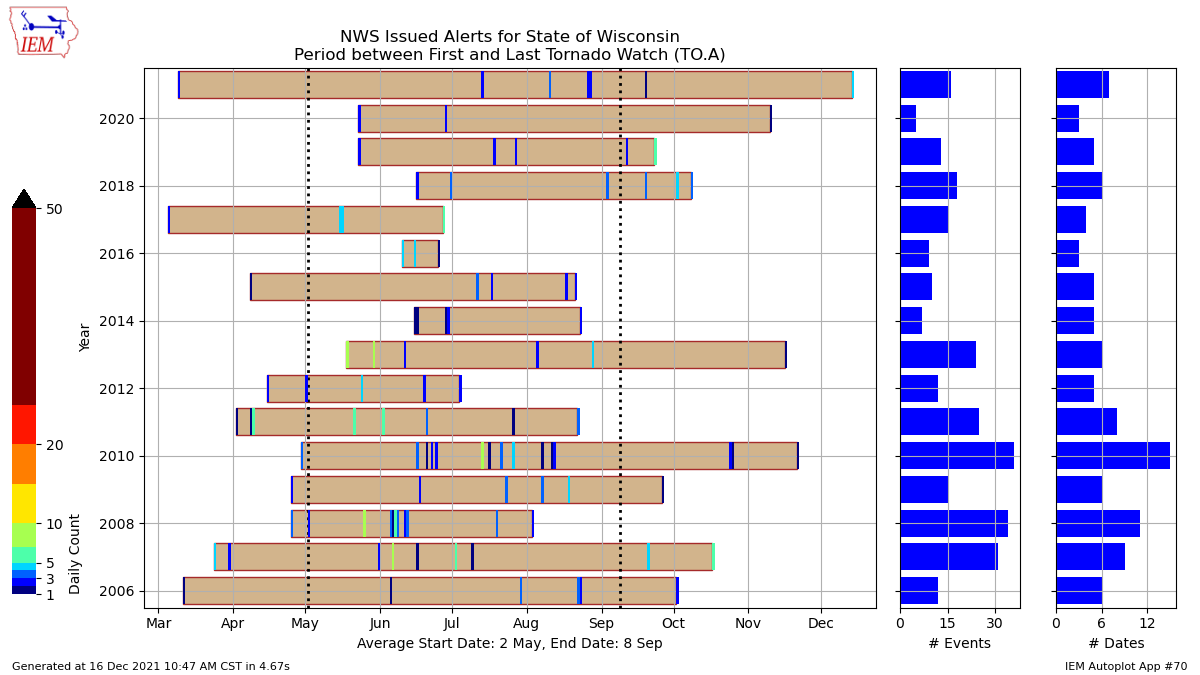
Looking back at records dating back to 1986, Wisconsin has never seen a Tornado Watch during the month of December. The Tornado Watch issued on the evening of December, 15, 2021 for western portions of Wisconsin is a first!
 |
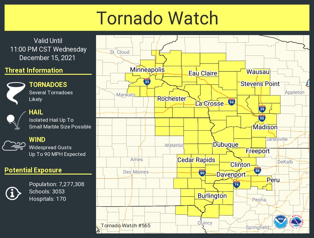 |
| The tornado watch issued on the evening of December 15th, 2021 was the first tornado watch issued for the state of Wisconsin during the month of December. Above is a graph showing the earliest and latest Tornado Watch issuances for the state of Wisconsin from 2006 to 2021. Image courtesy of the Iowa State University's Iowa Environmental Mesonet website. | First ever tornado watch issued for the state of Wisconsin in the month of December. |
Summary of Reports
For a complete list of Local Storm reports from this event from offices that serve the state of Wisconsin, click here!
.png) |
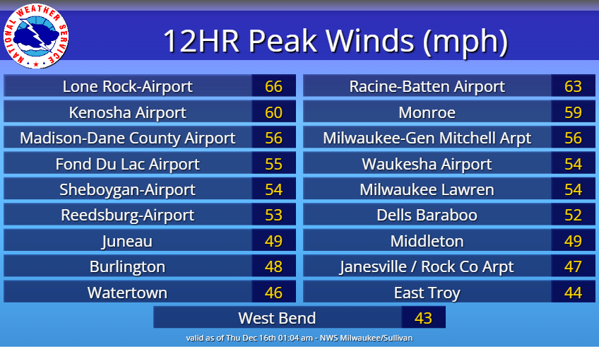 |
| Estimated winds across the state of Wisconsin from December 15-16th, 2021. Note: Due to the smoothing performed on this image, some of the higher peak wind gusts that occurred may be missed. | Peak wind gusts across south-central, east-central and southeast Wisconsin from December 15-16th, 2021. |
 |
Media use of NWS Web News Stories is encouraged! Please acknowledge the NWS as the source of any news information accessed from this site. |
|


 Follow us on X
 Follow us on Facebook
 Follow us on YouTube
 MKX RSS Feed