Heat expands across the Desert Southwest, Plains, Mississippi Valley and Midwest into Monday. Fire weather concerns continue for portions of the Intermountain West. Active monsoonal moisture fuels thunderstorms over the Southwest with possible flash flooding. Tropical cyclone Fausto in the Pacific, should weaken as it approaches Hawaii; Dangerous surf, swells and rip currents are expected. Read More >
Overview
|
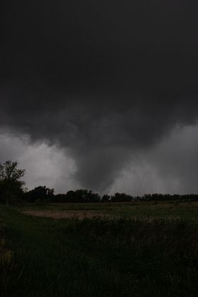
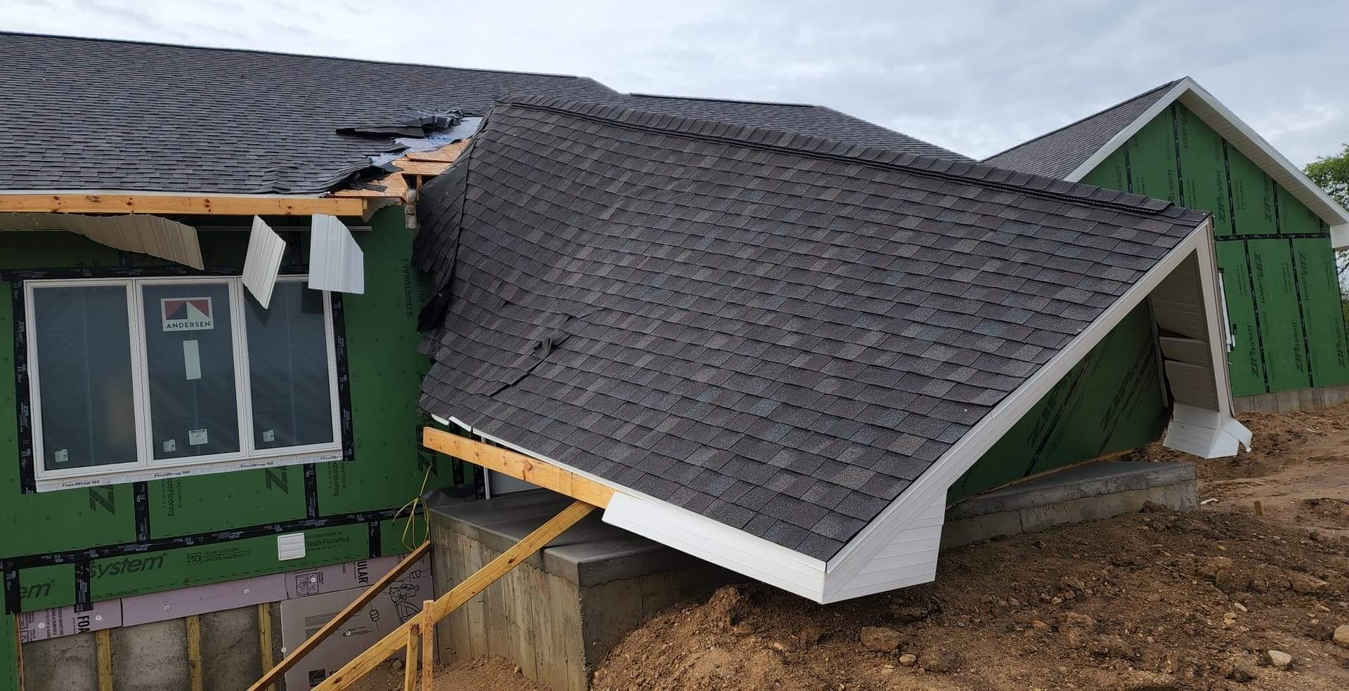
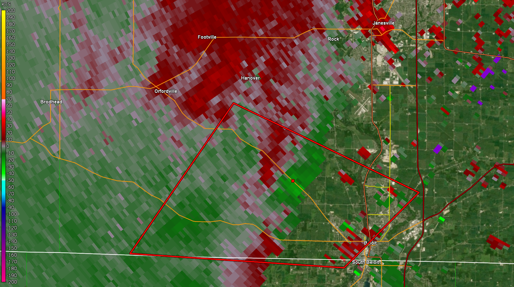
Showers and thunderstorms streamed into southern Wisconsin ahead of and along a warm front during the evening of Wednesday, May 25, 2022. There was just enough turning of the winds (shear) and instability for a few storms to rotate. One storm strengthened and started rotating over Winnebago County in north central Illinois and tracked into southwest Rock County at 6:37 pm. The storm produced a tornado as it tracked northwest of Beloit. |
Photo Credit: Barbara Heath |
Tornadoes
|
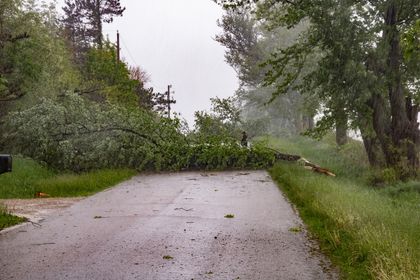
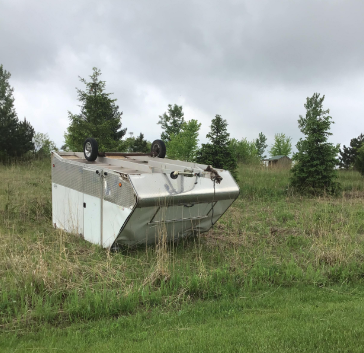
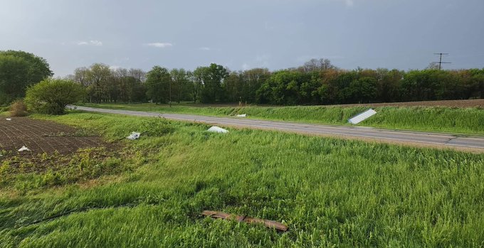
Tornado - 6 NW Beloit
Track Map 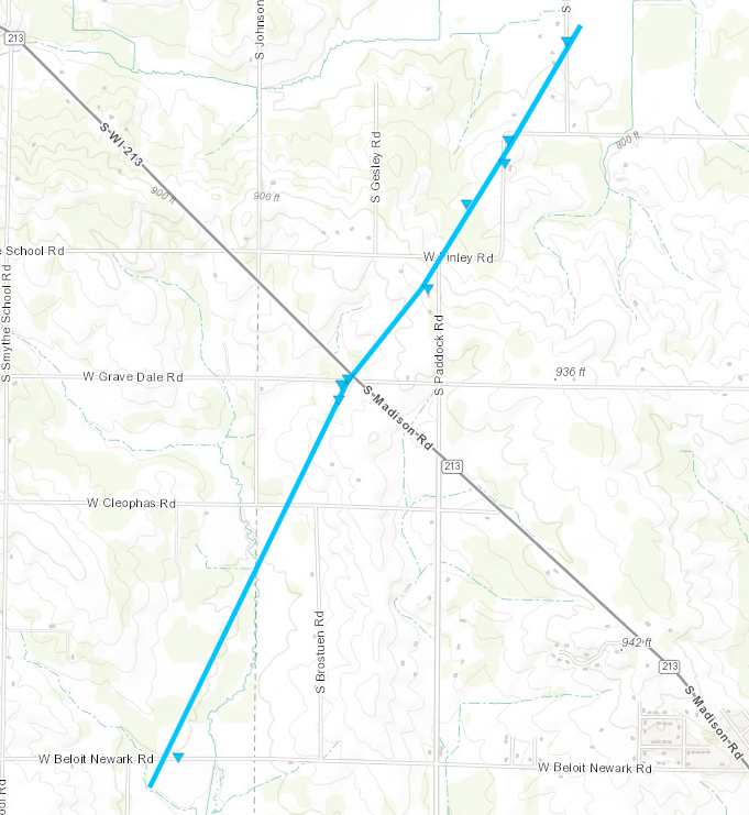 
Downloadable KMZ File |
||||||||||||||||
|
||||||||||||||||
The Enhanced Fujita (EF) Scale classifies tornadoes into the following categories:
| EF0 Weak 65-85 mph |
EF1 Moderate 86-110 mph |
EF2 Significant 111-135 mph |
EF3 Severe 136-165 mph |
EF4 Extreme 166-200 mph |
EF5 Catastrophic 200+ mph |
 |
|||||
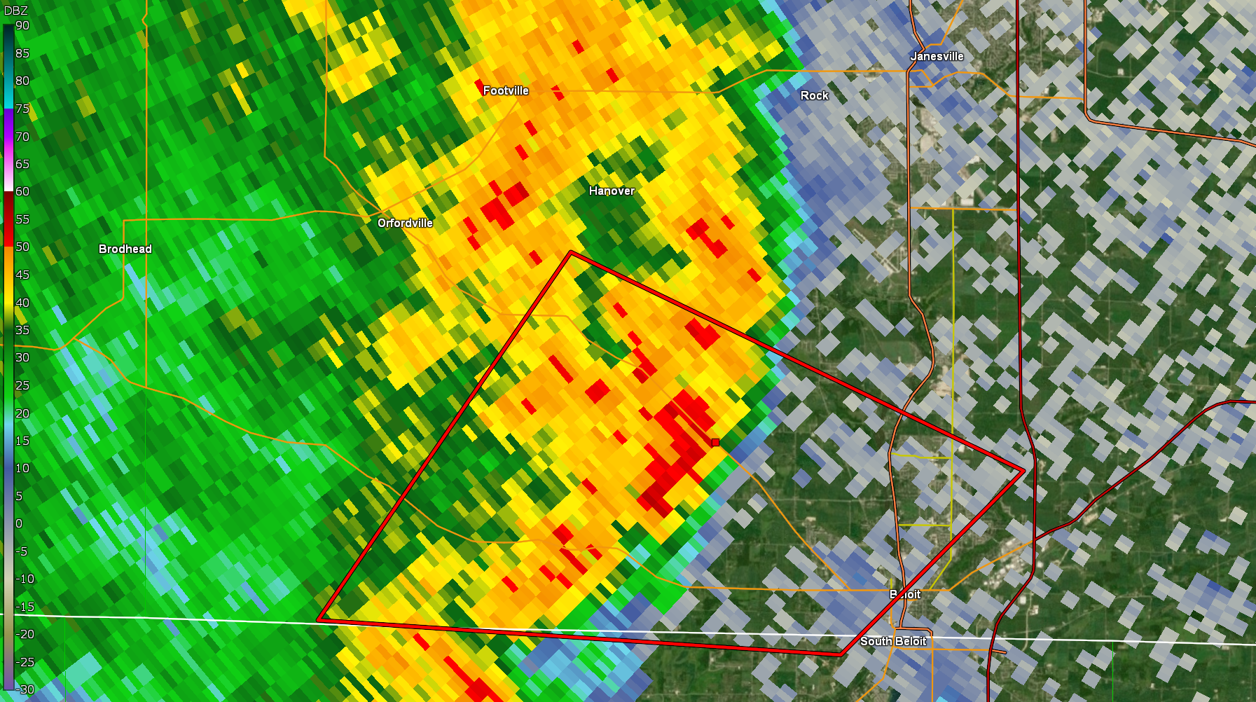
Radar
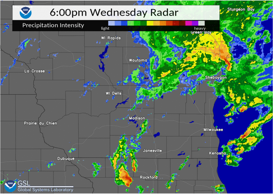 |
 |
 |
|
| Radar Reflectivity | 6:49 PM Reflectivity | 6:49 PM Storm Relative Velocity |
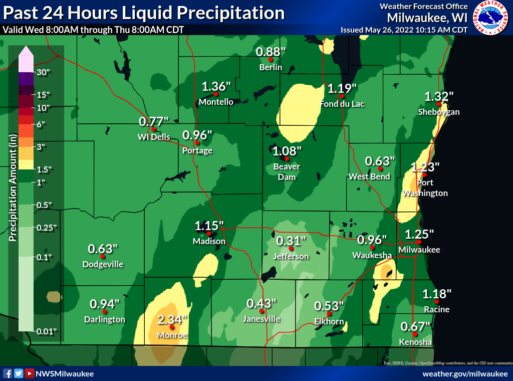
Rain Reports
Here is a map of the estimated rainfall amounts for southern Wisconsin and the state of Wisconsin.
 |
Media use of NWS Web News Stories is encouraged! Please acknowledge the NWS as the source of any news information accessed from this site. |
|