
Catastrophic Super Typhoon Bavi's eyewall has reached Rota and is expected to bring dangerous winds, heavy rainfall and storm surge to Guam, Rota, Tinian and Saipan. A Typhoon Warning remains in effect. Heavy to excessive rainfall will continue to bring a flooding threat from coastal Mid-Atlantic to southern New England through Monday. Read More >
Milwaukee/Sullivan, WI
Weather Forecast Office
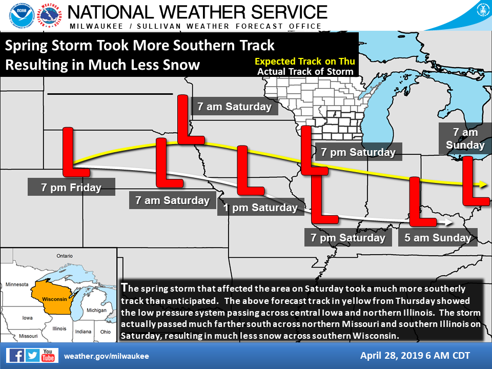
Southern Wisconsin received much less snowfall on Saturday than anticipated. The main reason was that the spring storm that was expected to pass to the south of Wisconsin took a farther south track. On Thursday, the storm was expected to move across Iowa and northern Illinois. Instead, it took a track across northern Missouri and southern Illinois. This resulted in less snowfall as well as a delay in the snow onset time across southern Wisconsin, due to lingering drier air in place.
Snowfall on Saturday was mainly confined to the southern three tiers of Wisconsin counties. Snowfall was generally in the 3 to 6 inch range in the counties near the Illinois border, with the Monroe, New Glarus and Kenosha areas reporting around 5.5 to 6.0 inches. Lower amounts were found to the north, with northern parts of the area not seeing any snow.
Madison received 1.2 inches which set a new record for April 27th. Milwaukee received 1.7 inches, which also set a new record for the date.

Despite wet weather returning at times through Wednesday, no additional snow is expected.
Hazards
National Briefing
Hazardous Weather Outlook
Skywarn
View Local Storm Reports
Submit A Storm Report
Winter Weather
Summer Weather
Beach Hazards
Local Forecasts
Marine
Aviation
Fire
Local Text Products
Local Precip Forecast
Hourly Forecast Graphics
Forecast Discussion
Climate
Historic Events For Srn WI
Lightning Plot Archive
Daily Climate Graphics
Local Climate Products
Normals/Records MKE/MSN
CoCoRaHS
US Dept of Commerce
National Oceanic and Atmospheric Administration
National Weather Service
Milwaukee/Sullivan, WI
N3533 Hardscrabble Road
Dousman, WI 53118
262-965-2074
Comments? Questions? Please Contact Us.

