Tropical Depression Two is expected to gradually strengthen and could bring tropical storm conditions to the Florida Panhandle beginning late Monday. Areas of flash flooding will be possible through Thursday along the eastern and central Gulf Coast. Severe thunderstorms will develop and move along a cold front crossing the Upper Midwest Monday, and through the Ohio Valley/Mid-Atlantic on Tuesday. Read More >
Lake Charles, LA
Weather Forecast Office
|
|
|
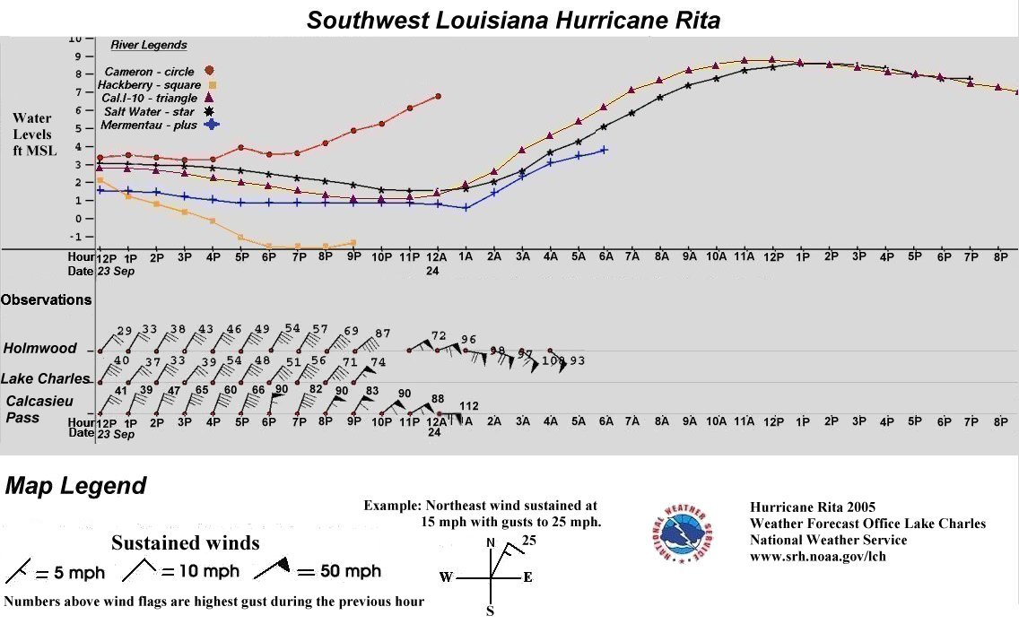
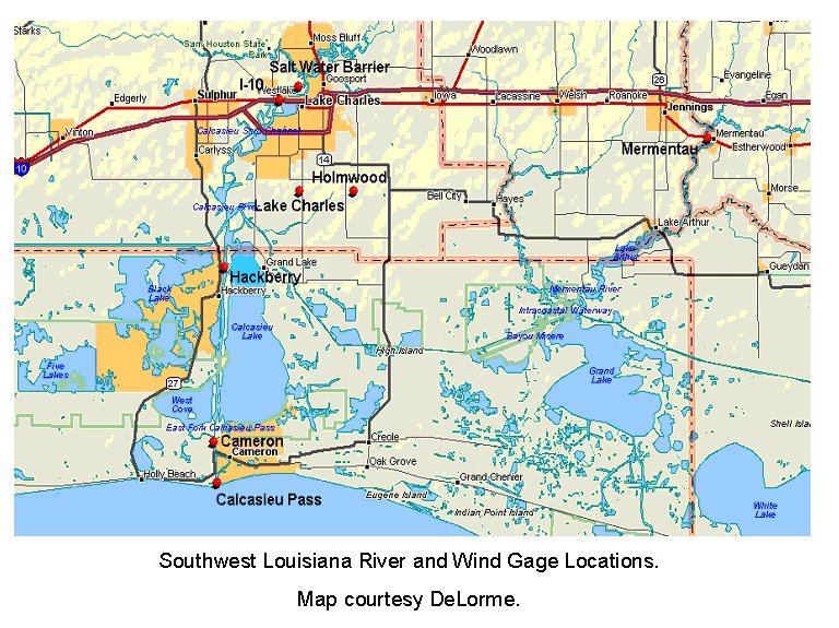
The Southwest Louisiana graphic shows the chronology of storm surge and surface winds as depicted by surface observations and river levels. Northeast winds prevailed before landfall with widespread tropical storm force winds (39 -73 mph) beginning mid afternoon Friday, September 23rd. At this time, strong northerly winds resulted in gradually falling river levels. About 6 PM, hurricane force winds (74 mph or greater) began pounding the immediate coastline and continued through the night. Storm surge waters reached the tide gage at the mouth of the Calcasieu River around 7 PM with a steady increase until the gage failed around midnight. The rest of the inland river gages began rising after midnight and continued until early afternoon on Saturday. Storm surge waters 10-15 feet MSL impacted the Southwest Louisiana coastline. Actual flood levels can be obtained by subtracting property elevations above sea level. |
Forecasts
Wet Bulb Globe Temps
Aviation Weather
Activity Planner
Mardi Gras Decision Support
Marine Forecasts
Local Products
Model Data
Forecaster's Discussion
Fire Weather
Graphical Forecasts
Other Links
National Hurricane Ctr
Storm Prediction Ctr
Weather Prediction Ctr
Other Links
Office History
LCH StoryMap
Hazards
Severe Weather
Tropical Weather
National Outlooks
Local Storm Reports
Tropical Cyclone Reports
Current
Satellite Data
Observations
Tide Data
Hydrology
Calcasieu Par. Network
Jefferson Co. DD6 Network
River/Lake Forecasts
Radar
Shreveport (SHV)
New Orleans (LIX)
Fort Polk (POE)
Houston/Galveston (HGX)
Lake Charles (LCH)
Probabilistic Pages
Probabilistic Snowfall
Probabilistic Rainfall
Probabilistic DSS
US Dept of Commerce
National Oceanic and Atmospheric Administration
National Weather Service
Lake Charles, LA
500 Airport Boulevard
Lake Charles, LA 70607
(337) 477-5285 M-F 8a to 4p only
Comments? Questions? Please Contact Us.