
Remnant moisture from Tropical Storm Rachel will persist over portions of the Great Basin and Southwest on Monday, bringing a potential heavy to excessive rainfall risk. Well above average and potentially record breaking temperatures will develop across the Plains and Midwest early this week, spreading into the Lower Mississippi Valley and Southeast midweek. Read More >
Lake Charles, LA
Weather Forecast Office
|
|
|
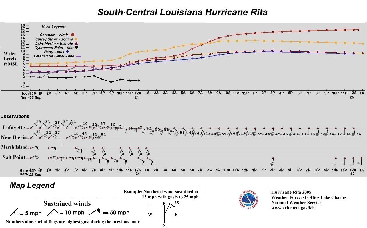
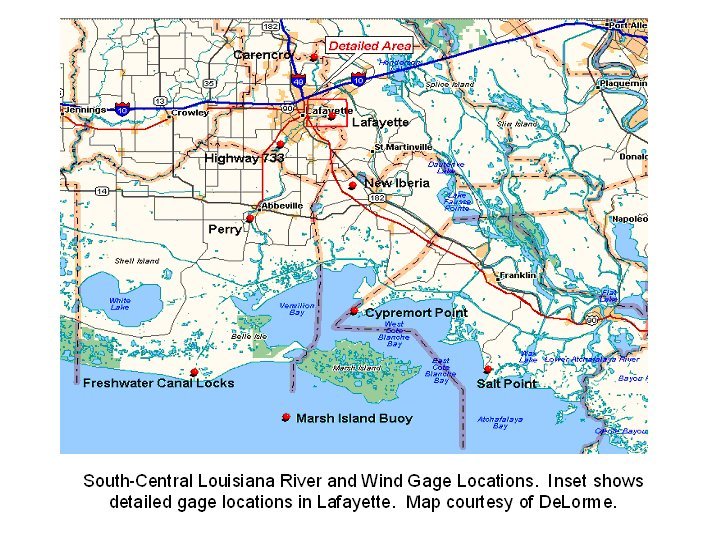
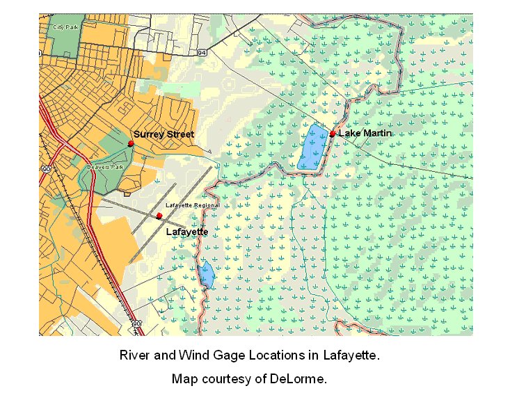
The South-Central Louisiana graphic shows the chronology of the storm surge and surface winds as depicted by surface observations and river readings. Northeast winds prevailed before landfall with widespread tropical storm force winds (39-73 mph) along the immediate coast before noon on Friday, September 23rd. At this time, strong northeast winds helped to keep the river levels steady with no appreciable storm surge. By 5 PM, near hurricane force winds (74 mph or greater) could be found over Marsh Island. Tropical Storm force winds continued to pound the coast through the night. Storm surge waters reached several of the river gages just about the time when the wind direction shifted to the southeast. Storm surge waters 10-15 feet MSL impacted south central Louisiana coastal parishes. Actual flood levels can be obtained by subtracting property elevations above sea level. |
Forecasts
Local Products
Model Data
Forecaster's Discussion
Fire Weather
Graphical Forecasts
Wet Bulb Globe Temps
Aviation Weather
Activity Planner
Mardi Gras Decision Support
Marine Forecasts
Other Links
National Hurricane Ctr
Storm Prediction Ctr
Weather Prediction Ctr
Other Links
Office History
LCH StoryMap
Hazards
Severe Weather
Tropical Weather
National Outlooks
Local Storm Reports
Tropical Cyclone Reports
Current
Tide Data
Satellite Data
Observations
Hydrology
Jefferson Co. DD6 Network
River/Lake Forecasts
Calcasieu Par. Network
Radar
Shreveport (SHV)
New Orleans (LIX)
Fort Polk (POE)
Houston/Galveston (HGX)
Lake Charles (LCH)
Probabilistic Pages
Probabilistic Rainfall
Probabilistic DSS
Probabilistic Snowfall

US Dept of Commerce
National Oceanic and Atmospheric Administration
National Weather Service
Lake Charles, LA
500 Airport Boulevard
Lake Charles, LA 70607
(337) 477-5285 M-F 8a to 4p only
Comments? Questions? Please Contact Us.



 Follow us on X
 Follow us on Facebook
 Follow us on YouTube
 LCH RSS Feed