|
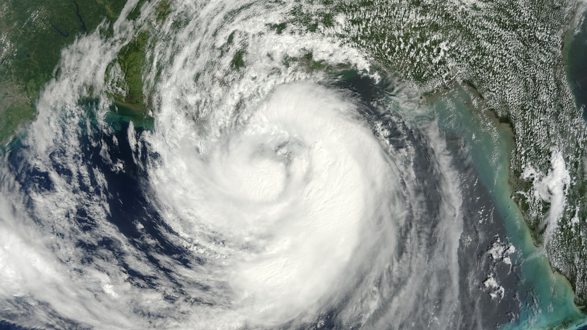
Above: MODIS Visible Satellite Image of Hurricane Isaac off the Southeast Louisiana Coast at 16:30 UTC (11:30 AM CDT) on August 28, 2012.
A tropical wave moves offshore the coast of western African by August 16th. Thunderstorm activity began to organize with the system over succeeding days. By the 21st, the system became well-enough organized with a defined circulation center to be declared Tropical Depression Nine well east of the Leeward Islands. Aircraft reconnaissance indicated the system had strengthened into a tropical storm later that day, named Isaac. Isaac passed to the south of Guadeloupe as it entered the Caribbean Sea on the 22nd. Slowly becoming better organized, Isaac approached Hispaniola with an eye feature, crossing the southwest peninsula of Haiti on the 25th.
Isaac became elongated as an upper low developed to its west, developing an east-west surface trough with Isaac on its eastern periphery. Moving northwest along the north coast of Cuba, Isaac slowly recovered some intensity while moving through the Florida Straits. A ragged eye occasionally formed with the system, but did not persist. Isaac grew in scale and strengthened as it moved northwest through the Gulf. Late on the morning of the 26th, Isaac strengthened into a hurricane before approaching southeast Louisiana that night. It lingered near the coast before making landfall during the early morning on the 29th west of Port Fourchon, Louisiana.
The slow-moving system weakened into a tropical storm that afternoon while drifting northwest through Louisiana. By the afternoon of the 30th, Isaac weakened into a tropical depression in northern Louisiana. The depression moved northward through Arkansas and Missouri, before evolving into an extratropical cyclone near Columbia, Missouri as it interacted with an upper trough across the central Plains during the morning of September 1st.
The low moved slowly eastward, moving across southern Illinois and Indiana before dropping towards western Kentucky on the night of the 3rd. The system's 700 hPa circulation then split in two, with one portion dropping down towards the Gulf and a second, smaller piece moving eastward, spawning a new extratropical low across Ohio during the morning of the 4th.
Listed below are post-storm reports and meteorological data gathered from this hurricane. All data is considered preliminary, and is subject to change at any time. Additional information will continue to be added to this page in the future.
|


 Follow us on X
 Follow us on Facebook
 Follow us on YouTube
 LCH RSS Feed