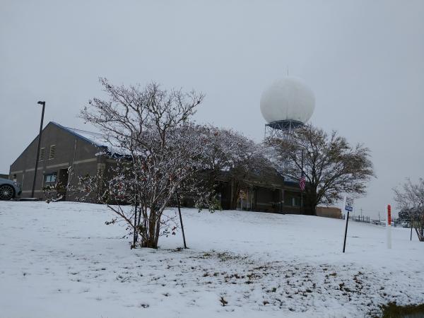
Photo of the National Weather Service Lake Charles office on the morning of 8 December.
A cold front moved across Southeast Texas and Southwest Louisiana during the late afternoon and early evening hours of December 7, 2017. Meanwhile, an area of low pressure in the western Gulf of America resulted in the development of precipitation along the cold front. Temperatures began to cool as colder air filtered into the region and the rain changed to snow during the early morning hours of December 8th. As the snow came to an end by mid-day December 8th, many parts of Southeast Texas and Southwest Louisiana experienced measurable snowfall with totals up to 5 inches.
|
12/8/17 Snowfall Reports |
|||
| TEXAS | LOUISIANA | ||
| Port Acres | 4.3" | Garden City | 4.5" |
| Pine Forest | 4.1" | Centerville | 4" |
| Bridge City | 3.4" | Moss Bluff | 4" |
| Woodville | 3.1" | Pine Prairie | 4" |
| Beaumont | 3" | Turkey Creek | 4" |
| Jack Brooks Airport | 3" | DeQuincy | 3.75" |
| South Beaumont | 3" | Franklin | 3.75" |
| Spurger | 2.6" | Elton | 3.5" |
| Little Cypress | 2" | Bunkie | 3" |
| Lumberton | 2" | Carlyss | 3" |
| Mauriceville | 2" | DeRidder | 3" |
| Orange | 2" | Dry Creek | 3" |
| China | 1.5" | Fenton | 3" |
| Fred | 1.5" | Ragley | 3" |
| Port Neches | 1.5" | Rosepine | 3" |
| Kountze | 1" | Tate Cove | 3" |
| Topsy | 3" | ||
| Westlake | 3" | ||
| Charenton | 2.75" | ||
| Marksville | 2.75" | ||
| Berwick | 2.5" | ||
| Iowa | 2.5" | ||
| Patterson | 2.5" | ||
| Sulphur | 2.5" | ||
| Acadiana Airport | 2.5" | ||
| Lake Charles Airport | 2.1" | ||
| Grand Lake | 1.8" | ||
| Oberlin | 1.8" | ||
| Deville | 1.75" | ||
| Lafayette Airport | 1.7" | ||
| Oakdale | 1.6" | ||
| Morgan City | 1.5" | ||
| Ville Platte | 1.5" | ||
| Carencro | 1" | ||
| Pineville | 1" | ||
| Scott | 1" | ||
| Eunice | 0.5" | ||