
Tropical Depression Two is expected to gradually strengthen and could bring tropical storm conditions to the Florida Panhandle beginning late Monday. Areas of flash flooding will be possible through Thursday along the eastern and central Gulf Coast. Severe thunderstorms will develop and move along a cold front crossing the Upper Midwest Monday, and through the Ohio Valley/Mid-Atlantic on Tuesday. Read More >
Lake Charles, LA
Weather Forecast Office
| MARCH 27 2009 SEVERE WEATHER |
| Overview |
| The third day in a row of severe weather impacted Southeast Texas and Southwest Louisiana. Numerous multicell and supercell thunderstorms moving across the area spawned one confirmed tornado and widespread large hail. One intense supercell thunderstorm developed north of Houston, TX, and tracked for hundreds of miles across southeast Texas, through southwest Louisiana, into Mississippi, with dozens of reports of large hail received. This supercell thunderstorm produced hail up to grapefruit size in Allen Parish, which was the largest known hail in southwest Louisiana since 2003. |
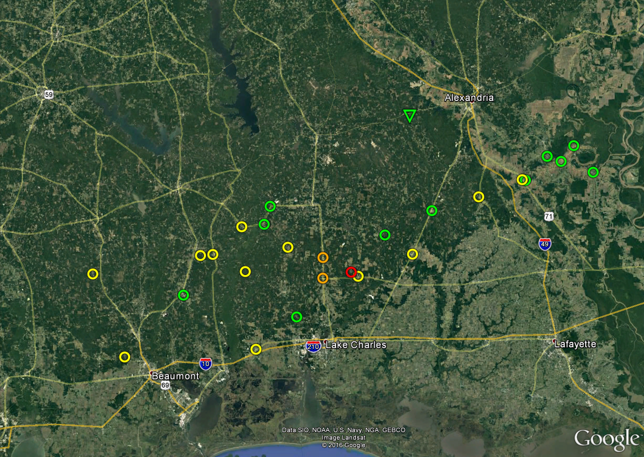
| Google Map Legend | |||||
|
Tornadoes |
EF0 |
EF1 |
EF2 |
||
|
Hail |
<1" |
1"+ |
2"+ |
3"+ |
4"+ |
| T'storm Wind |
|
||||
Forecasts
Marine Forecasts
Local Products
Model Data
Forecaster's Discussion
Fire Weather
Graphical Forecasts
Wet Bulb Globe Temps
Aviation Weather
Activity Planner
Mardi Gras Decision Support
Other Links
National Hurricane Ctr
Storm Prediction Ctr
Weather Prediction Ctr
Other Links
Office History
LCH StoryMap
Hazards
Severe Weather
Tropical Weather
National Outlooks
Local Storm Reports
Tropical Cyclone Reports
Current
Tide Data
Satellite Data
Observations
Hydrology
Jefferson Co. DD6 Network
River/Lake Forecasts
Calcasieu Par. Network
Radar
Shreveport (SHV)
New Orleans (LIX)
Fort Polk (POE)
Houston/Galveston (HGX)
Lake Charles (LCH)
Probabilistic Pages
Probabilistic Rainfall
Probabilistic DSS
Probabilistic Snowfall
US Dept of Commerce
National Oceanic and Atmospheric Administration
National Weather Service
Lake Charles, LA
500 Airport Boulevard
Lake Charles, LA 70607
(337) 477-5285 M-F 8a to 4p only
Comments? Questions? Please Contact Us.

