
Tropical Depression Two is expected to gradually strengthen and could bring tropical storm conditions to the Florida Panhandle beginning late Monday. Areas of flash flooding will be possible through Thursday along the eastern and central Gulf Coast. Severe thunderstorms will develop and move along a cold front crossing the Upper Midwest Monday, and through the Ohio Valley/Mid-Atlantic on Tuesday. Read More >
Lake Charles, LA
Weather Forecast Office
|
FEBRUARY 21 2008 SEVERE WEATHER |
| Overview |
| A very busy month for severe weather continued across Southeast Texas and Southwest Louisiana as severe thunderstorms impacted the region again on February 21st. One long-track supercell developed near Sabine Pass, TX and moved northeastward across Cameron, Calcasieu, Jeff Davis, Allen, Evangeline, St. Landry, and Avoyelles Parishes for several hours. 4 tornadoes, several funnel clouds, large hail, and flooding were all produced by this single thunderstorm. Other severe thunderstorms dropped large hail and brought damaging winds to parts of the area as well. |
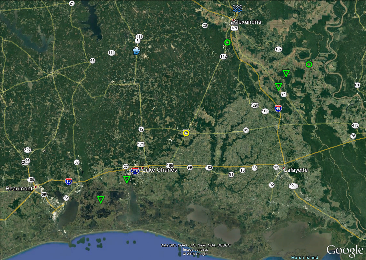
| Google Map Legend | |||||
|
Tornadoes |
EF0 |
EF1 |
EF2 |
||
|
Hail |
<1" |
1"+ |
2"+ |
3"+ |
4"+ |
| T'storm Wind |
|
||||
Forecasts
Forecaster's Discussion
Fire Weather
Graphical Forecasts
Wet Bulb Globe Temps
Aviation Weather
Activity Planner
Mardi Gras Decision Support
Marine Forecasts
Local Products
Model Data
Other Links
National Hurricane Ctr
Storm Prediction Ctr
Weather Prediction Ctr
Other Links
Office History
LCH StoryMap
Hazards
Severe Weather
Tropical Weather
National Outlooks
Local Storm Reports
Tropical Cyclone Reports
Current
Tide Data
Satellite Data
Observations
Hydrology
River/Lake Forecasts
Calcasieu Par. Network
Jefferson Co. DD6 Network
Radar
Shreveport (SHV)
New Orleans (LIX)
Fort Polk (POE)
Houston/Galveston (HGX)
Lake Charles (LCH)
Probabilistic Pages
Probabilistic DSS
Probabilistic Snowfall
Probabilistic Rainfall
US Dept of Commerce
National Oceanic and Atmospheric Administration
National Weather Service
Lake Charles, LA
500 Airport Boulevard
Lake Charles, LA 70607
(337) 477-5285 M-F 8a to 4p only
Comments? Questions? Please Contact Us.

