Wichita, Kansas
Weather Forecast Office
Wind Tools Review
-by Rob Cox-
NWS Wichita, Kansas
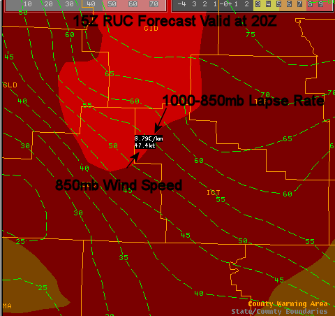
This fall, we have had some good wind events as one would expect. What I would like to do is to show some of the science and technology that was discussed in the recent seminar that will help you make headline decisions with regard to wind.
Basically, forecasting wind speeds for wind advisories can be boiled down to the following:
There are a few tools that will help you do this.
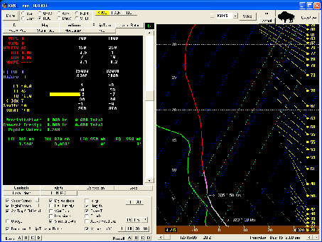
Remember there are factors that can prohibit this from occurring. Typically, you want very few clouds, as the will decrease mixing. With that said, it can still occur, but the clouds will undoubtedly hinder mixing and therefore transport of winds to the surface.
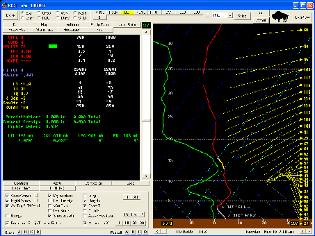
| Here is another case, the November 15th case here we issued a High Wind Watch, then Warning. BUFKIT clearly shows the potential high wind. The image here (click to enlarge) shows the 3 things here we want to see, unidirectional flow, strong instability, and strong winds. |
Click Image to Enlarge |
Hazards
Briefing pages
Local weather story
Submit a storm report
Storm Prediction Center
Enhanced Hazardous Weather Outlook
Current Conditions
Local Radar
National Radar
Satellite
Hourly weather(text)
Precip Analysis
Snowfall analysis
This day in weather history
7 Day Lightning Archive
Forecasts
Forecast Discussion
Weather Story
Fire Weather
Activity Planner
Aviation Weather
Soaring Forecast
Hurricane Center
Graphical Forecasts
Regional Weather Summary
Probabilistic Snow
Probabilistic QPF
Wet Bulb Globe temp
Climate
Local Climate Page
Daily/Monthly data(F6)
Daily Records
Climate Normals
Local drought page
Latest Climate Report(ICT)
Latest Climate Report(SLN)
Latest Climate Report(CNU)
CoCoRaHS
7 Day Lightning Archive
US Dept of Commerce
National Oceanic and Atmospheric Administration
National Weather Service
Wichita, Kansas
2142 S. Tyler Road
Wichita, KS 67209-3016
316-942-3102
Comments? Questions? Please Contact Us.


