Wichita, Kansas
Weather Forecast Office
New 1991-2020 Climate Normals Released May 4th
 |
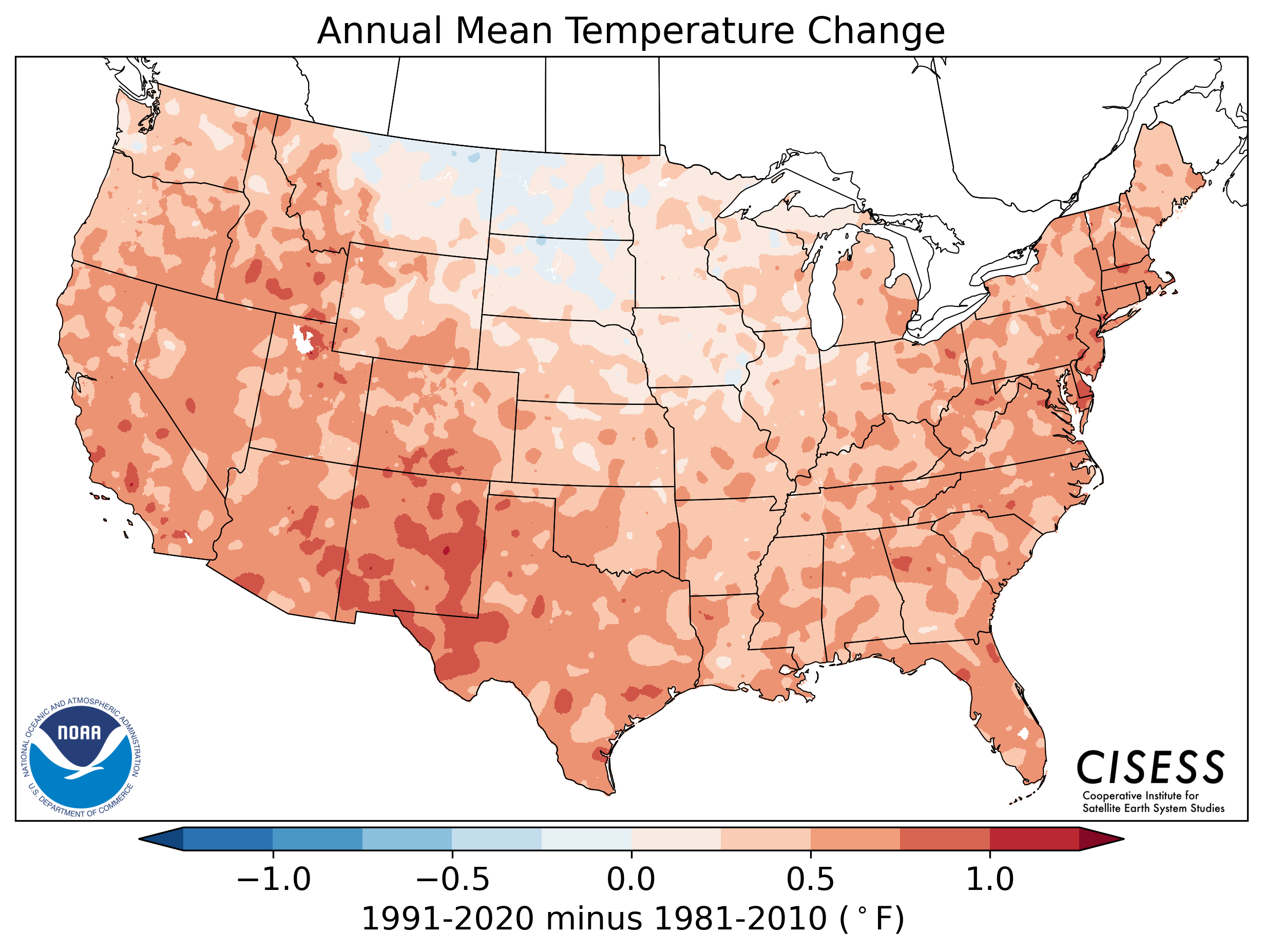
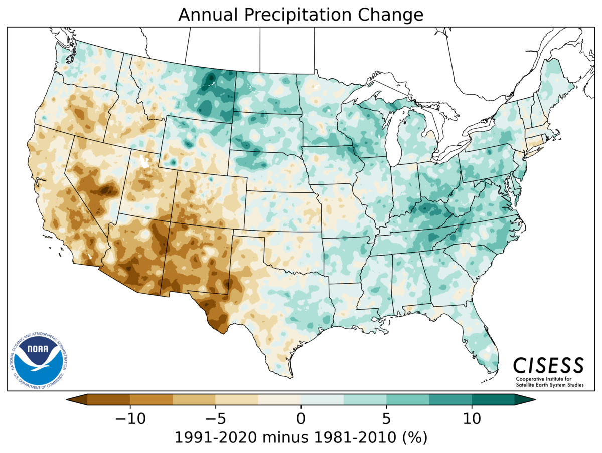
After much anticipation, the National Oceanic and Atmospheric Administration (NOAA) along with the National Centers for Environmental Information (NCEI) have released the new U.S. Climate normals for 1991-2020. These normals span a 30-year period, and are updated once each decade. The previous set of normals spanned from 1981-2010.
This important update helps us explain how current weather conditions measure up to the recent past. Normals provide information about temperature, precipitation, snowfall, heating/cooling degree days, first and last frost/freeze dates, growing degree days, and much more. Several new normals will be introduced for the first time.
Below are some helpful links:
Hazards
Briefing pages
Local weather story
Submit a storm report
Storm Prediction Center
Enhanced Hazardous Weather Outlook
Current Conditions
Local Radar
National Radar
Satellite
Hourly weather(text)
Precip Analysis
Snowfall analysis
This day in weather history
7 Day Lightning Archive
Forecasts
Forecast Discussion
Weather Story
Fire Weather
Activity Planner
Aviation Weather
Soaring Forecast
Hurricane Center
Graphical Forecasts
Regional Weather Summary
Probabilistic Snow
Probabilistic QPF
Wet Bulb Globe temp
Climate
Local Climate Page
Daily/Monthly data(F6)
Daily Records
Climate Normals
Local drought page
Latest Climate Report(ICT)
Latest Climate Report(SLN)
Latest Climate Report(CNU)
CoCoRaHS
7 Day Lightning Archive
US Dept of Commerce
National Oceanic and Atmospheric Administration
National Weather Service
Wichita, Kansas
2142 S. Tyler Road
Wichita, KS 67209-3016
316-942-3102
Comments? Questions? Please Contact Us.


