Overview
|
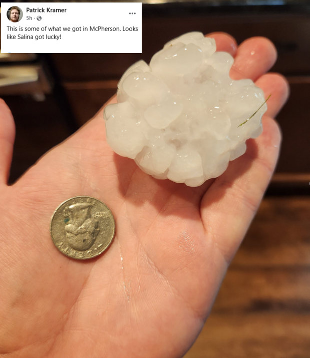
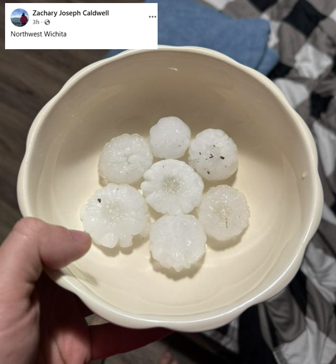
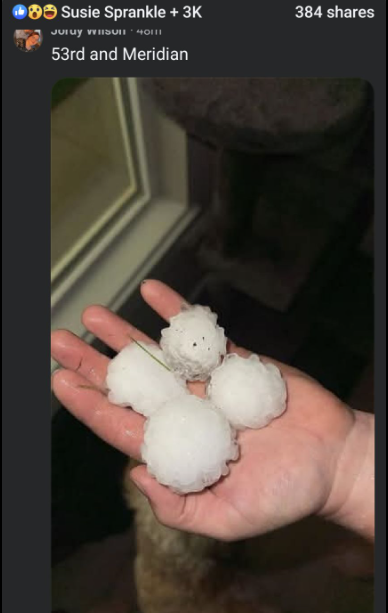
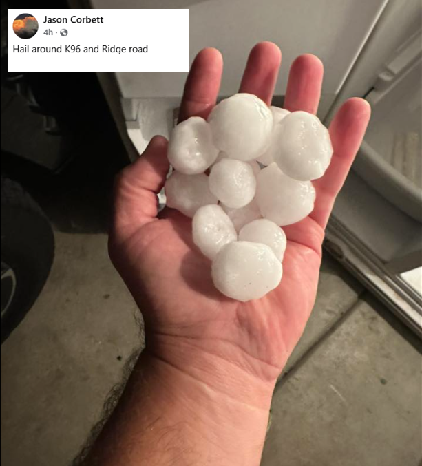
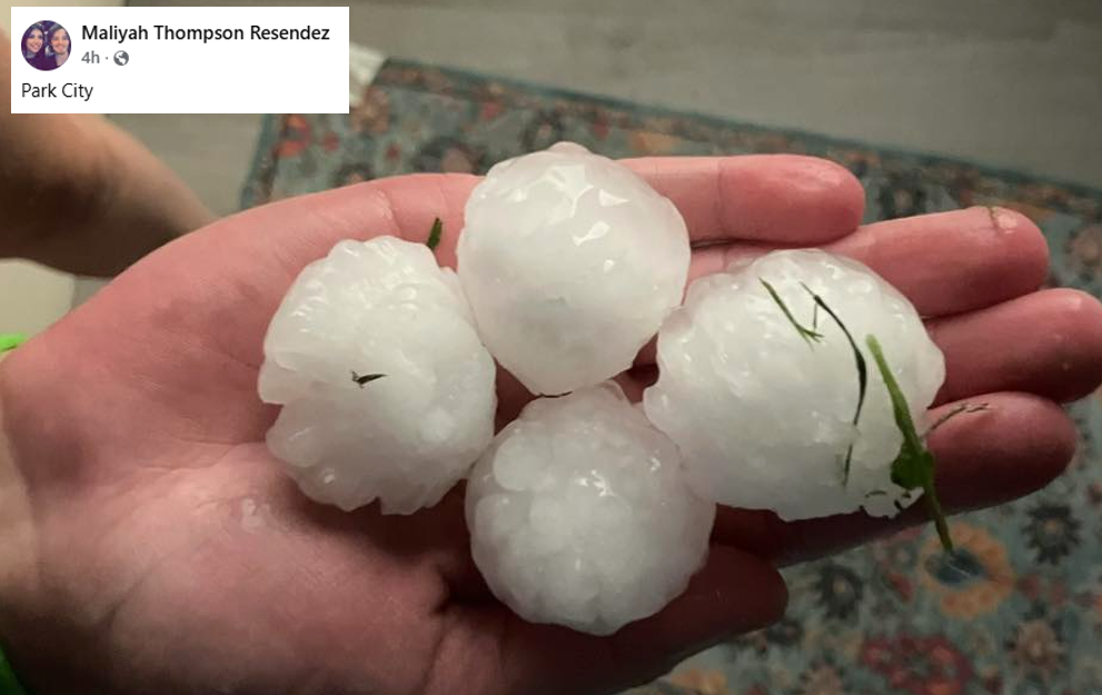
During the early evening of Wednesday September 3rd, a few powerful supercells tracked south across central and south central Kansas. These storms quickly became severe, producing very large hail as they tracked off to the southeast. Salina, McPherson, parts of Wichita along with areas in Harvey county all experienced hail to the size of base balls! The extremely large hail caused extensive damage to cars, homes and agriculture. |
 |
Hail Pictures
 |
 |
 |
 |
|
|
|
|
|
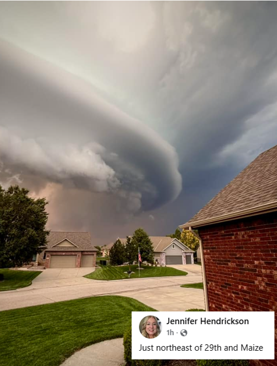
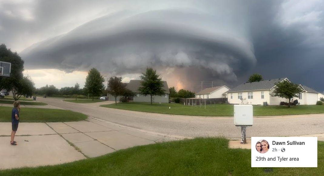
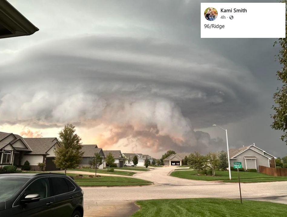
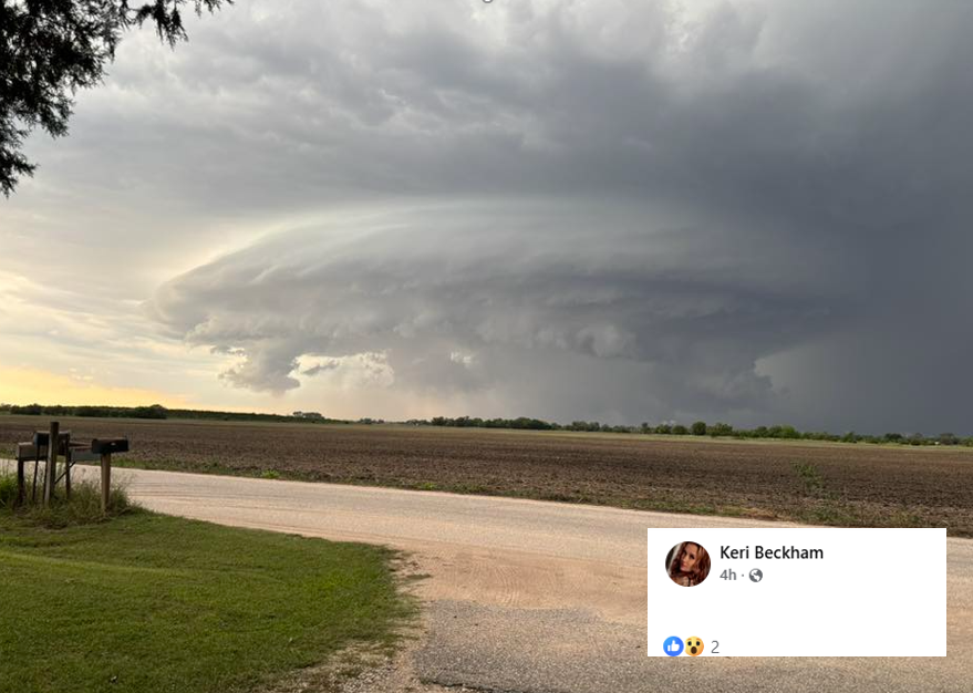
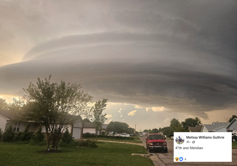
Storm Structure Pictures
 |
 |
 |
 |
 |
|
|
|
|
|
|
|
Radar & Satellite
 |
 |
 |
| Radar animation of the entire event | Radar animation showing the supercell going through McPherson | Radar animation showing two supercell going through Wichita |
 |
 |
| Infrared Satellite animation | Visible satellite animation |
Storm Reports
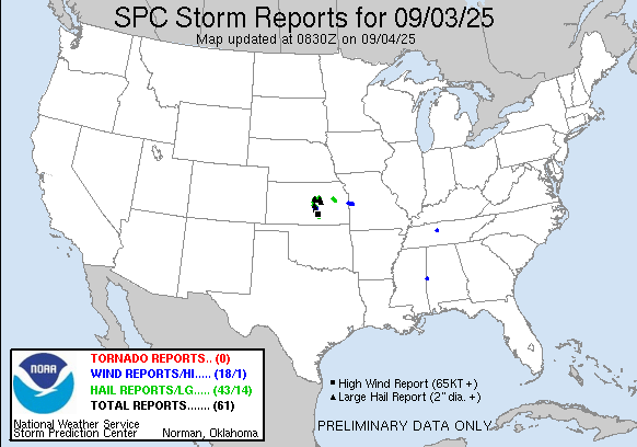
Preliminary Local Storm Report...Summary
National Weather Service Wichita KS
1007 PM CDT Wed Sep 3 2025

..TIME...   ...EVENT...      ...CITY LOCATION...     ...LAT.LON...
..DATE...   ....MAG....      ..COUNTY LOCATION..ST.. ...SOURCE....
            ..REMARKS..

0508 PM     Hail             4 W Salina              38.82N 97.69W
09/03/2025  M1.00 Inch       Saline             KS   Trained Spotter


0516 PM     Hail             5 NW Smolan             38.80N 97.74W
09/03/2025  M2.75 Inch       Saline             KS   Emergency Mngr


0516 PM     Hail             4 W Salina              38.83N 97.70W
09/03/2025  E1.50 Inch       Saline             KS   Public


0520 PM     Hail             1 NW Salina             38.82N 97.63W
09/03/2025  M1.25 Inch       Saline             KS   Public


0525 PM     Hail             3 E Smolan              38.74N 97.62W
09/03/2025  M2.25 Inch       Saline             KS   Broadcast Media

            Delayed report, time estimated via radar.

0526 PM     Hail             3 NE Smolan             38.77N 97.65W
09/03/2025  M1.50 Inch       Saline             KS   Trained Spotter

            Hail was covering the ground south of Salina
            Airport.

0533 PM     Hail             Assaria                 38.68N 97.61W
09/03/2025  M1.50 Inch       Saline             KS   Emergency Mngr


0536 PM     Hail             Assaria                 38.68N 97.61W
09/03/2025  E1.50 Inch       Saline             KS   Trained Spotter


0540 PM     Hail             Marquette               38.56N 97.84W
09/03/2025  E1.50 Inch       McPherson          KS   Public

            Size estimated from picture sent with
            quarter for scale.

0545 PM     Hail             2 SSW Assaria           38.66N 97.62W
09/03/2025  E1.75 Inch       Saline             KS   Storm Chaser


0602 PM     Hail             6 WNW Lost Springs      38.60N 97.06W
09/03/2025  M2.00 Inch       Marion             KS   Emergency Mngr

            Two inch size hail in Ramona.

0609 PM     Hail             6 WNW Lost Springs      38.60N 97.06W
09/03/2025  E3.00 Inch       Marion             KS   Emergency Mngr

            Report from Ramona.

0610 PM     Hail             1 N Mcpherson           38.39N 97.66W
09/03/2025  M1.50 Inch       McPherson          KS   Trained Spotter


0614 PM     Hail             1 N Mcpherson           38.39N 97.66W
09/03/2025  E1.75 Inch       McPherson          KS   Trained Spotter


0616 PM     Hail             1 N Mcpherson           38.39N 97.66W
09/03/2025  M2.00 Inch       McPherson          KS   Trained Spotter


0621 PM     Hail             Mcpherson               38.37N 97.66W
09/03/2025  E2.75 Inch       McPherson          KS   Broadcast Media


0638 PM     Tstm Wnd Gst     6 ESE Inman             38.20N 97.66W
09/03/2025  M71 MPH          McPherson          KS   Public

            Measured from personal weather station.

0642 PM     Hail             1 N Moundridge          38.22N 97.52W
09/03/2025  M1.75 Inch       McPherson          KS   Trained Spotter


0644 PM     Hail             7 SW Moundridge         38.15N 97.62W
09/03/2025  E2.75 Inch       Harvey             KS   Public

            Relayed via phone.

0651 PM     Tstm Wnd Gst     6 S Moundridge          38.11N 97.52W
09/03/2025  E60 MPH          Harvey             KS   Trained Spotter

            Reported half dollar size hail as well.

0658 PM     Hail             5 NW Halstead           38.05N 97.57W
09/03/2025  M2.25 Inch       Harvey             KS   Trained Spotter

            Golf ball to tennis ball size hail.

0702 PM     Hail             7 WSW Mcpherson         38.33N 97.78W
09/03/2025  M1.50 Inch       McPherson          KS   Trained Spotter


0704 PM     Tstm Wnd Dmg     1 NW Halstead           38.01N 97.52W
09/03/2025                   Harvey             KS   Law Enforcement

            Railroad crossing arms were ripped off from
            thunderstorm winds estimated around 75mph in
            Halstead.

0706 PM     Tstm Wnd Gst     Halstead                38.00N 97.51W
09/03/2025  E60 MPH          Harvey             KS   Law Enforcement

            Reported with tennis ball size hail.

0706 PM     Hail             Halstead                38.00N 97.51W
09/03/2025  M2.50 Inch       Harvey             KS   Law Enforcement

            Reported with 60 mph winds.

0710 PM     Hail             3 NE Inman              38.26N 97.73W
09/03/2025  M1.75 Inch       McPherson          KS   Trained Spotter


0716 PM     Hail             Sedgwick                37.92N 97.43W
09/03/2025  M1.75 Inch       Harvey             KS   Emergency Mngr


0731 PM     Hail             Valley Center           37.84N 97.37W
09/03/2025  M1.75 Inch       Sedgwick           KS   Broadcast Media


0739 PM     Hail             Park City               37.80N 97.32W
09/03/2025  E1.50 Inch       Sedgwick           KS   Law Enforcement

            Relayed via emergency manager.

0740 PM     Hail             2 SSE Wichita           37.72N 97.32W
09/03/2025  E2.75 Inch       Sedgwick           KS   Public


0742 PM     Tstm Wnd Gst     3 SE Maize              37.74N 97.43W
09/03/2025  E75 MPH          Sedgwick           KS   NWS Employee

            Reported 70-75 mph estimated, with a small
            bit of paneling blown off roof of gas
            station.

0742 PM     Hail             Park City               37.80N 97.32W
09/03/2025  M1.75 Inch       Sedgwick           KS   Broadcast Media

            KSN news media reported golf ball size hail
            in Park City.

0743 PM     Tstm Wnd Dmg     3 SE Maize              37.74N 97.43W
09/03/2025                   Sedgwick           KS   NWS Employee

            Reported a portion of paneling blown off
            roof of gas station.

0750 PM     Hail             Halstead                38.00N 97.51W
09/03/2025  M1.75 Inch       Harvey             KS   Emergency Mngr

            Golfball size hail covering most of the
            ground.

0800 PM     Tstm Wnd Gst     Mcconnell Air Force Bas 37.62N 97.27W
09/03/2025  M71 MPH          Sedgwick           KS   ASOS


0815 PM     Hail             3 NW Downtown Wichita   37.72N 97.39W
09/03/2025  E2.50 Inch       Sedgwick           KS   Broadcast Media


0817 PM     Tstm Wnd Gst     2 SE Maize              37.75N 97.44W
09/03/2025  E60 MPH          Sedgwick           KS   Broadcast Media


0817 PM     Hail             2 SE Maize              37.75N 97.44W
09/03/2025  M1.25 Inch       Sedgwick           KS   Broadcast Media


0822 PM     Tstm Wnd Gst     Wichita Eisenhower Airp 37.65N 97.44W
09/03/2025  M58 MPH          Sedgwick           KS   ASOS


0822 PM     Hail             3 WNW Downtown Wichita  37.70N 97.39W
09/03/2025  E2.00 Inch       Sedgwick           KS   NWS Employee

            Many ping pong ball size hailstones along
            with a couple of 2 inch hailstones.

0824 PM     Hail             3 SSW Downtown Wichita  37.65N 97.35W
09/03/2025  M1.75 Inch       Sedgwick           KS   Trained Spotter


0829 PM     Flood            1 NW Park City          37.81N 97.34W
09/03/2025                   Sedgwick           KS   Emergency Mngr

            911 caller reported 6900 N Broadway
            completely covered with water.

0838 PM     Hail             3 S Haysville           37.52N 97.35W
09/03/2025  M1.00 Inch       Sedgwick           KS   Trained Spotter

            Relayed via emergency manager.
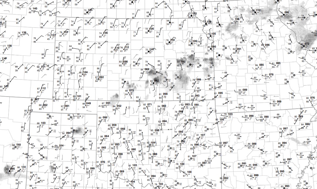
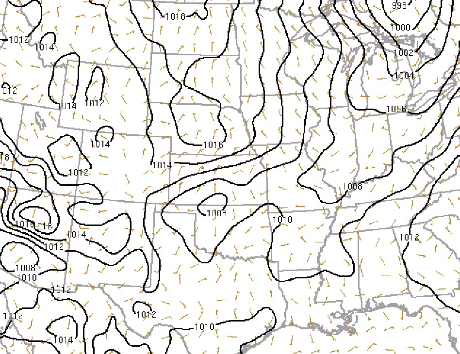
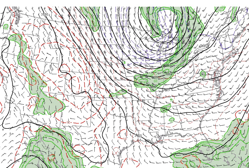
Environment
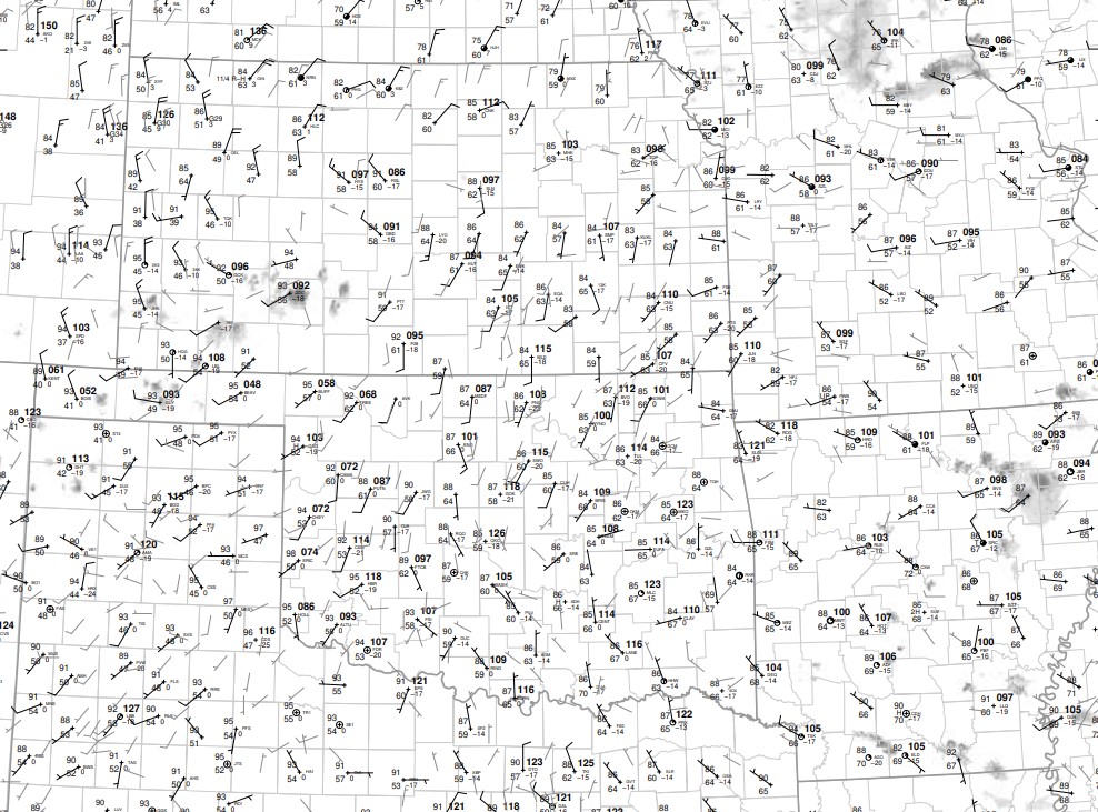 |
 |
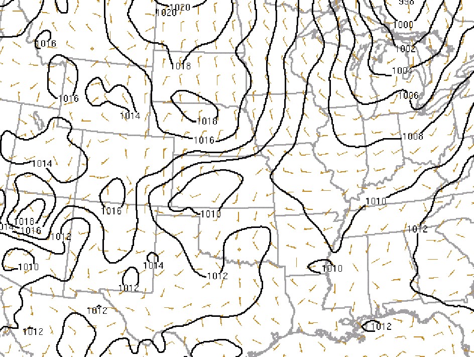 |
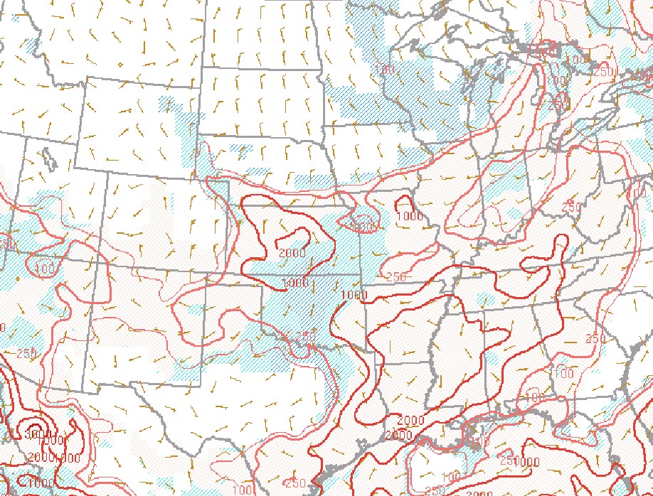
| 21z Surface map | 00z Surface map | 21z MSL |
 |
 |
 |
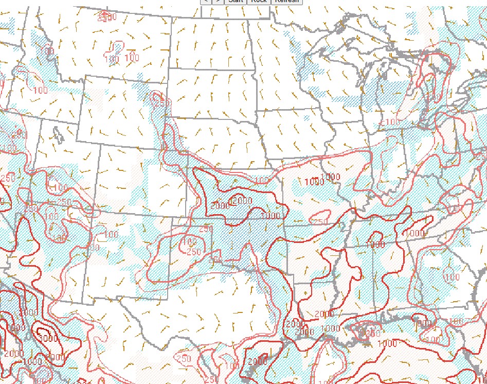
| 00Z MSL | 21z 700mb | 00z 700mb |
 |
 |
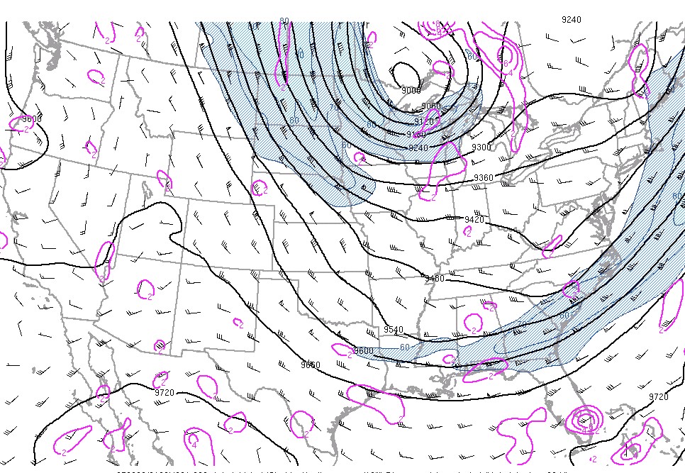 |
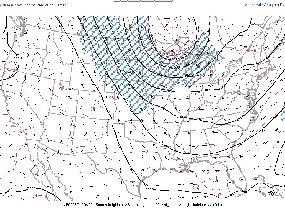
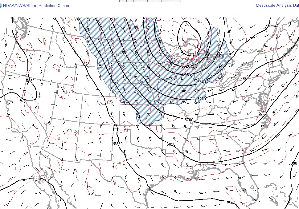
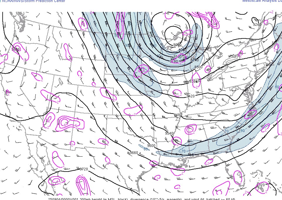
| 21z 500mb | 00z 500mb | 21z 300mb |
 |
 |
 |
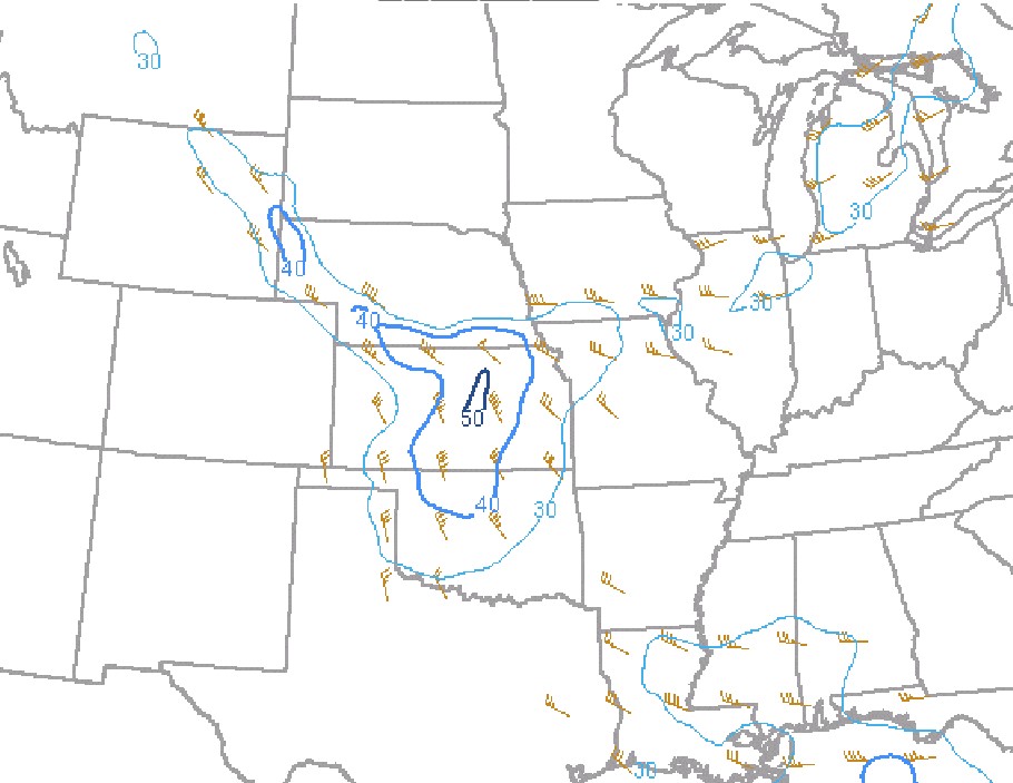
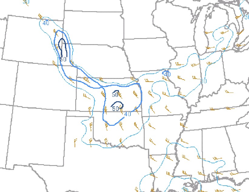
| 00z 300mb | 21z ML CAPE | 00z ML CAPE |
 |
 |
|
| 21z Effective shear | 00z Effective shear |
 |
Media use of NWS Web News Stories is encouraged! Please acknowledge the NWS as the source of any news information accessed from this site. |
|

