Overview
|
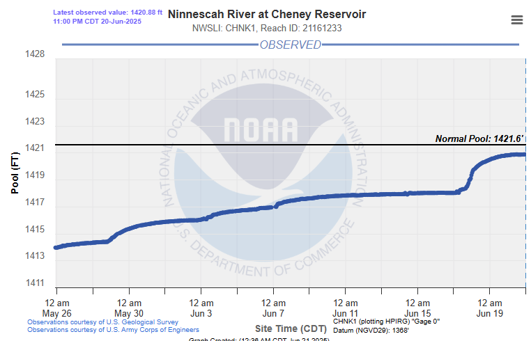
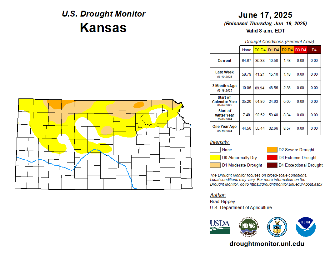
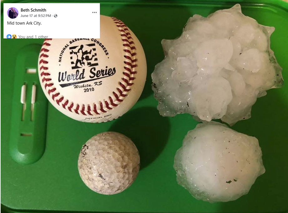
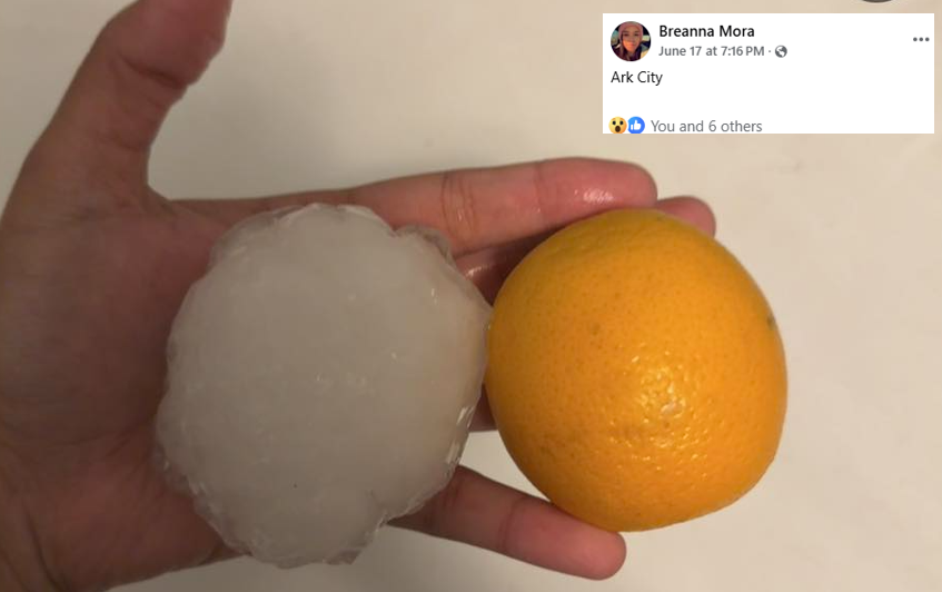
A very moist and unstable airmass combined with a slow moving front to produce numerous rounds of storms across South Central Kansas during the late afternoon and evening hours of June 17th. The storms produced high rainfall rates and with ground already saturated, significant flooding took place across much of the area. Along with flash flooding, heavy rain sent many rivers across the area into flood. One of the benefit's of the heavy rain was that it increased the level of Cheney Lake by around 7 feet, to a level it has not seen since August of 2022. Because of how low Cheney Lake has been over the last several months, Wichita has been under water restrictions since August of 2024. The most intense supercell thunderstorm of the day developed over Harper County and tracked slowly east. This storm then moved southeast and tracked over Arkansas City, producing extremely large hail. There were numerous reports of baseball to softball size hail across Arkansas City which produced extensive damage. |
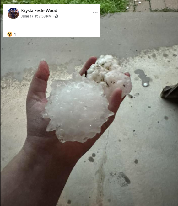 Large hail in Arkansas City |
Photos & Video
 |
|
 |
|
|
h
|
|
|
|
|
|
|
Radar
 |
 |
|
| Radar animation of the supercell that produced extremely large hail in Arkansas City | Radar animation from the afternoon and evening of June 17th | |
|
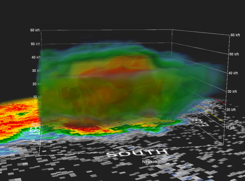
3-D radar view of the storm that produced large hail over Arkansas City. This shows the core of the storm was over 40,000ft and the storm tops over 50,000ft. |
||
Storm Reports
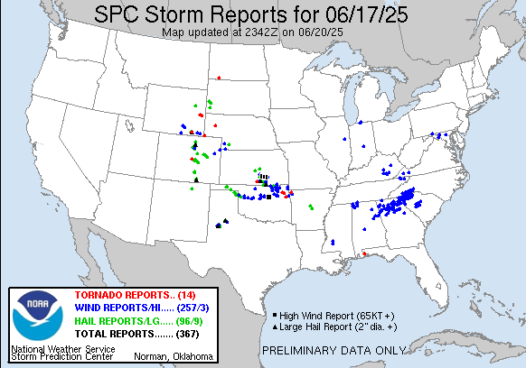
1059 PM     Tstm Wnd Gst     7 N Arkansas City       37.17N 97.03W
06/17/2025  M71 MPH          Cowley             KS   ASOS

            ASOS station KWLD Strother Field Airport.

1054 PM     Tstm Wnd Gst     Winfield                37.17N 97.04W
06/17/2025  M71 MPH          Cowley             KS   ASOS


0948 PM     Tstm Wnd Gst     5 SW Conway Springs     37.34N 97.71W
06/17/2025  M62 MPH          Sumner             KS   Public


0924 PM     Tstm Wnd Gst     2 N Derby               37.58N 97.26W
06/17/2025  M58 MPH          Sedgwick           KS   Public


0920 PM     Tstm Wnd Gst     3 SE Haysville          37.54N 97.32W
06/17/2025  M59 MPH          Sedgwick           KS   Mesonet


0912 PM     Tstm Wnd Gst     3 SSW Downtown Wichita  37.65N 97.35W
06/17/2025  E65 MPH          Sedgwick           KS   Broadcast Media

            KS Storm Info estimates 60 to 65 mph and pea
            to dime sized hail.

0912 PM     Hail             2 SW Downtown Wichita   37.67N 97.36W
06/17/2025  E1.00 Inch       Sedgwick           KS   Public


0908 PM     Hail             3 NNW Haysville         37.61N 97.37W
06/17/2025  E0.88 Inch       Sedgwick           KS   Trained Spotter


0906 PM     Tstm Wnd Gst     3 NW Wichita Eisenhower 37.69N 97.48W
06/17/2025  E70 MPH          Sedgwick           KS   Trained Spotter

            Combined with dime sized hail.

0854 PM     Tstm Wnd Gst     4 N Clearwater          37.56N 97.51W
06/17/2025  E70 MPH          Sedgwick           KS   NWS Employee

            Estimates 65 to 70 mph winds.

0847 PM     Hail             Goddard                 37.66N 97.57W
06/17/2025  E1.75 Inch       Sedgwick           KS   Public


0845 PM     Rain             2 N Arkansas City       37.10N 97.04W
06/17/2025  M2.87 Inch       Cowley             KS   Emergency Mngr

            Since 6:30 am, measured at 8:45 pm.

0839 PM     Hail             3 W Goddard             37.66N 97.63W
06/17/2025  E0.88 Inch       Sedgwick           KS   Public


0832 PM     Hail             Garden Plain            37.66N 97.68W
06/17/2025  E1.25 Inch       Sedgwick           KS   Trained Spotter


0723 PM     Tstm Wnd Gst     3 W Winfield            37.24N 97.01W
06/17/2025  M60 MPH          Cowley             KS   Trained Spotter


0713 PM     Hail             Arkansas City           37.07N 97.04W
06/17/2025  E2.00 Inch       Cowley             KS   Trained Spotter


0707 PM     Hail             Arkansas City           37.07N 97.04W
06/17/2025  M3.81 Inch       Cowley             KS   Public


0707 PM     Hail             Arkansas City           37.07N 97.04W
06/17/2025  M2.75 Inch       Cowley             KS   Amateur Radio


0706 PM     Hail             Arkansas City           37.06N 97.04W
06/17/2025  M1.75 Inch       Cowley             KS   Amateur Radio


0703 PM     Hail             Arkansas City           37.07N 97.04W
06/17/2025  E1.00 Inch       Cowley             KS   Public


0645 PM     Hail             Geuda Springs           37.11N 97.15W
06/17/2025  E1.50 Inch       Sumner             KS   Storm Chaser


0635 PM     Flood            Wellington              37.27N 97.40W
06/17/2025                   Sumner             KS   Public

            Flooding on all the roads through downtown
            including on portions of Highway 160.

0615 PM     Tstm Wnd Gst     Leon                    37.69N 96.78W
06/17/2025  E60 MPH          Butler             KS   Fire Dept/Rescue


0613 PM     Rain             Towanda                 37.80N 97.00W
06/17/2025  M2.25 Inch       Butler             KS   Fire Dept/Rescue

            Rainfall total in the last hour.

0613 PM     Tstm Wnd Gst     Leon                    37.69N 96.78W
06/17/2025  E60 MPH          Butler             KS   Fire Dept/Rescue


0613 PM     Tstm Wnd Dmg     Leon                    37.69N 96.78W
06/17/2025                   Butler             KS   Fire Dept/Rescue

            10 inch diameter tree uprooted.

0610 PM     Hail             3 E Wellington          37.28N 97.34W
06/17/2025  E1.75 Inch       Sumner             KS   Public


0557 PM     Hail             Augusta                 37.69N 96.98W
06/17/2025  E1.75 Inch       Butler             KS   Fire Dept/Rescue


0552 PM     Tstm Wnd Dmg     Augusta                 37.69N 96.98W
06/17/2025                   Butler             KS   Fire Dept/Rescue

            Power pole snapped and leaning onto a house.

0552 PM     Hail             1 NW Augusta            37.70N 96.99W
06/17/2025  E1.00 Inch       Butler             KS   Fire Dept/Rescue


0551 PM     Hail             1 NW Augusta            37.70N 96.99W
06/17/2025  M1.00 Inch       Butler             KS   Fire Dept/Rescue


0542 PM     Tstm Wnd Gst     4 SSE Benton            37.74N 97.08W
06/17/2025  M64 MPH          Butler             KS   Mesonet


0539 PM     Flash Flood      1 NE Downtown Wichita   37.70N 97.33W
06/17/2025                   Sedgwick           KS   Emergency Mngr

            vehicle stalled in water.

0538 PM     Tstm Wnd Dmg     Andover                 37.70N 97.14W
06/17/2025                   Butler             KS   Public

            2 foot diameter trees down.

0536 PM     Flash Flood      Bel Aire                37.76N 97.27W
06/17/2025                   Sedgwick           KS   Emergency Mngr

            Stalled vehicle in 4 feet of water.

0535 PM     Flash Flood      3 NW Downtown Wichita   37.71N 97.39W
06/17/2025                   Sedgwick           KS   Emergency Mngr

            vehicle stalled in water on 15th St N / N
            Westridge, Wichita.

0535 PM     Tstm Wnd Gst     2 E Andover             37.69N 97.10W
06/17/2025  E80 MPH          Butler             KS   Trained Spotter

            Estimated 80 mph winds along with nickel
            sized hail.

0535 PM     Tstm Wnd Gst     4 ESE Andover           37.67N 97.08W
06/17/2025  M59 MPH          Butler             KS   AWOS

            AWOS station K3AU Augusta Municipal Airport.

0534 PM     Hail             5 SE Conway Springs     37.33N 97.59W
06/17/2025  E2.75 Inch       Sumner             KS   Trained Spotter


0530 PM     Tstm Wnd Gst     1 SSE Wichita Eisenhowe 37.65N 97.43W
06/17/2025  M58 MPH          Sedgwick           KS   ASOS

            ASOS station KICT Wichita Eisenhower
            Airport.

0530 PM     Tstm Wnd Dmg     2 N Andover             37.71N 97.14W
06/17/2025                   Butler             KS   Emergency Mngr

            power lines down.

0522 PM     Hail             4 SSW Conway Springs    37.33N 97.67W
06/17/2025  E1.75 Inch       Sumner             KS   Law Enforcement


0519 PM     Hail             3 W Andover             37.69N 97.19W
06/17/2025  E1.00 Inch       Sedgwick           KS   Public


0516 PM     Tstm Wnd Gst     Mcconnell Air Force Bas 37.62N 97.26W
06/17/2025  M61 MPH          Sedgwick           KS   ASOS


0513 PM     Tstm Wnd Gst     2 NNW Mcconnell Air For 37.65N 97.28W
06/17/2025  E70 MPH          Sedgwick           KS   Trained Spotter

            60 to 70 mph wind estimate at Pawnee and
            Oliver.

0510 PM     Hail             2 NNW East Wichita      37.71N 97.27W
06/17/2025  E1.25 Inch       Sedgwick           KS   Trained Spotter


0509 PM     Tstm Wnd Gst     3 SSE Bel Aire          37.73N 97.26W
06/17/2025  E60 MPH          Sedgwick           KS   Mesonet


0508 PM     Tstm Wnd Dmg     1 ESE Downtown Wichita  37.69N 97.33W
06/17/2025                   Sedgwick           KS   Emergency Mngr

            Several powerlines down throughout the
            metro.

0506 PM     Tstm Wnd Dmg     3 NW East Wichita       37.72N 97.29W
06/17/2025                   Sedgwick           KS   Storm Chaser

            Six inch diameter branches down.

0501 PM     Tstm Wnd Dmg     4 WNW Downtown Wichita  37.71N 97.40W
06/17/2025                   Sedgwick           KS   Dept of Highways

            Overturned semi truck based on view from
            highway camera.

0459 PM     Hail             Park City               37.80N 97.32W
06/17/2025  M1.25 Inch       Sedgwick           KS   Trained Spotter


0453 PM     Funnel Cloud     5 NE Anthony            37.21N 97.97W
06/17/2025                   Harper             KS   Law Enforcement


0449 PM     Tstm Wnd Gst     4 S Maize               37.72N 97.45W
06/17/2025  E75 MPH          Sedgwick           KS   Mesonet


0447 PM     Tstm Wnd Gst     3 SSW Maize             37.73N 97.48W
06/17/2025  E60 MPH          Sedgwick           KS   Public

            Tree limbs down with the 60 mph winds.

0442 PM     Tstm Wnd Gst     3 SE Maize              37.75N 97.42W
06/17/2025  E70 MPH          Sedgwick           KS   Trained Spotter

            Estimated 60 to 70 mph winds near 34th N &
            Ridge Rd.

0441 PM     Tstm Wnd Gst     2 ESE Maize             37.76N 97.44W
06/17/2025  E62 MPH          Sedgwick           KS   Mesonet


0441 PM     Tornado          1 SSW Harper            37.27N 98.03W
06/17/2025                   Harper             KS   Law Enforcement


0428 PM     Tstm Wnd Gst     Colwich                 37.79N 97.54W
06/17/2025  M60 MPH          Sedgwick           KS   Mesonet


0426 PM     Tstm Wnd Gst     Mount Hope              37.87N 97.67W
06/17/2025  E70 MPH          Sedgwick           KS   Law Enforcement

            Law enforcement estimated 70 mph winds and
            nickel sized hail.

0417 PM     Hail             Mount Hope              37.87N 97.67W
06/17/2025  M1.25 Inch       Sedgwick           KS   Trained Spotter


0300 PM     Rain             3 NW Mcpherson          38.41N 97.70W
06/17/2025  M6.16 Inch       McPherson          KS   Public

            Storm total rainfall since last night.

0239 PM     Hail             3 E Sterling            38.21N 98.15W
06/17/2025  M1.00 Inch       Rice               KS   Emergency Mngr


0222 PM     Hail             3 S Mcpherson           38.33N 97.67W
06/17/2025  E1.00 Inch       McPherson          KS   Public

            KAKE relayed viewer report of quarter sized
            hail. Time is estimated from radar.
Rainfall & Flooding
|
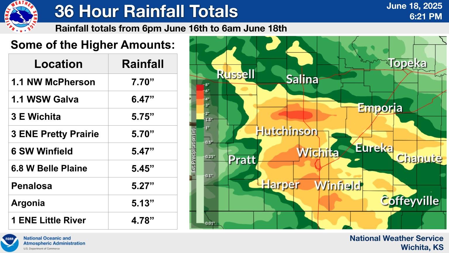
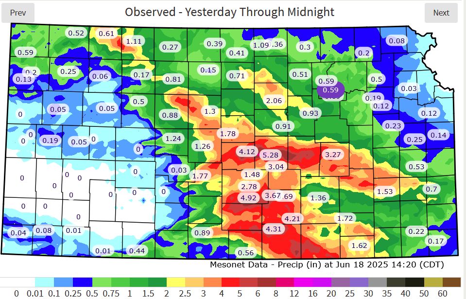
Some of the higher rainfall reports from across the area. |
Rainfall map from the Kansas Mesonet |
|
A look at the level of Cheney Lake from the middle of May to around June 20th. This shows the lake level increased by around 7 feet! |
Drought monitor issued June 19th, showing most of the drought removed from Kansas. |
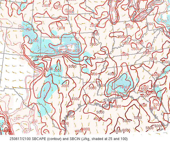
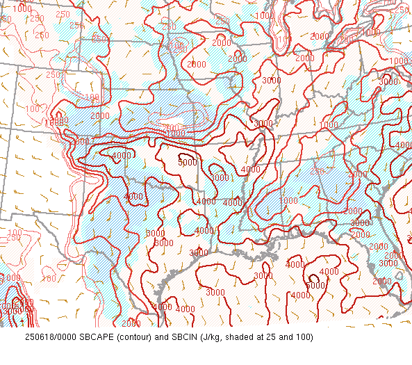
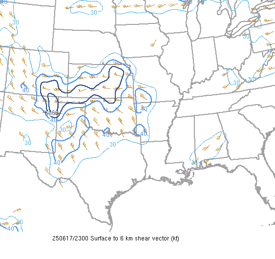
Environment
 |
 |
 |
 |
 |
 |
|
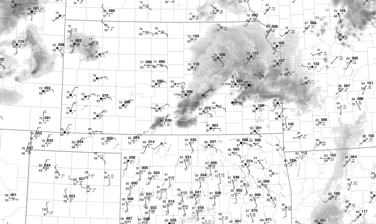
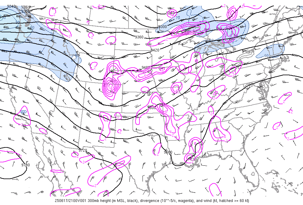
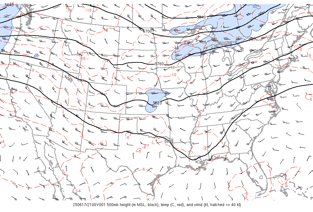
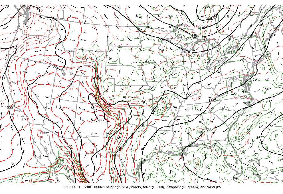
June 17th 21z surface map |
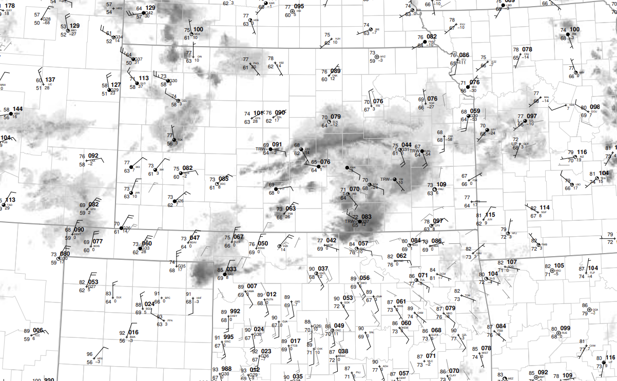
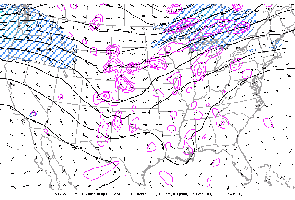
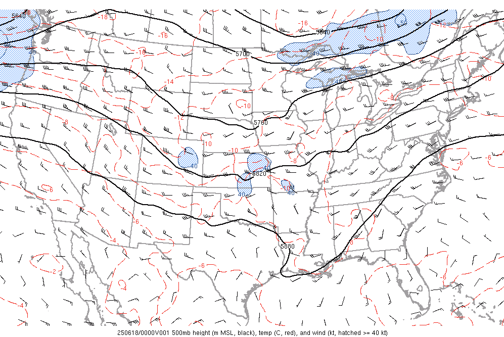
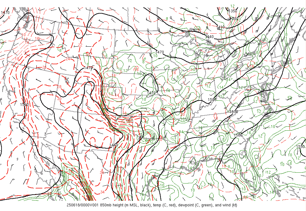
June 18z 00z surface map |
 |
 |
 |
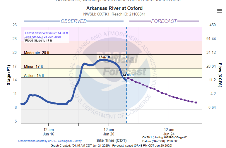
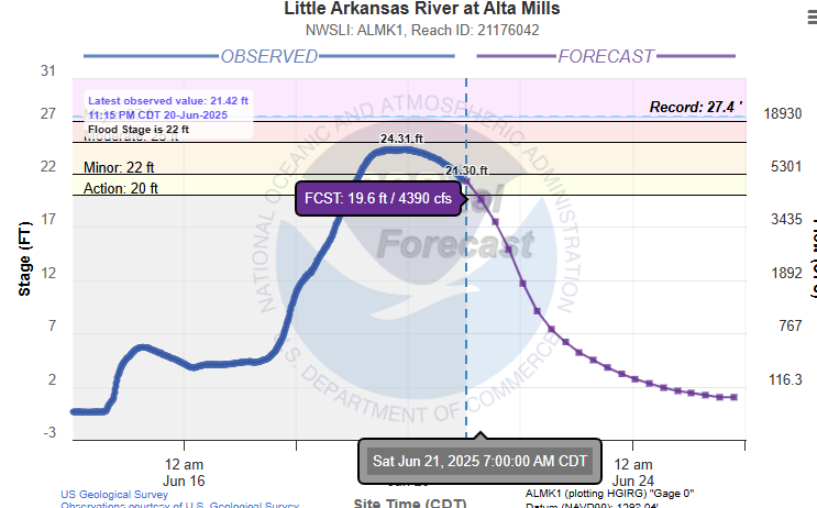
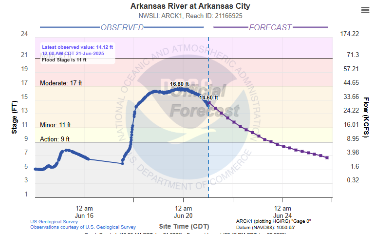
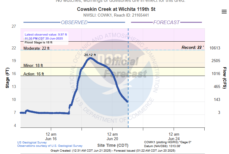
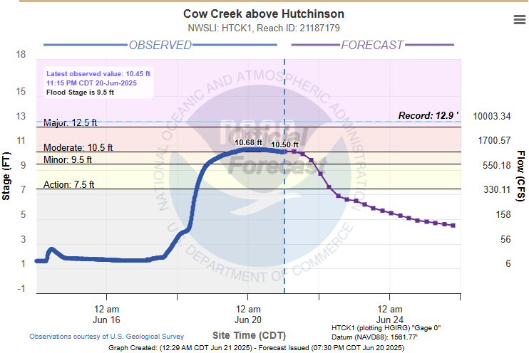
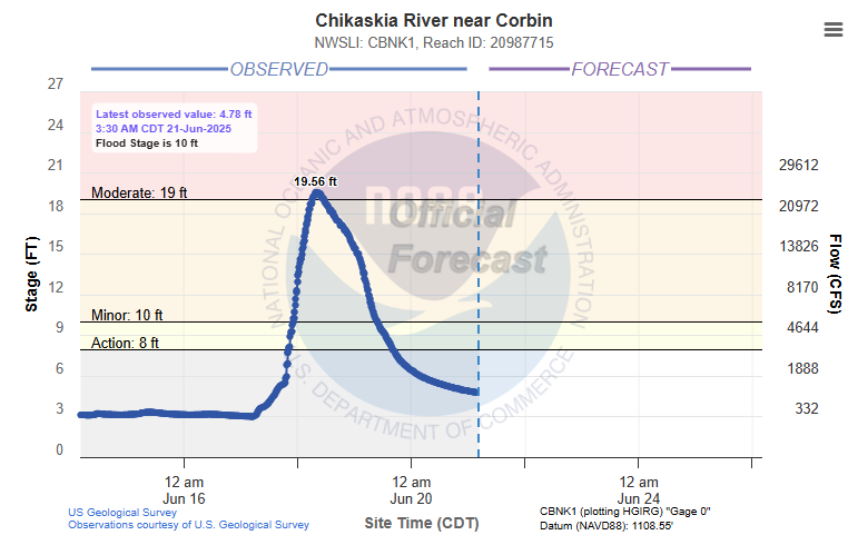
Hydrographs
 |
 |
 |
 |
|
 |
 |
Media use of NWS Web News Stories is encouraged! Please acknowledge the NWS as the source of any news information accessed from this site. |
|