Overview
|
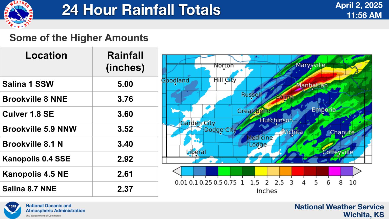
Strong south winds quickly increased low level moisture on Tuesday April 1st while a cold front sagged down from the north. This set the stage for severe storms to erupt during the early evening hour across Central Kansas. One storm along the line quickly became a supercell the started to exhibit low level rotation. It produced a couple brief tornadoes as it approached Salina but luckily lifted before reaching the city. Numerous additional storms produced large hail along with damaging winds. Training storms over the same areas also resulted in flooding across Ellsworth and Barton Counties. |
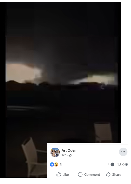
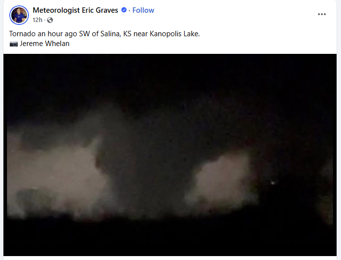 Picture of tornado near Kanopolis Lake. Picture taken by Jereme Whelan |
Photos & Video
 |
 |
| Infrared satellite animation showing storms erupting over central KS | Radar animation from April 1st. |
 |
 |
| Radar animation from KICT of the supercell that produced a couple tornadoes southwest of Salina | Radar animation from KTWX of the supercell that produced a couple tornadoes southwest of Salina |
|
 |
| Picture of tornado just east of Kanopolis Lake | Picture of possible tornado southwest of Salina |
|
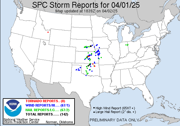
Storm reports from April 1st |
Rainfall totals from the event |
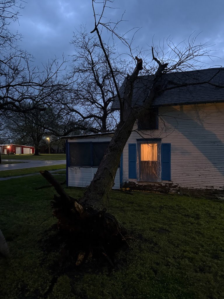
Early morning wind damage in Tyro |
|
|
|
|
Storm Reports
Preliminary Local Storm Report...Summary
National Weather Service Wichita KS
1028 AM CDT Wed Apr 2 2025

..TIME...   ...EVENT...      ...CITY LOCATION...     ...LAT.LON...
..DATE...   ....MAG....      ..COUNTY LOCATION..ST.. ...SOURCE....
            ..REMARKS..

0135 AM     Tstm Wnd Gst     1 N Moundridge          38.22N 97.52W
04/02/2025  E65 MPH          McPherson          KS   Trained Spotter

            Pea-sized hail also occurring.

0838 PM     Tstm Wnd Gst     9 WNW Salina            38.87N 97.77W
04/01/2025  E60 MPH          Saline             KS   Trained Spotter


1155 PM     Tstm Wnd Gst     1 W Lyons               38.34N 98.23W
04/01/2025  M60 MPH          Rice               KS   AWOS

            Measured at the Lyons Airport.

0125 AM     Tstm Wnd Gst     2 N Burrton             38.06N 97.67W
04/02/2025  E60 MPH          Harvey             KS   Law Enforcement

            Relayed by Harvey County EM.

0536 AM     Tstm Wnd Gst     2 W Elk City            37.28N 95.95W
04/02/2025  E60 MPH          Montgomery         KS   Emergency Mngr

            EM relayed fire department report of 60 mph
            gusts at intersection.

0602 AM     Tstm Wnd Gst     1 S Tyro                37.02N 95.82W
04/02/2025  E60 MPH          Montgomery         KS   Trained Spotter


1143 PM     Hail             1 N Chase               38.37N 98.35W
04/01/2025  M1.57 Inch       Rice               KS   Emergency Mngr

            Emergency manager reported ping pong ball
            size hail just north of Chase.

1230 AM     Hail             2 N Salina              38.84N 97.61W
04/02/2025  M1.50 Inch       Saline             KS   Trained Spotter

            Picture of 1.5 inch hail received from
            trained spotter.

0856 PM     Hail             4 N New Cambria         38.94N 97.51W
04/01/2025  E1.00 Inch       Saline             KS   Trained Spotter


1020 PM     Hail             Bushton                 38.51N 98.39W
04/01/2025  E1.00 Inch       Rice               KS   Public


1035 PM     Hail             Kanopolis               38.71N 98.16W
04/01/2025  M1.00 Inch       Ellsworth          KS   Trained Spotter

            Trained spotter reported quarter size hail.

1050 PM     Hail             Ellsworth               38.74N 98.23W
04/01/2025  E1.00 Inch       Ellsworth          KS   Trained Spotter


1157 PM     Hail             1 W Geneseo             38.52N 98.17W
04/01/2025  M1.00 Inch       Rice               KS   Trained Spotter


1230 AM     Hail             3 SE Salina             38.79N 97.59W
04/02/2025  M1.00 Inch       Saline             KS   Public


0111 AM     Hail             2 N Hutchinson          38.09N 97.92W
04/02/2025  E1.00 Inch       Reno               KS   Public

            Report from mPING

0255 AM     Hail             Wichita Eisenhower Airp 37.65N 97.44W
04/02/2025  M1.00 Inch       Sedgwick           KS   Official NWS Obs

            Mostly peas and dimes, but a couple of hail
            stones measured up to 1 inch in diameter.

0312 AM     Hail             2 W Whitewater          37.96N 97.19W
04/02/2025  E1.00 Inch       Harvey             KS   Public


0825 PM     Hail             3 WNW Wichita Eisenhowe 37.68N 97.48W
04/01/2025  E0.88 Inch       Sedgwick           KS   Public


0351 AM     Hail             2 S El Dorado           37.80N 96.85W
04/02/2025  E0.88 Inch       Butler             KS   Public


0931 PM     Hail             1 SE Chanute            37.66N 95.45W
04/01/2025  E0.75 Inch       Neosho             KS   Trained Spotter


0949 PM     Funnel Cloud     7 W Marquette           38.57N 97.96W
04/01/2025                   Ellsworth          KS   Trained Spotter


0953 PM     Tornado          8 SW Brookville         38.69N 97.97W
04/01/2025                   Ellsworth          KS   Trained Spotter


1014 PM     Tornado          1 N Smolan              38.76N 97.69W
04/01/2025                   Saline             KS   Trained Spotter

            Trained spotter reported a tornado on the
            ground.

1115 PM     Flood            Ellsworth               38.74N 98.23W
04/01/2025                   Ellsworth          KS   Trained Spotter

            Reports of roads being shut down on the
            south side of Ellsworth due to flooding.

1150 PM     Flood            2 E Great Bend          38.36N 98.77W
04/01/2025                   Barton             KS   911 Call Center

            Multiple calls of stalled
            vehicles due to street flooding in Great
            Bend between 1115PM and 1150PM CDT.

0127 AM     Tstm Wnd Dmg     1 SSE Burrton           38.01N 97.67W
04/02/2025                   Harvey             KS   Emergency Mngr

            Broken power pole at SW 24th
            and Burmac Rd near Burrton.

0555 AM     Tstm Wnd Dmg     Tyro                    37.03N 95.82W
04/02/2025                   Montgomery         KS   Public

            Large tree uprooted onto house.
Environment
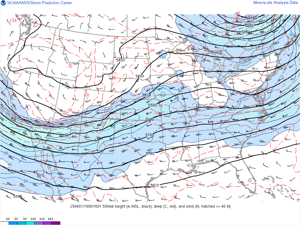
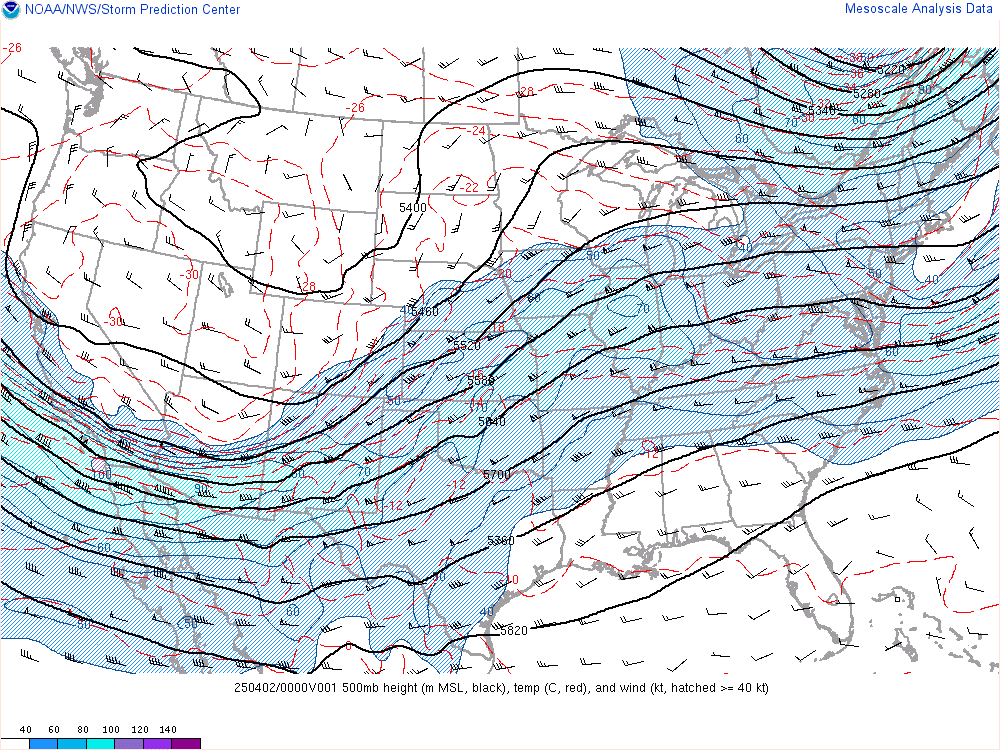
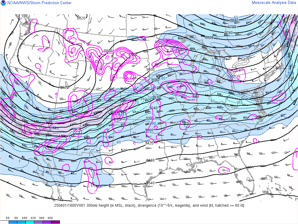
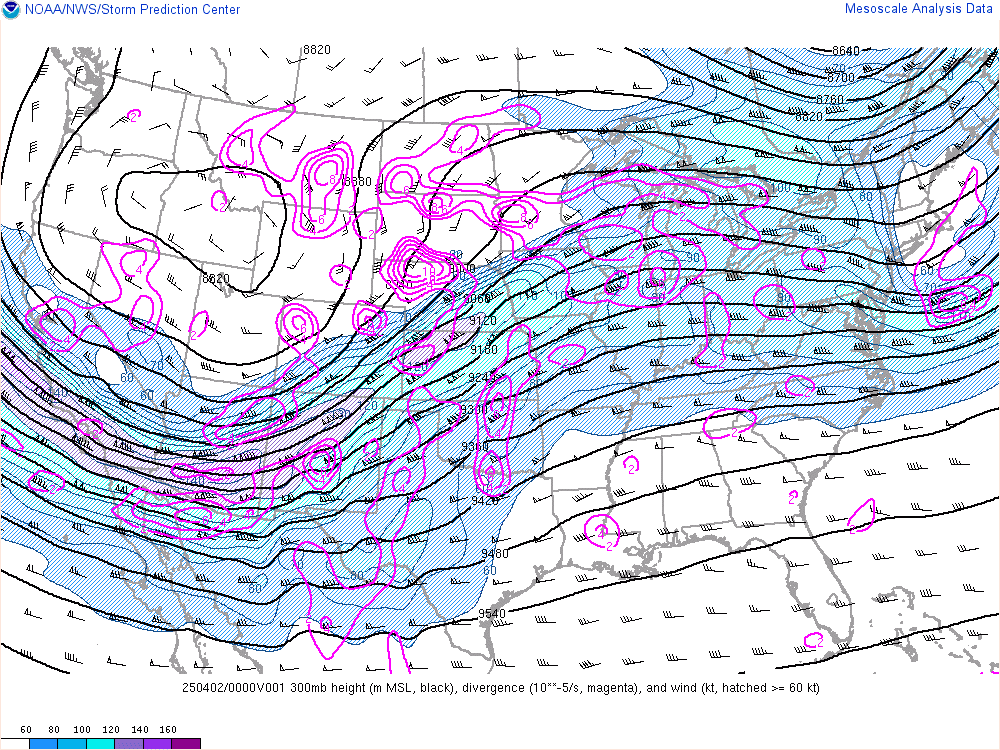
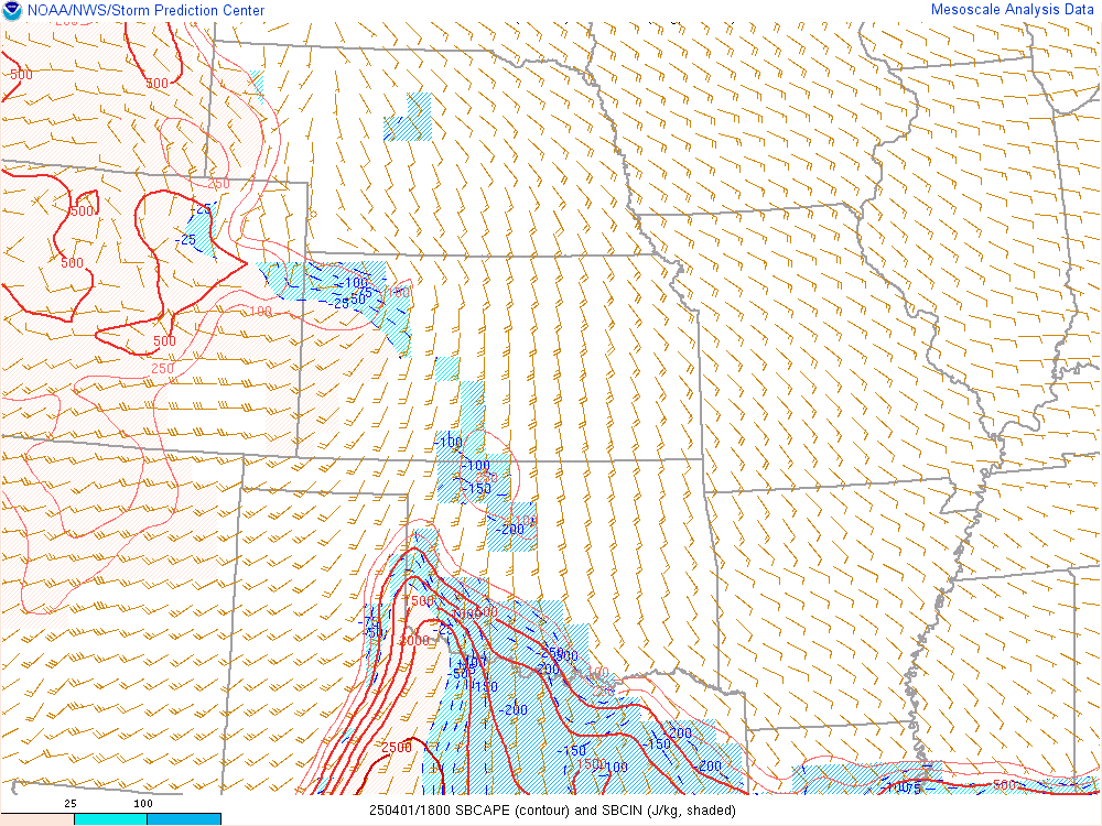
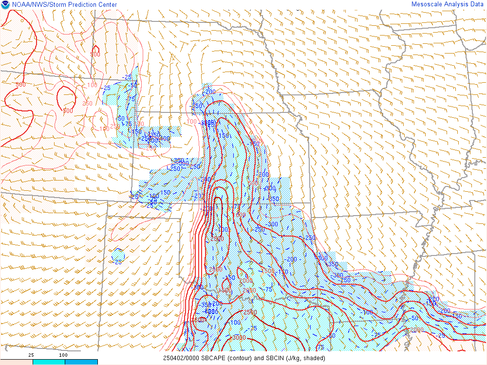
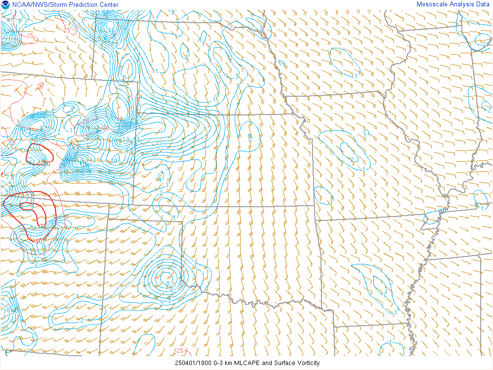
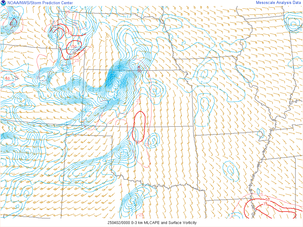
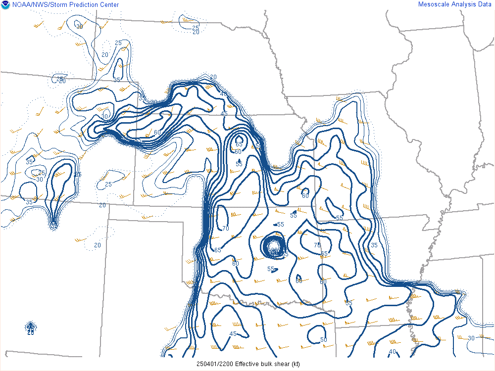
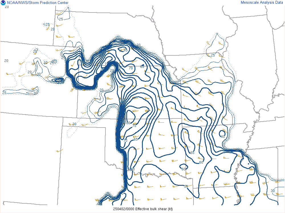
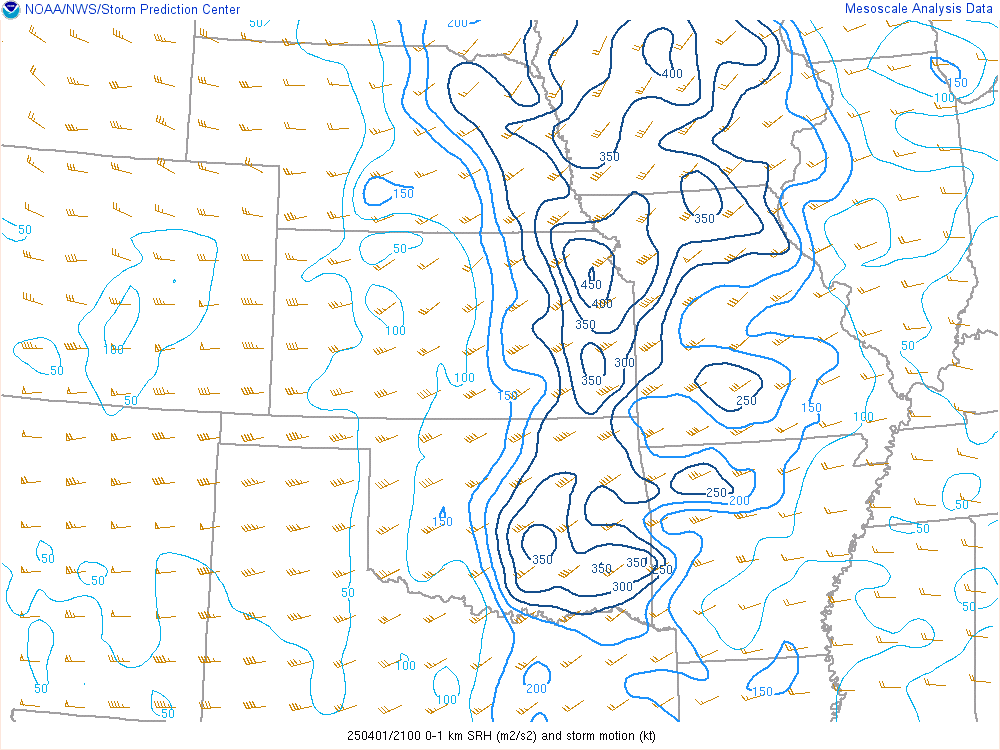
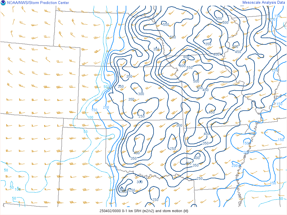
The biggest question with this setup was whether the good low level moisture would make it far enough north for storms in Kansas to be tornadic or even severe. Extreme levels of low level shear and deep shear was already in place, so it was just a mater of quality moisture. In addition there was some questions regarding capping, since storms would likely hold off until after dark.
 |
 |
 |
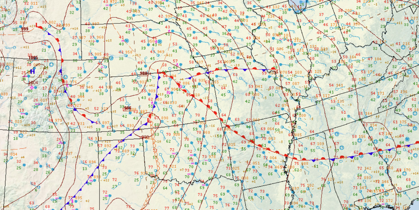 |
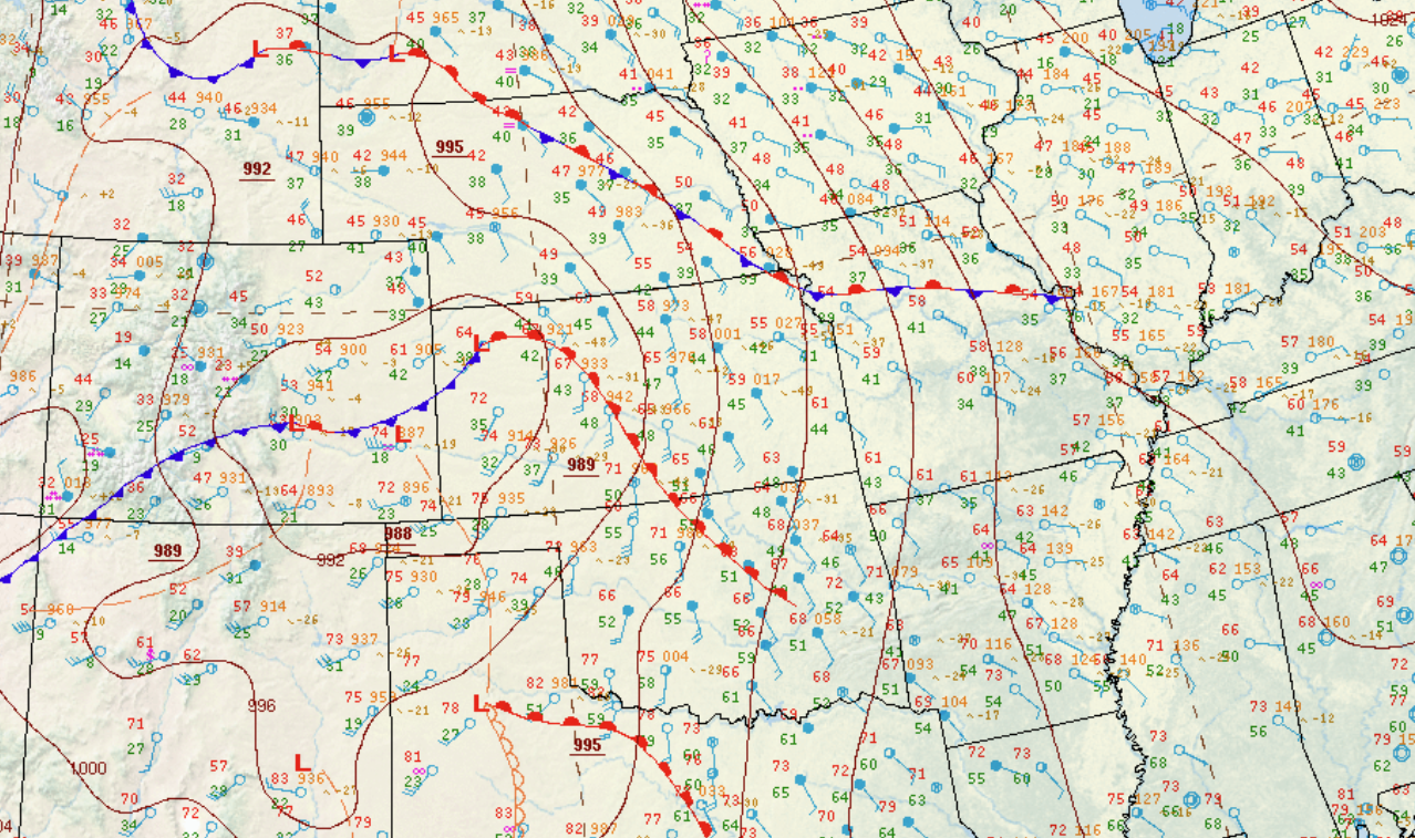
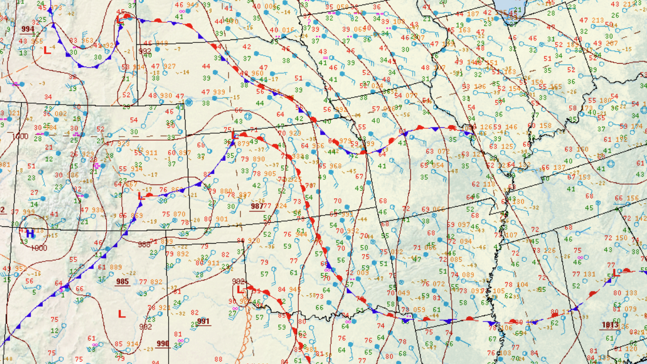
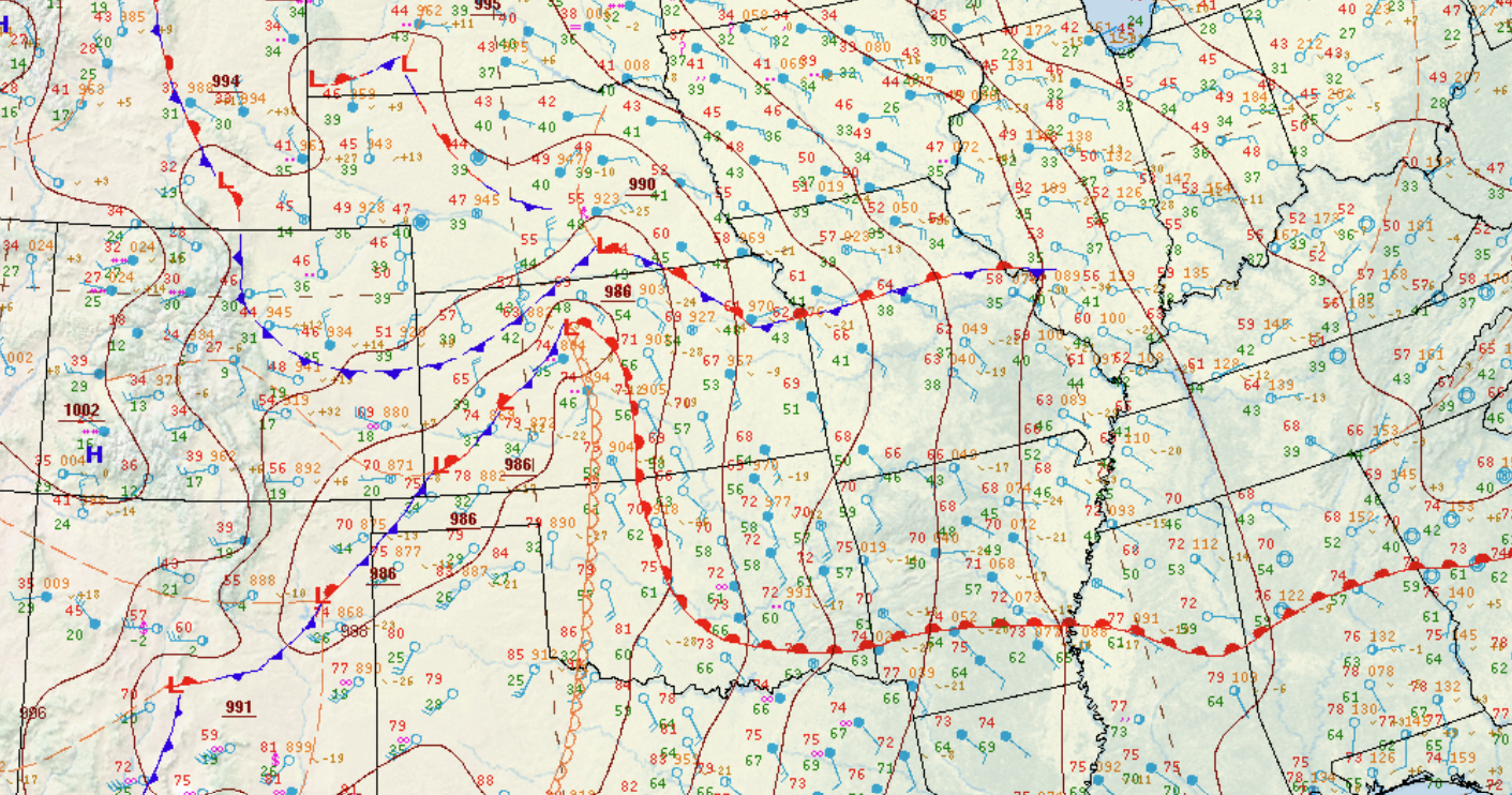
| 18z SFC Chart | 21z SFC Chart | 00Z SFC Chart | 03z SFC Chart |
Near-storm environment summary.
 |
 |
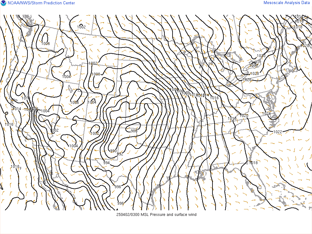 |
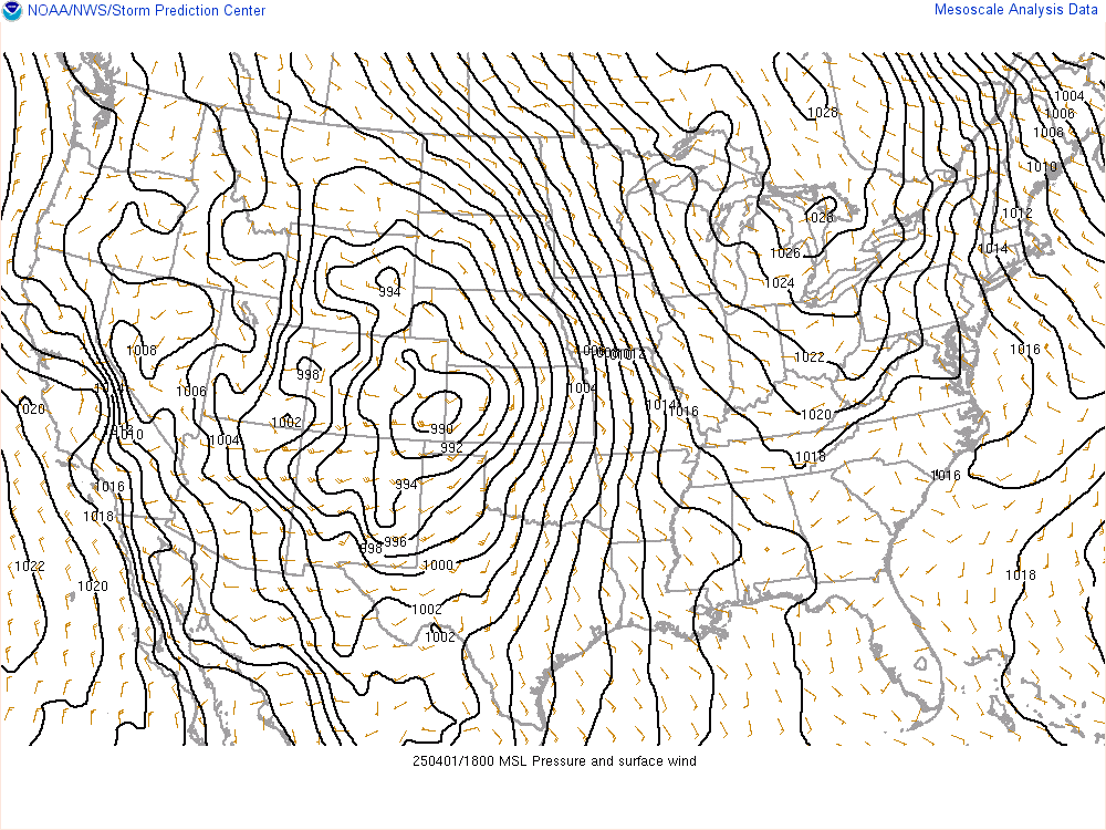
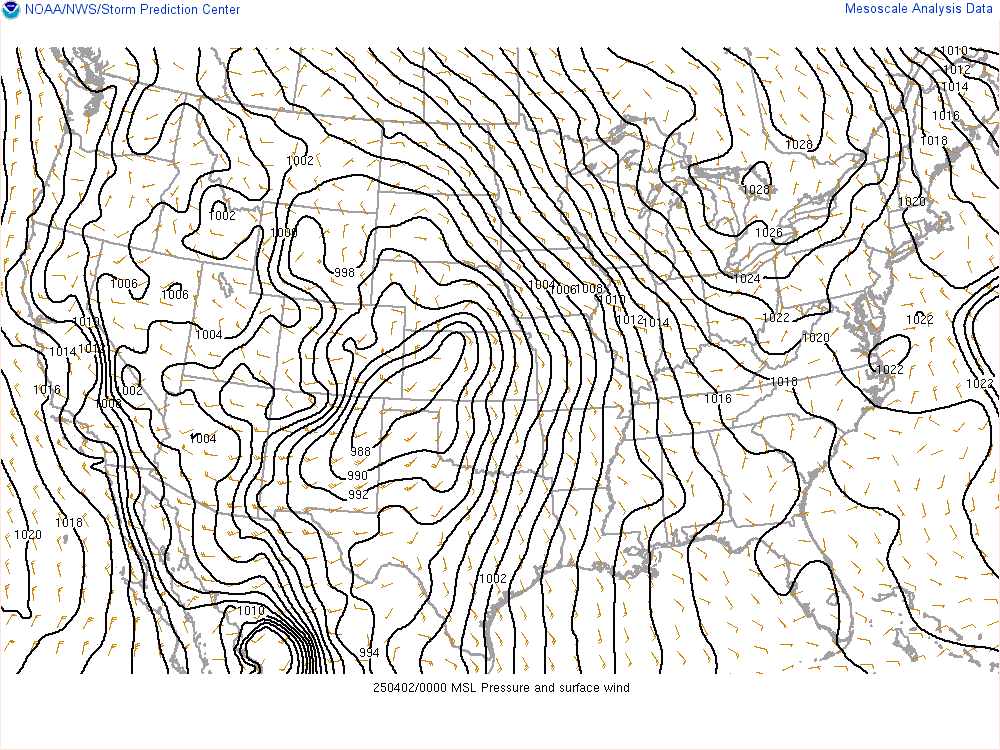
| 18z MSLP | 00z MSLP | 03 MSLP |
 |
 |
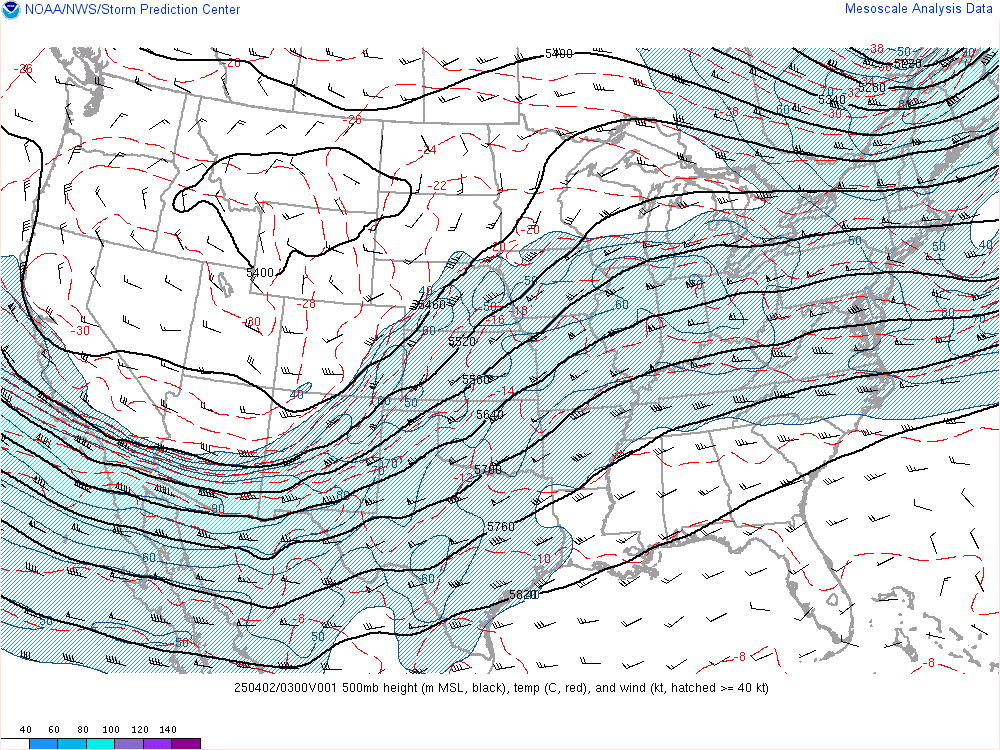 |
| 18z 500mb | 00z 500mb | 03z 500mb |
 |
 |
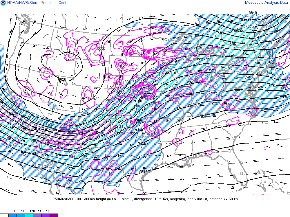 |
| 18z 300mb | 00z 300mb | 03z 300mb |
 |
 |
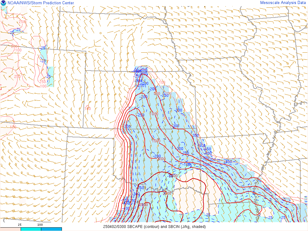 |
| 18z SFC CAPE | 00z SFC CAPE | 03z SFC CAPE |
 |
 |
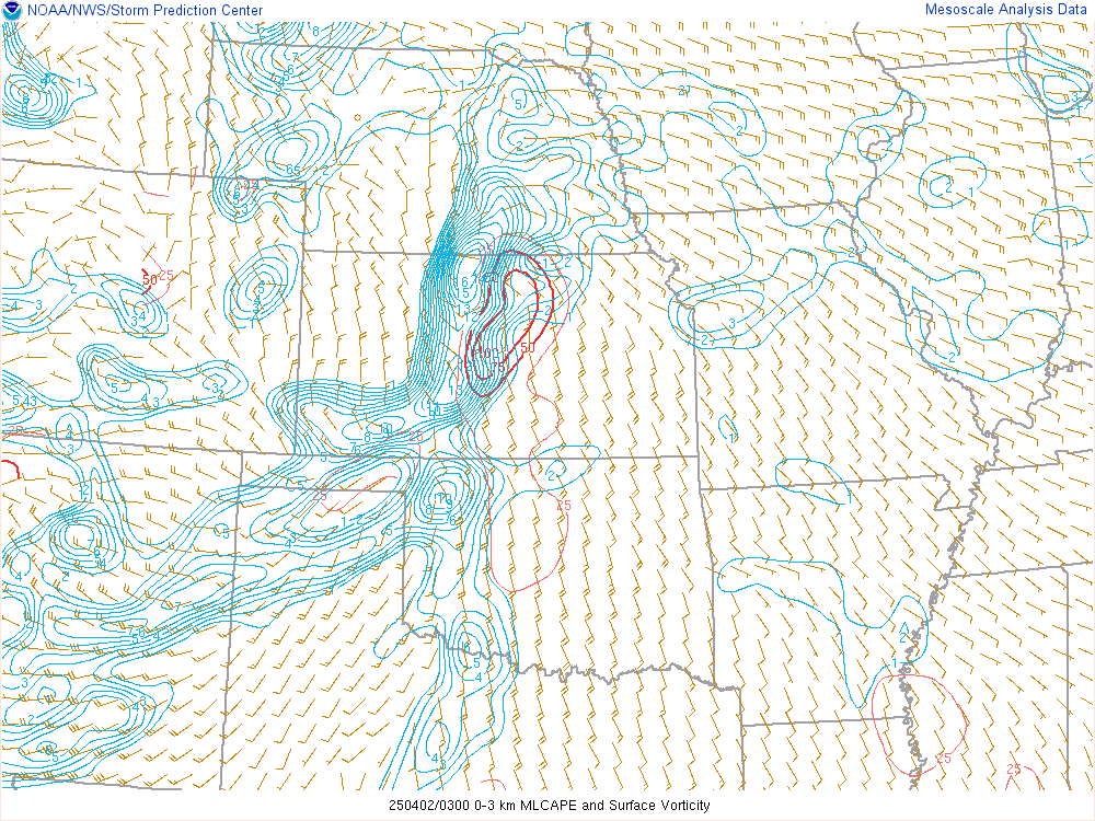 |
| 18z 0-3km CAPE | 00z 0-3km CAPE | 03z 0-3km CAPE |
 |
 |
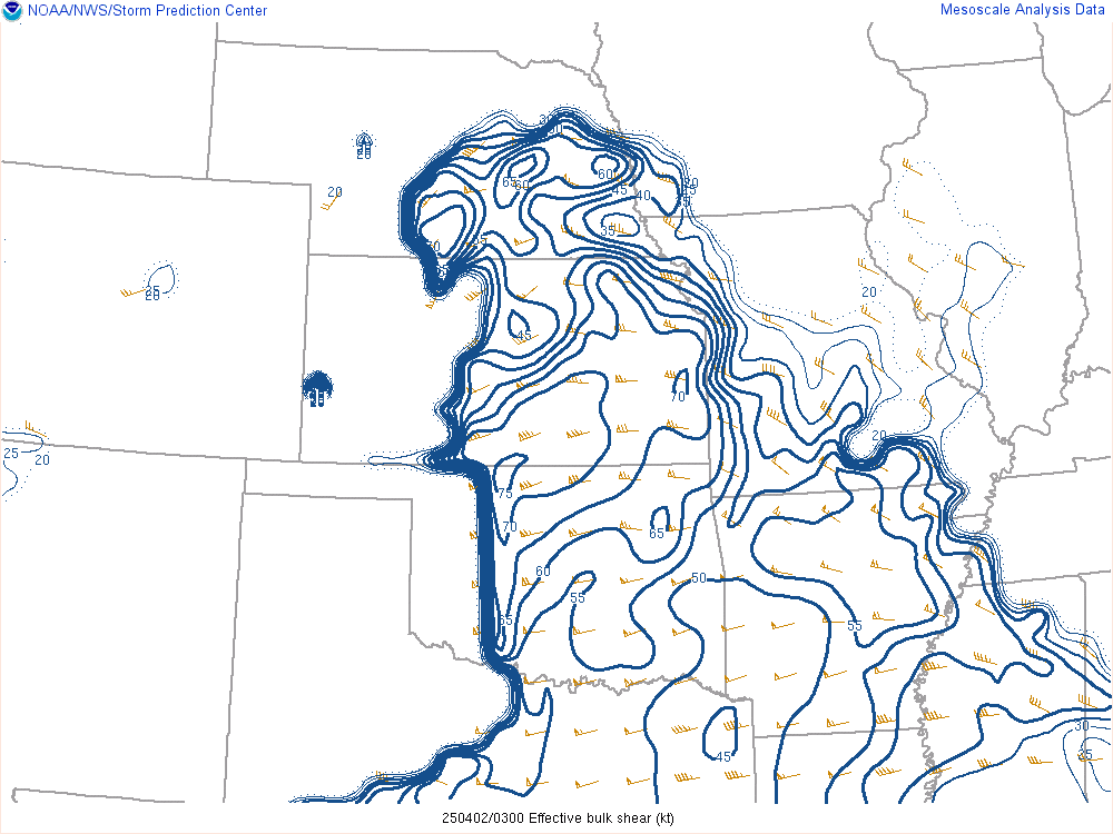 |
| 21z Effective bulk shear | 00z Effective bulk shear | 03 Effective bulk shear |
 |
 |
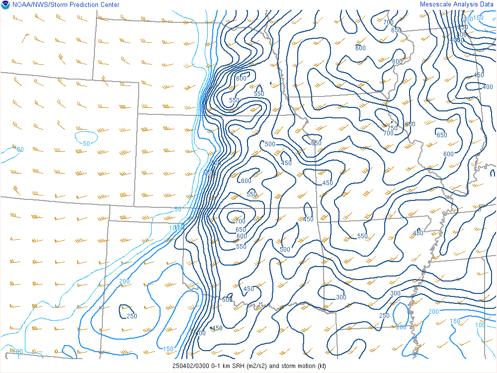 |
| 21z 0-1km SRH | 00z 0-1km SRH | 03z 0-1km SRH |
 |
Media use of NWS Web News Stories is encouraged! Please acknowledge the NWS as the source of any news information accessed from this site. |
|