Overview
|
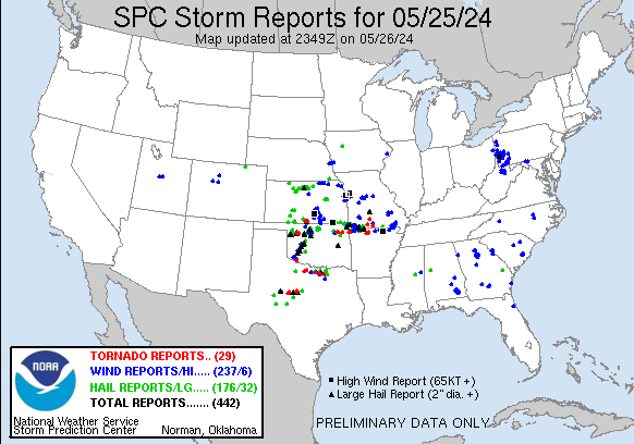
Rich low level moisture rapidly lifted north across the Plains on Saturday May 25th with storms initially developing along a developing dryline across Western Oklahoma. One particular storm gained strength as it tracked north of the Oklahoma/Kansas border. This supercell thunderstorm produced a brief tornado in Barber county before tracking east and producing an EF-2 tornado west of Anthony. What made this tornado unique was that it did not form from the main mesocyclone associated with the supercell, but rather from the supercells interaction with one of the storms lifting due north out of Oklahoma. The tornado threat was short-lived though as storms lifting north out of northern Oklahoma merged with the supercell which transitioned the threat to damaging winds. This cluster of storms produced 60 to 75 mph winds as it tracked across Wichita which caused widespread tree damage and widespread power outages. Around midnight additional storms developed over southern Cowley County and rapidly starting rotating which required a tornado warning as it tracked toward the Kansas/Oklahoma border. This storm went on to produce just shy of baseball size hail in Tyro and 80 mph winds in Caney. |
 |
Tornadoes:
|
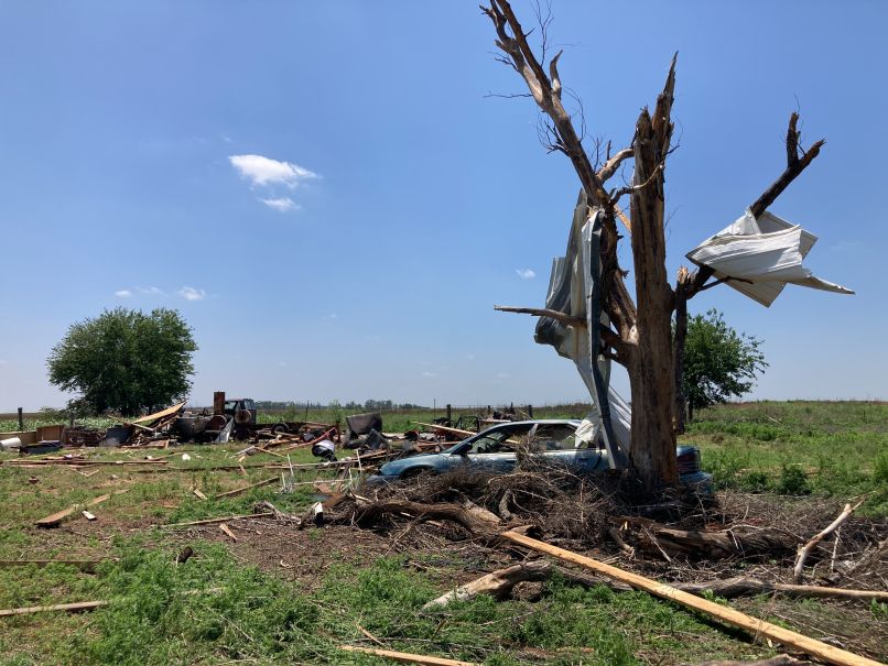
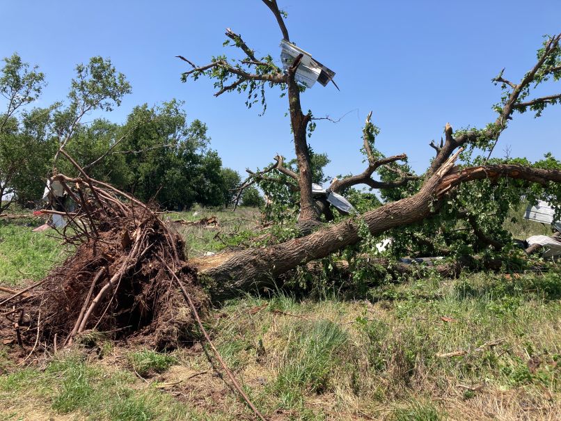
West of Anthony KS
Track Map 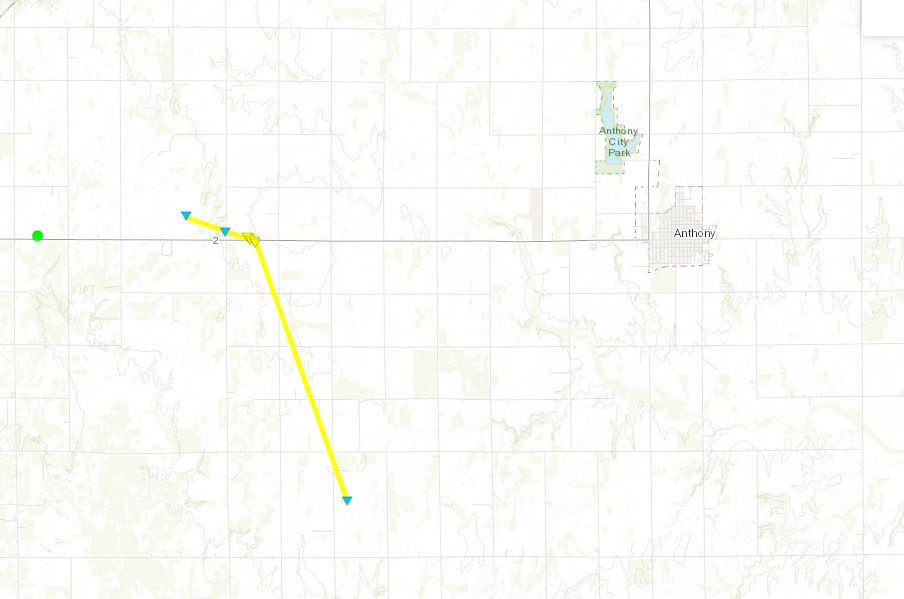 
|
|||||||||||||||||||
The Enhanced Fujita (EF) Scale classifies tornadoes into the following categories:
| EF0 Weak 65-85 mph |
EF1 Moderate 86-110 mph |
EF2 Significant 111-135 mph |
EF3 Severe 136-165 mph |
EF4 Extreme 166-200 mph |
EF5 Catastrophic 200+ mph |
 |
|||||
Photos & Video
|
|
h
|
|
|
|
|
h
|
|
Radar
 |
 |
 |
| Reflectivity(left) and storm relative velocity(right) from KVNX | Storm relative velocity(left) and Correlation Coefficient(right) showing the small but strong circulation tracking north. |
Storm Reports
Preliminary Local Storm Report...Summary
National Weather Service Wichita KS
413 AM CDT Sun May 26 2024
..TIME... ...EVENT... ...CITY LOCATION... ...LAT.LON...
..DATE... ....MAG.... ..COUNTY LOCATION..ST.. ...SOURCE....
..REMARKS..
0723 PM Non-Tstm Wnd Gst Arkansas City 37.07N 97.04W
05/25/2024 M58 MPH Cowley KS Emergency Mngr
0727 PM Hail 6 S Attica 37.15N 98.21W
05/25/2024 E1.25 Inch Harper KS Public
0731 PM Tornado 4 ENE Corwin 37.10N 98.23W
05/25/2024 Harper KS Public
Delayed report of a tornado 10 miles
west-southwest of Anthony. The spotter
observed damage.
0732 PM Tstm Wnd Dmg Arkansas City 37.07N 97.04W
05/25/2024 Cowley KS Emergency Mngr
Delayed report. Trees and powerlines
reported down near downtown Arkansas City.
0732 PM Hail 11 NNW Waldron 37.15N 98.26W
05/25/2024 E2.00 Inch Harper KS Broadcast Media
0735 PM Hail 5 S Corwin 37.01N 98.29W
05/25/2024 E1.00 Inch Harper KS Public
0742 PM Tstm Wnd Gst 7 N Arkansas City 37.17N 97.04W
05/25/2024 M74 MPH Cowley KS ASOS
0743 PM Tstm Wnd Gst 6 N Arkansas City 37.16N 97.03W
05/25/2024 M60 MPH Cowley KS ASOS
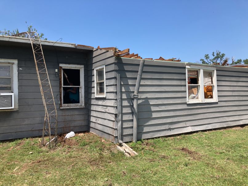
0758 PM Tornado 10 W Anthony 37.15N 98.21W
05/25/2024 Harper KS Trained Spotter
Trained spotter indicated a roof completely
removed off of house. Power lines down as
well.
0810 PM Tstm Wnd Gst Conway Springs 37.39N 97.64W
05/25/2024 E70 MPH Sumner KS Public
Estimated 70-75 mph with 6-10 inch diameter
tree limb down.
0821 PM Tstm Wnd Gst 1 S Wichita Eisenhower 37.65N 97.44W
05/25/2024 E72 MPH Sedgwick KS ASOS
0824 PM Tstm Wnd Gst 1 N Goddard 37.67N 97.58W
05/25/2024 M78 MPH Sedgwick KS NWS Employee
0824 PM Tstm Wnd Dmg 1 N Wichita Eisenhower 37.68N 97.44W
05/25/2024 Sedgwick KS Public
8 inch diameter tree snapped onto vehicles.
0825 PM Tstm Wnd Dmg 3 SSE Wichita Eisenhowe 37.63N 97.42W
05/25/2024 Sedgwick KS Emergency Mngr
Powerlines are reported down.
0830 PM Tstm Wnd Gst Colwich 37.78N 97.54W
05/25/2024 M59 MPH Sedgwick KS Trained Spotter
0839 PM Tstm Wnd Gst 3 NNE East Wichita 37.73N 97.23W
05/25/2024 E65 MPH Sedgwick KS CO-OP Observer
Estimated 60-70 mph.
0845 PM Tstm Wnd Gst 3 ESE Bel Aire 37.75N 97.22W
05/25/2024 M50 MPH Sedgwick KS ASOS
0849 PM Tstm Wnd Dmg Sedgwick 37.92N 97.43W
05/25/2024 Harvey KS Emergency Mngr
Mulitple reports of trees down in the city.
0853 PM Tstm Wnd Dmg Halstead 38.00N 97.51W
05/25/2024 Harvey KS Emergency Mngr
Powerlines are down in the city of Halstead.
0853 PM Tstm Wnd Dmg Newton 38.04N 97.34W
05/25/2024 Harvey KS Emergency Mngr
Power lines down reported.
0854 PM Tstm Wnd Gst 4 ENE Newton 38.06N 97.28W
05/25/2024 M69 MPH Harvey KS AWOS
0855 PM Tstm Wnd Gst Udall 37.39N 97.12W
05/25/2024 E70 MPH Cowley KS Public
Corrects previous tstm wnd gst report from
Udall.
0855 PM Tstm Wnd Gst Colwich 37.78N 97.54W
05/25/2024 E62 MPH Sedgwick KS Trained Spotter
0857 PM Tstm Wnd Gst 4 ENE Newton 38.06N 97.28W
05/25/2024 M69 MPH Harvey KS AWOS
0859 PM Tstm Wnd Gst Douglass 37.52N 97.01W
05/25/2024 M60 MPH Butler KS Trained Spotter
0911 PM Tstm Wnd Dmg 4 NNE Sedgwick 37.97N 97.39W
05/25/2024 Harvey KS Emergency Mngr
Trees and debris blocking SW 60th Road.
0917 PM Tstm Wnd Gst Mcpherson 38.37N 97.66W
05/25/2024 E55 MPH McPherson KS Public
50-60 mph gust.
0932 PM Tstm Wnd Dmg Burden 37.31N 96.75W
05/25/2024 Cowley KS Law Enforcement
Reported tree limbs and power lines down in
the city.
0940 PM Hail 5 N Lincoln 39.12N 98.15W
05/25/2024 E0.75 Inch Lincoln KS Emergency Mngr
0942 PM Non-Tstm Wnd Gst 2 SW Salina 38.79N 97.65W
05/25/2024 M63 MPH Saline KS ASOS
0952 PM Hail 1 N Mcpherson 38.39N 97.66W
05/25/2024 M0.88 Inch McPherson KS NWS Employee
1020 PM Tstm Wnd Gst 5 NE Lincoln 39.09N 98.08W
05/25/2024 E60 MPH Lincoln KS Trained Spotter
50-60 mph wind gust and penny-sized hail
reported.
1032 PM Hail 2 N Durham 38.51N 97.23W
05/25/2024 M0.75 Inch Marion KS Law Enforcement
1150 PM Hail 4 SW Winfield 37.23N 97.02W
05/25/2024 E0.75 Inch Cowley KS Trained Spotter
1152 PM Tstm Wnd Dmg 4 S Arkansas City 37.01N 97.04W
05/25/2024 Cowley KS Emergency Mngr
Trees and powerlines knocked down. Delayed
report. Time estimated by radar.
1154 PM Tstm Wnd Dmg 5 SSE Arkansas City 37.00N 97.01W
05/25/2024 Cowley KS Emergency Mngr
Knocked down trees and power lines. Delayed
report. Time estimated by radar.
1158 PM Tstm Wnd Gst 7 N Arkansas City 37.17N 97.03W
05/25/2024 M58 MPH Cowley KS ASOS
ASOS station KWLD Strother Field Airport.
0110 AM Hail Caney 37.01N 95.93W
05/26/2024 E1.75 Inch Montgomery KS Broadcast Media
0113 AM Hail 2 S Havana 37.07N 95.94W
05/26/2024 E1.00 Inch Montgomery KS Law Enforcement
0118 AM Tstm Wnd Gst Caney 37.01N 95.93W
05/26/2024 E80 MPH Montgomery KS Emergency Mngr
0119 AM Hail 2 S Tyro 37.01N 95.82W
05/26/2024 E1.75 Inch Montgomery KS Trained Spotter
0132 AM Hail Tyro 37.04N 95.82W
05/26/2024 E2.50 Inch Montgomery KS Trained Spotter
0134 AM Hail Coffeyville 37.04N 95.64W
05/26/2024 E1.75 Inch Montgomery KS Public
Report from mPING: Golf Ball (1.75 in.).
0154 AM Hail 3 E Edna 37.05N 95.30W
05/26/2024 E1.00 Inch Labette KS Public
Report from mPING: Quarter (1.00 in.).
0206 AM Hail 2 SW Bartlett 37.03N 95.24W
05/26/2024 E1.50 Inch Labette KS Trained Spotter
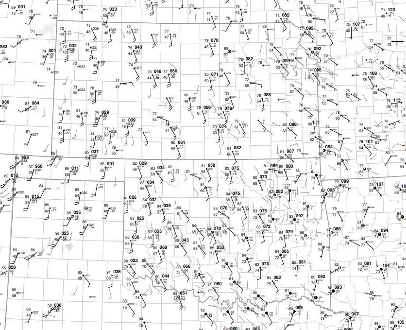
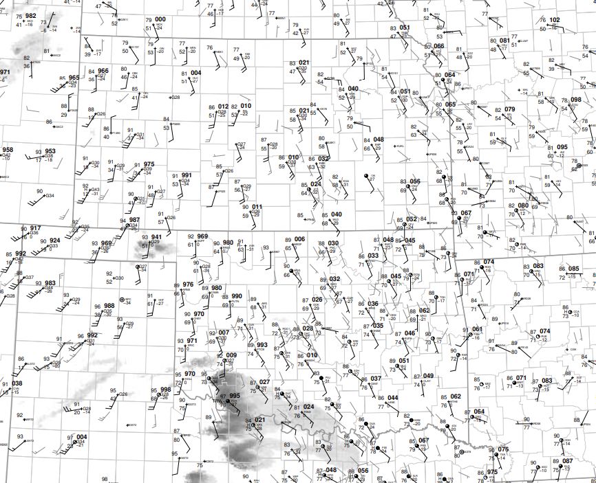
Environment
|
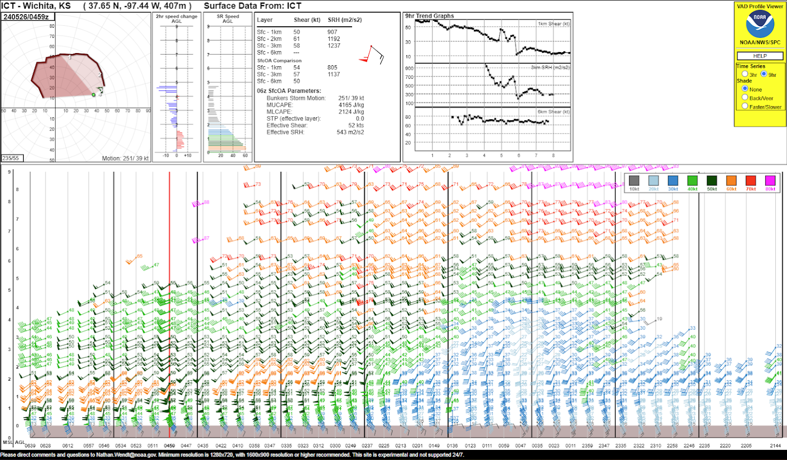
VAD wind profile from around 1:30am, which is when the supercell was tracking across southern Cowley and Chautauqua counties. |
 |
 |
 |
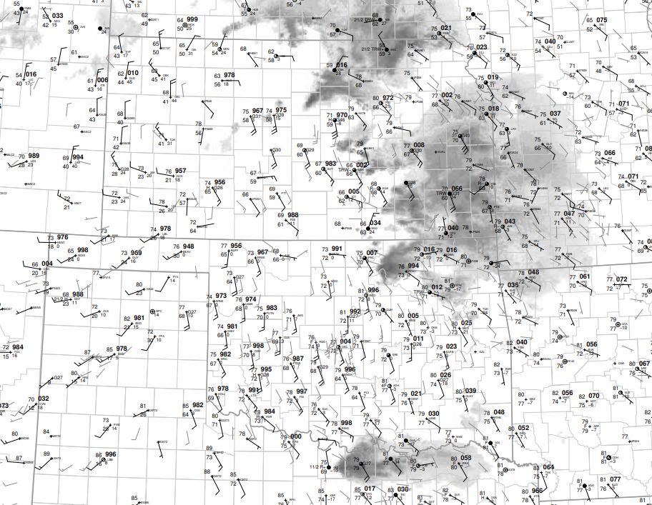 |
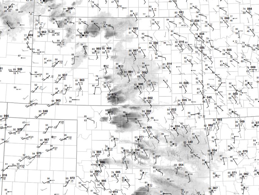
| 18z surface Map | 21z Surface map | 00z Surface map | 03z Surface map |
 |
 |
 |
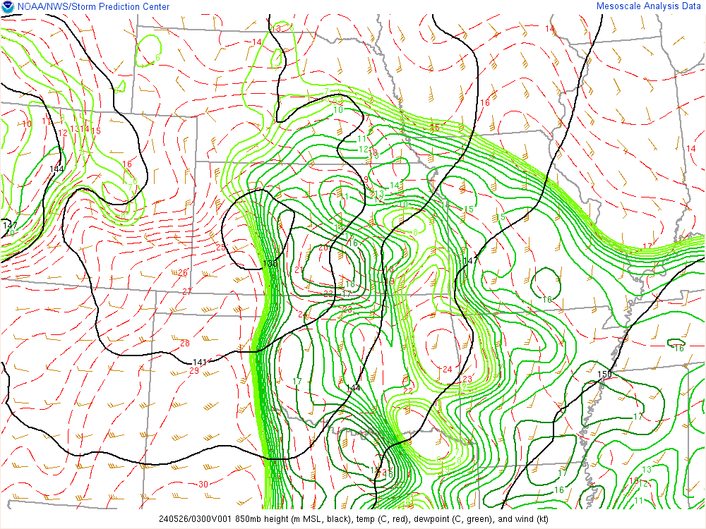 |
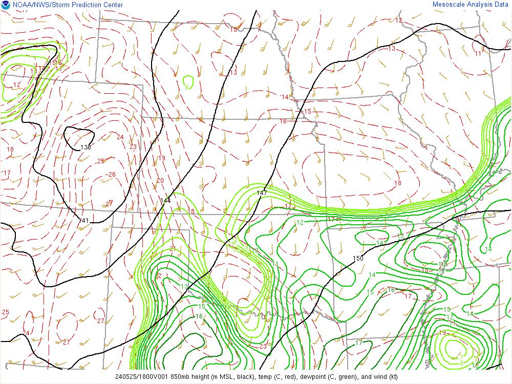
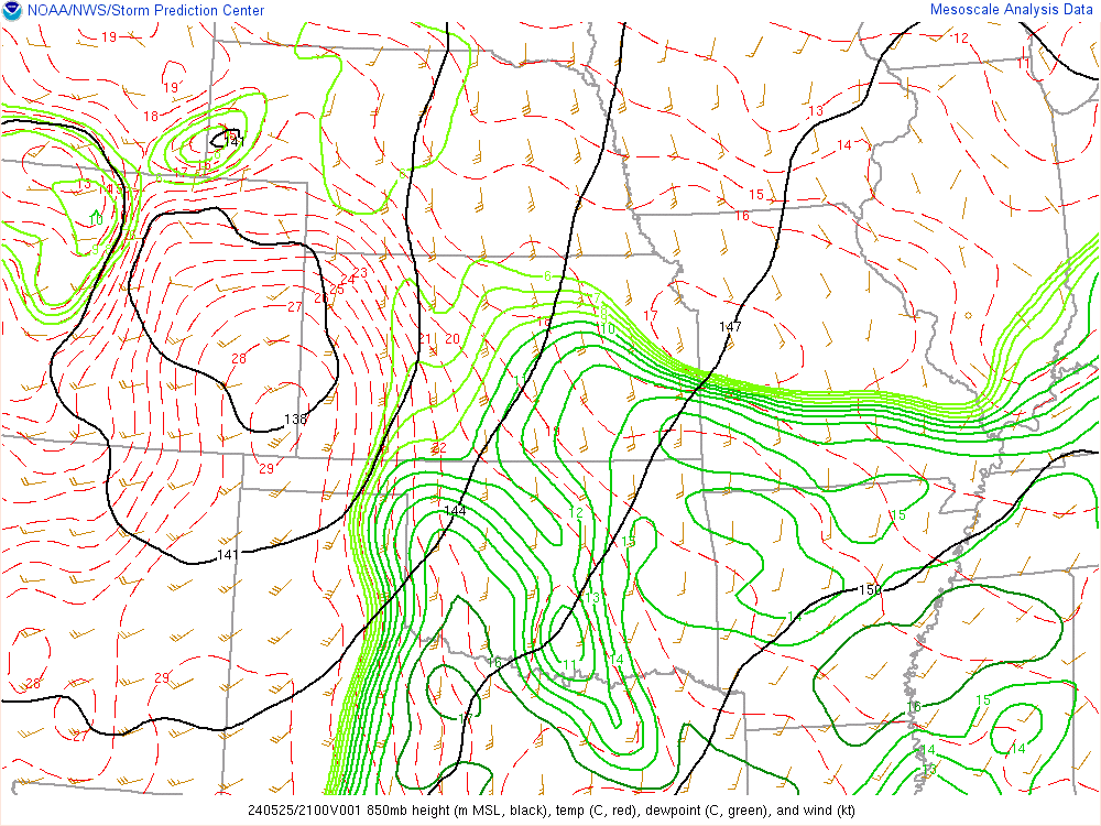
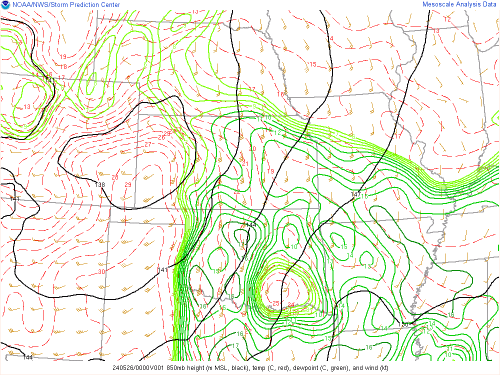
| 18z 850mb chart | 21z 850mb chart | 00z 850mb chart | 03z 850mb chart |
 |
 |
 |
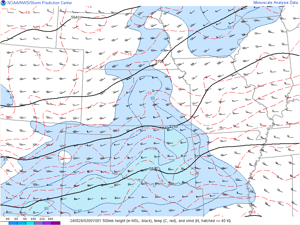 |
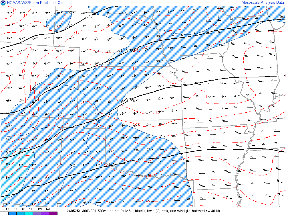
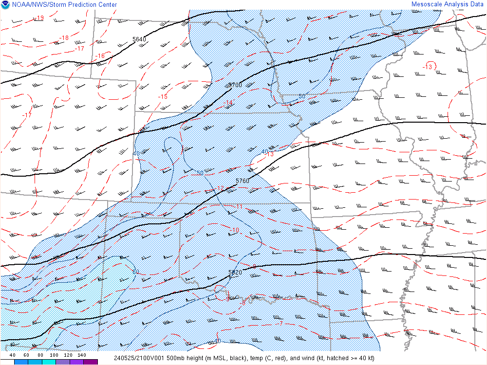
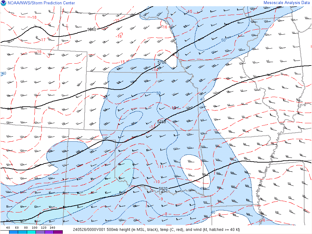
| 18z 500mb chart | 21z 500mb chart | 00z 500mb chart | 03z 50mb chart |
 |
 |
 |
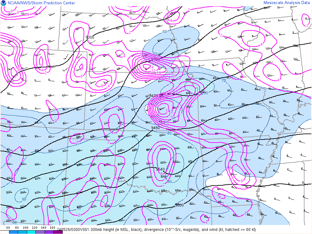 |
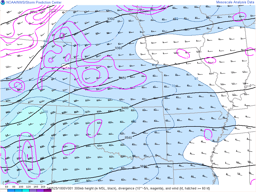
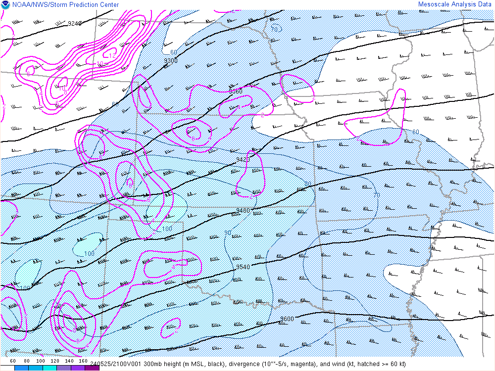
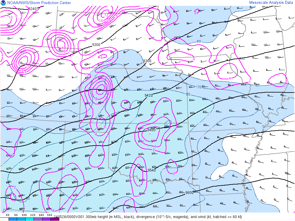
| 18z 300mb chart | 21z 300mb chart | 00z 300mb chart | 03z 300mb chart |
 |
 |
 |
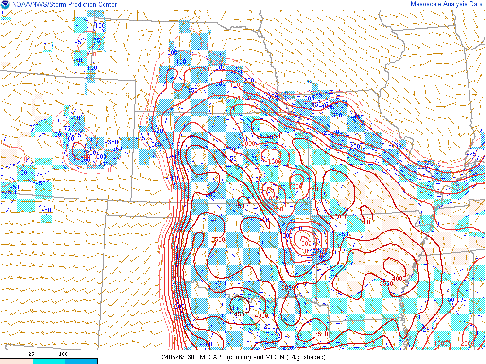 |
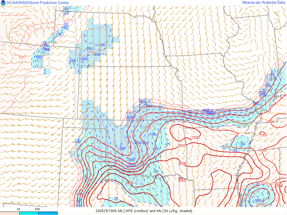
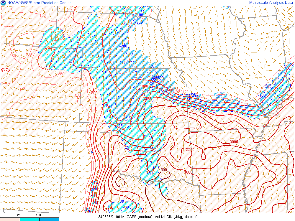
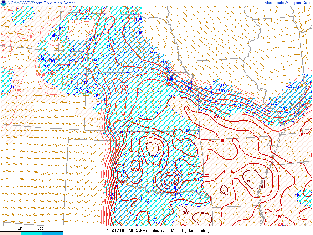
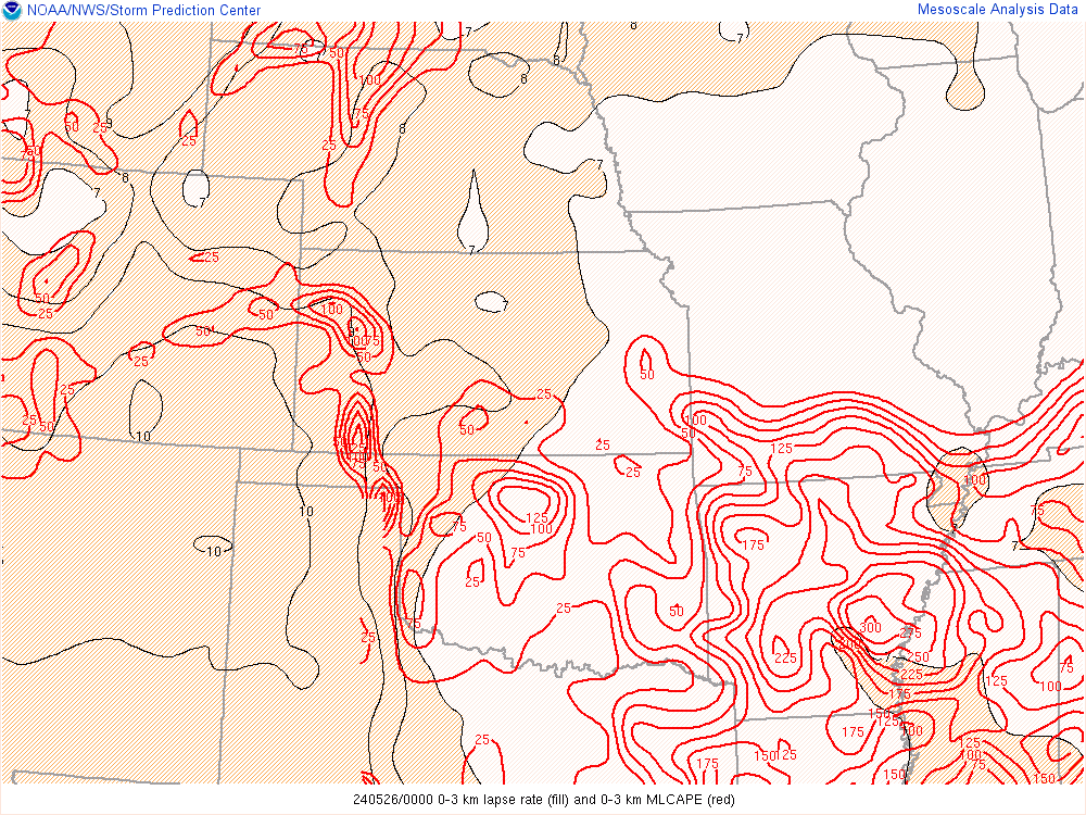
| 18z ML CAPE | 21z ML CAPE | 00z ML CAPE | 03z ML CAPE |
 |
 |
 |
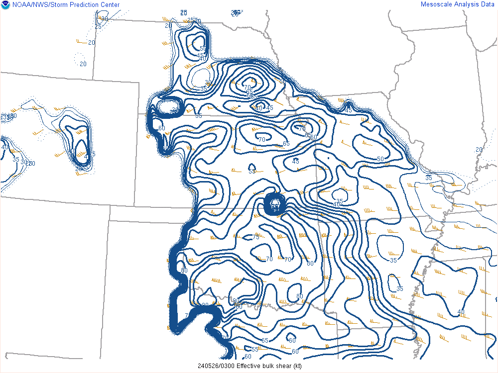 |
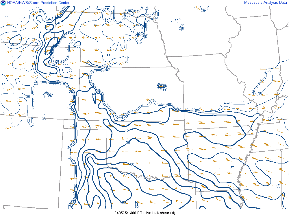
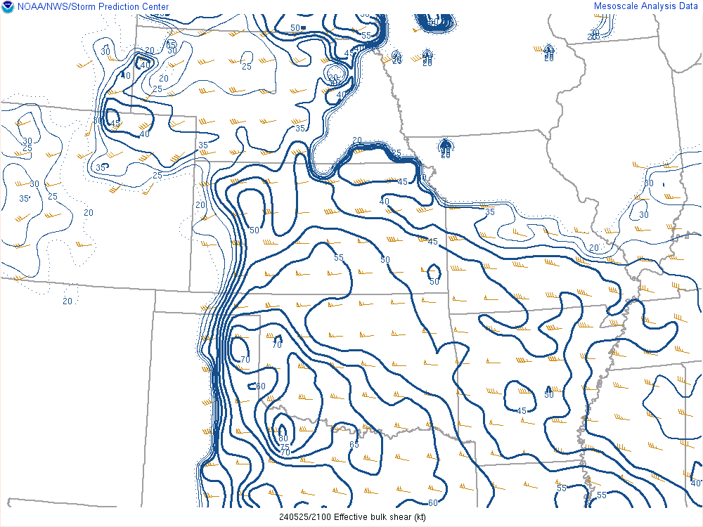
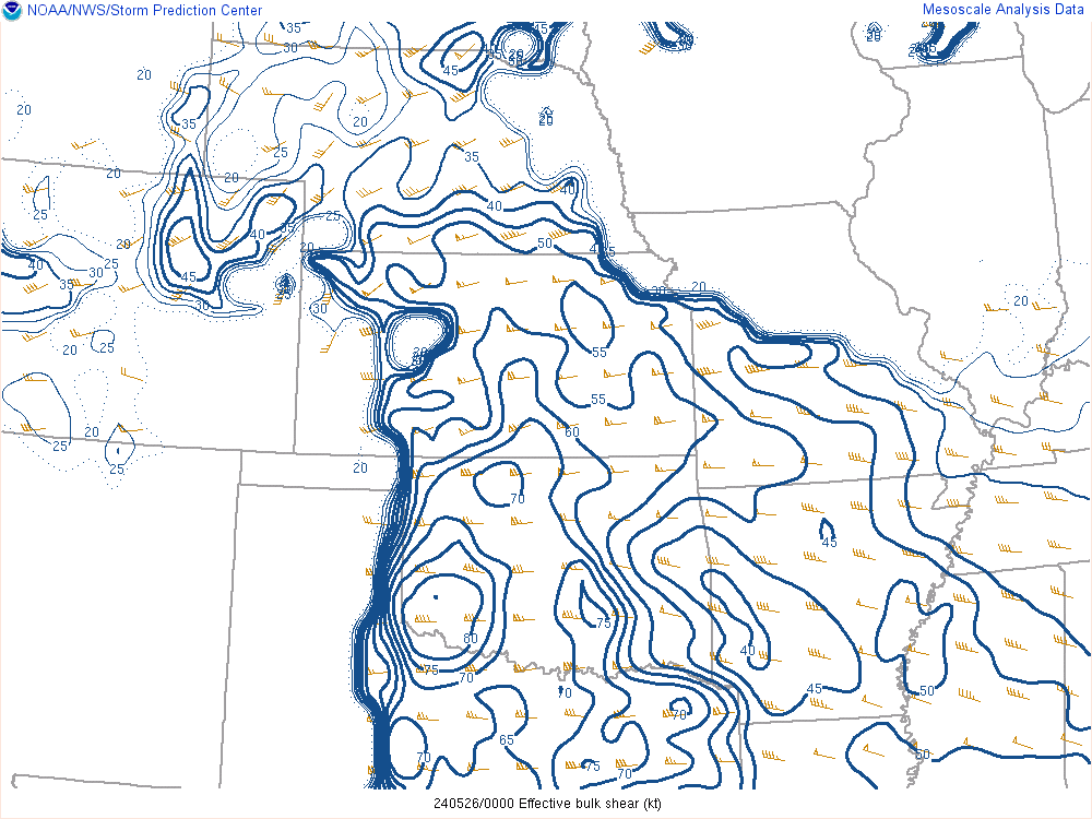
| 18z Effective deep layer shear | 21z Effective deep layer shear | 00z Effective deep layer shear | 03z Effective deep layer shear |
 |
 |
 |
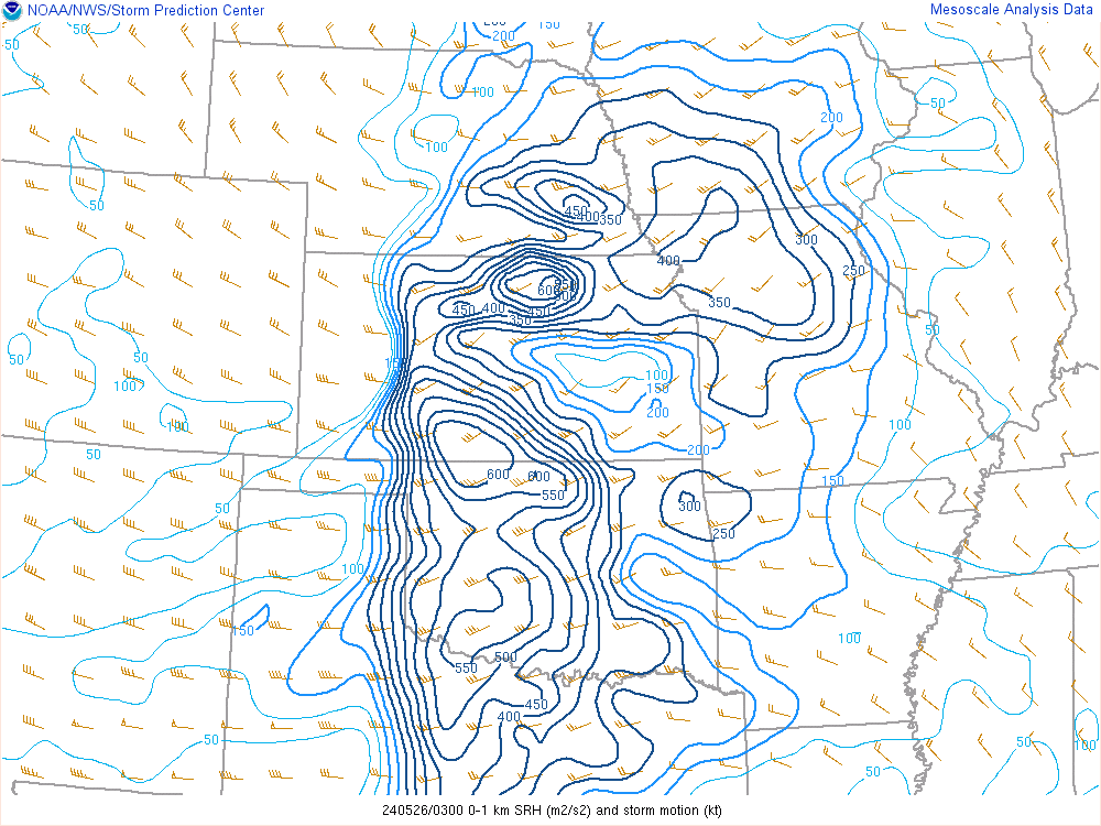 |
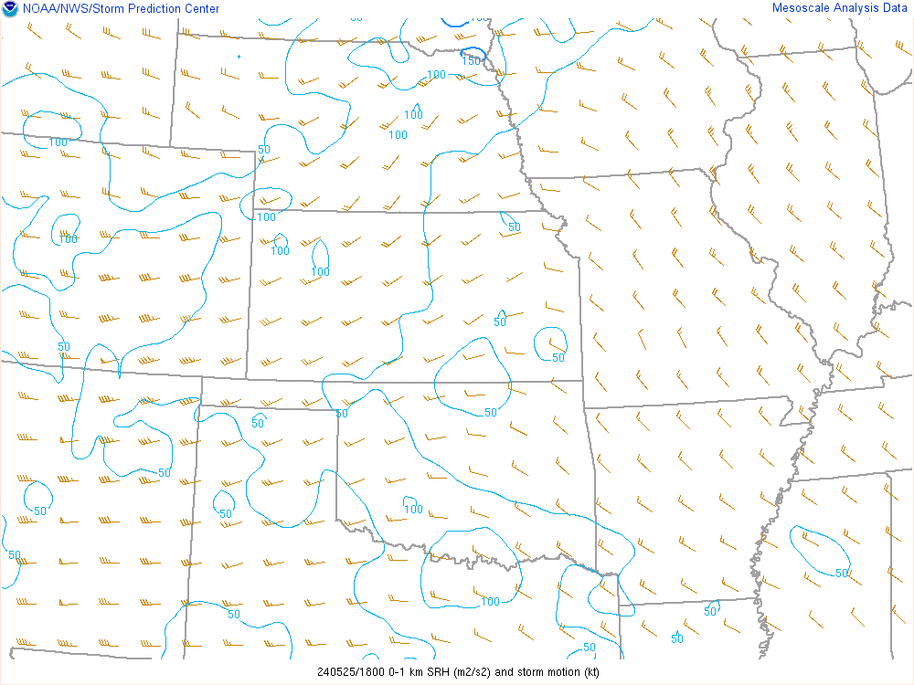
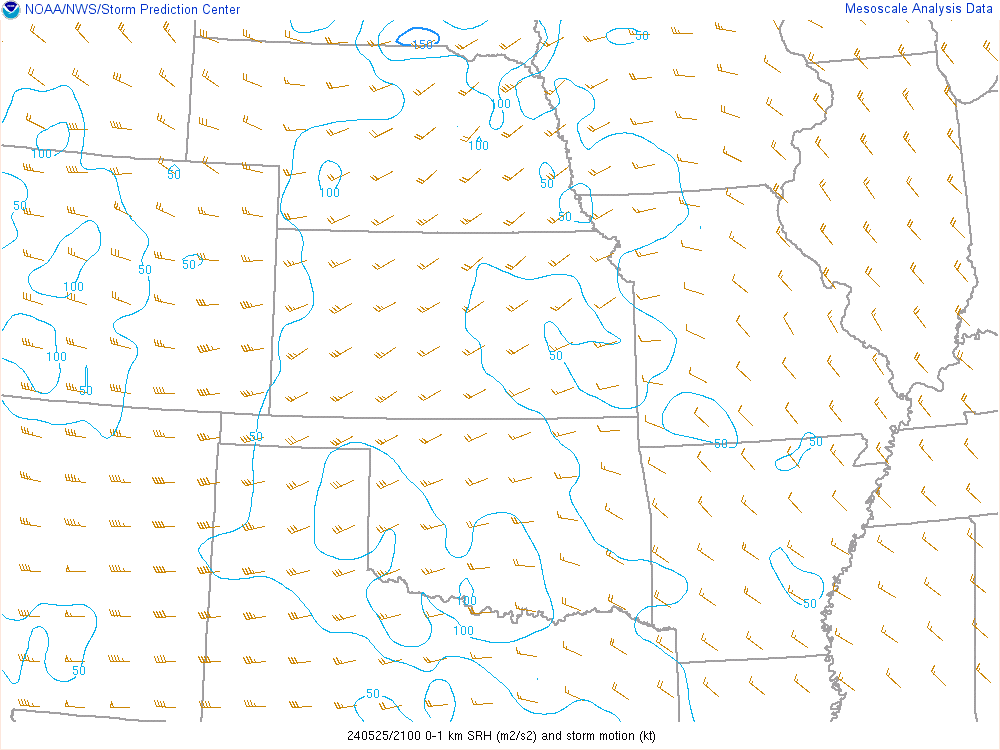
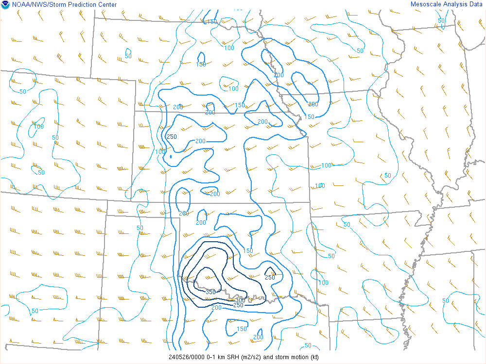
| 18z 0-1km SRH | 21z 0-1km SRH | 00z 0-1km SRH | 03z 0-1km SRH |
 |
 |
 |
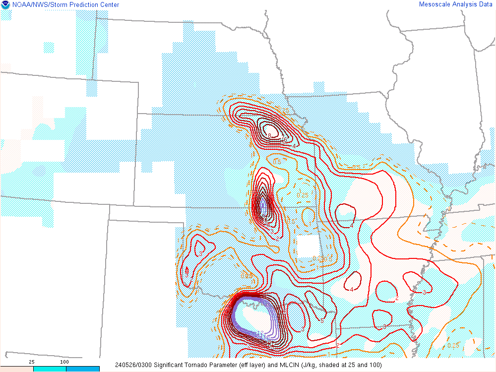 |
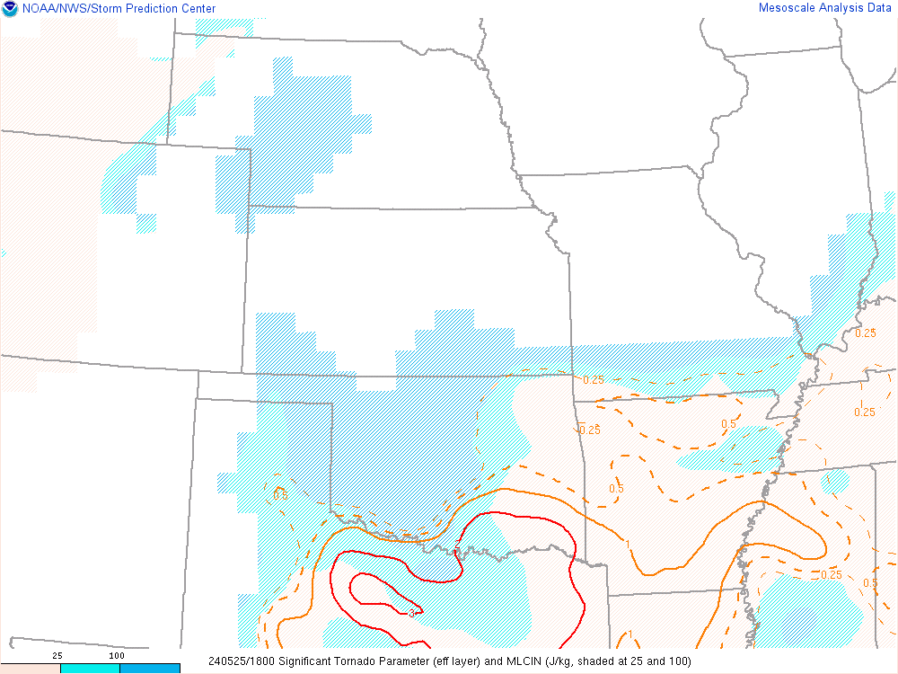
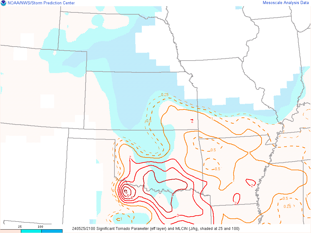
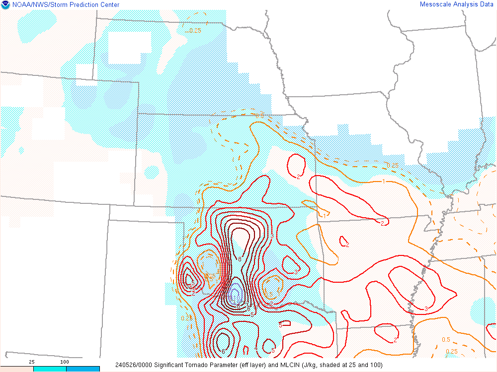
| 18z Sig tor | 21z Sig tor | 00z Sig tor | 03z Sig tor |
 |
 |
 |
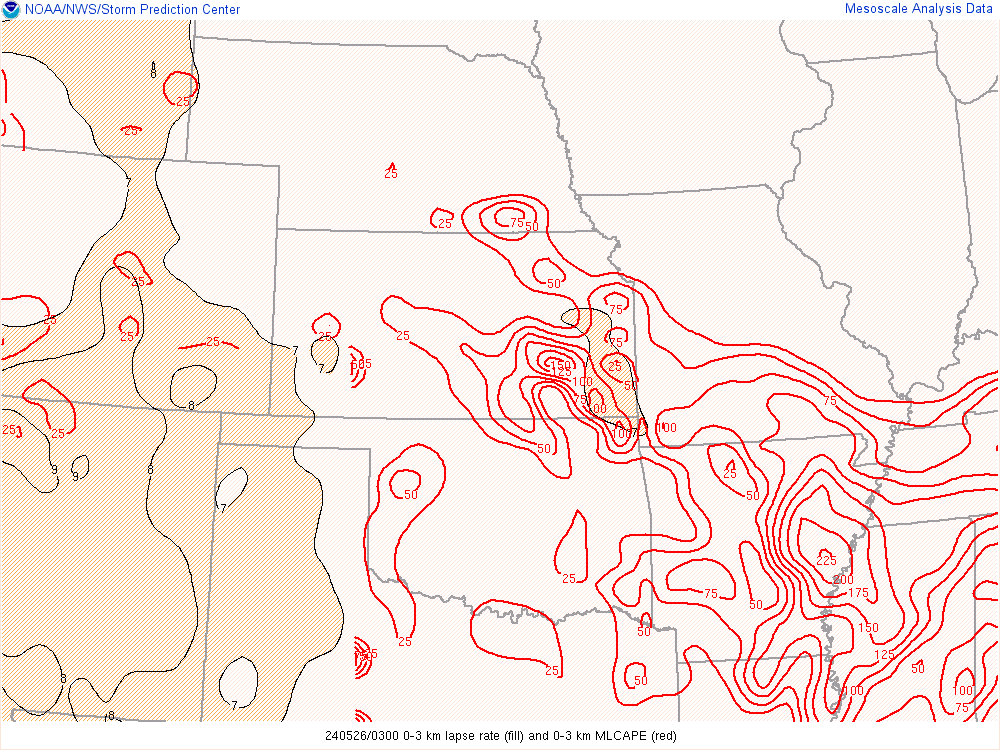 |
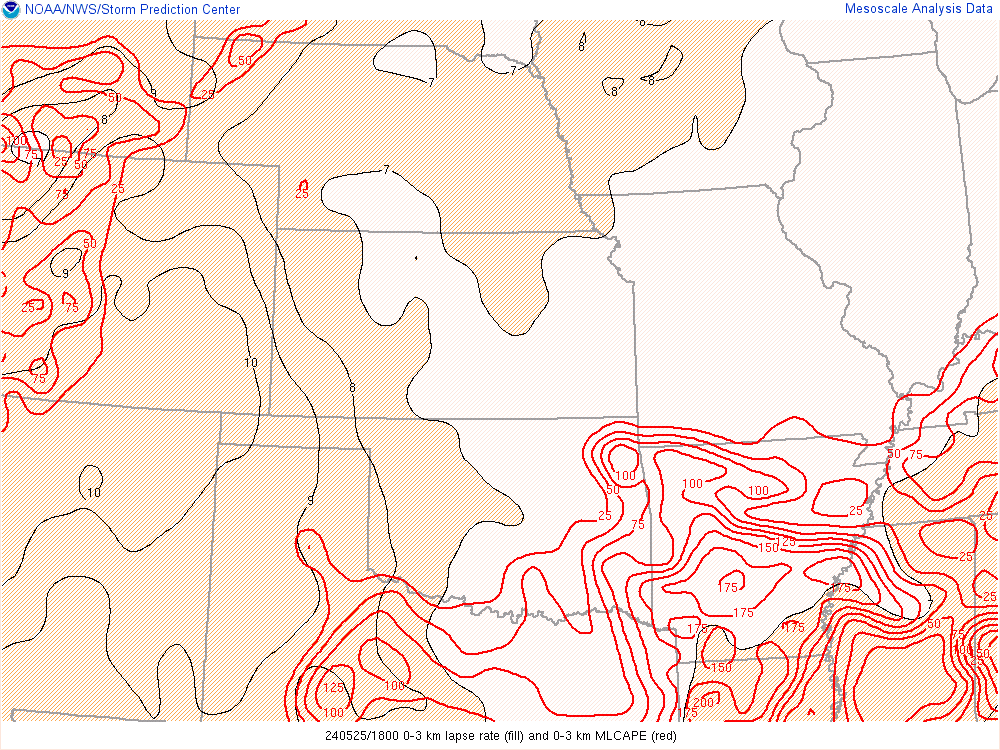
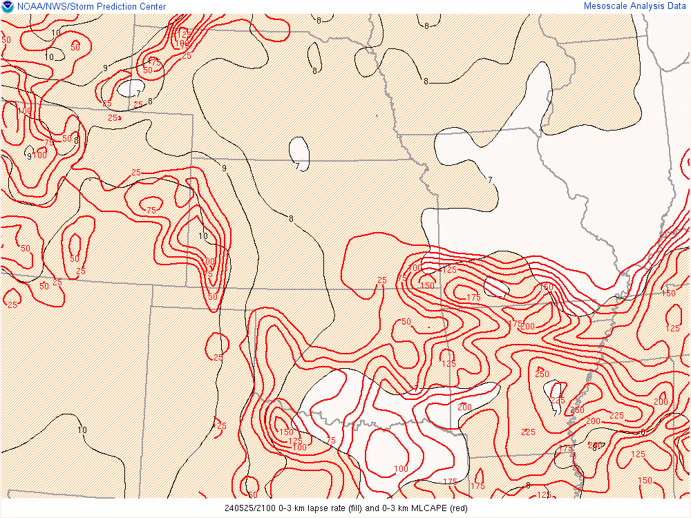
| 18z 0-3km CAPE | 21z 0-3km CAPE | 00z 0-3km CAPE | 03z 0-3km CAPE |
 |
Media use of NWS Web News Stories is encouraged! Please acknowledge the NWS as the source of any news information accessed from this site. |
|