Overview
|
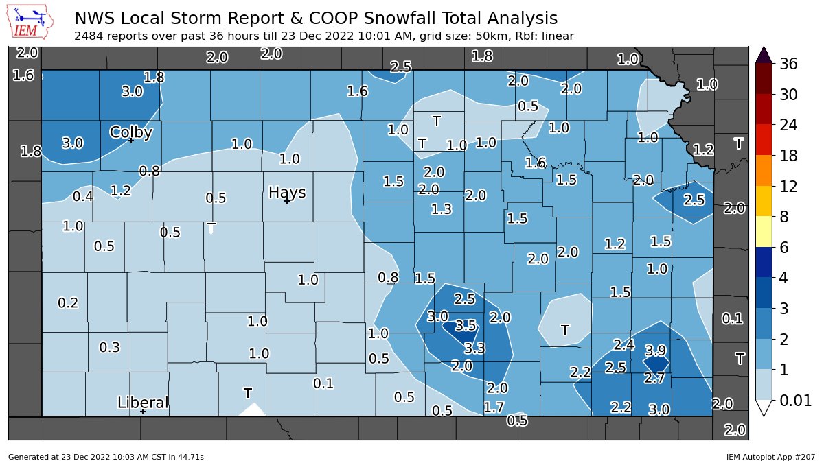
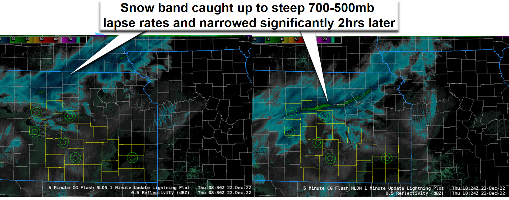
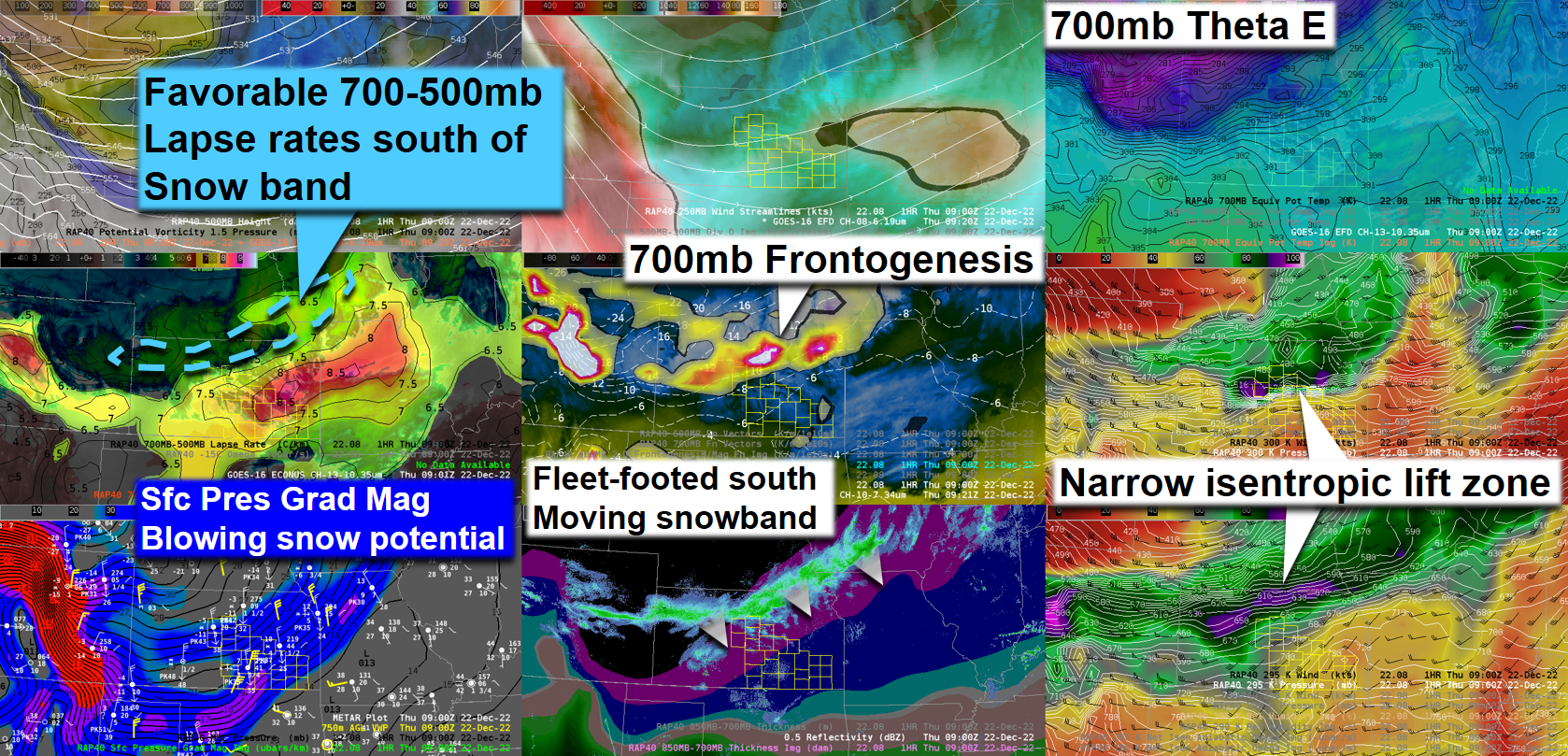
A blast of arctic air raced south across the area during the overnight hours on Dec 22nd bringing very cold air and dangerous wind chills to the region. A band of moderate to heavy snow also developed during the early morning hours across south central and southeast Kansas bringing a quick 1-3 inches of snow to much of the area. Wind chills on both December 22nd and 23rd were in the -25 to -40 degree range! |
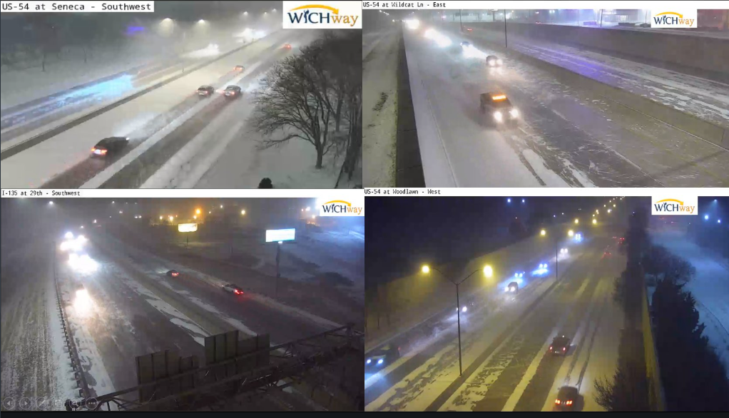 |
Photos & Video
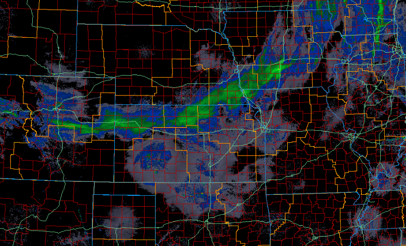
| Wind chill values early Thursday morning as the Arctic surged into the area. | Radar animation from the morning of Thursday Dec 22nd. |
 |
 |
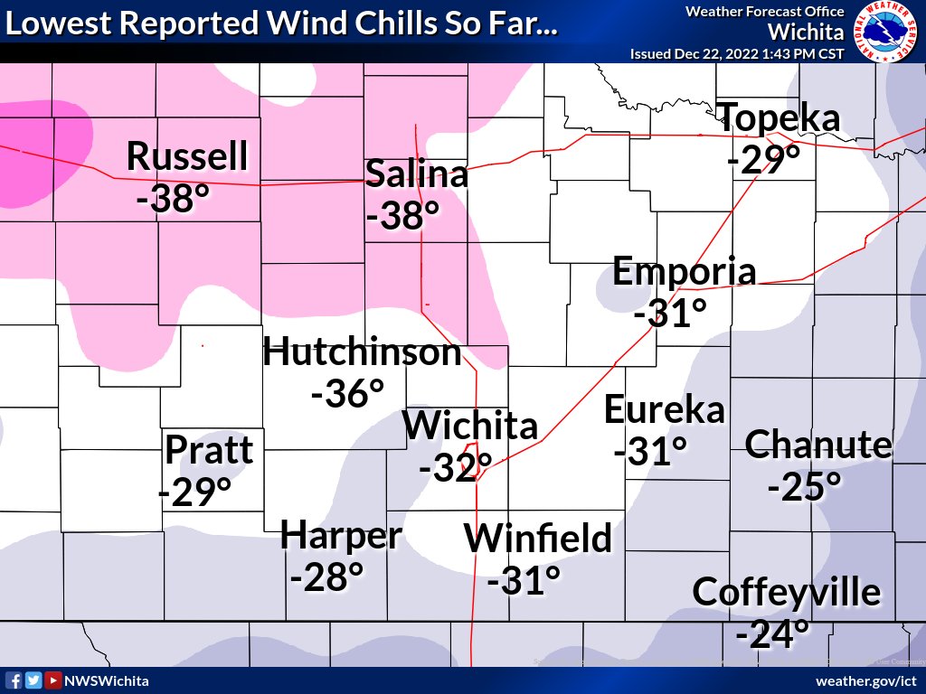 |
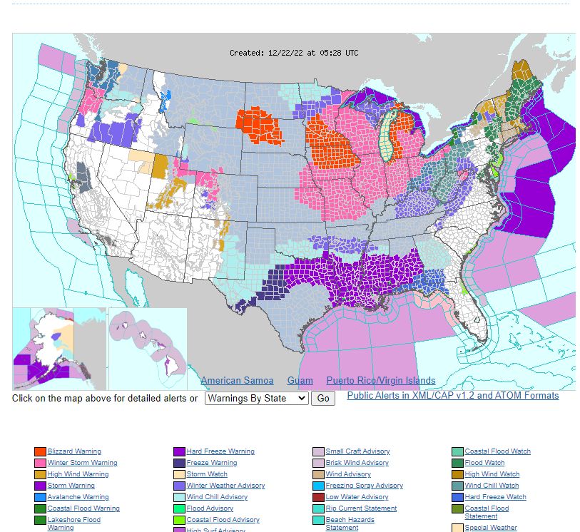
| ffap showing all watches and warnings across the U.S. on the morning of Dec 22nd | Snowfall totals from this event | Lowest wind chills on Dec 22nd |
|
|
|
|
|
|
Environment
 |
 |
 |
| Band of moderate snow moving into the area |
 |
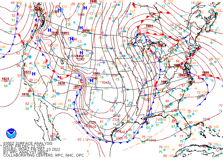 |
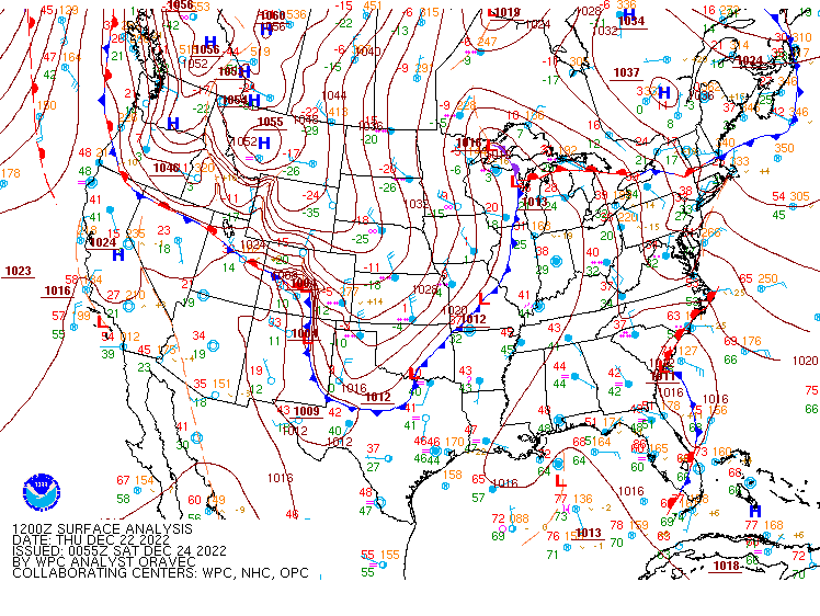
| Surface map from around 6am on Dec 22nd. | Surface map from around 11:30pm on Dec 22nd showing how far south the Arctic front made it! |
 |
Media use of NWS Web News Stories is encouraged! Please acknowledge the NWS as the source of any news information accessed from this site. |
 |