Overview
|
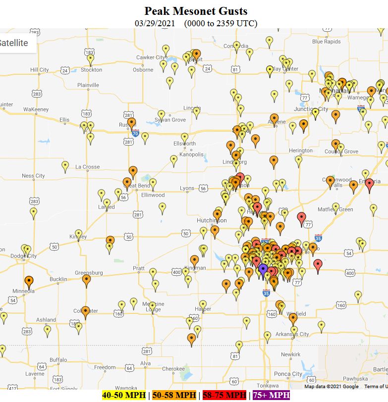
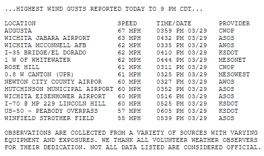
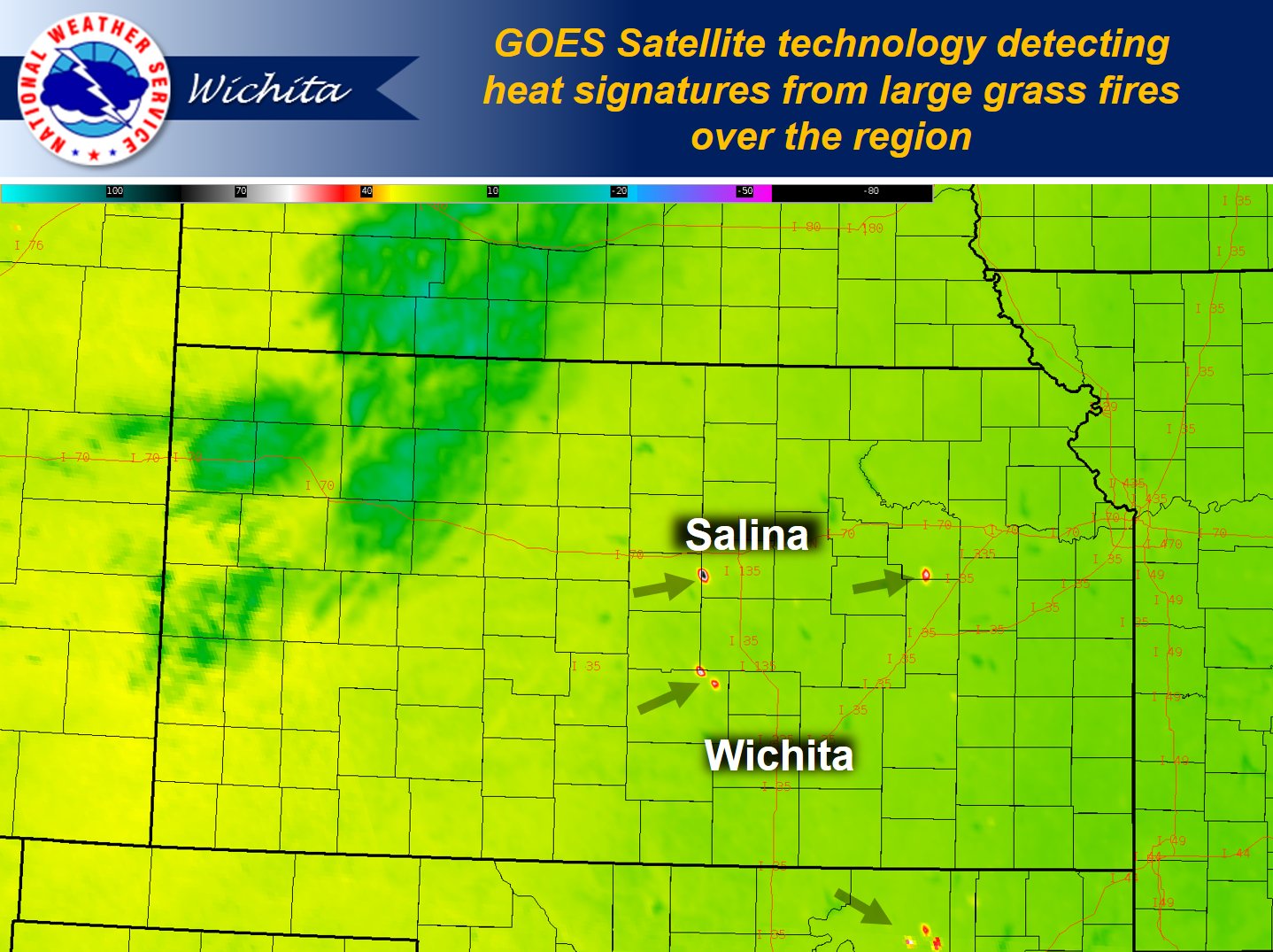
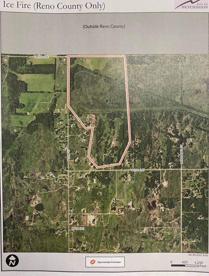
Extremely strong winds overspread the region on Monday March 29th 2021. South wind speeds gusted between 55 and 65 mph which downed trees, power poles along with ripping shingles off of roofs. In addition, strong winds and dry low levels resulted in volatile fire weather conditions with numerous large grass fires that were difficult to contain. The two largest fires were in northeast Reno County with one burning 600 acres and another around 300 acres. |
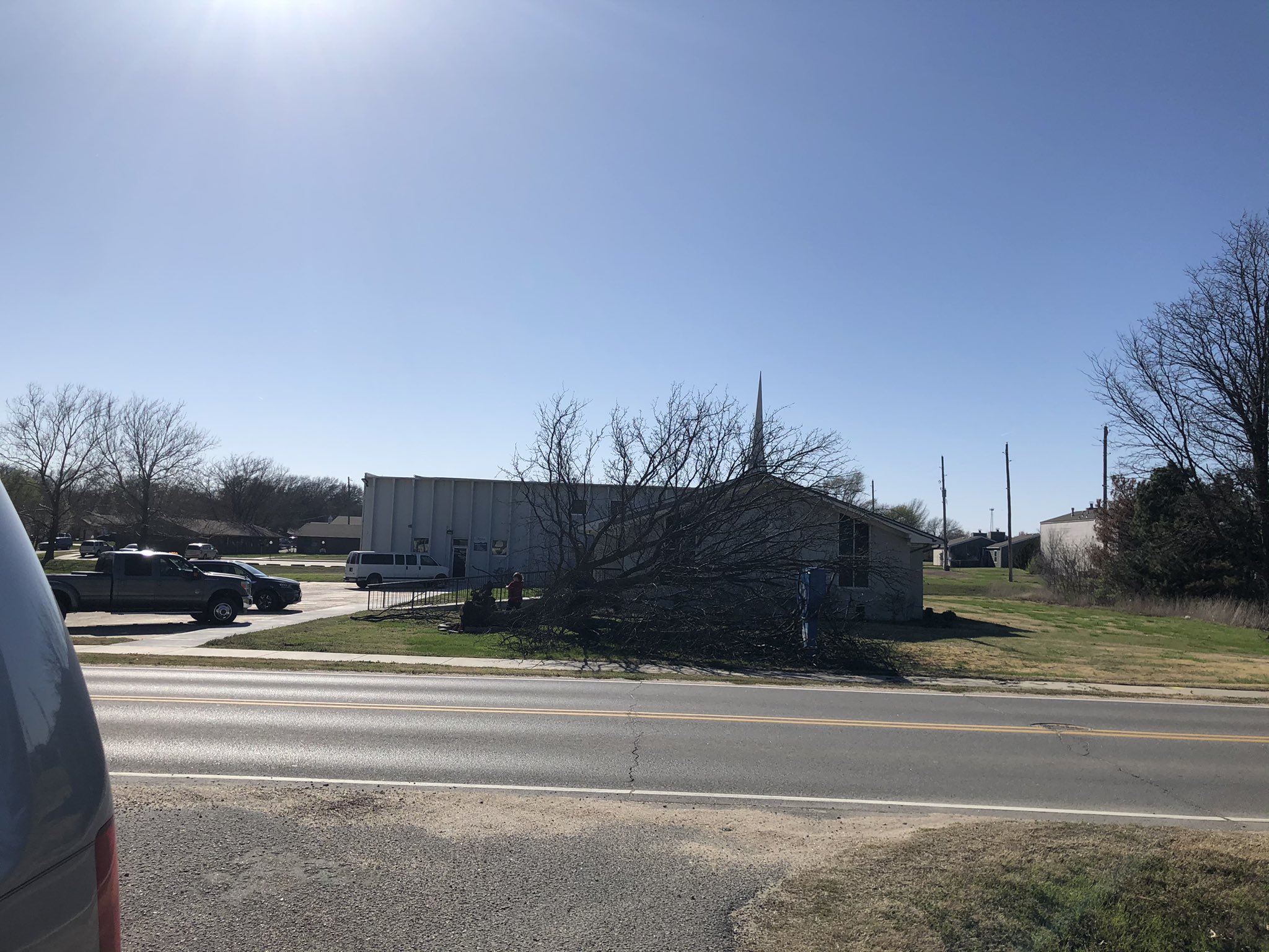 Downed tree in Cleaerwater |
Photos & Video
 |
|
|
 |
 |
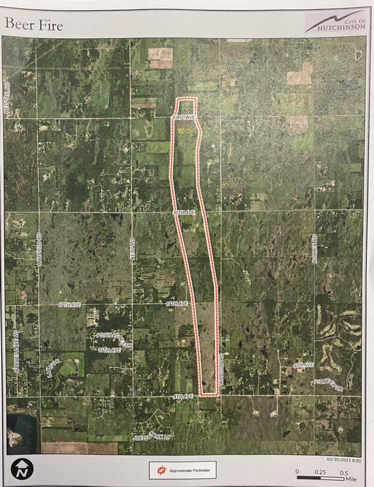 |
| Satellite image showing location of fires | Location of the 600 acre fire in northeast Reno county, courtesy of Hutchinson Fire Department | Location of the 300 acre fire in northeast Reno county, courtesy of Hutchinson Fire Department |
|
|
|
Environment
Insert synoptic summary.
 |
 |
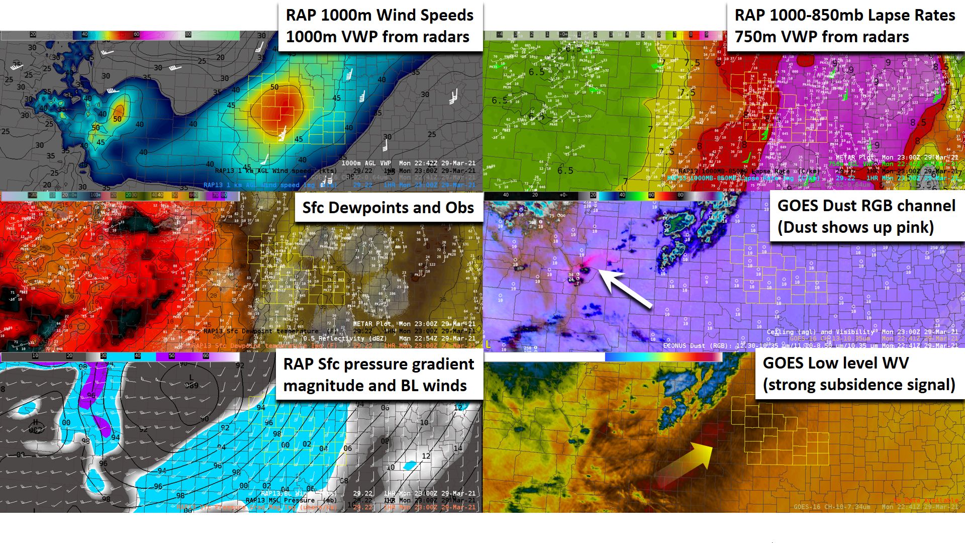 |
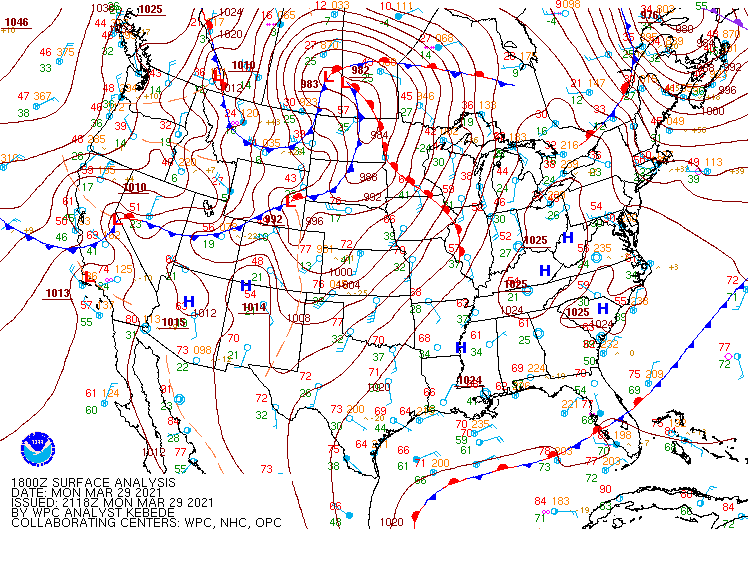
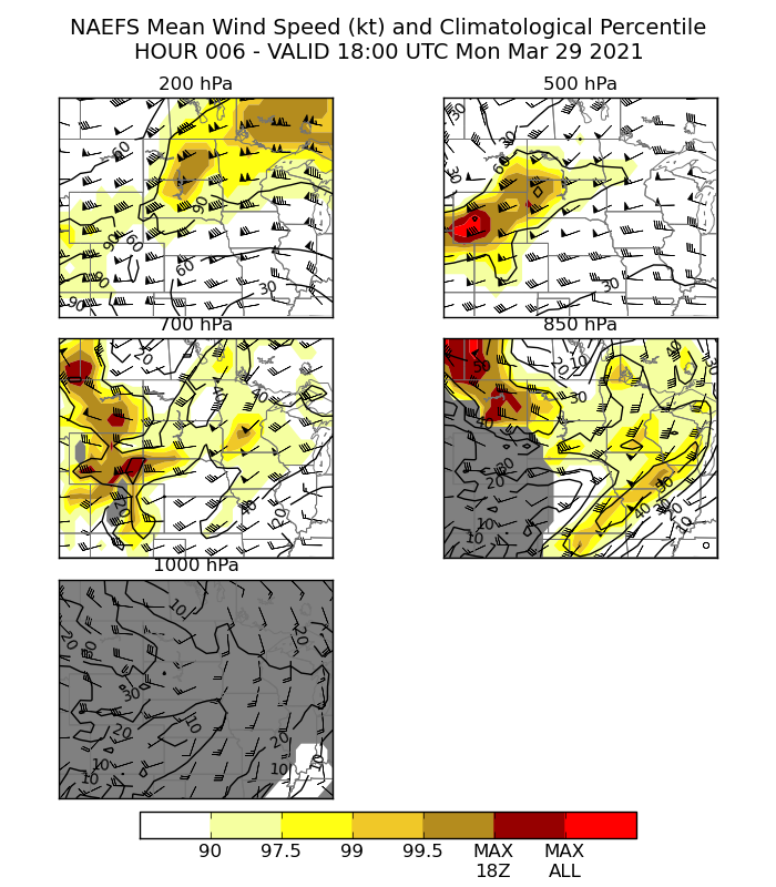
| Surface map from the afternoon of March 29th | Map showing that 850mb wind speeds were above the 99th percentile | AWIPS procedure used to diagnose strong low level winds |
 |
Media use of NWS Web News Stories is encouraged! Please acknowledge the NWS as the source of any news information accessed from this site. |
 |