Overview
|
A higher end severe weather event impacts portions of central and south-central Kansas during the afternoon and early evening hours of June 21, 2020. Notable reports include widespread wind damage across the town of Great Bend, wind gusts to 80 mph, as well as hail up to around baseball size. |
Photos & Video
|
|
|
|
|
|
|
|
|
|
Storm Reports
| Damaging Wind Reports | Hail Reports |
Environment and Radar
| Several ingredients came together to produce high amounts of instability, essentially the fuel needed to build severe thunderstorms. These ingredients included afternoon temperatures in the 80s and 90s, dewpoints in the 60s to near 70 degrees, and steep mid-level lapse rates. Furthermore, a cold front approaching from the west served as a focus for thunderstorm development. | While not overly strong, the difference in wind speed and direction between the surface and 6 km above ground of 30-35 kts proved sufficient for severe storm organization and longevity, especially given the high amounts of instability. |
 |
|
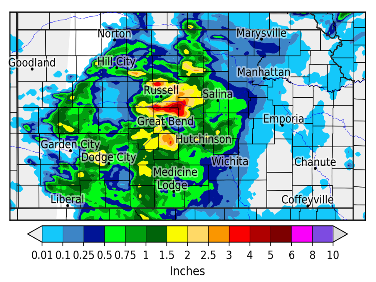
| Regional radar loop from 4-10 PM on June 21. Several thunderstorm clusters at the onset gradually merged into a large thunderstorm complex surging southeast. | Best-estimate 24-hour rainfall through 7 AM June 22. This is a mix between observed and radar-estimated rainfall. |
 |
Media use of NWS Web News Stories is encouraged! Please acknowledge the NWS as the source of any news information accessed from this site. |
 |