Overview
|
A rare June high wind event impacted portions of central and south-central Kansas June 9-10, 2020. High wind events aren't unheard of in June, but they are typically associated with thunderstorms. What made this event more rare is that it was not associated with any thunderstorm activity. It was driven by an unusually strong mid-latitude storm system. A High Wind Warning was in effect for portions of central and south-central Kansas. The last time a High Wind Warning was issued by the NWS Wichita office for a non-thunderstorm wind event in June was back in 2007. With this wind event, it is currently the windiest June since 2011 (for Great Bend, Hutchinson, and Wichita) and the windiest June since 2002 (for Russell and Salina). |
Photos & Video
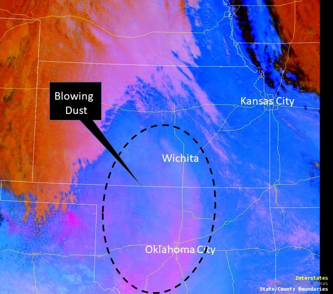
Satellite imagery picked up on blowing dust that developed across parts of Oklahoma and Kansas as the wind increased during the afternoon hours of June 9th
|
|
|
|
Storm Reports
Environment
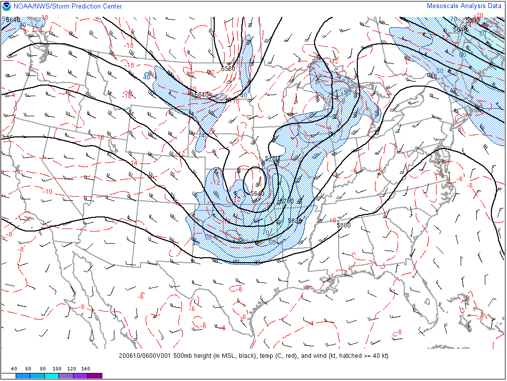
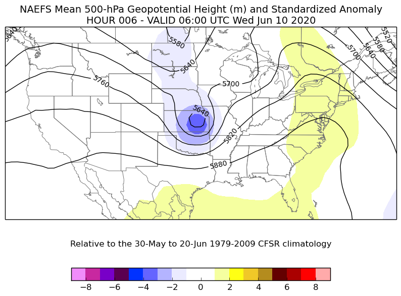
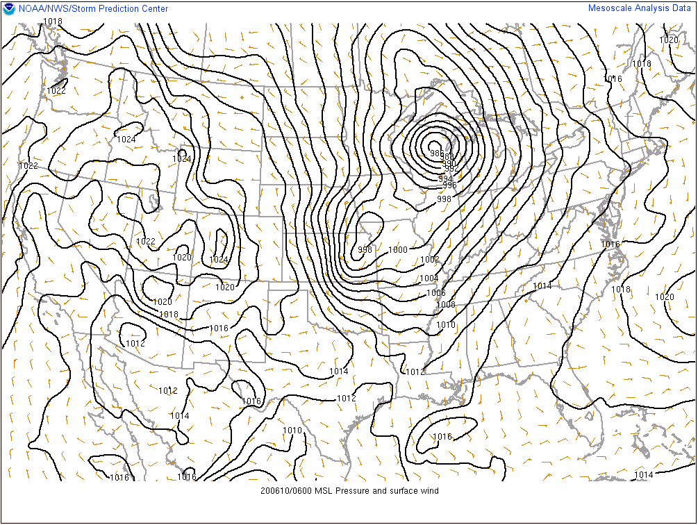
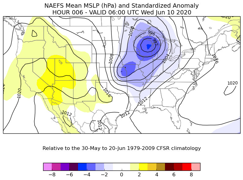
An anomalous storm system moved across the Central Plains June 9-10, and was accompanied by a strong pressure gradient and very strong winds just above the surface (by June's standards). The combination of the tight pressure gradient and stronger winds aloft allowed a period of 50-60 mph wind gusts to occur across much of central and south-central Kansas. Note: you can click the images to enlarge them if you want to be able to see them better.
 |
 |
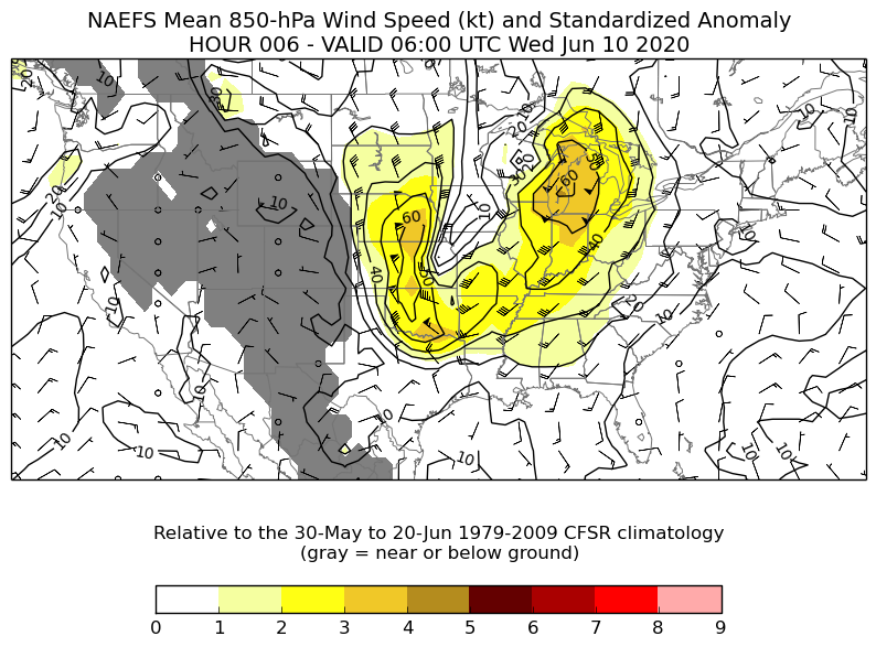 |
| Figure 1: 500mb Height and Wind | Figure 2: 500mb Height Standardized Anomaly. This shows that the storm system was stronger than normal for this time of year | Figure 3: 850mb Wind Speed Standardized Anomaly. This shows the abnormally strong winds just above the surface (by June's standards) |
 |
 |
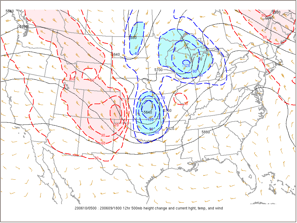 |
| Figure 4: 1 am Surface Analysis. Notice the close packing of the isobars (black lines). This indicates a tight pressure gradient. The tightest pressure gradient with this system occurred during the overnight hours and is why most of the strongest wind gusts occurred between 1 am and 3 am, June 10th. | Figure 5: Surface Pressure Standardized Anomaly. This reveals a deeper-than-normal surface low for this time of year. | Figure 6: 500mb Height Change. An area of strong height rises next to an area of strong height falls can support stronger winds at the surface |
 |
Media use of NWS Web News Stories is encouraged! Please acknowledge the NWS as the source of any news information accessed from this site. |
 |