|
Unlike the tornadoes of May 12th that affected mainly Harper county, these storms continued to move east, saving the strongest tornado of the night for Sumner county. Based on the damage survey, at least 9 tornadoes occurred, including two F3's and one F2.
The first tornado warning was issued for Harper county at 704 PM and was extended at 753 PM. The first reported touchdown was around 718 PM, west of Anthony. Three more tornadoes would touch down in Harper county before the night was over. The second brief touchdown occurred just northwest of Harper. The third one started just northeast of Anthony and was on the ground for 6 miles. It lifted northwest of Freeport, but another tornado developed northeast of Freeport, and crossed into Sumner County west of Argonia. Radar showed an impressive "hook echo" at this time.
The first Sumner County warning went out at 800 PM, and it was extended at 853 PM. Tornadoes sometimes develop in cycles as the supercell undergoes periods of strengthening and weakening. This storm was no exception. The next tornado occurred 6 miles later, and was the first of three to that touched down near Conway Springs. The first two of these were rated F3, but were only on the ground for 2.5 and 1.5 miles respectively. The last tornado which occurred east of Conway Springs was an F1. In addition to the tornadoes, the storm produced 80 mph winds at Belle Plaine and 2.5 inch hail near Conway Springs and Viola.
The large supercell thunderstorm which produced these tornadoes then drifted toward the northern Sumner county border, prompting a tornado warning for Sedgwick county at 936 PM. The storm weakened, but continued to drop golf ball sized hail near Mulvane around 930 PM.
|
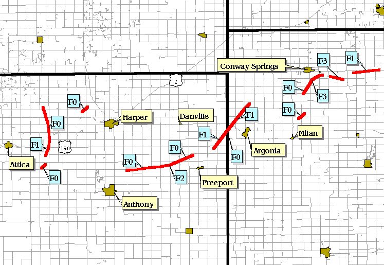
Map of tornado tracks
|
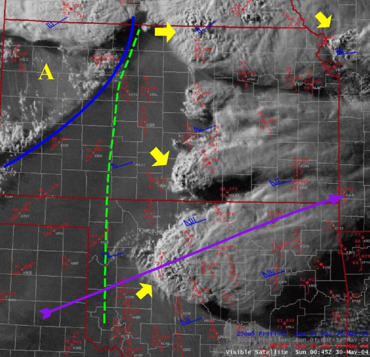
This image is a visible satellite view at 745 PM. The dashed green line, shows the 'dryline'. To the west of the dryline, dewpoints were in the 20's and 30's, and in the upper 60's to the lower 70's to east. The cold front (solid blue line) was sweeping across northwest Kansas with 50-70 mph winds occurring behind the front. (Incidently the area around letter A shows the blowing dust occurring behind the cold front, which was being kicked up by the very strong winds. ) The four storms, indicated by yellow arrows, all produced tornadoes within 20 minutes of the time of this image. The purple arrow indicates the jet stream, or axis of strongest winds at 34,000 ft (250mb).
|
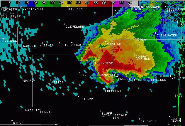
Reflectivity image at 810 PM, just before the tornado crossed into Sumner county.
|
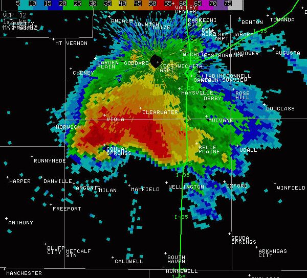
Reflectivity image at 845 PM. Note the hook echo immediately southwest of Conway Springs. This was likely just prior to the first F3 developing immediately south of the town.
|
|
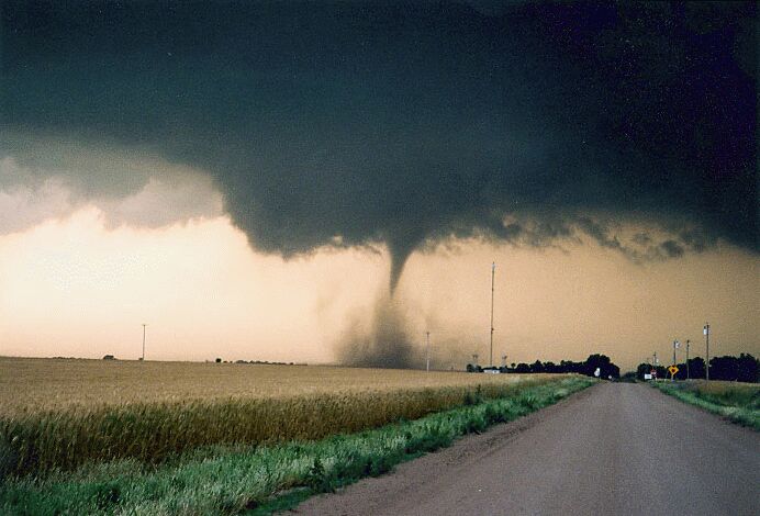
Picture of tornado taken from near Highway 44, 3 miles east of Anthony looking north. Picture courtesy Damon Shaw.
|
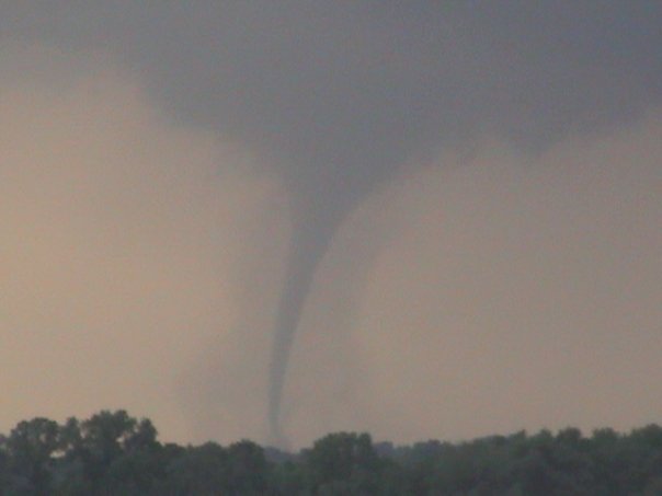
Tornado east of Attica, taken by Kevin Darmofal
|

A modular home was completely blown off of it's foundation 3 miles ESE of Conway Springs. Note the saferoom towards the left of the image.
|
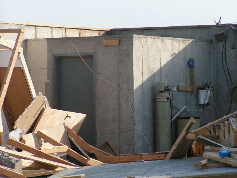
The owner took refuge in the saferoom and walked out unharmed. However, the propane tank was leaking and the fumes started to fill the room prior to his departure.
|
|
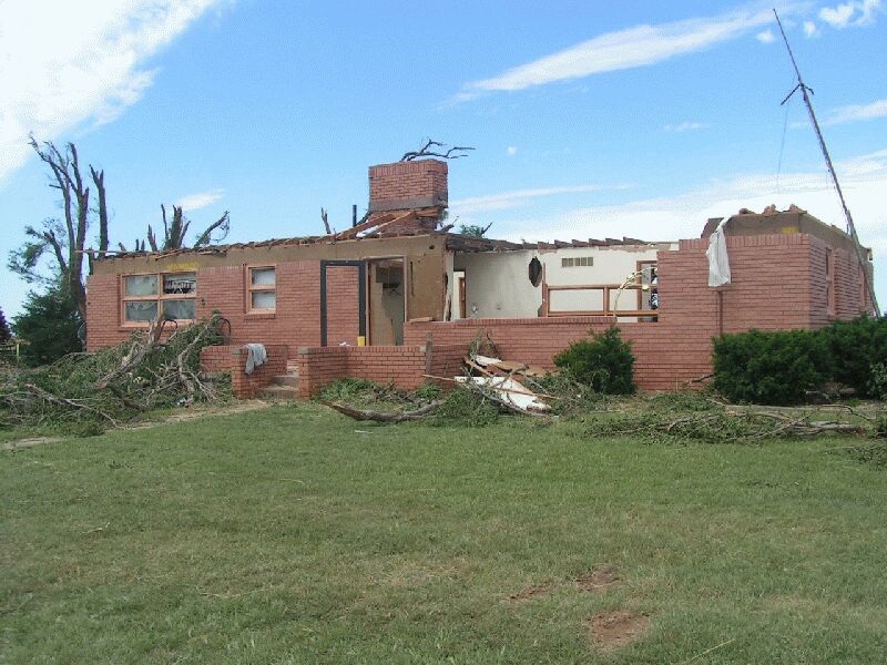
Solid brick home 4 miles west of Freeport lost it's roof and partial exterior wall.
|
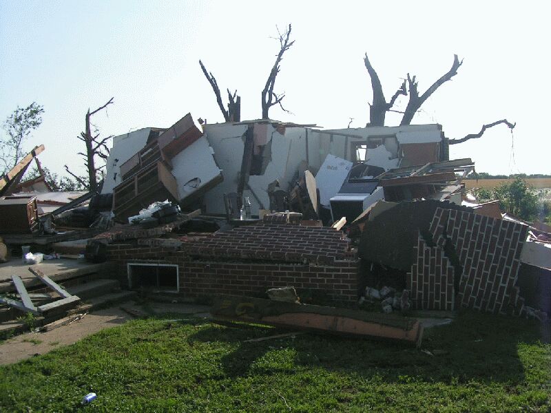
Full brick home with nothing left but the inner guts of the home. Goes to show how important it is to go to a closet or bathroom in the center portion of a home
|
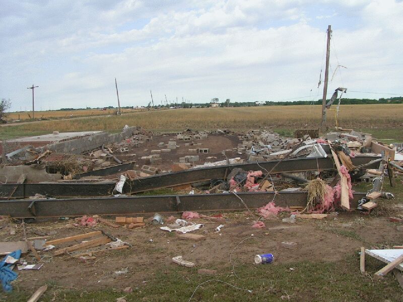 \ \
A mobile once stood here. This is the only location that we are aware of that an injury occurred.
|
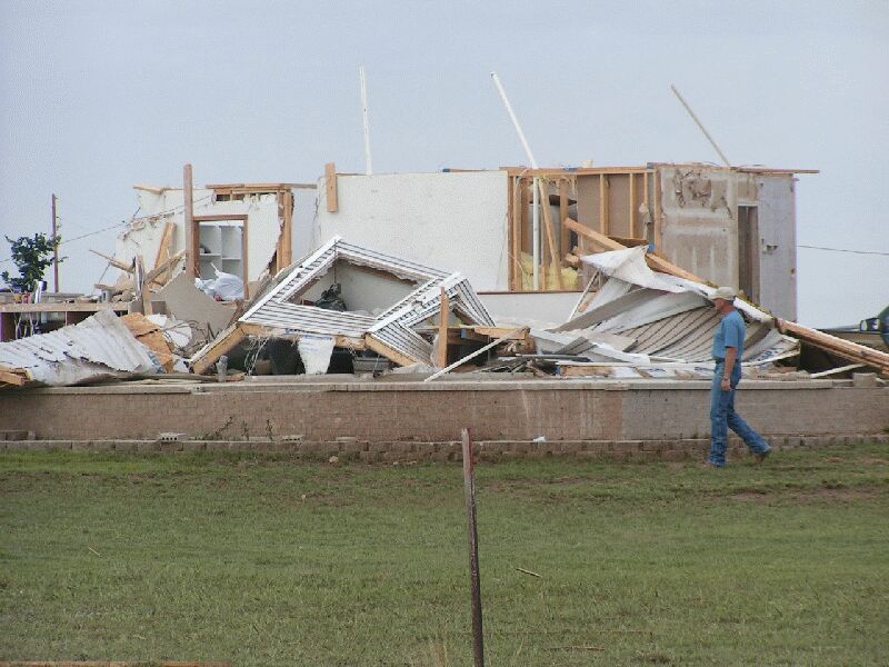
Tornado damage from 1.5 South of Conway Springs.
|
|
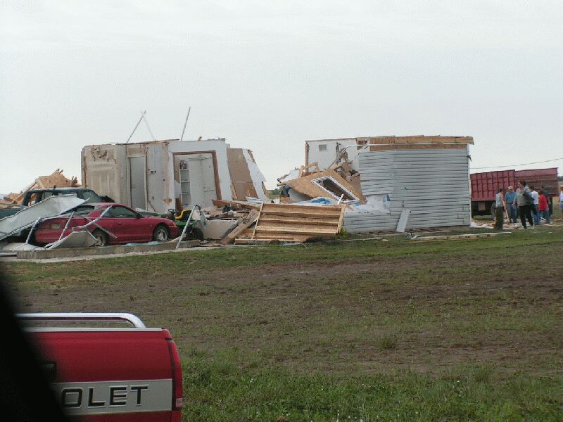
Tornado damage from 1.5 South of Conway Springs.
|
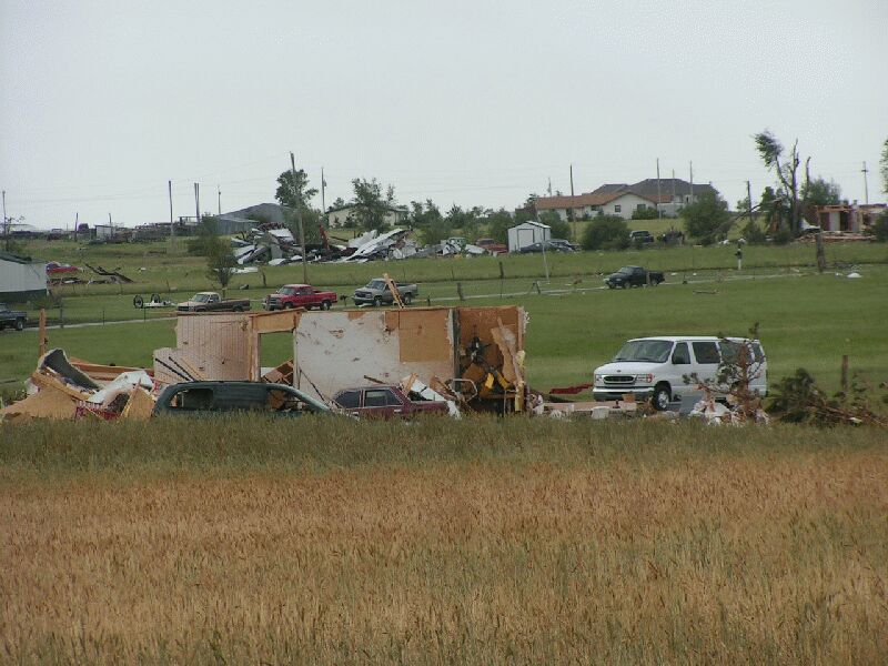
Tornado damage from 1.5 South of Conway Springs.
|
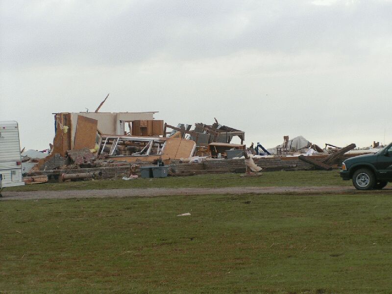
Tornado damage from 1.5 South of Conway Springs.
|
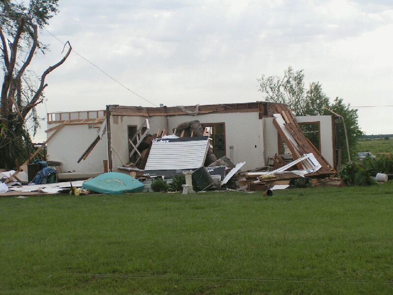
Tornado damage from 1.5 South of Conway Springs.
|
|

Picture of tornado near Argonia by Jim Caruso
|
|