Tiyan, GU
Weather Forecast Office
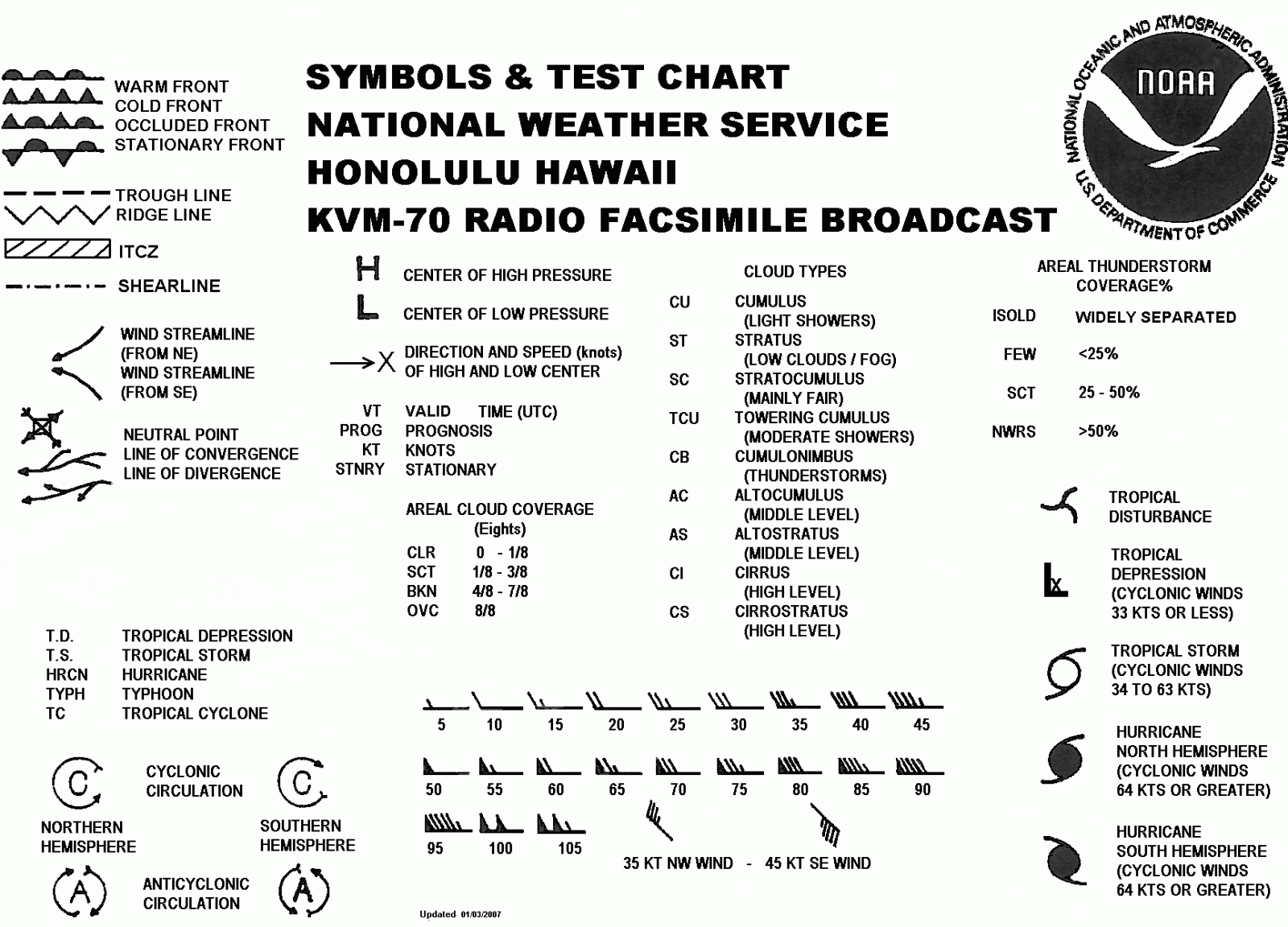
The Pacific Streamline Analysis is a Forecast Chart produced by the National Weather Service located in Honolulu, Hawaii.
A streamline analysis is a depiction of the surface wind field. Streamlines are drawn parallel to the wind. Surface meteorological features are then analyzed and drawn on to the chart using weather symbols. For more information on what these weather symbols represent, see the Symbols & Test Chart below.
US Dept of Commerce
National Oceanic and Atmospheric Administration
National Weather Service
Tiyan, GU
3232 Hueneme Rd
Barrigada, GU 96913
(671) 472-0900
Comments? Questions? Please Contact Us.


 Public Forecast
 Marine Forecast
 Radar
Radar Satellite
 Area Forecast Discussion
.png) Active Tropical Cyclones
Active Tropical Cyclones Palau Sector
 Yap Sector
 Marianas Sector
 Chuuk Sector
 Pohnpei/Kosrae Sector
 Marshall Islands Sector