
Severe thunderstorms will be possible from the central Plains to the Mid-Atlantic and Northeast on Monday. Hazardous heat will linger across the southern U.S. and build across the West through mid-week. Hot and dry conditions will fuel fire weather concerns for Interior Alaska and the Four Corners region through Monday. Read More >
| Click on the icons below to access individual briefing pages |
|
|
|
***Click Here for Probabilistic Snowfall Products***
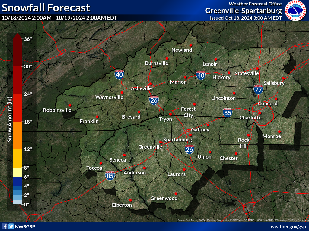
Snowfall Accumulation Forecast (click on thumbnails to display below)
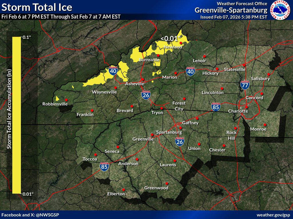
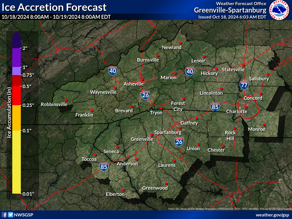
Ice Accumulation Forecast (click on thumbnails to display below)
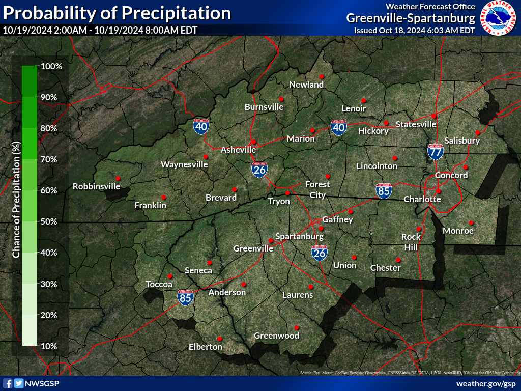
Probability of Precipitation (PoP) (click on thumbnails to display below)
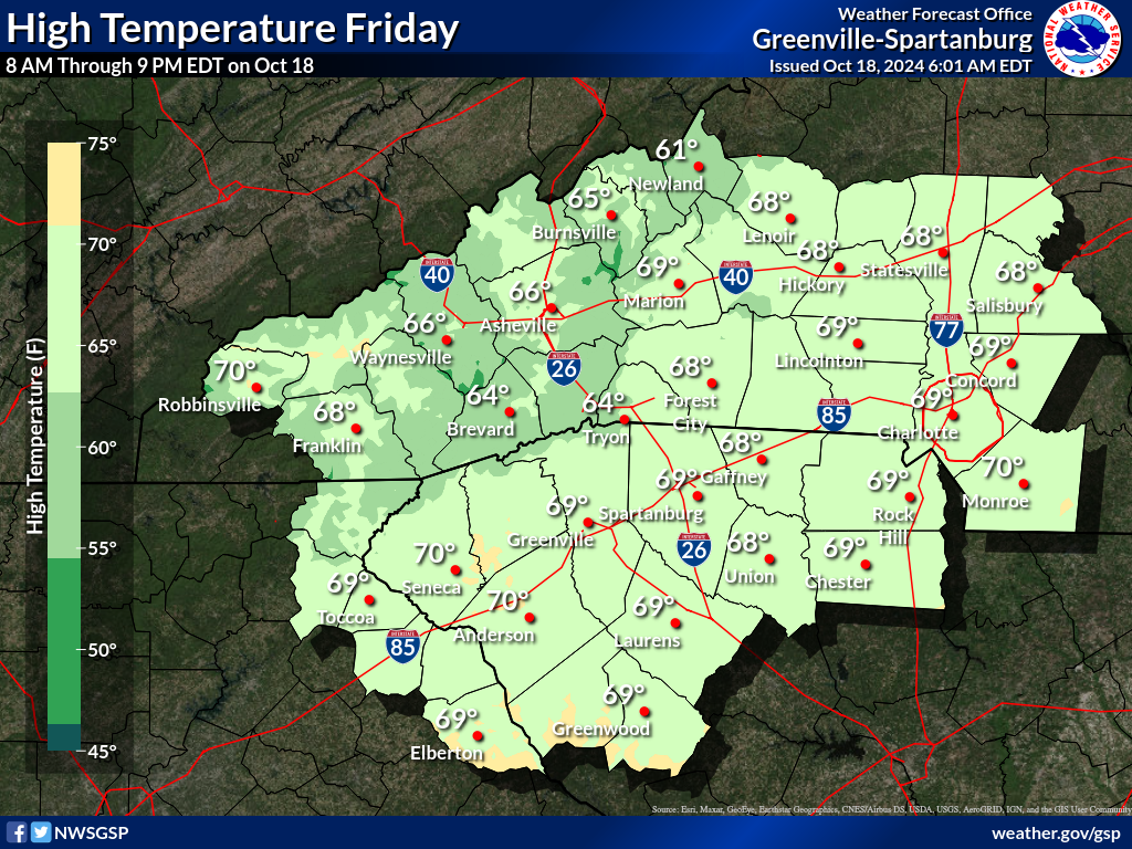
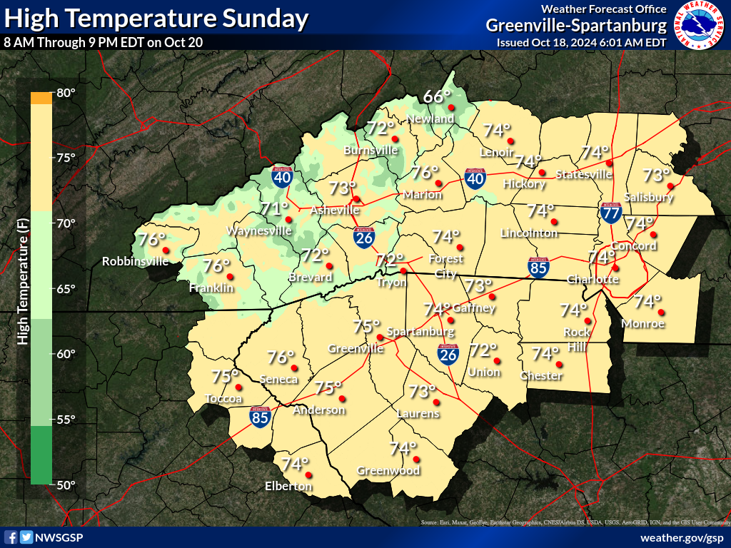
Days 1-4 Max Temperatures(click on thumbnails to display below)
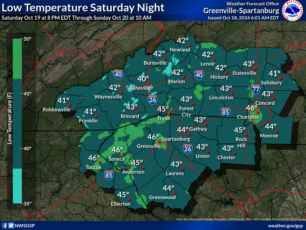
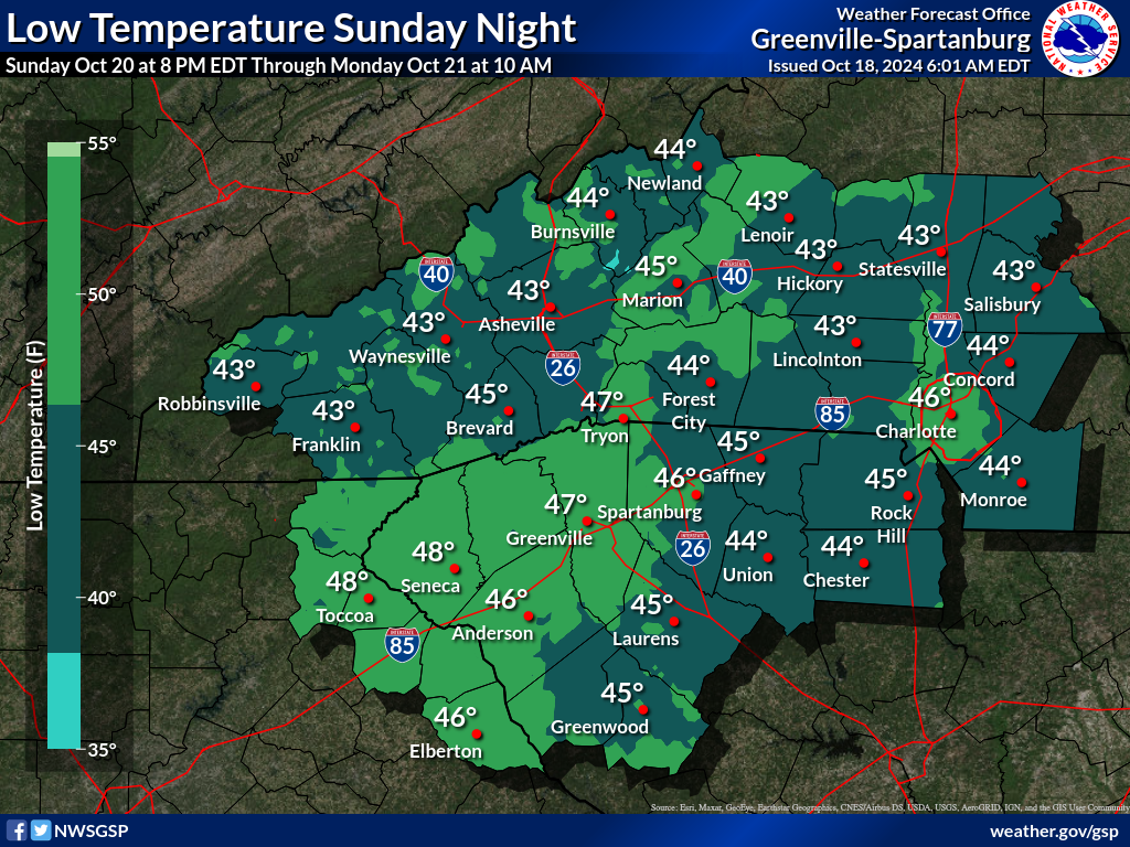
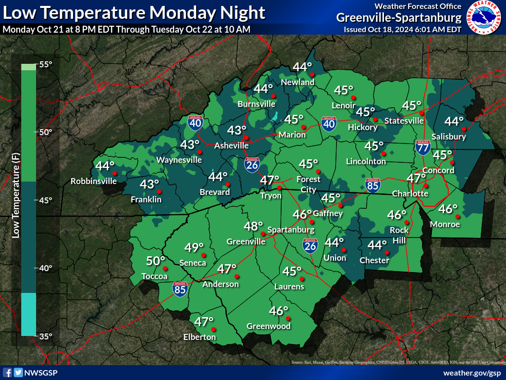
Nights 1-4 Min Temperatures(click on thumbnails to display below)
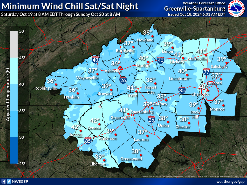
Days 1-4 Min Wind Chill(click on thumbnails to display below)
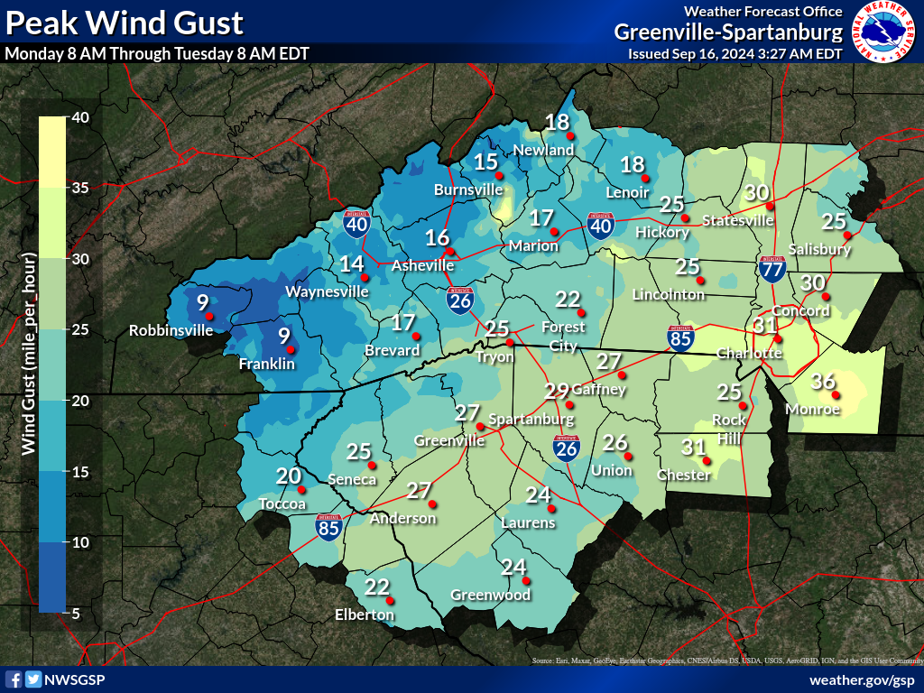
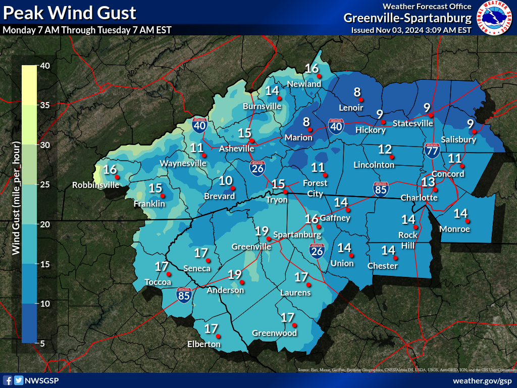
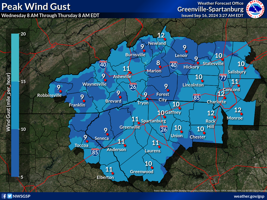
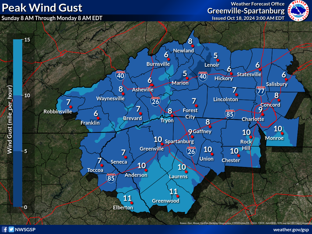
Days 1-4 Max Wind Gusts(click on thumbnails to display below)
|


 Tropical Weather
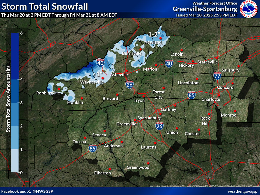


 Hourly Weather