
Record setting heat is expected over the next several days from the Intermountain West through the northern Plains. Furthermore, fire weather concerns increase with dry and breezy conditions. Meanwhile, heavy rainfall and severe thunderstorm threats for the Ohio/Tennessee Valleys, central Appalachians and Southeast today. The threat shifts to central Gulf Coast and across central Texas this week. Read More >
| Hazard Type | Watch/Warning Name Criteria |
Advisory Name Criteria |
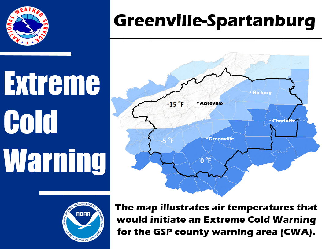
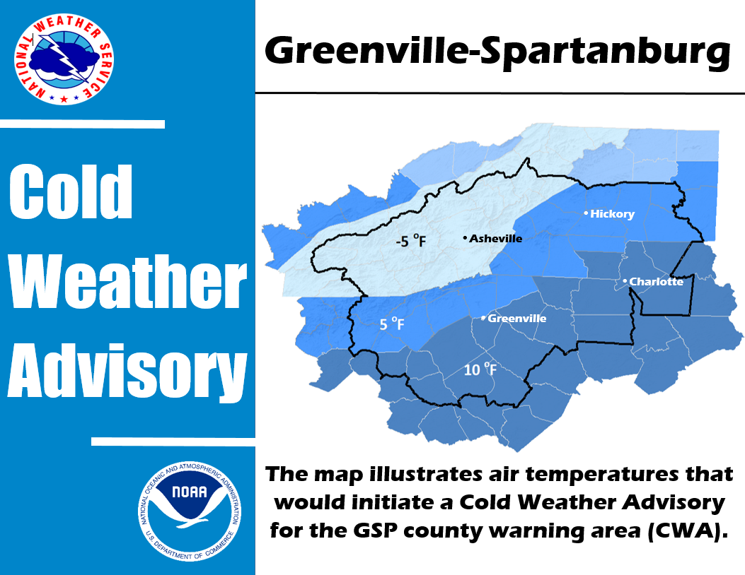
| Cold Weather | ||
| Heat | Excessive Heat Watch/Warning Heat Index 110 or greater |
Heat Advisory Heat Index 105 or greater but less than 110 |
| Wind (Non-Thunderstorm) | High Wind Watch/Warning Sustained winds higher than 40 mph and/or frequent gusts greater than 57 mph |
Wind Advisory |
| Frost Freeze | Freeze Watch/Warning Low temperature of 32 degrees or less during the |
Frost Advisory Scattered to widespread frost is forecast during the Growing Season* |
| Fog | N/A | Dense Fog Advisory Fog causing widespread visibility of 1/4 mile or less |
NWS Greenville-Spartanburg Criteria for Winter Weather Watches/Warnings/Advisories
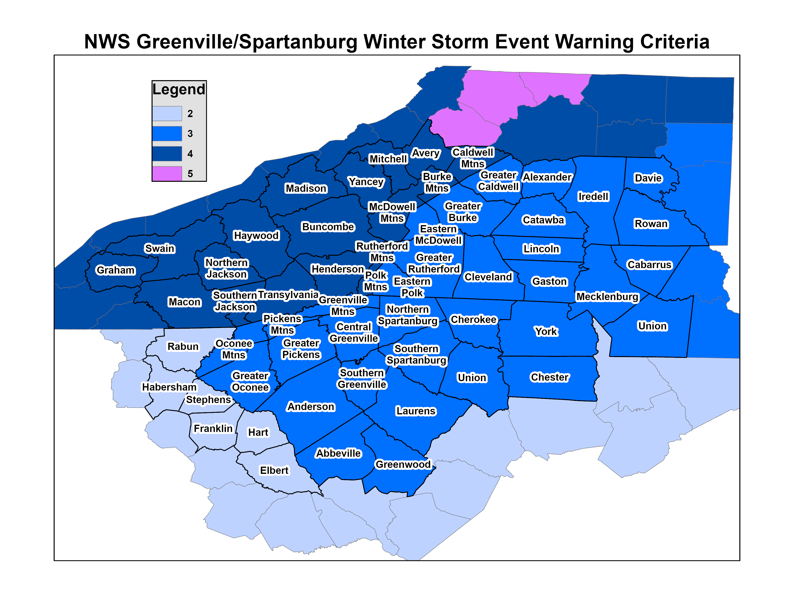
| Winter Storm Event Warning Accumulation Criteria |
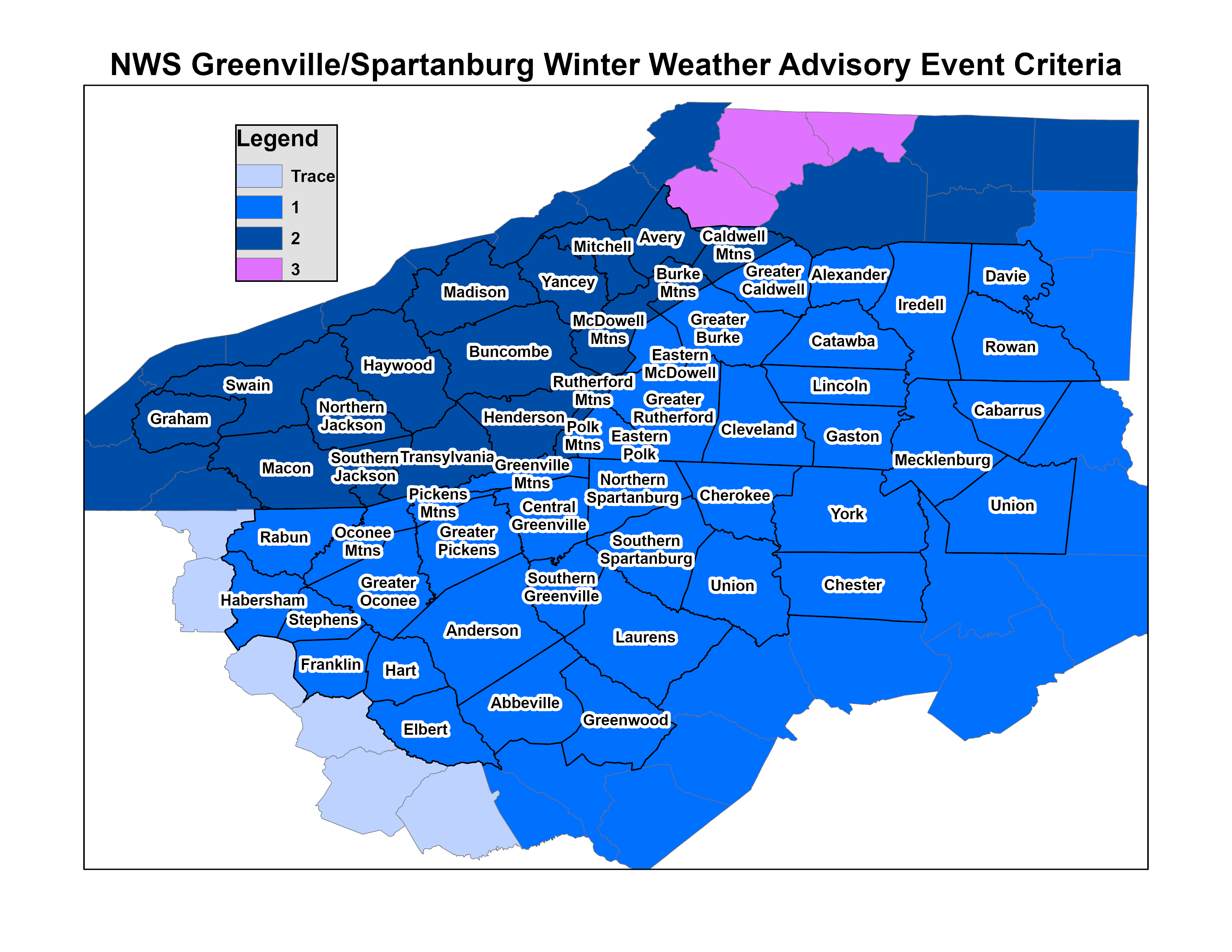
Winter Weather Advisory Event Accumulation Criteria |
| Ice Storm Warning Criteria 1/4" or Greater Ice Accretion |
Winter Weather Advisory Criteria Trace Amounts to Less Than 1/4" Ice Accretion |
|
Your reports can be a vital component of our decision to issue warnings. To Report Severe Weather to the National Weather Service at Greenville-Spartanburg: By phone: 1-800-267-8101. Leave a message describing your report. Please include the following info with your report:
|
|
The following weather events meet reporting criteria:
Hail Size Per the Following
|
| Diameter (inches) | Size Description |
|---|---|
| 3/4 | Dime or Penny |
| 7/8 | Nickel |
| 1.0 | Quarter |
| 1.25 | Half Dollar |
| 1.5 | Ping Pong Ball |
| 1.75 | Golf Ball |
| 2.5 | Tennis Ball |
| 2.75 | Baseball |
| 4 | Softball |
| 4.5 | Grapefruit |
| Visual Clues and Damage Impacts | Speed (mph) | Description |
|---|---|---|
| Twigs and small branches breaking off trees, impedes walking | 39-46 | Gale |
| Minor structural damage, many twigs on ground | 47-54 | Strong Gale |
| Minor to moderate structural damage. Trees blown down. Severe Thunderstorm Warning criteria: 58 mph and greater |
55-63 | Whole Gale |
| Widespread minor to moderate structural damage. Many large trees down. | 64-75 | Storm Force |
| Severe and extensive damage. Roofs peeled off, mobile homes overturned. | >75 | Hurricane Force |
Real Time Severe Weather Reports


 Hourly Weather
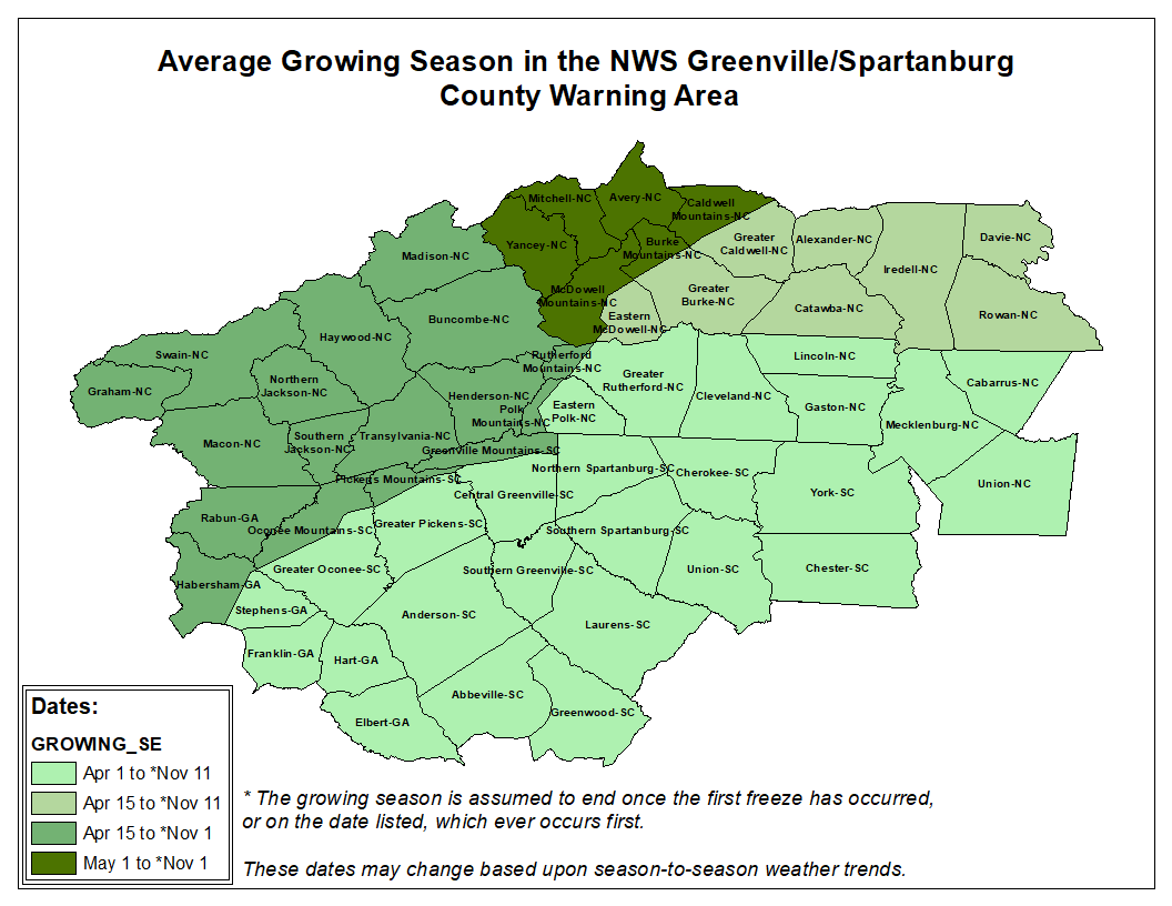