A high pressure system is bringing mostly clear skies and cooler temperatures across much of the eastern U.S. to the Mid-South. A stationary front will produce thunderstorms and heavy rain across the Florida Peninsula to the immediate Southeastern coast. Severe thunderstorms are possible across portions of the central and southern Plains. Read More >
Greenville-Spartanburg, SC
Weather Forecast Office
Forecast Graphics | ||
Day 1 Minimum RH | Day 2 Minimum RH | Day 3 Minimum RH |
Day 1 Peak Wind Gust | Day 2 Peak Wind Gust | Day 3 Peak Wind Gust |
Day 1 Precip Amount | Day 2 Precip Amount | Day 3 Precip Amount |
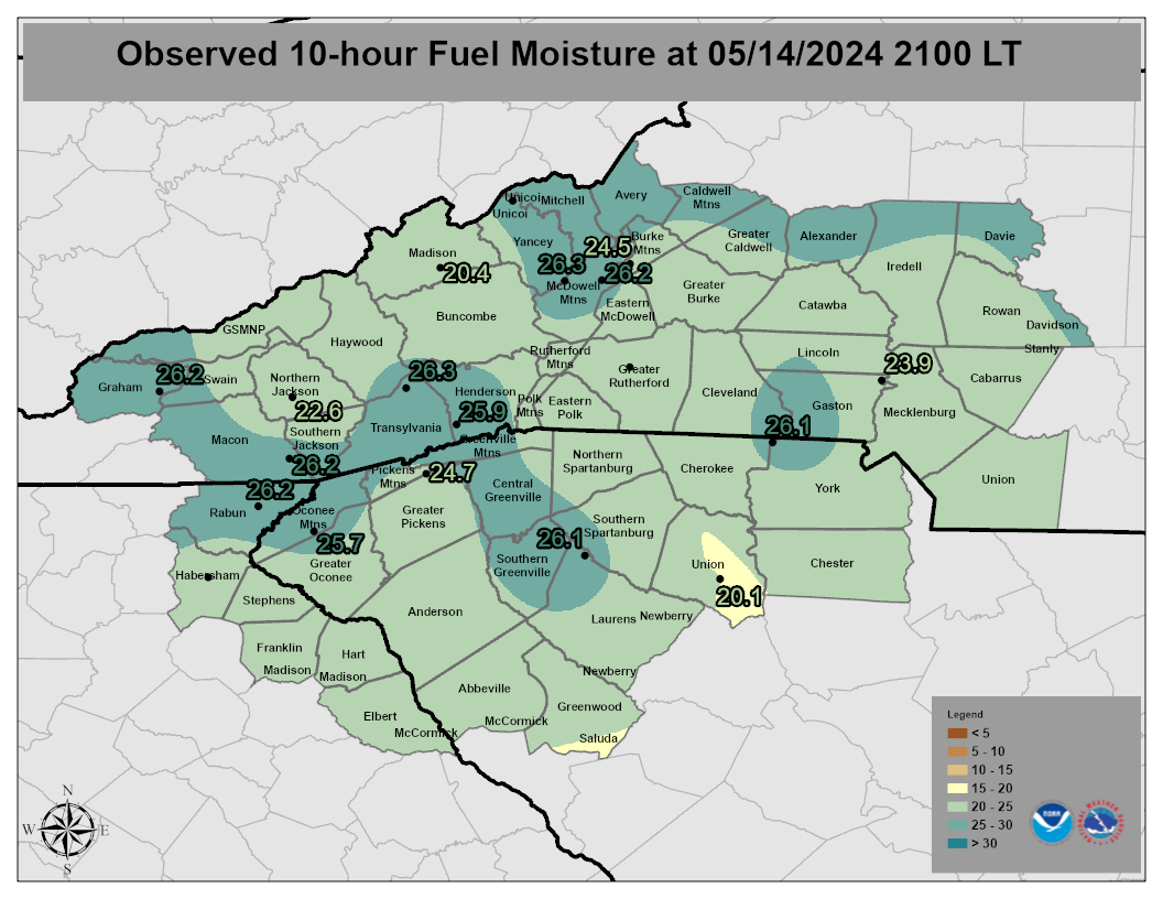
Click an icon to display a Point Forecast Matrix for RAWS and N.C. Econet sites or click inside a zone polygon to display the Area Forecast Matrix (Point Forecast Matrix Key)
Forecast
Weather Activity Planner
Aviation Weather
Graphical Forecasts
Weather Prediction Center
Long Range Forecast
Model Data
Hazards
Severe Thunderstorms
Tropical Weather
Winter Weather
Storm Prediction Center
National Hurricane Center
Space Weather
Office Programs
Skywarn
CoCoRaHS
Cooperative Observers
StormReady
WRN Ambassadors
Office Staff
Local Research
US Dept of Commerce
National Oceanic and Atmospheric Administration
National Weather Service
Greenville-Spartanburg, SC
GSP International Airport
1549 GSP Drive
Greer, SC 29651
(864) 848-3859
Comments? Questions? Please Contact Us.