
A Pacific storm will bring rain and high elevation snow from the Pacific Northwest into the Northern Rockies. A series of storms are expected to move through the Bering Sea bringing strong winds, heavy precipitation, and elevated water levels from the West Coast to northern Alaska. Read More >
Greenville-Spartanburg, SC
Weather Forecast Office


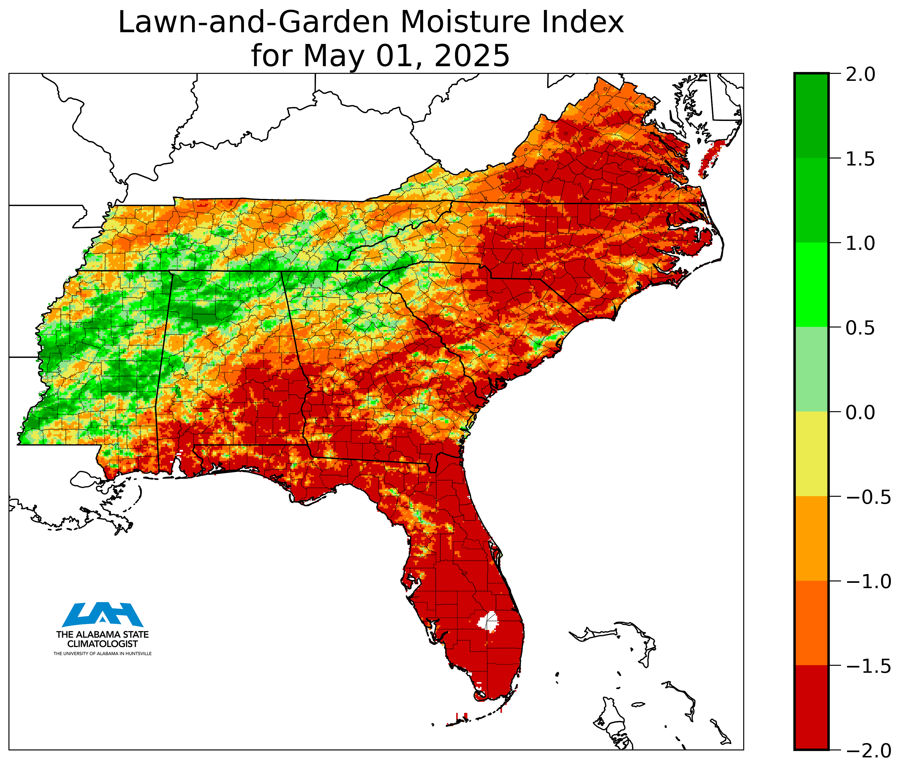
| Drought.gov Additional Maps for NC |
| Soil Anomaly Map |
| Crop Moisture Index |
| Palmer Index |
| YTD Rainfall Deficit/Surplus |
| USGS Water Conditions for NC, SC, GA |

Hazards
Severe Thunderstorms
Tropical Weather
Winter Weather
Storm Prediction Center
National Hurricane Center
Space Weather
Hydrology
Stream Level Forecasts
Precipitation Forecasts
Past Precipitation
Stream and Lake Levels
Stream/Lake Levels (List)
Forecast
Weather Activity Planner
Aviation Weather
Graphical Forecasts
Weather Prediction Center
Long Range Forecast
Model Data

US Dept of Commerce
National Oceanic and Atmospheric Administration
National Weather Service
Greenville-Spartanburg, SC
GSP International Airport
1549 GSP Drive
Greer, SC 29651
(864) 848-3859
Comments? Questions? Please Contact Us.


 Radar
Radar Current Weather
 Rivers & Lakes
 Satellite
 Forecast Maps
 Hour by Hour Forecast
 Tropical Weather
 Graphical Hazards
 Weather Hazard Briefing
 Report Severe Weather
 Fire Weather
 Drought
 Recreation Forecasts
 Obs & Text Products
 Forecaster's Discussion
 Climate Data
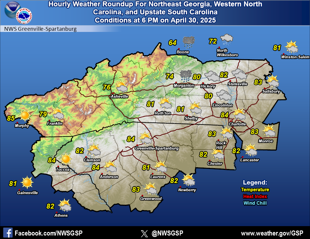 Hourly Weather
 NOAA Weather Radio
 Follow us on X
 Follow us on Facebook
 Follow us on YouTube
 GSP RSS Feed