Grand Forks, ND
Weather Forecast Office
The Probabilistic Flood Outlook Summary (PFOS) is an experimental product/service. Your comments or suggestions for improvement are encouraged. Your feedback will help us determine product/service utility, if modifications are needed, and whether the product/service should become part of our operational suite.
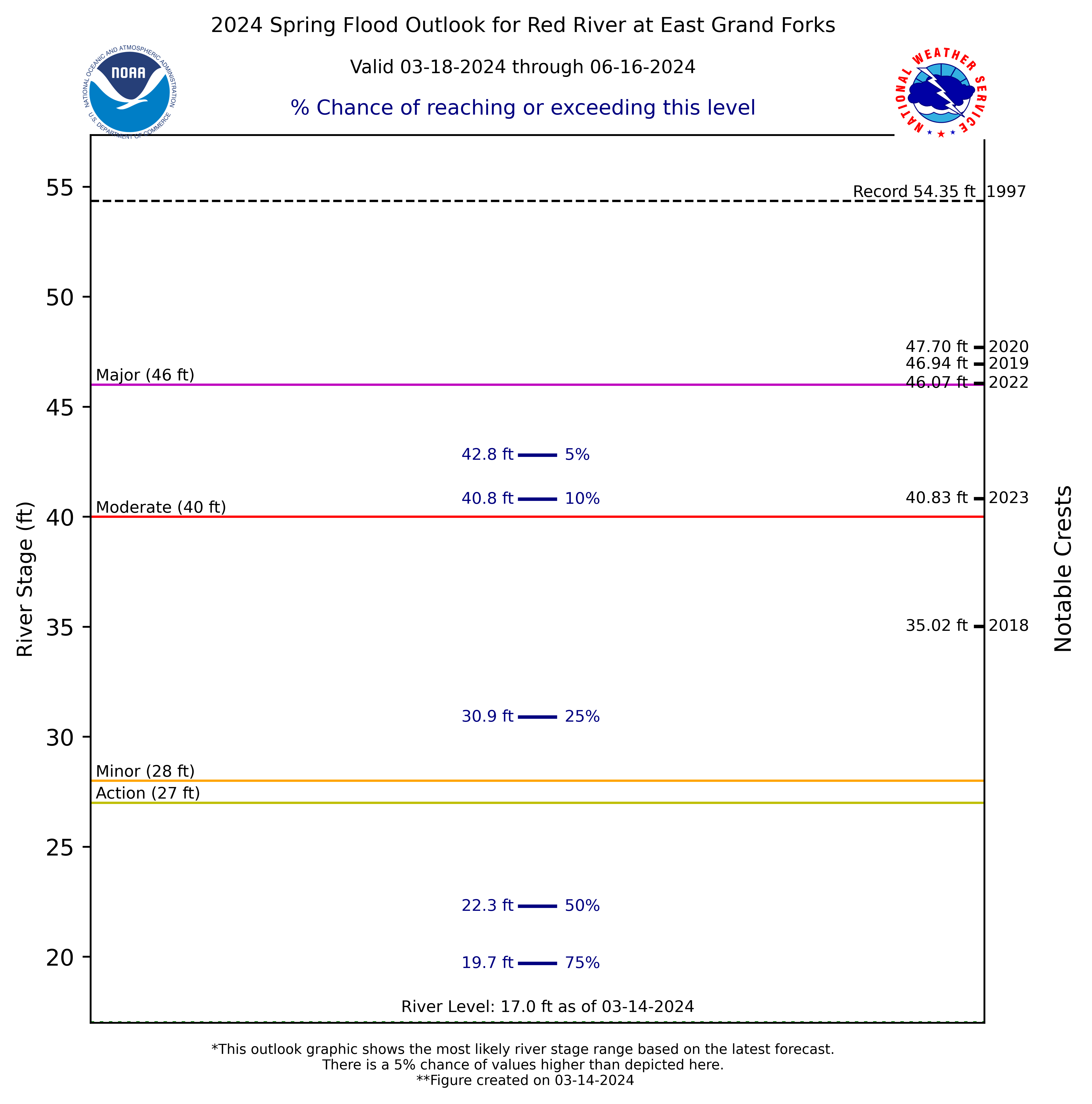
This product/service is a graphic that depicts the probabilities of reaching certain river stages based on the standard probabilities of 95%, 90%, 75%, 50%, 25%, 10%, and 5%. This product is intended to give users an overview of the flood risk in the Red River of the North Basin for the next 90 days during the spring snowmelt season.
Feedback/comments regarding this product can be submitted via a survey or can be directed to Ryan Knutsvig, MIC, through e-mail: ryan.knutsvig@noaa.gov.
The primary website for viewing PFOS data can be found here. The last flood outlook made using this graphic was completed on March 11th, 2020. An example PFOS image is below (OLD DATA).
US Dept of Commerce
National Oceanic and Atmospheric Administration
National Weather Service
Grand Forks, ND
4797 Technology Circle
Grand Forks, ND 58203-0600
701-772-0720
Comments? Questions? Please Contact Us.

