
| Office | Regional Forecast |
Forecast Discussion |
Hazards Outlook |
Shortterm Forecast |
State Forecast |
Surface Fronts & Precipitation Forecasts
| --Discussions-- | --Precipitation Forecast Maps-- | |
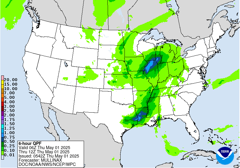
| Forecast Precipitation Discussion | UPDATED 6 hour | |
| Excessive Rainfall Discussion | 6-12 hour Precipitation | |
| Heavy Snowfall Discussion | 12-18 hour Precipitation | |
| --Surface Forecast Maps-- | 18-24 hour Precipitation | |
| Surface Forecasts from WPC | 24-30 hour Precipitation | |
| Day 1/2 to 2 1/2 Forecast Maps | Day 1 Day 2 Day 3 | |
| Days 3 to 7 Forecast Maps | Days 4 & 5 Day 5 total Day 7 total |
Climate and Drought Situational Awareness
| Near Term Climate Outlooks |
| 6 to 10 day Outlooks | 8 to 14 day Outlooks | |||
| Temperature | Precipitation | Temperature | Precipitation | |
 |
 |
 |
 |
|
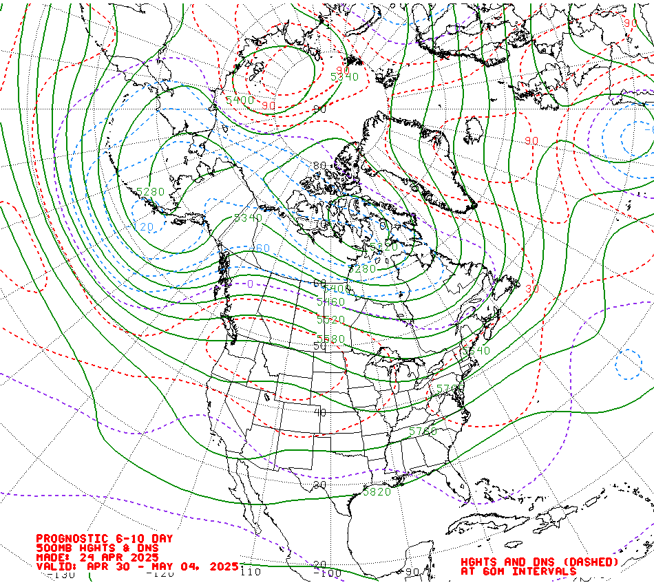
| 6 to 10 day Upper Air Forecast | 8 to 14 day Upper Air Forecast | |||
 |
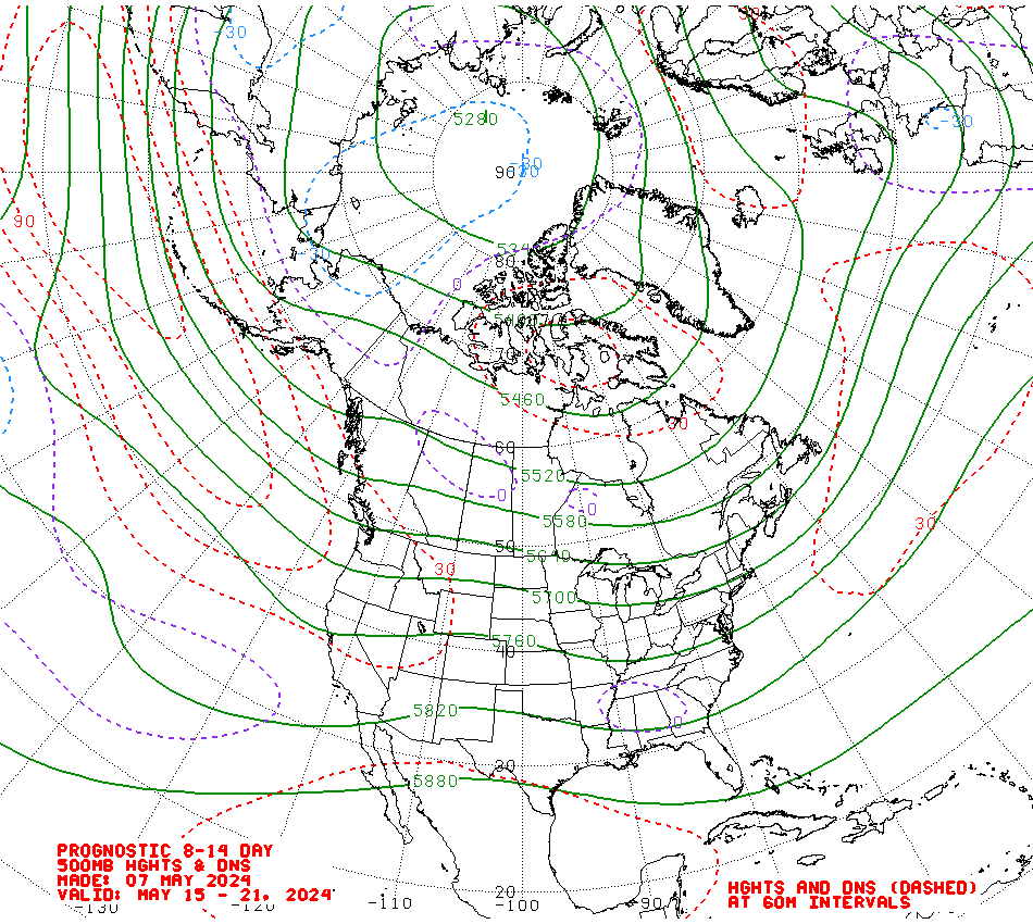 |
|||
| What do these maps mean? | ||||
| Hazards Outlook | ||
| 3 to 7 days | 8 to 14 days | |
 |
 |
|
| Longer Term Climate Outlooks and Drought Monitoring |
| Monthly Outlooks (Final-updated monthly) | Next Seasons Outlooks | |||
| Temperature | Precipitation | Temperature | Precipitation | |
 |
 |
 |
 |
|
|
Monthly Outlooks (Preliminary - issued 3rd Thursday of each month) |
||||
 |
 |
|||
CPC Downscaled Climate Outlooks
What do these images represent?
Climate Prediction Center Long Lead Briefing Page
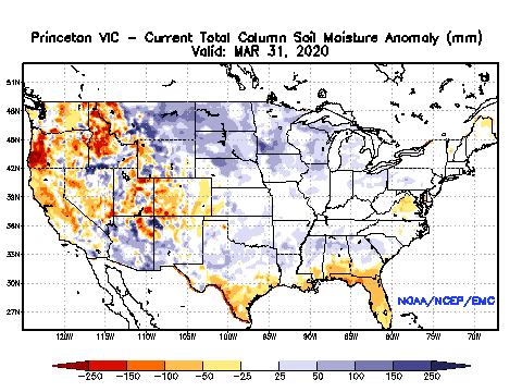
| Drought Monitoring | ||
| US | North America | Soil Moisture |
 |
 |
 |
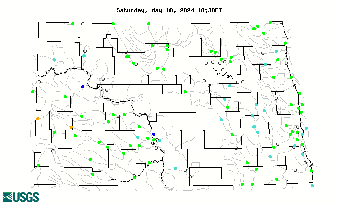
| USGS Hydrographs | ||
| North Dakota | Minesota | |
 |
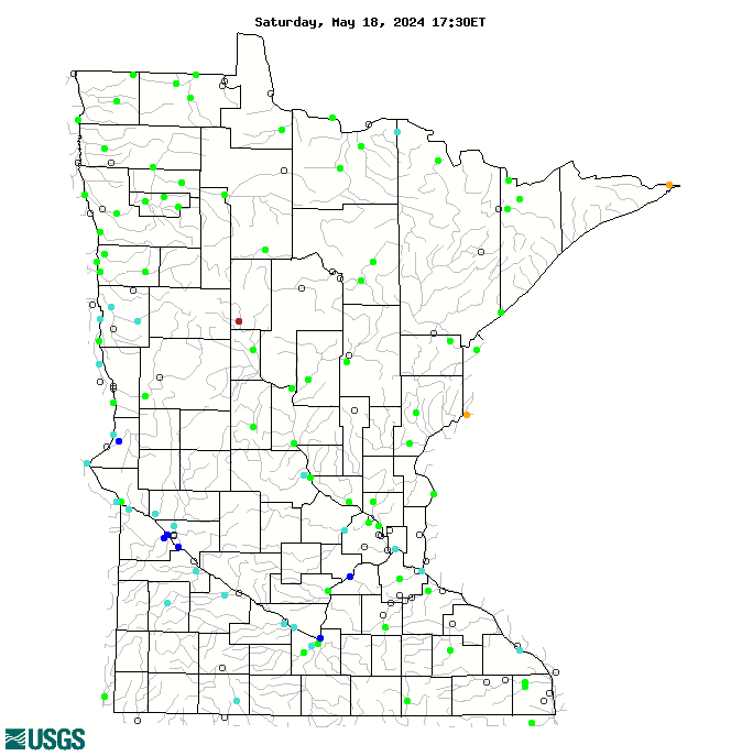 |
|

