|
Americans' health, security, and economic well being are tied to climate and weather. This briefing sheet describes how NOAA is leveraging its climate science and services to help the nation prepare for the impacts of climate variability and change. |
|
|
|
Red River Valley and Lake |
||
|
|
||
|
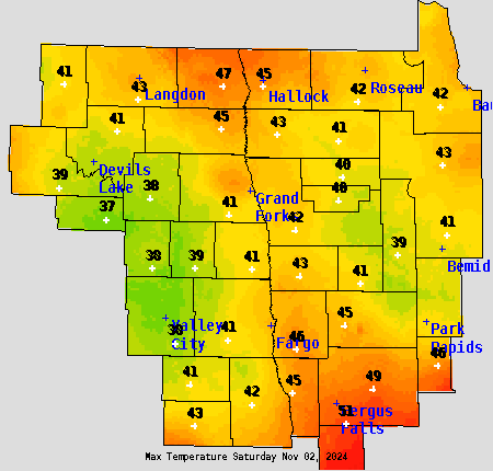
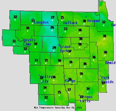
Local Area Observed Maximum (left) & Minimum (right) temperatures
|
||
|
Maximum available 830 pm CDT / 730 pm CST Minimum available 830 am CDT / 730 am CDT |
|
|
||
|
||
| Local Drought Page | |||
| Freeze / Frost Information Page | |||
| Information of Interest to Area Growers | |||
| NOAA/NWS Climate Decision Support Services |
| North Dakota | South Dakota | Minnesota | |
| The climate data above are preliminary and unofficial. Updated and verified climate data are available from the National Centers for Environmental Information. Please read our Legal Disclaimer here. | |||
| The recently updated 30 year (1991 - 2020) Climate Normals Information is now available. |
| Additional Sources for Climate Information | ||

