
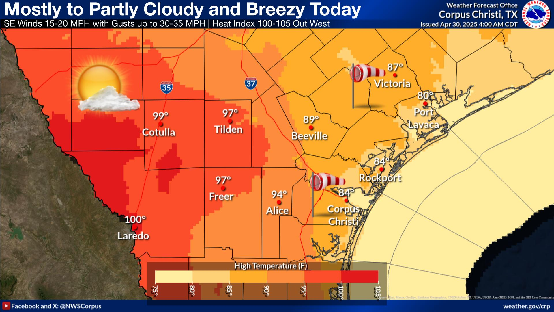
Heat expands across the Desert Southwest, Plains, Mississippi Valley and Midwest into Monday. Fire weather concerns continue for portions of the Intermountain West. Active monsoonal moisture fuels thunderstorms over the Southwest with possible flash flooding. Tropical cyclone Fausto in the Pacific, should weaken as it approaches Hawaii; Dangerous surf, swells and rip currents are expected. Read More >
Last Map Update: Fri, Jul 31, 2026 at 5:12:12 am CDT


|
||||||||||||||||||||||||||||||||||||||||||||||||||||||||||||||||||||||||||||||||||||||||||||||||||||||||
 |
|||||
| Video Briefing | Weather Outlook | Fcst Discussion | Tropical | Marine | Tides |
| Rivers and Lakes | Daily Rainfall | Drought | Fire | Observations | Satellite |
| Hourly Wx Graph | Graphical Fcst | Aviation | Climate | Past Events | Hurricane Guide |


 Local Radar
 Weather Map