
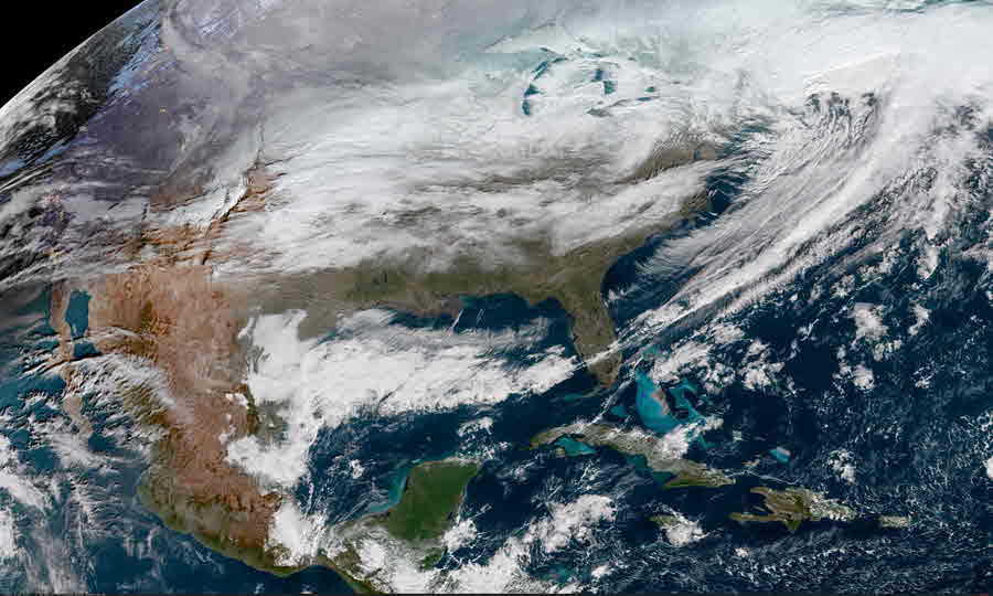
Tropical Depression Two is expected to gradually strengthen and could bring tropical storm conditions to the Florida Panhandle beginning late Monday. Areas of flash flooding will be possible through Thursday along the eastern and central Gulf Coast. Severe thunderstorms will develop and move along a cold front crossing the Upper Midwest Monday, and through the Ohio Valley/Mid-Atlantic on Tuesday. Read More >
| GeoColor Channel | Southern Plains View | CONUS View | Full Disk View | |
 |
 |
 |
||
| GeoColor | Small | Loop | Large | Small | Loop | Large | Small | Loop | Large | |
| Visible Channels | Southern Plains View | CONUS View | Full Disk View | |
 |
 |
 |
||
| Visible Blue 0.47 μm (Band 1) | Small | Loop | Large | Small | Loop | Large | Small | Loop | Large | |
| Visible Red 0.64 μm (Band 2) | Small | Loop | Large | Small | Loop | Large | Small | Loop | Large | |
| Near Infrared (NIR) Channels | Southern Plains View | CONUS View | Full Disk View | |
 |
 |
 |
||
| Veggie NIR Channel 0.86 μm (Band 3) | Small | Loop | Large | Small | Loop | Large | Small | Loop | Large | |
| Cirrus NIR Channel 1.37 μm (Band 4) | Small Loop | Large | Small | Loop | Large | Small | Loop | Large | |
| Snow/Ice NIR Channel 1.6 μm (Band 5) | Small Loop | Large | Small | Loop | Large | Small | Loop | Large | |
| Cloud Particle NIR Channel 2.2 μm (Band 6) | Small | Loop | Large | Small | Loop | Large | Small | Loop | Large | |
| Shortwave IR and Water Vapor Channels | Southern Plains View | CONUS View | Full Disk View | |
 |
 |
 |
||
| Shortwave IR Channel 3.9 μm (Band 7) | Small | Loop | Large | Small | Loop | Large | Small | Loop | Large | |
| Upper Level Water Vapor Channel 6.2 μm (Band 8) | Small | Loop | Large | Small | Loop | Large | Small | Loop | Large | |
| Mid Level Water Vapor Channel 6.9 μm (Band 9) | Small | Loop | Large | Small | Loop | Large | Small | Loop | Large | |
| Lower Level Water Vapor Channel 7.3 μm (Band 10) | Small | Loop | Large | Small | Loop | Large | Small | Loop | Large | |
| Infrared (IR) Channels | Southern Plains View | CONUS View | Full Disk View | |
 |
 |
 |
||
| Cloud Top IR Channel 8.4 μm (Band 11) | Small | Loop | Large | Small | Loop | Large | Small | Loop | Large | |
| Ozone IR Channel 9.6 μm (Band 12) | Small | Loop | Large | Small | Loop | Large | Small | Loop | Large | |
| Clean Longwave Window 10.3 μm (Band 13) | Small | Loop | Large | Small | Loop | Large | Small | Loop | Large | |
| Legacy Longwave Window 11.2 μm (Band 14) | Small | Loop | Large | Small | Loop | Large | Small | Loop | Large | |
| Dirty Longwave IR Window 12.3 μm (Band 15) | Small | Loop | Large | Small | Loop | Large | Small | Loop | Large | |
| Carbon Dioxide Longwave IR Window 13.3 μm (Band 16) | Small | Loop | Large | Small | Loop | Large | Small | Loop | Large | |
Gulf of America |
Carribean |
|---|---|
 |
 |
| GeoColor: Small | Loop | Large | GeoColor: Small | Loop | Large |
| Visible: Small | Loop | Large | Visible: Small | Loop | Large |
| H2O Vapor: Small | Loop | Large | H2O Vapor: Small | Loop | Large |
| IR(10.3 μm): Small | Loop | Large | IR(10.3 μm): Small | Loop | Large |
| Other Gulf of America Images | Other Caribbean Images |
U.S. Atlantic Coast |
Puerto Rico |
|---|---|
 |
 |
| GeoColor: Small | Loop | Large | GeoColor: Small | Loop | Large |
| Visible: Small | Loop | Large | Visible: Small | Loop | Large |
| H2O Vapor: Small | Loop | Large | H2O Vapor: Small | Loop | Large |
| IR(10.3 μm): Small | Loop | Large | IR(10.3 μm): Small | Loop | Large |
| Other U.S. Atlantic Coast Images | Other Puerto Rico Images |
 |
 |
 |
 |
 |
 |
 |
 |
 |
 |
 |
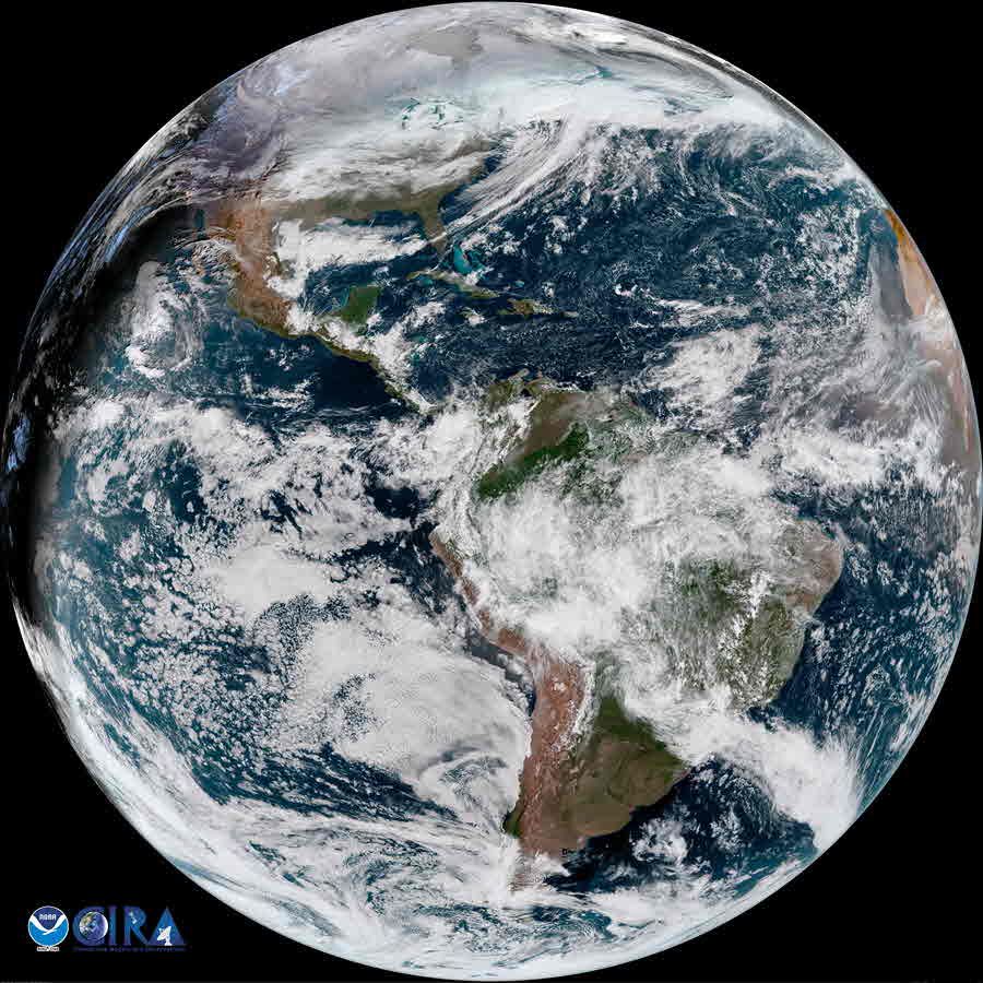
| GOES-East Image Views | Southern Plains View | CONUS View | Full Disk View | |
 |
 |
 |
||


