| St. Clair...Etowah...Cherokee County Tornadoes
|
||||||||||||||||||||||||
|---|---|---|---|---|---|---|---|---|---|---|---|---|---|---|---|---|---|---|---|---|---|---|---|---|
|
Images of the tornado as it moved across the Hokes Bluff area of Etowah County. ...view images...
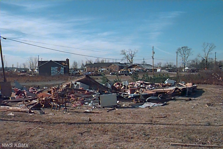
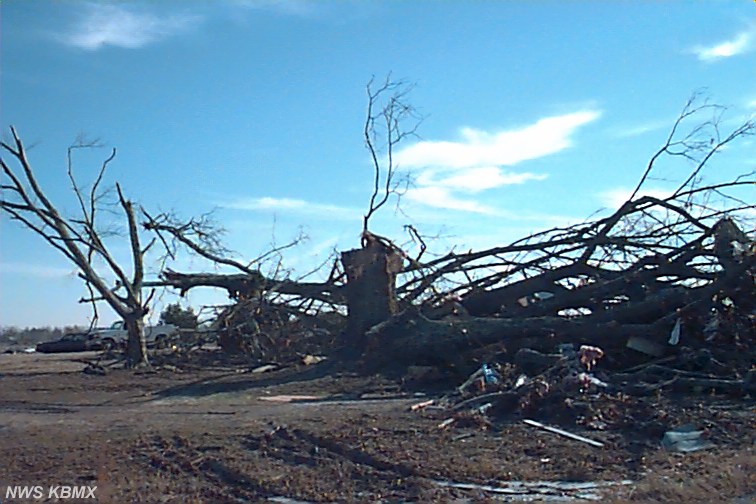
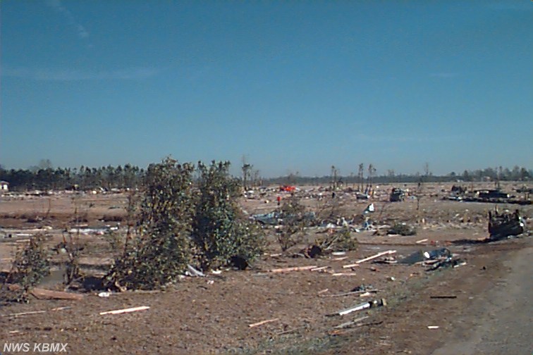
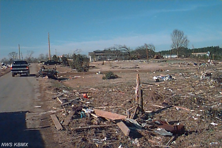
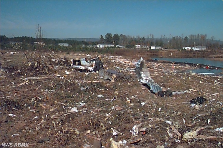
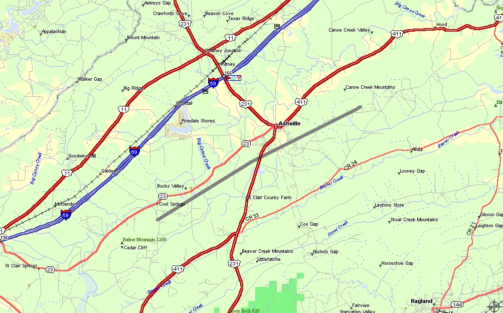
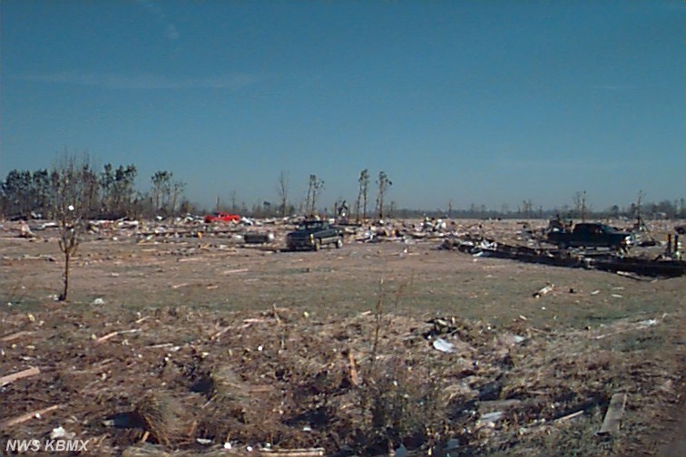
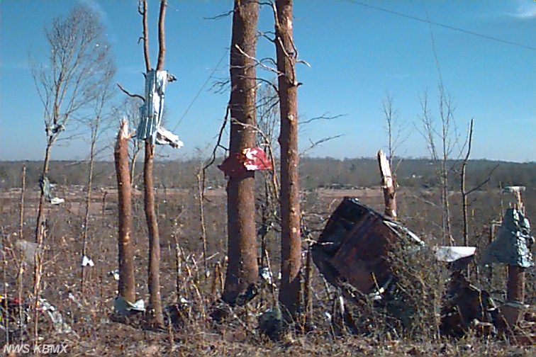
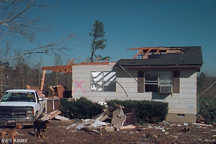
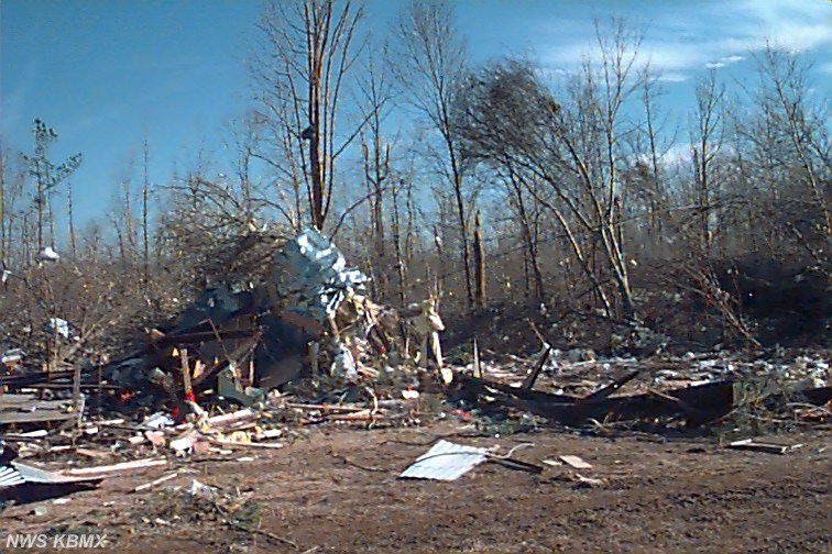
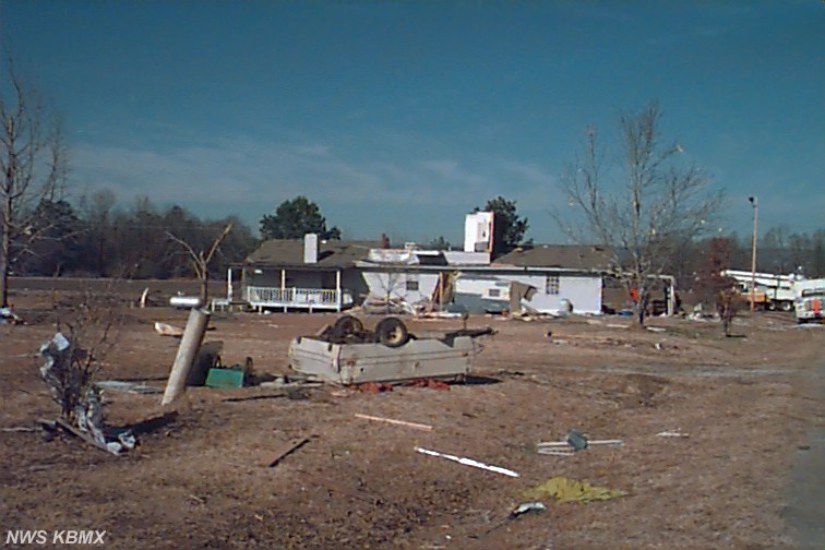
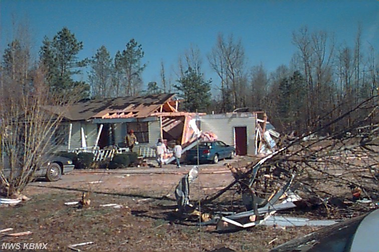
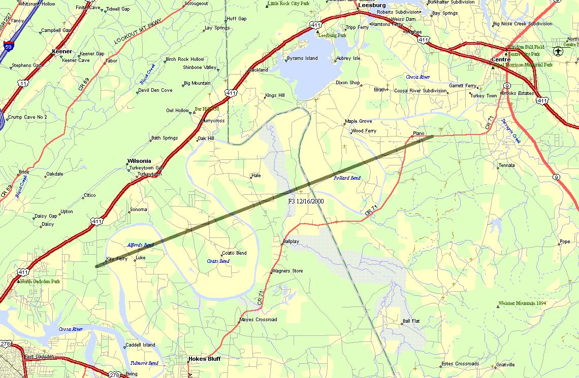
The National Weather Service conducted additional storm surveys today of the tornado damage across north-central St. Clair County and eastern Etowah/Western Cherokee Counties that were from Saturdays supercell thunderstorm. In St. Clair county an F2 tornado track was found, which extended from near Cool Springs to south Ashville, to near Gum Springs Church. The total track was 8.5 miles long, and about 200 yards wide at its widest point. The tornado began at 220 PM on County Road 31, just west of Cool Springs. The tornado lifted around 231 PM, about 3 miles east of Ashville. Click on the map image to the right, to see the approximate path of this tornado. Image size is about 200k. Four houses sustained significant damage and two mobile homes were annihilated. A baseball park was damaged at the Ashville High School. Two injuries occurred near the beginning of the tornado track, near Cool Springs. Damage in Etowah and Cherokee Counties was the result of an F3 tornado. The tornado track was 12.8 miles long and just over one quarter of a mile or about 500 yards wide at its widest point. Click on the map image to the right, to see the track of this tornado. Image size is about 495k. The tornado touched down near Tidmore Bend, three miles east north east of the city of Gadsden, at 246 PM and lifted at 305 PM near Plano just east-northeast of Pollard Bend in Cherokee County. The tornado track was 4.7 miles in Cherokee County. The most significant damage with the F3 tornado was in the Coats Bend Community of Etowah County where 14 injuries occurred and approximately 250 homes were either totally destroyed or had major damage. Damage in Cherokee County was primarily downed trees along with damage to several structures. These tornadoes were associated with the same supercell thunderstorm that caused the killer Tuscaloosa tornado. A Tornado Watch on Saturday, December 16, 2000, was in effect from 10 AM to 4 PM. A Tornado Warning for St. Clair County was in effect from 157 PM to 245 PM. A Tornado Warning was in effect for Etowah County from 220 PM to 3PM. A Tornado Warning was in effect for Cherokee County from 250 PM to 330 PM.
|
|
||||||||||||||||||||||