Cullman County Tornado...October 4, 2002
| The fourth tornado of the year in Alabama formed from a line of thunderstorms associated with the remnants of Hurricane Lili on Friday, October 4th, 2002. The National Weather Service surveyed the damage area from the small tornado which touched down in Northeastern Cullman County. Here is the storm summary of the damage area. Images of damage and debris were taken with a digital camera. Click on the graphic to get a larger image.
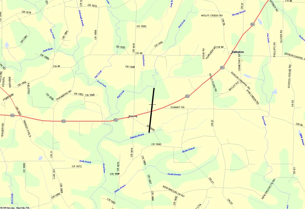
Northeastern Cullman County TornadoAn F0 tornado touched down in extreme Northeastern Cullman County producing a track of about one mile. The tornado began at 11:06 AM CST, 1 mile west of Baileyton on County Road 1693, off of Highway 69 North. The tornado generally moved north-northeast and crossed over Highway 69 North before it ended at 11:08 AM CST. The tornado briefly touched down and was only about 100 yards wide. There were no injuries reported with the touchdown of this tornado.
|
Click on the image to view a map showing the path. 
Most damage occurred along County Road 1693 just south of Highway 69. The damage path began on County Road 1693 where three homes and four outbuildings received minor damage, one outbuilding was completely destroyed, and three greenhouses were damaged. Most of the trees and power lines down were along County Road 1693. On Highway 69 North, one cabinet shop received moderate damage. One side of the cabinet shop was completely blown out along with large amounts of insulation scattered around the area. The tornado also did damage to one home, one outbuilding, another business, and destroyed one outbuilding. Numerous trees were down at this location as well. Two witnesses said they saw the funnel cloud/tornado.
Heavy rainfall amounts and strong winds plagued Lousiana and Mississippi October 3rd, 2002 while Hurricane Lili made landfall. A few other wind damage reports were received on Friday, October 4th, 2002 as the remnants of Lili tracked northeast through our region.