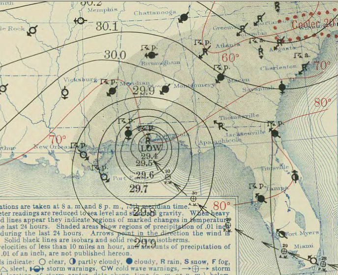
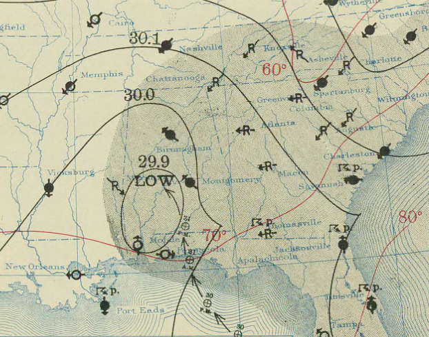
Dissipating Tropical Cyclone Hits Southwest Alabama - August 1, 1936
Special thanks for Bill Murray for his assistance with this information.
The history of this disturbance is not clearly shown by observations until the morning of July 27th when a well formed but weak cyclonic circulation was charted a short distance south of Cat Island, Bahamas. Progressing on a west-northwesterly course, with increasing intensity, the disturbance moved across Andros Island at 5 AM on the 28th. With estimated wind velocites of 60 MPH near its center, the storm reached the southern tip fo Florida mainland about 30 miles south of Miami at 8 pm EST. The Weather Bureau Office at Miami reported a maximum wind velocity of 44 MPH from the southeast, while the Miami Airport Station gave a east-southeast wind of 49 MPH with gusts to 65 MPH. Between 9:30 and 10:00 PM EST, the storm center passed over Homestead and Florida City maintaining a west-northwesterly course at about 10 to 12 MPH. The center then moved into the Gulf of America.
At 11:00 AM EST, on the morning of July 31st, the storm crossed over the Northwest Florida coast and was centered over Valparaiso, FL. Reports from Valparaiso at 9:00 AM EST gave a barometer reading of 28.80 inches (975.3 mb) with an attendant north-northeast wind of 90-100 MPH. The barometric minimumm, 28.73 inches (972.9 mb) occurred there at 11:00 AM EST. The calm center was over Fort Walton and Valparaiso for about 1 hour and 20 minutes. From R.A. Dyke, a forecaster at the New Orleans office:
"The hurricane winds extended on the coast line for about 70 miles, but when allowance is made for the angle at which the storm reached the coast, the hurricane winds may by accepted as only reaching 50 miles of the coast directly across the storm. As the storm moved in, the storm tide reached a height of approximately 6 feet at Panama City and Valparaiso."
With rapidly diminishing intensity, after passing inland, the storm continued to move northwestward and was centered just north of Pensacola at 8:00 PM EST of July 31st. It dissipated on August 1st over the southwestern portions of Alabama.
Rainfall Totals around Central Alabama for July 31st - August 1st in 1936:
Selma - 2.94"
Union Springs - 7.30"
Clanton - 4.34"
Birmingham - 2.18"
Montgomery - 4.90"

