NWS Birmingham, Alabama
Weather Forecast Office
Local Sounding Data
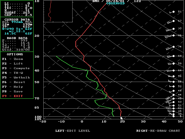
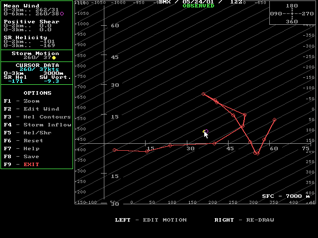
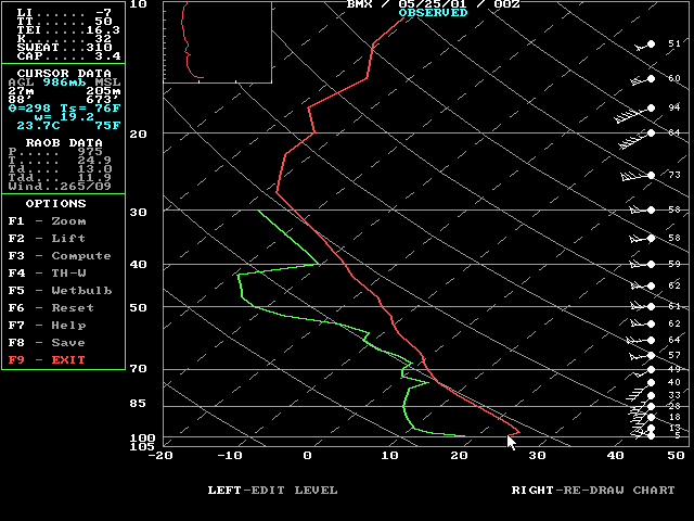
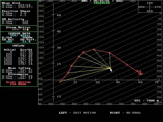
Shown below are the morning and evening soundings on May 24, 2001, at the Shelby County Airport, Alabama. There are four images. The Skew T diagram shows the temperature, moisture and wind profile through the atmosphere. The hodograph shows how the winds change with height. Soundings are also used to generate other parameters which are listed below.
The soundings from May 24, 2001, show that the atmosphere was relatively stable during the morning and became unstable through the day and into the evening. Most notable is the vertical profile of winds and how it changed through the day. Storm Relative Helicity and the shape of the hodograph significantly changed from morning to evening. The wind profile became more favorable through the afternoon for rotating storms.
Observed sounding at the Shelby County Airport on May 24, 2001, 7:00 AM CDT ( or 1200 UTC ).


Observed sounding at the Shelby County Airport on May 24, 2001 7:00 PM CDT ( or May 25, 2001 0000 UTC ).


Current Hazards
National Outlooks
Tropical
Local Storm Reports
Public Information Statement
Graphical Hazardous Weather Outlook
Current Conditions
Regional Weather Roundup
Rivers and Lakes
Drought Monitor
Forecasts
Fire Weather
Aviation Weather
Graphical Forecasts
Forecast Discussion
Air Quality
Climate and Past Weather
Past Events
Storm Data
Tornado Database
Daily Rainfall Plots
Tropical Cyclone Reports
Monthly Climate
Annual Climate
Warnings and Other Products
Tornado Warnings
Severe Thunderstorm Warnings
Flash Flood Warnings
Winter Weather Warnings
Special Weather Statements
Non-Precipitation Warnings
Flood/River Flood Warnings
Productos en Español
Conciencia y Preparación
Previsión de 7 Días
Weather Safety
NOAA Weather Radio
Severe Weather Preparedness
Severe Safety Rules
Tornado Safety Rules
Severe Safety w/ ASL
Awareness Weeks
Severe Weather
Hurricane Preparedness
Summer Safety Campaign
Winter Weather
US Dept of Commerce
National Oceanic and Atmospheric Administration
National Weather Service
NWS Birmingham, Alabama
465 Weathervane Road
Calera, AL 35040
205-664-3010
Comments? Questions? Please Contact Us.

