 Meteorologists from the National Weather Service Forecast Office in Birmingham conducted both a ground and aerial survey of the tornado that struck Rainsville in Dekalb County the afternoon of April 22 1997. Note: to view a larger image of the pictures contained on this page, just click on the image.
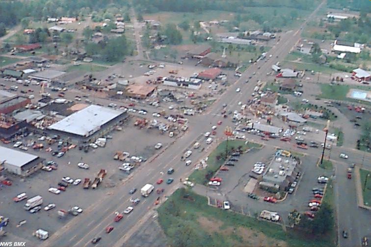
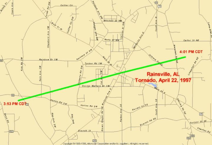
 The tornado track was 5 miles in length beginning approximately 3 miles southwest of Rainsville and traveled five miles through the center of Rainsville ending about 2 miles northeast of the center of Rainsville ( map of tornado track). The tornado was 220 yards in width at its widest. On the Fujita scale for tornado classification which ranks tornadoes from F0 for the weakest to F5 for the most violent storms, this tornado was rated as an F2. This places the wind speed in the range from 113 to 157 miles per hour.
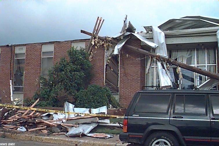
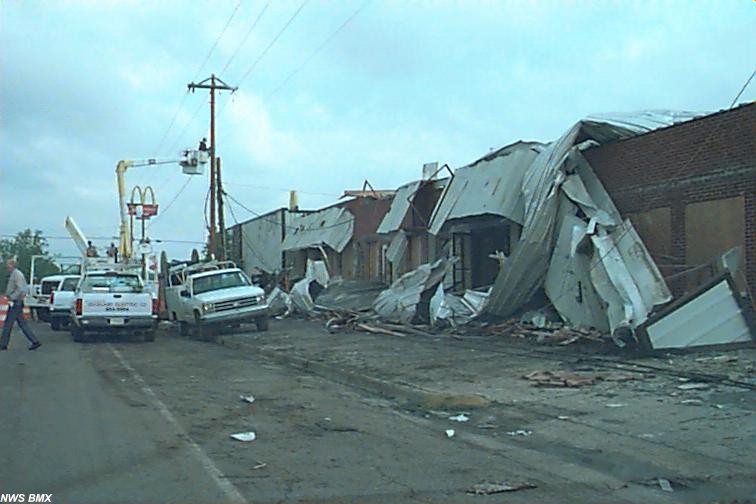
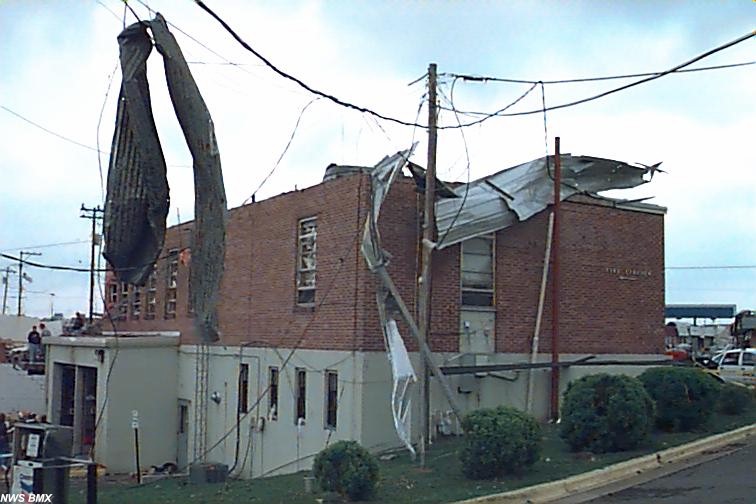
 The tornado began at 3:53 pm 3 miles southwest of Rainsville, just south of the intersection of County Roads 92 and 72. The tornado moved northeastward directly through the downtown area of Rainsville where the fire and police station was severely damaged along with a
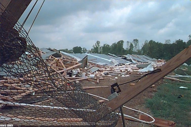
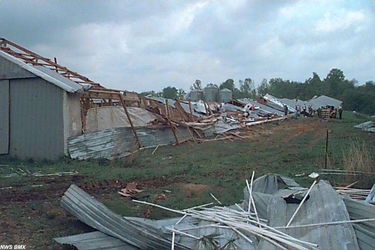
 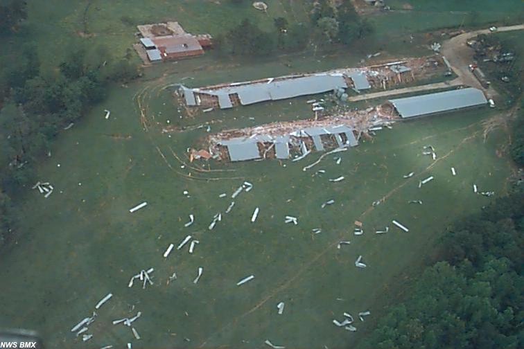 number of commercial buildings. The tornado continued northeast crossing Dilbeck and Marshall Roads before ending about 2 miles northeast of Rainsville on the east side of Marshall Road. The tornado severely damaged a large poultry raising facility and debris from the chicken houses was blown over half a mile further to the northeast. The tornado had dissipated by 4:01 pm. Rainsville officials put the tornado in downtown Rainsville at 3:57 pm.
In Rainsville, eleven of 12 police cars were either damaged or destroyed and several of the city�s fire trucks were damaged.
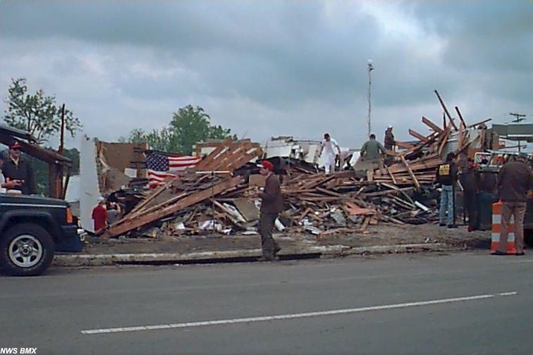
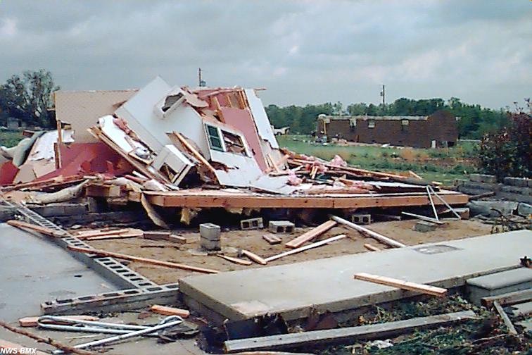 There were no deaths in the tornado, and the injury count was 10. Five of the ten people injured were hospitalized according to emergency management officials. Initial damage assessment by the American Red Cross and emergency management teams indicated that 63 homes and apartments were damaged or destroyed along with 34 businesses.
 The National Weather Service forecast for Dekalb County issued at 4:45 am indicated the possibility of severe storms for that night. This was updated at 1:52 pm to indicate that severe storms were possible during the afternoon and evening. A Special Weather Statement was issued at 5:50 am describing the possibility of severe weather for Alabama in the afternoon and evening.
 A Tornado Watch was issued at 1:30 pm valid until 9:00 pm which included Dekalb County. No other weather warnings were issued prior to the tornado.
 A - JPG Size = 87kb |
 B- JPG size = 55kb |
 C - JPG size = 102kb |
 D - JPG Size = 83kb |
 E - JPG size = 82kb |
 F - JPG size = 100kb |
Some notes about some of the images above. If your browser is capable, place your mouse pointer over the image and it should display a short description of the image. Here are some additional comments of some of the images shown above,
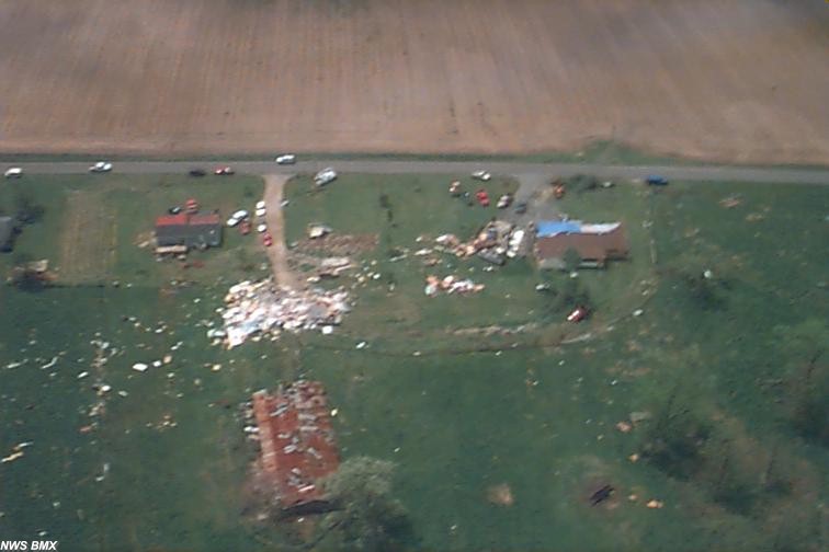
Image B - Shows aerial view of some house and trailer damage. The image is somewhat blurred. The reason for this is due to the helicopter's motion and the picture being taken through the cockpit windshield.
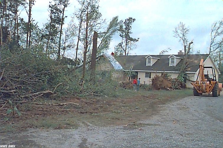
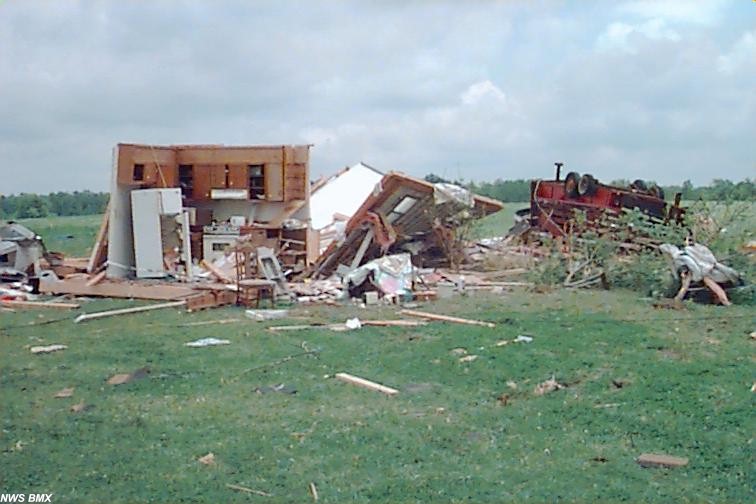
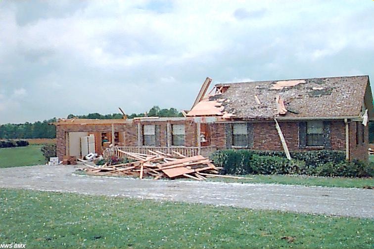
Image F - Shows damage to a house southwest of Rainsville. The white specks that you see are small pieces of insulation sticking to the house.

