|
|
| |
|
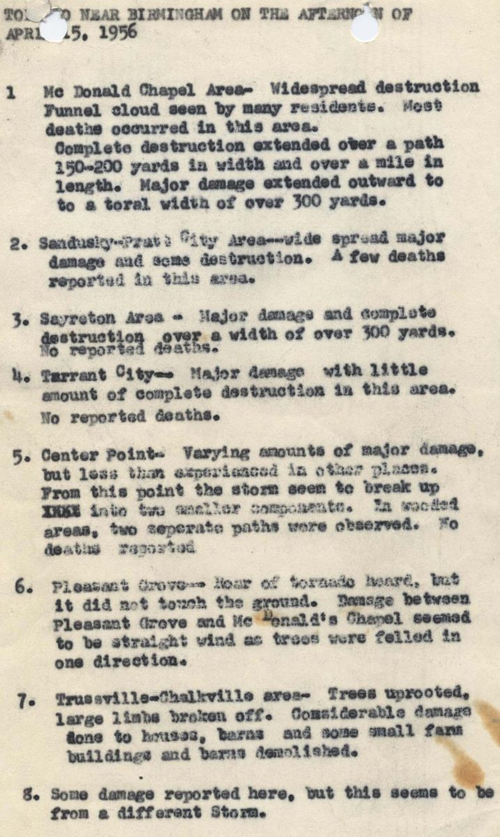
Local Storm Reports
|
|
|
| |
|
Storm Survey Pictures (captions are the hand written notes from the survey)
|
|
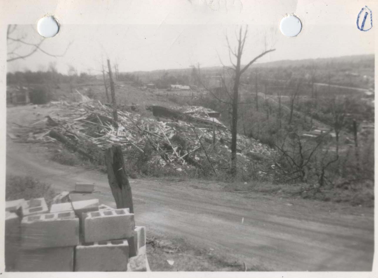
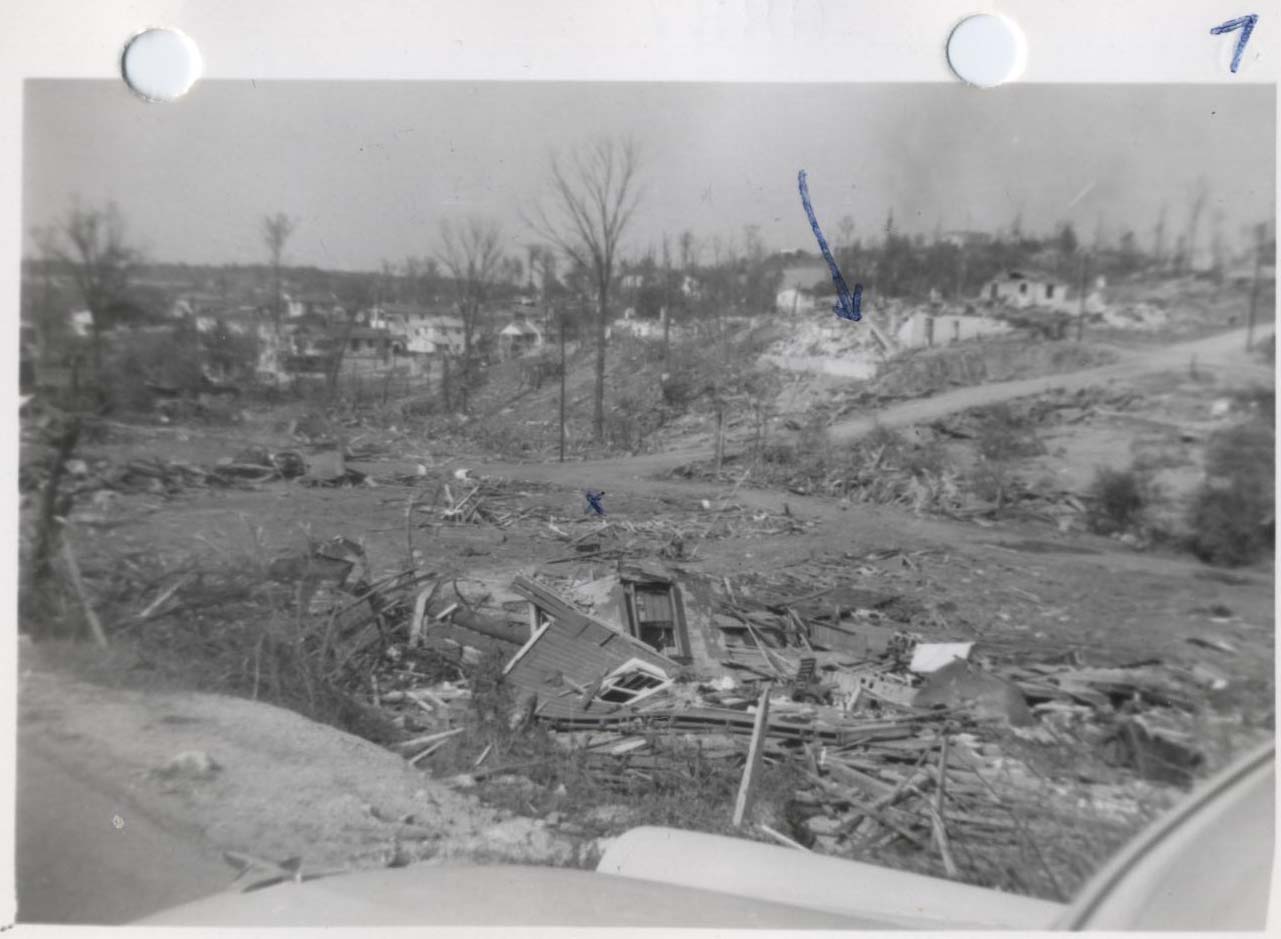
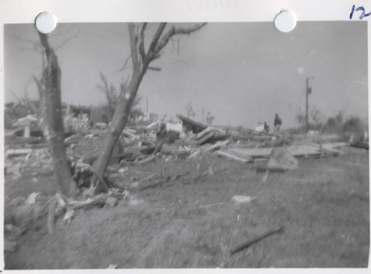
Looking SW from atop hill in McDonald Chapel
|
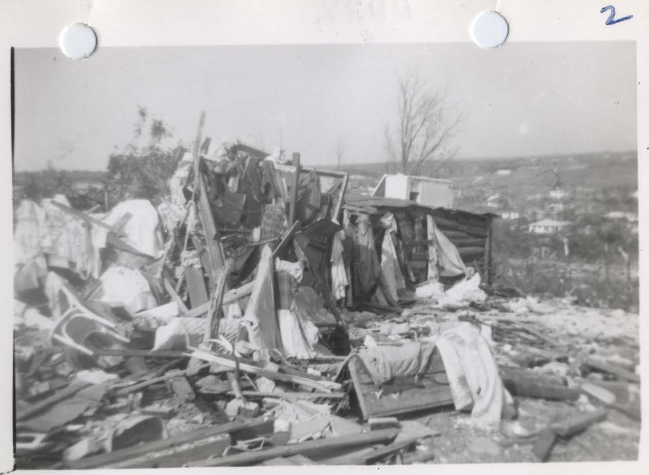
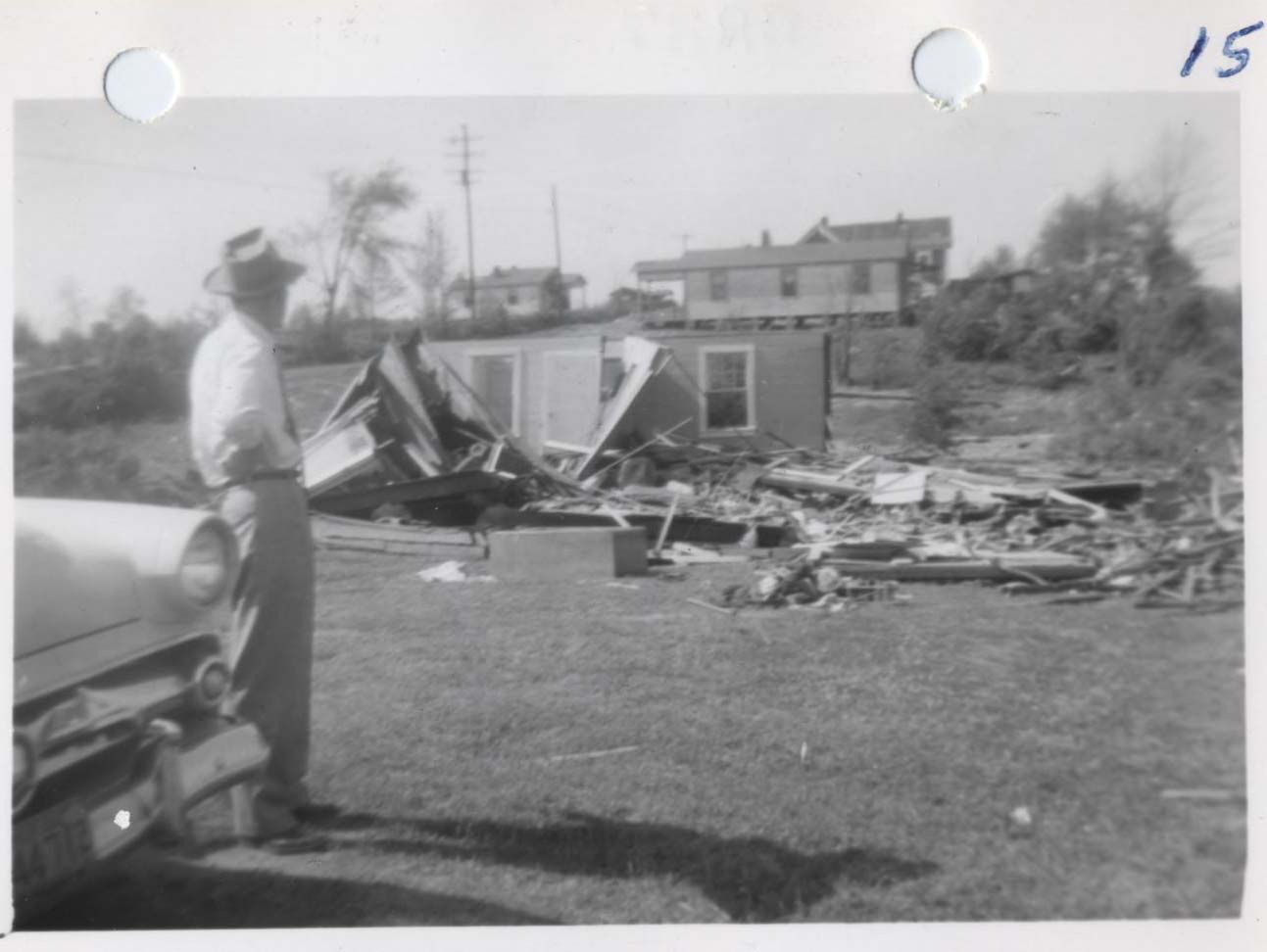
Across road from photo #1, but looking NE
|
|
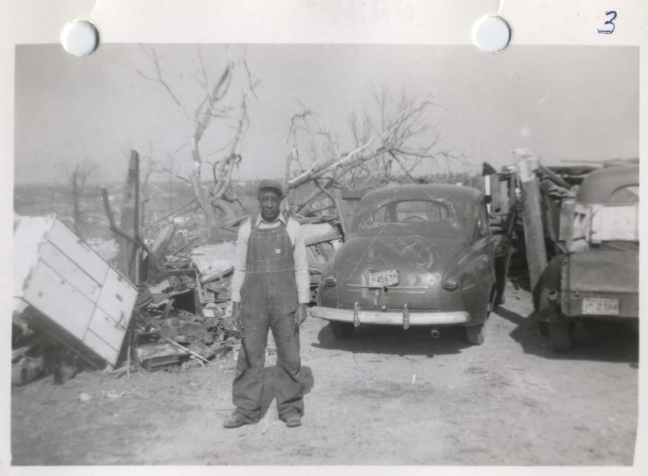
Looking NE. One body was found at man's feet
and two others at about the position of the camera
|
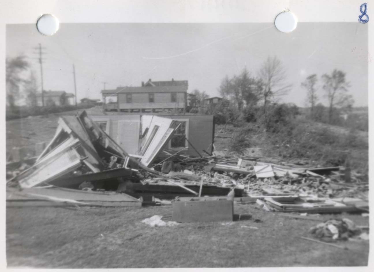
Looking SE. Next door to photo #2. There was almost
total destruction within a 300 yard path atop this hill
|
|
Looking NE. Local church destroyed.
|
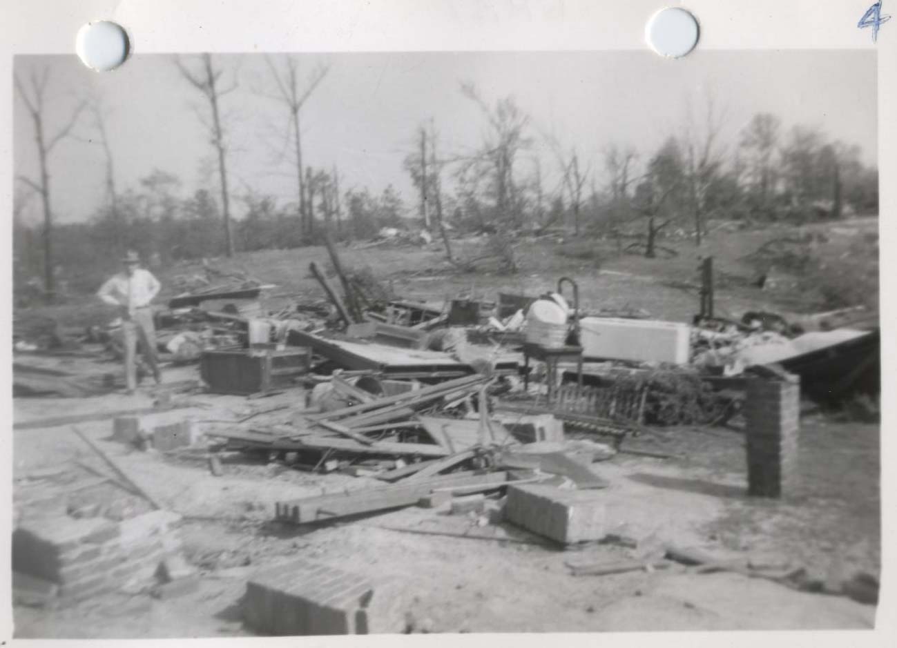
Looking W, on the floor of Stacy Hollow
|
|
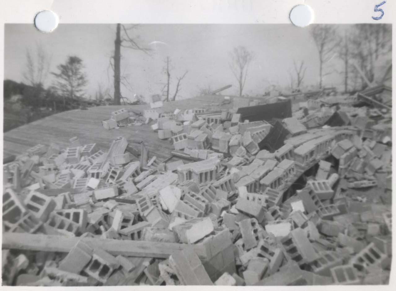
Stacy Hollow. Note unusual total destruction in this area.
Looking NE, the arrow points to the church destroyed in photo #5
|
Looking W along ridge west of Stacy Hollow.
Tornado dipped into Stacy Hollow and into McDonald
Chapel. Small home in background untouched
|
|
Looking S. Near photos #1-5.
|
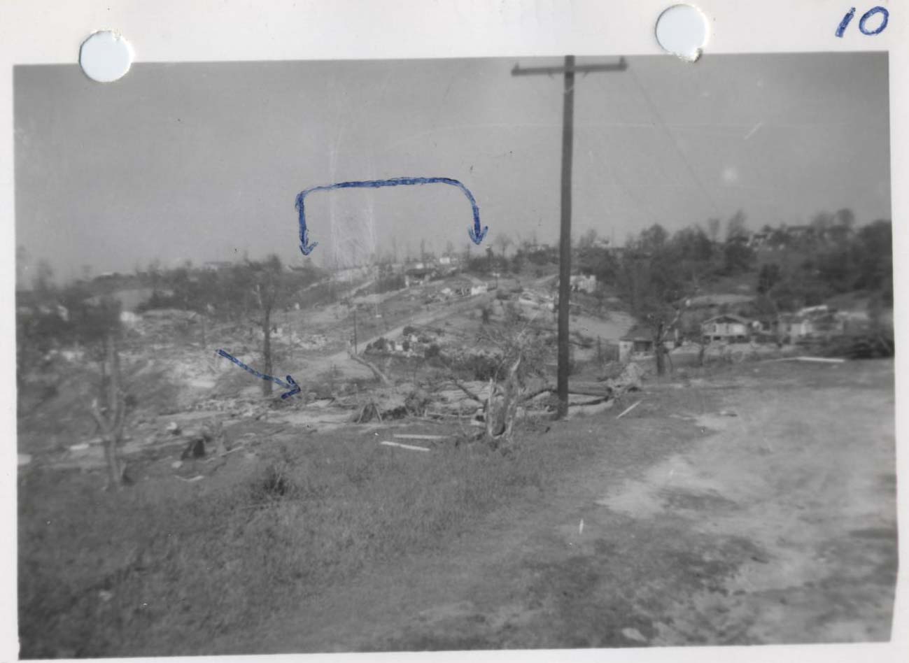
General view, looking NE across Stacy Hollow.
Arrows indicate damage from photo #8
|
|
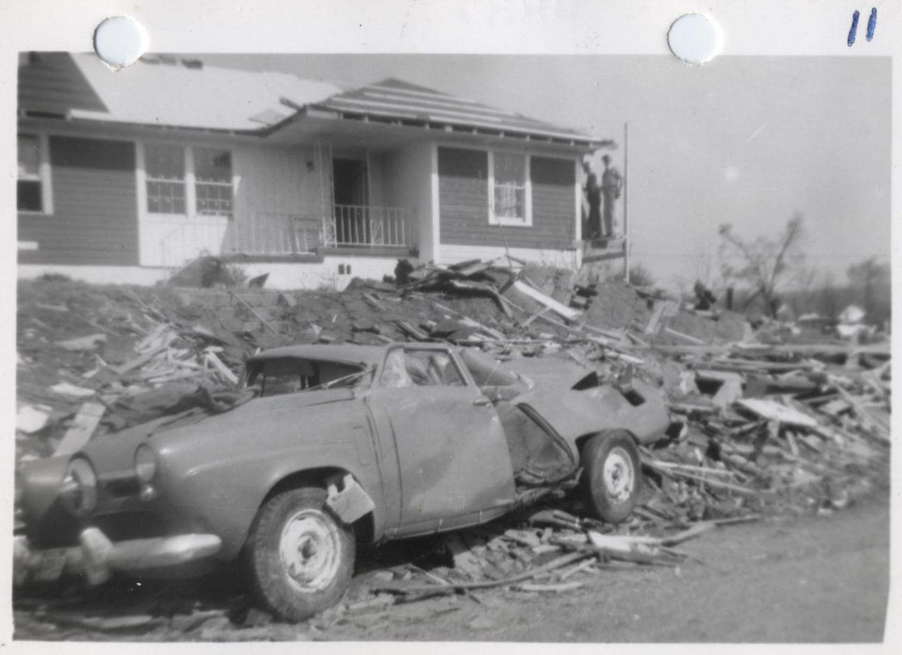
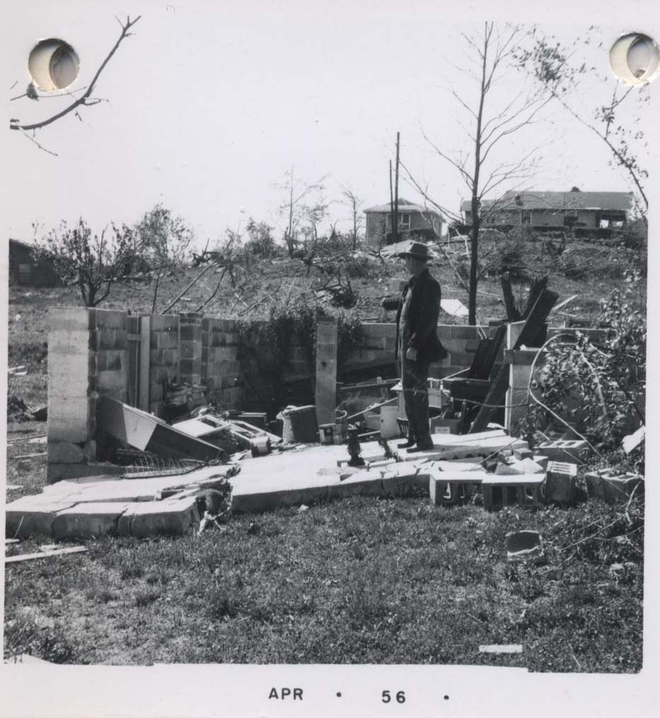
Looking SE in McDonald Chapel area, near school. Note concrete block under auto fender with no damage to fender. Whether this auto is at home is not known
|
Looking NE, from the same area as #11. Note Chinaberry tree completely stripped, also almost all of brick foundation had been torn away
|
|
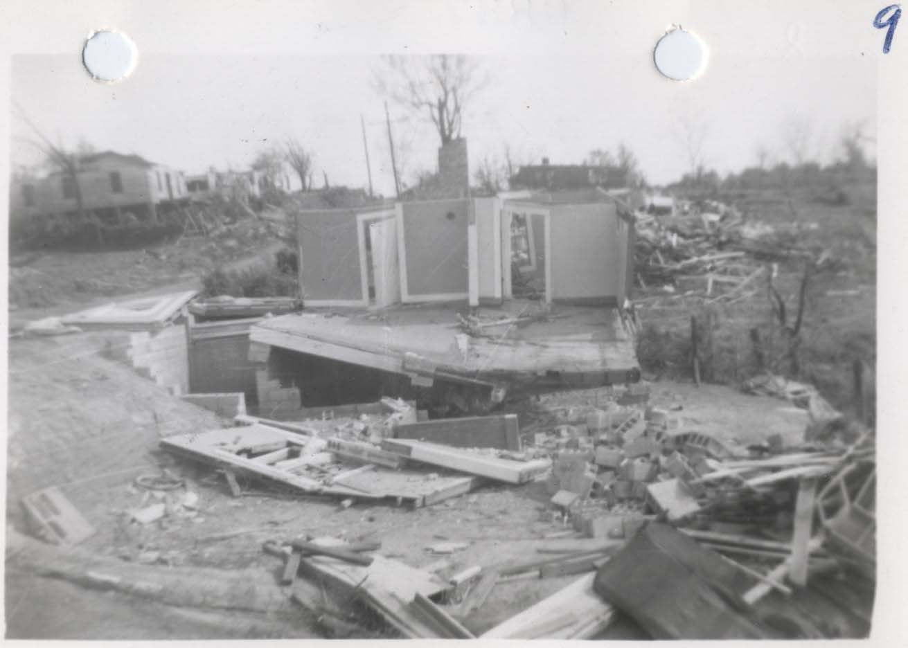
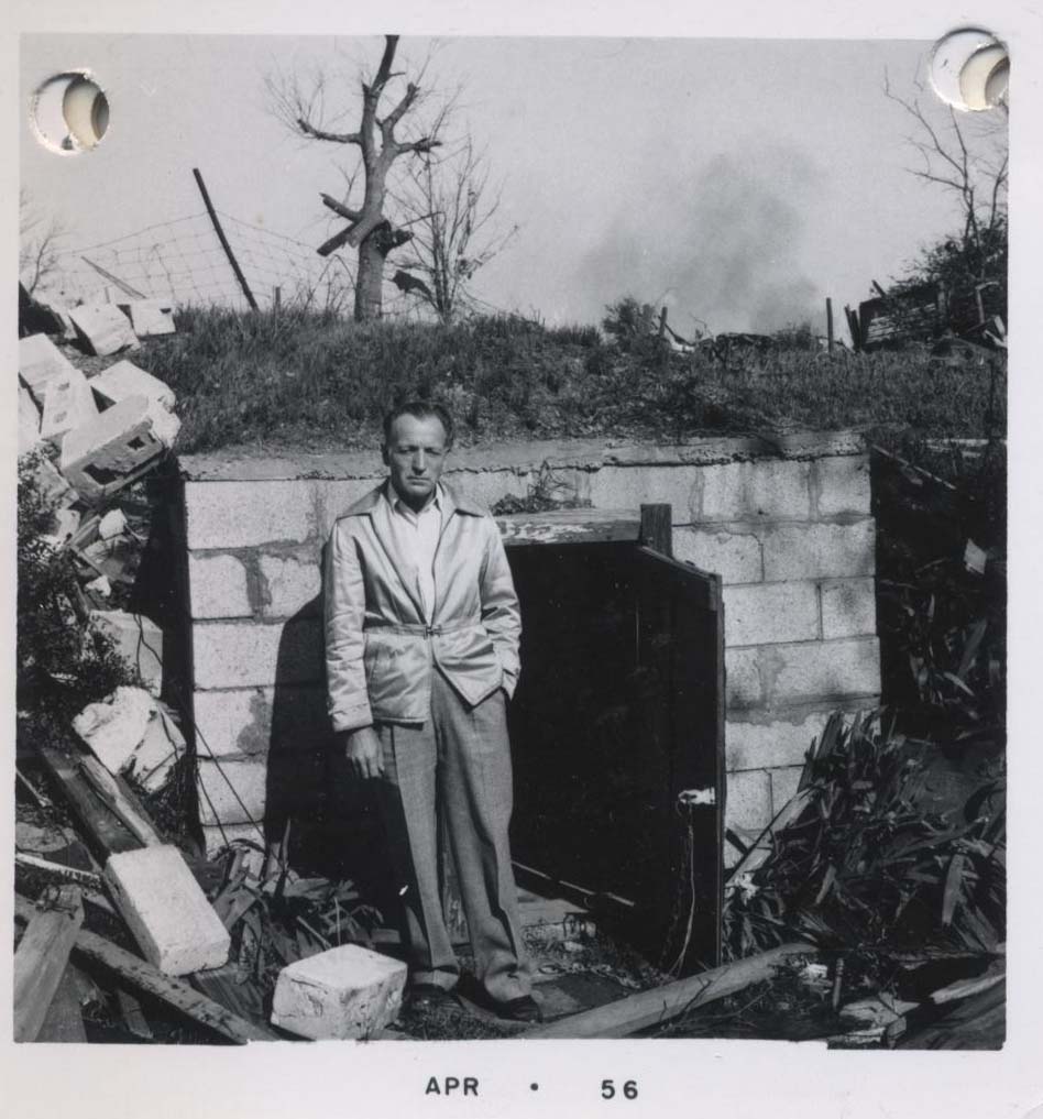
Same as #9, but looking more SSW. Man in photo lost 3 members of his family in home about two blocks to the right
|
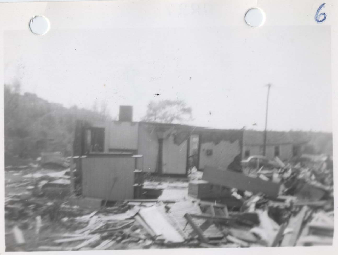
Looking NE. Entire building at right was removed. Several total losses in left center of photo in McDonald Chapel
|
|
Same as #8, looking same direction
|
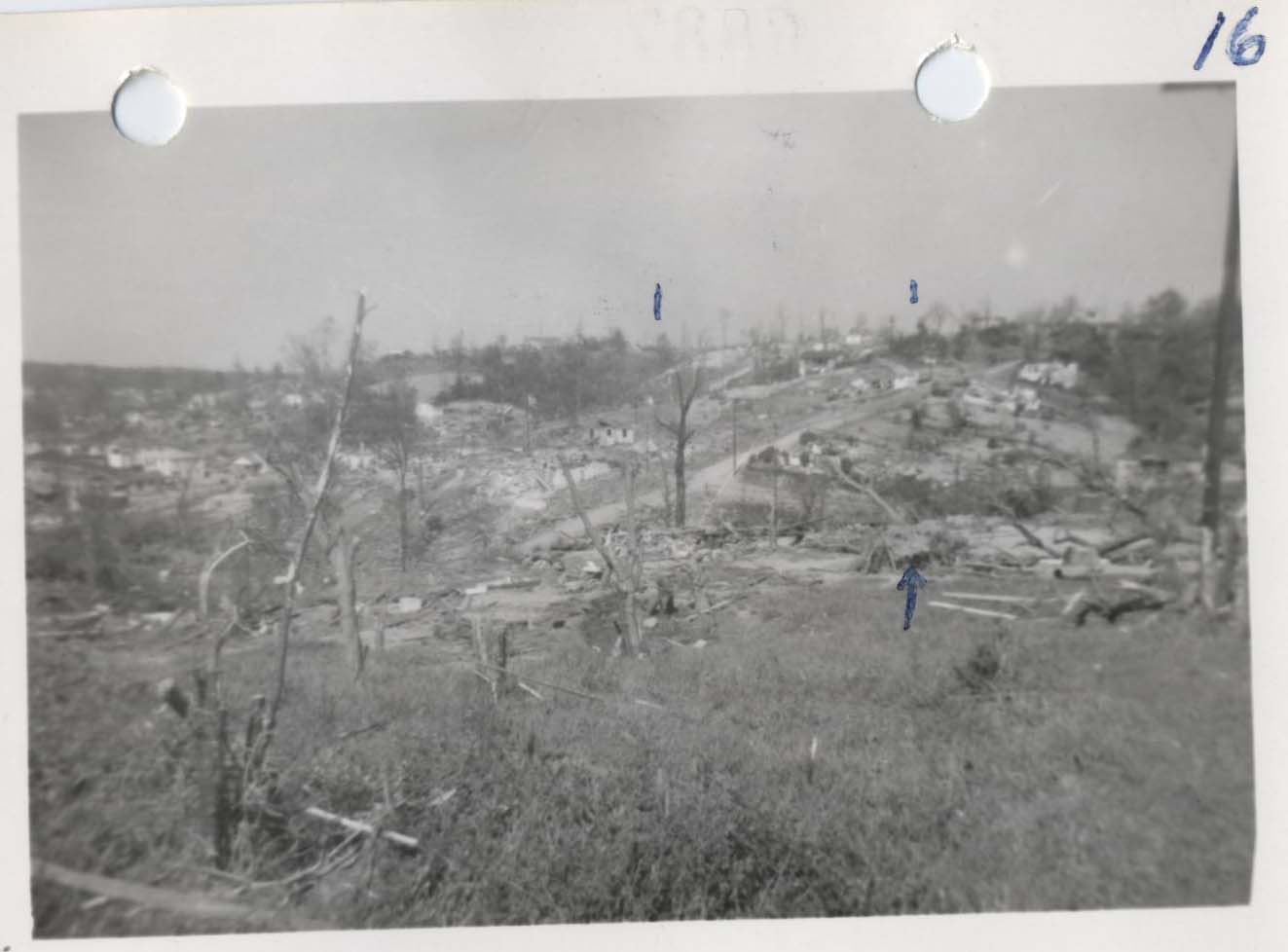
Looking NE, in general direction of #10. Again, width of path can be seen as it crosses the ridge in background, marked by two ink marks
|
| |
|
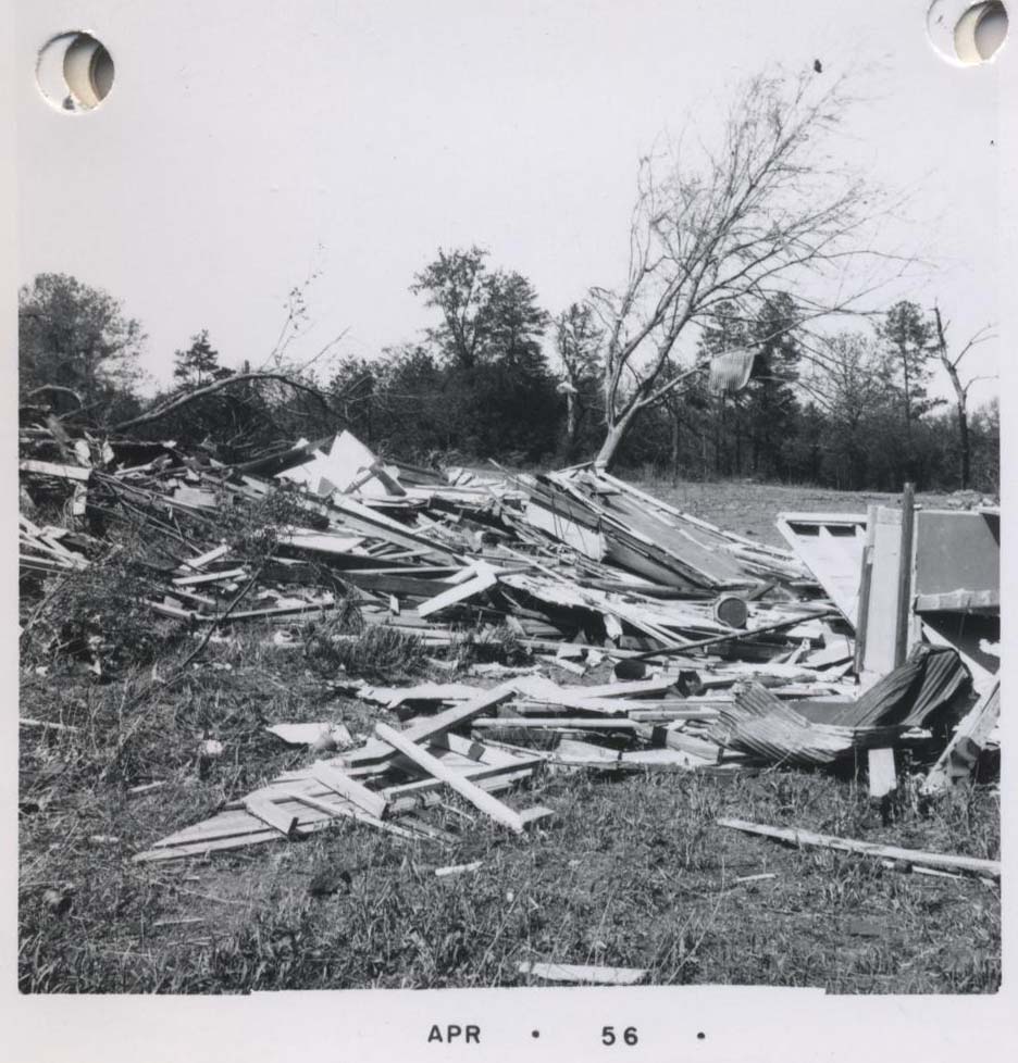
Additional Damage Pictures
|
|
|
|
|
|
|
|
|
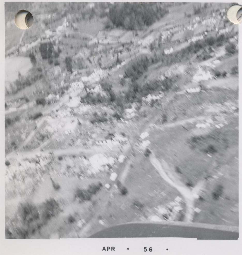
Aerials were taken, but this was the best one, as the rest were even more blurry
|
| |
|
Synoptic Set Up (Hand Written Analyses from April 15th, 1956)
|
|
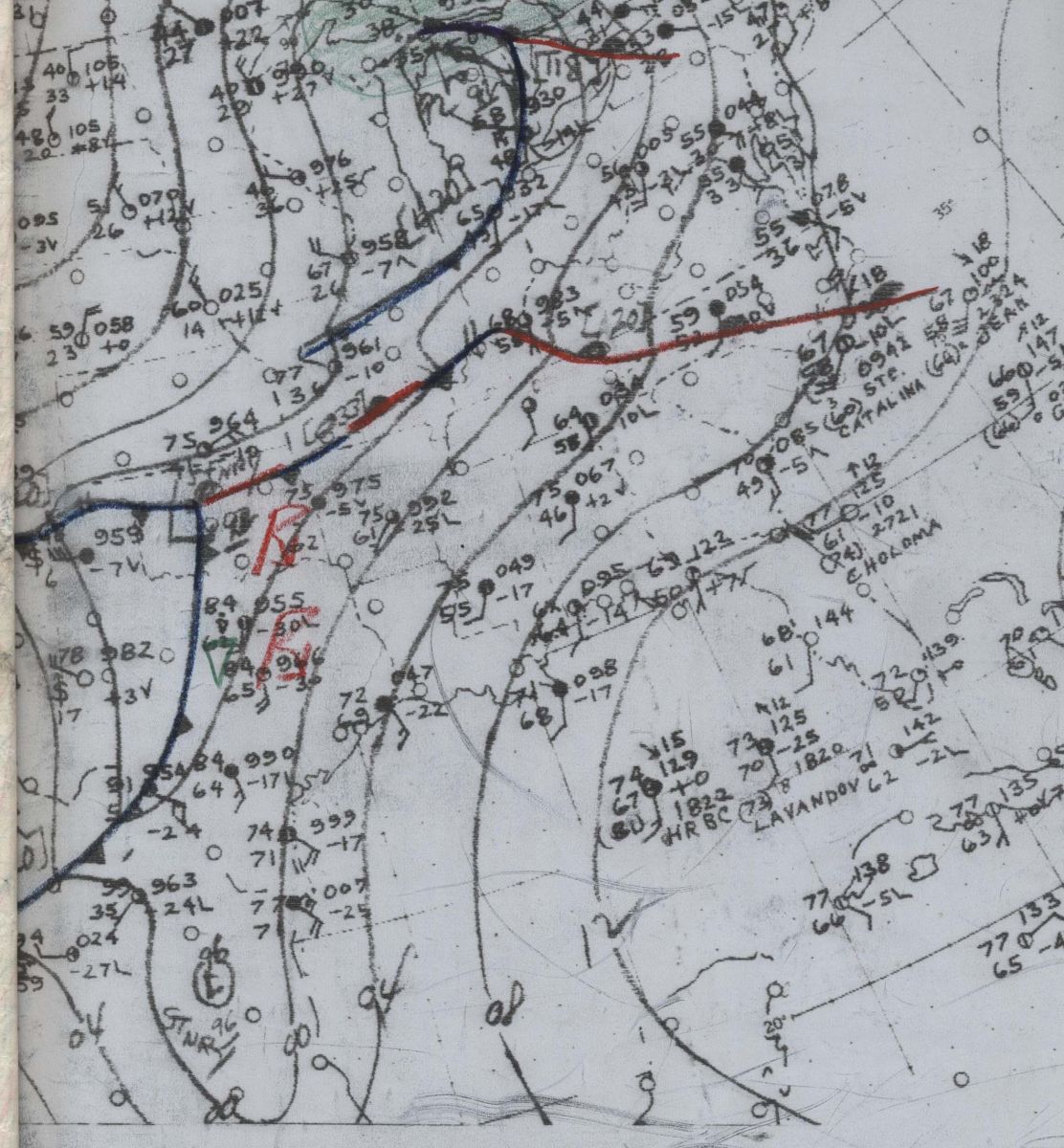
Surface at 10 pm, Saturday, April 14th
|
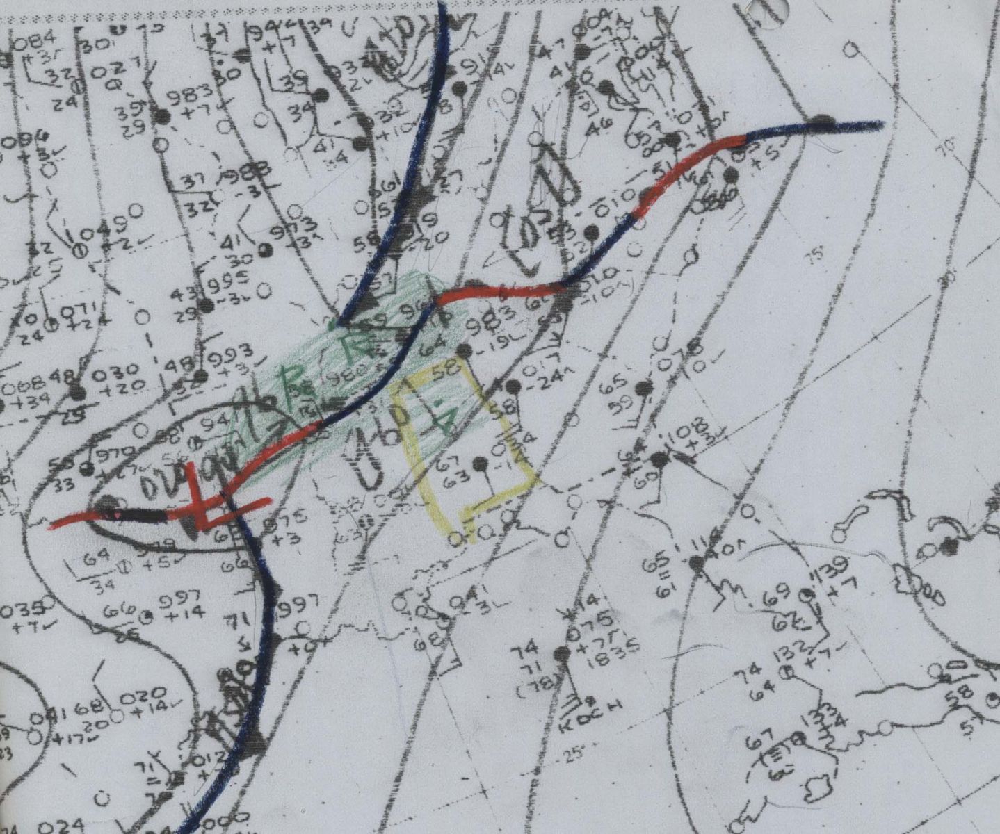
Surface at 10 am, Sunday, April 15th
|
|
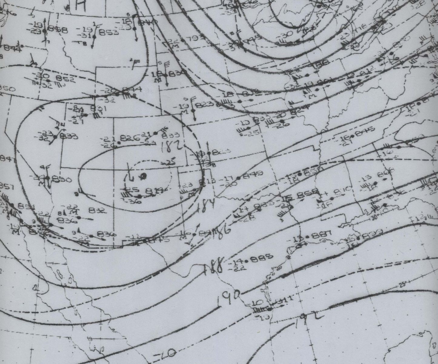
500mb at 10 pm, Saturday, April 14th
|
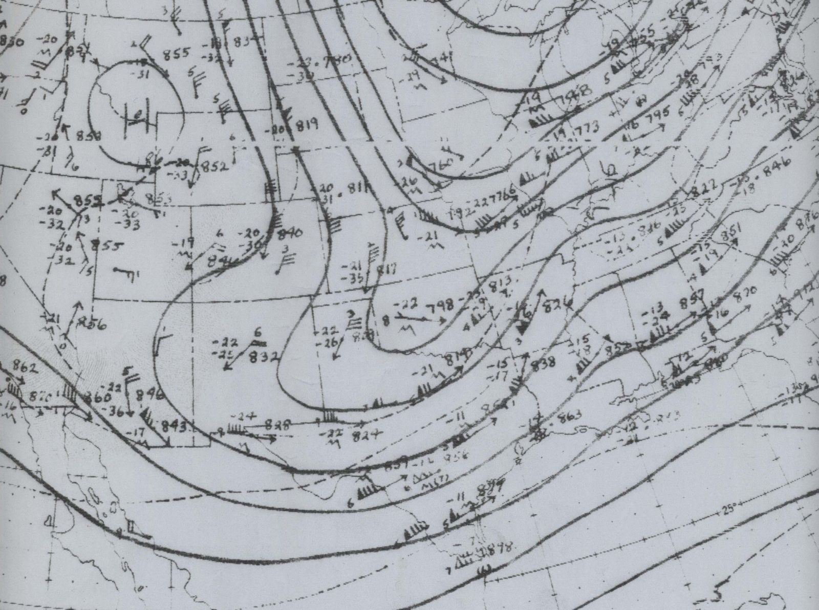
500mb at 10 am, Sunday, April 15th
|
| |
|
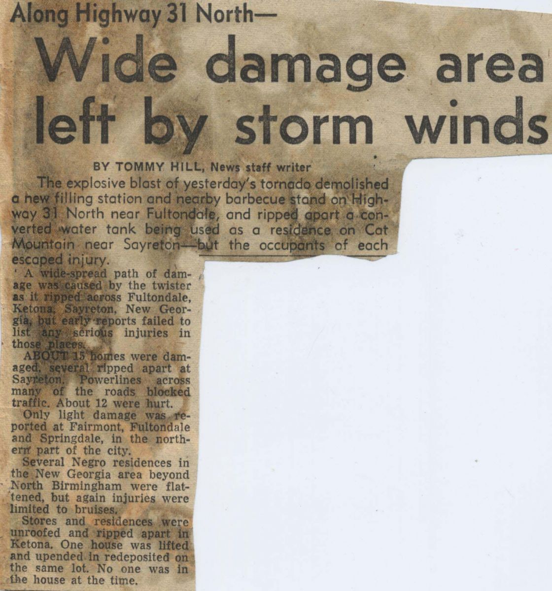
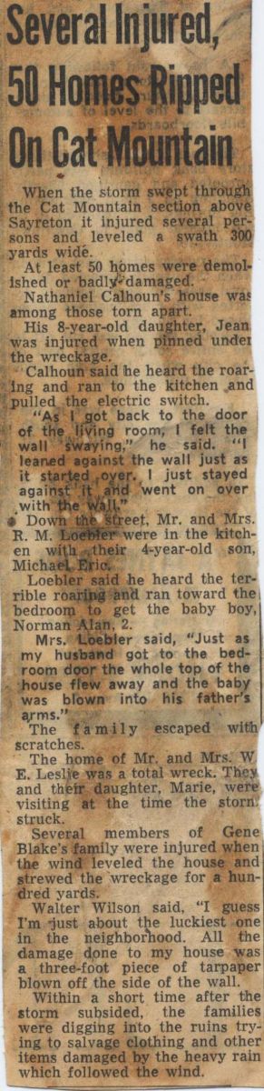
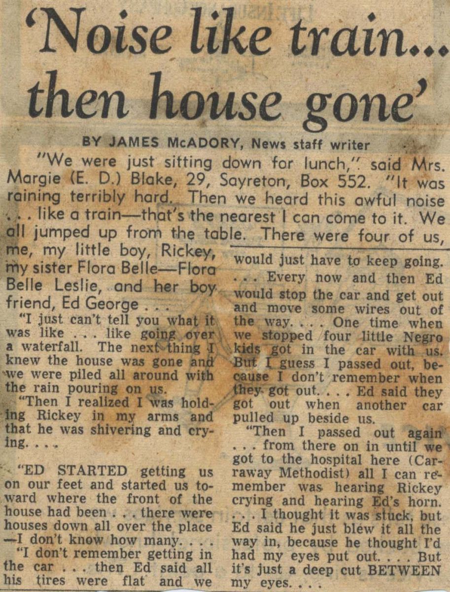
Local Newspaper Accounts of Storm
(from The Birmingham News on April 16, 1956)
|
|
|
|
|
|