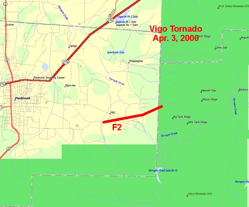
Vigo Tornado - April 3, 2000
| Storm Survey | |||||||||
|---|---|---|---|---|---|---|---|---|---|
|
A National Weather Service meteorologist surveyed the damage in extreme northeast Calhoun County and determined that it was caused by a tornado.
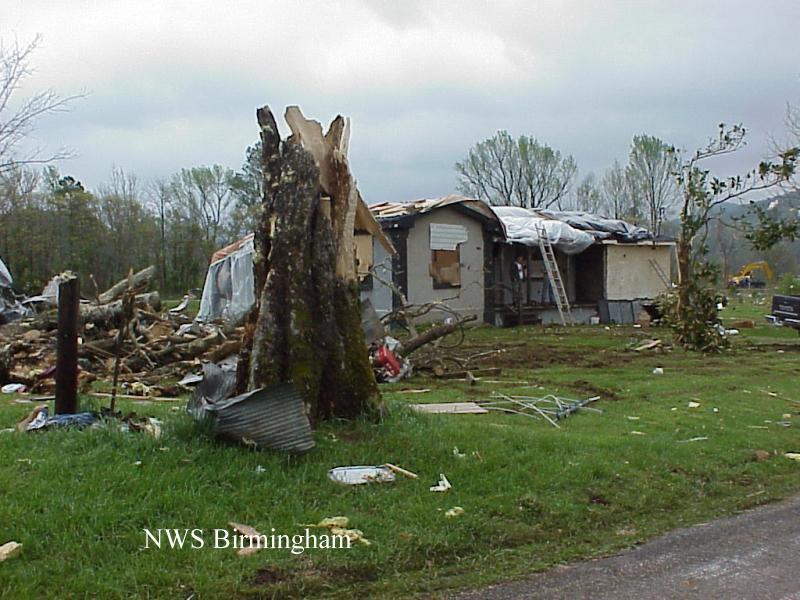
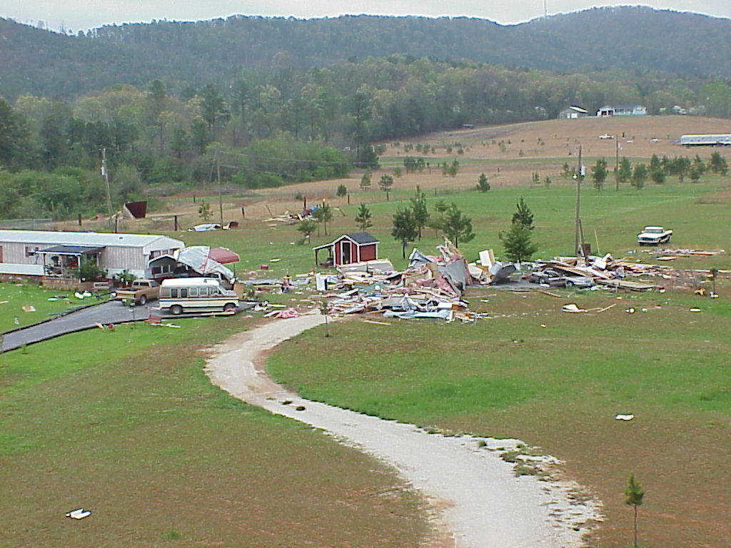
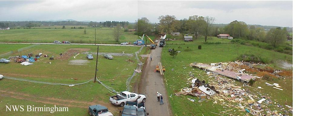
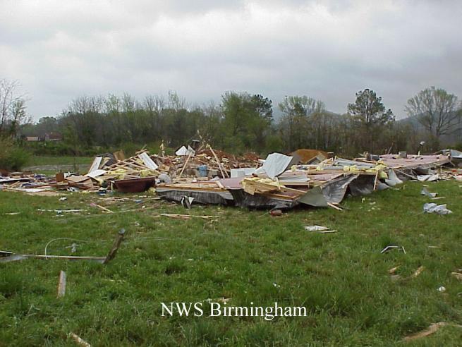
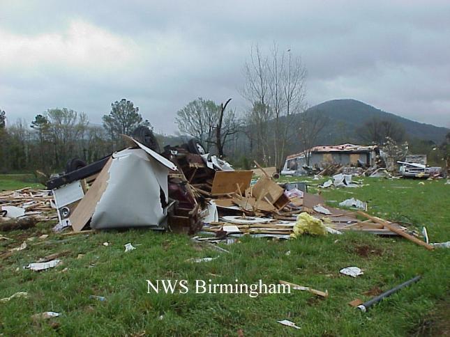
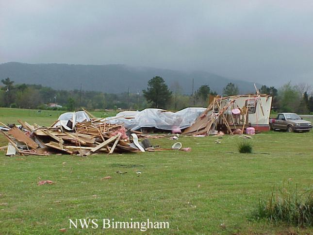
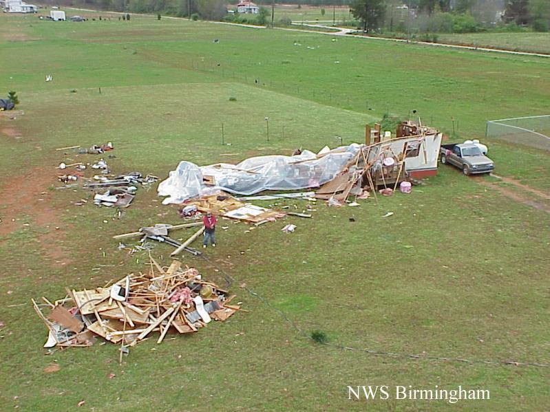
The tornado began at 12:34 am just south of Vigo at the end of Helen Drive. Vigo is located east of Piedmont, AL. The tornado traveled on a northeast track crossing Bethel The tornado path was 1.9 miles long and approximately 100 yards wide. Most of the property that was damaged or destroyed was located in the area of Helen Drive and Bethel Church Road. Six mobile homes were destroyed along with two houses, one of which was under construction. One elderly woman was killed and six people were injured in that area. The woman was one of three people in a mobile home whose frame was thrown approximately 130 feet by the force of the tornado. The tornado was classified an F2 on the Fujita scale for tornado classification putting it into the strong category. Wind speeds associated with an F2 range from 113 to 157 miles an hour. Damage in the area suggested the wind speed in this case was probably on the lower end of this range. Calhoun County was within Tornado Watch number 149 valid from 10 pm to 4 am. A Severe Thunderstorm Warning was issued for Calhoun County at 11:47 pm and was upgraded to a Tornado Warning at 12:18 am. Local emergency management officials sounded their outdoor warning sirens immediately upon receipt of the warning. All images are from the Vigo, Alabama area. Click on an image to see a large one. Special thanks: Special thanks are extended to Utilities Construction Company, Inc., Charleston, SC, and Alabama Power Company for their cooperation in documenting the tornado destruction from one of their bucket trucks. Special thanks also to Richard Freeman, Piedmont Emergency Management, for his assistance in touring the damage area and for providing information to the survey.
|
|
|||||||