|
A warm front moved northward across Central Alabama late on March 30th and into the early morning hours on March 31st. The atmosphere changes drastically with much increased moisture. A low pressure area developed along the front and moved west to east across northern Alabama. This feature pooled the available instability just south of the front and added just enough shear for some rotating and organized storms. Subsequently, 3 weak and short-lived tornadoes developed. The tornadoes affected Marion, Winston and Blount Counties.
Due to the strong southerly winds and lift near the front, heavy rainfall was observed from northern Alabama into the Ohio Valley. Areas from Lamar and Marion Counties eastward to Etowah and Cherokee Counties received widespread 1 to 3 inches of rainfall in a relatively short period of time. Some localized areas received 5 to 6 inches of rain. These amounts produced flash flooding in several locations where roads were washed out and or became impassable. Additionally, many local creeks and streams flooded and this eventually lead to river and lake flooding.
| Interactive Tornado Map |
|
**The data below are considered PRELIMINARY.** |
|
|
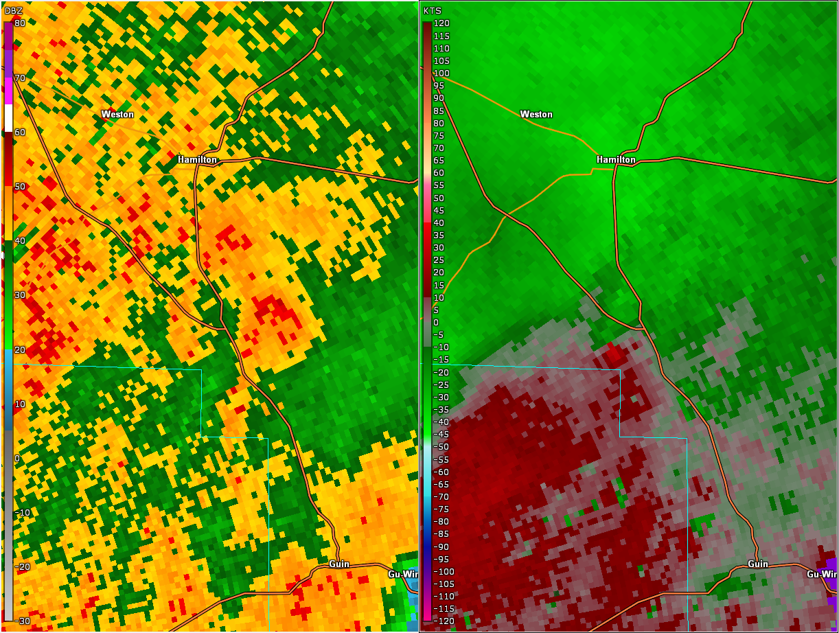
Hamilton EF-0 Tornado (Marion County)
|
|
|
||||||||||||||
|
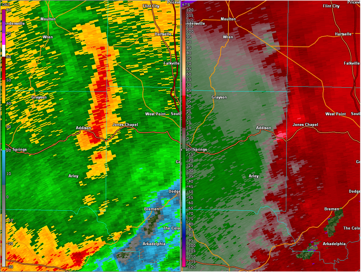
Nesmith EF-1 Tornado (Winston County)
|
|
|
||||||||||||||
|
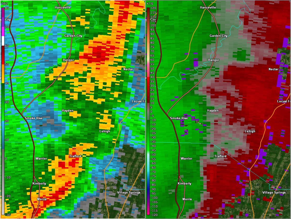
Hayden EF-0 Tornado (Blount County)
|
|
|
||||||||||||||
|
|
|
|
|
|
|
|
|
|
|
|