NWS Birmingham, Alabama
Weather Forecast Office
March 2, 2001...Montgomery Tornado
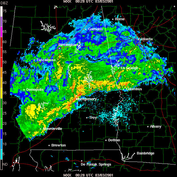
Meteorologists from the National Weather Service, with assistance from the Emergency Management director of Montgomery County, conducted a storm survey of the March 2, 2001, tornado that occurred on the east side of Montgomery.
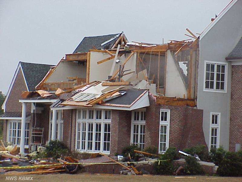
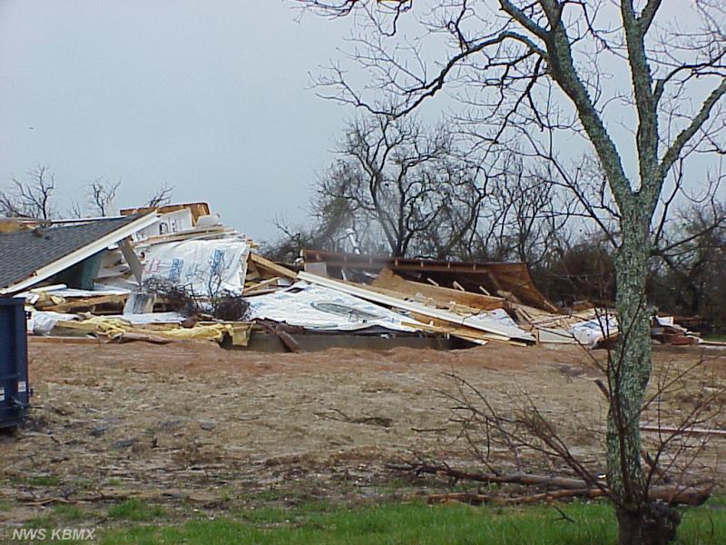
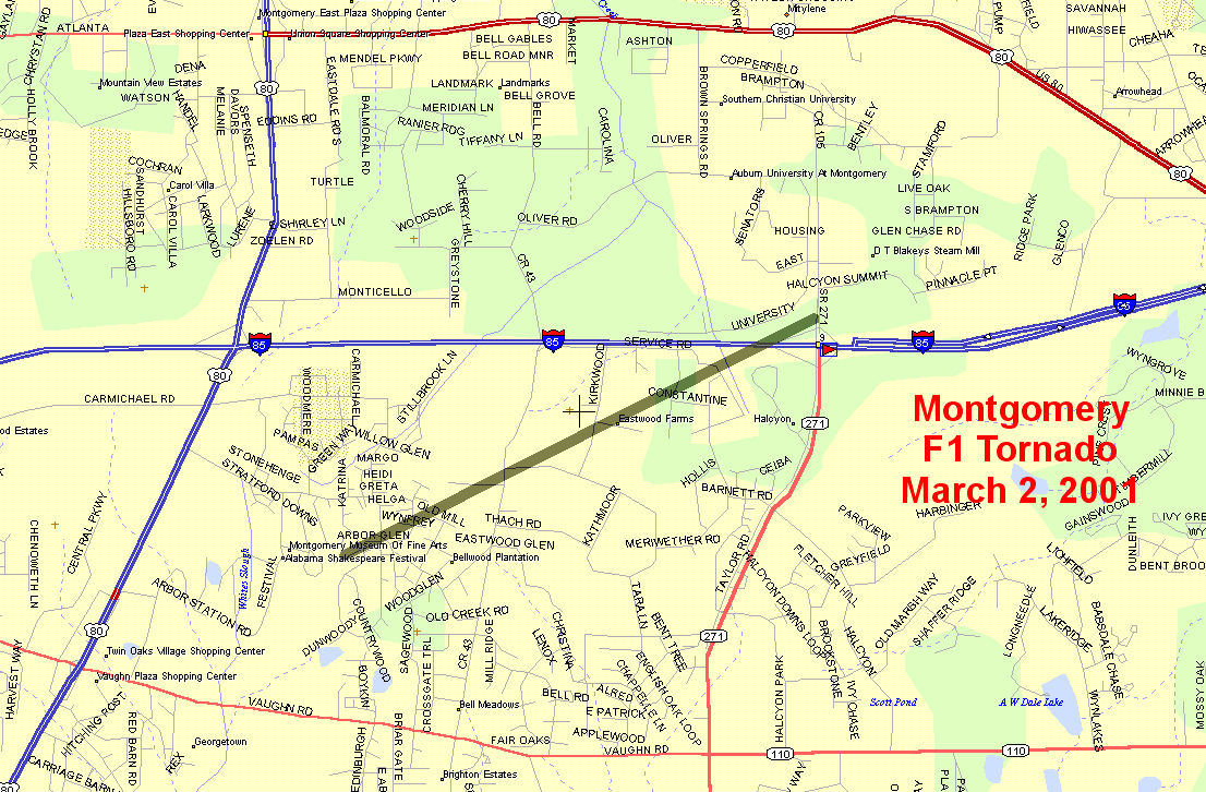
The tornado began in the Woodmere area where a number of houses sustained roof damage primarily in the form of lost shingles, fences were downed, and small trees were uprooted. The tornado moved northeast and tracked through the Beauvoir Lake subdivision where one house under construction was flattened and another house was partially deroofed.
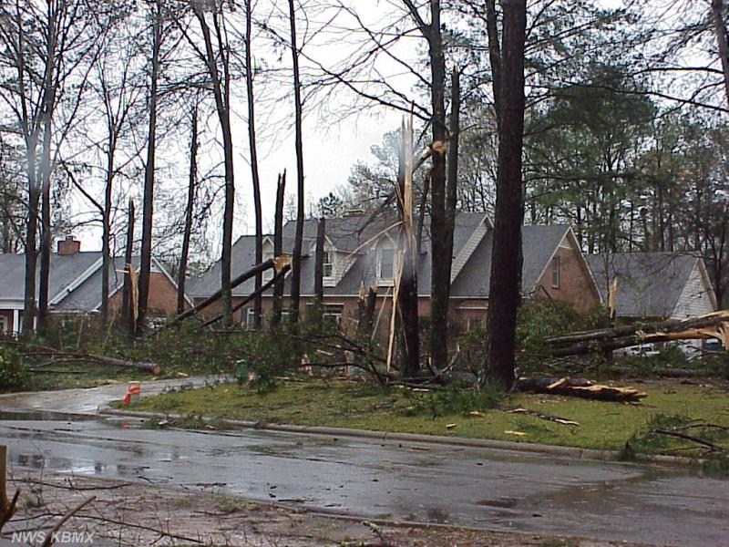
From Beauvoir Lake subdivision the tornado downed trees and removed shingles from house roofs in the Halcyon area. The tornado crossed Interstate 85 just west of the Taylor Road exit snapping off numerous pine trees in the interstate median. The tornado apparently ended at Taylor Road just north of the interstate.
On the Fujita Scale for tornado classification, the tornado was rated at F1 based on structural damage in the Beauvoir Lake area. Much of the damage along the track was in the F0 category. The Fujita scale ranges from F0 for the weakest tornadoes to F5 for the most intense tornadoes. Wind speeds associated with this ranking fall into the range from 73 mph to 112 mph.
The tornado track was 2.2 miles in length and estimated to be about 100 yards wide at it's widest point. The tornado began at 6:29 PM and ended at 6:33 PM. No injuries or deaths were reported with this storm. Click on the map for a larger view of the tornado track.
Tornado watch number 41 that included Montgomery County was issued at 1:31 PM CST valid until 7:00 PM CST. A tornado warning was issued for Montgomery county at 6:06 PM valid until 6:45 PM.
Click Here to see the Storm Total Rainfall amounts with this event.
Current Hazards
National Outlooks
Tropical
Local Storm Reports
Public Information Statement
Graphical Hazardous Weather Outlook
Current Conditions
Regional Weather Roundup
Rivers and Lakes
Drought Monitor
Forecasts
Air Quality
Fire Weather
Aviation Weather
Graphical Forecasts
Forecast Discussion
Climate and Past Weather
Past Events
Storm Data
Tornado Database
Daily Rainfall Plots
Tropical Cyclone Reports
Monthly Climate
Annual Climate
Warnings and Other Products
Tornado Warnings
Severe Thunderstorm Warnings
Flash Flood Warnings
Winter Weather Warnings
Special Weather Statements
Non-Precipitation Warnings
Flood/River Flood Warnings
Productos en Español
Conciencia y Preparación
Previsión de 7 Días
Weather Safety
NOAA Weather Radio
Severe Weather Preparedness
Severe Safety Rules
Tornado Safety Rules
Severe Safety w/ ASL
Awareness Weeks
Severe Weather
Hurricane Preparedness
Summer Safety Campaign
Winter Weather
US Dept of Commerce
National Oceanic and Atmospheric Administration
National Weather Service
NWS Birmingham, Alabama
465 Weathervane Road
Calera, AL 35040
205-664-3010
Comments? Questions? Please Contact Us.


