NWS Birmingham, Alabama
Weather Forecast Office
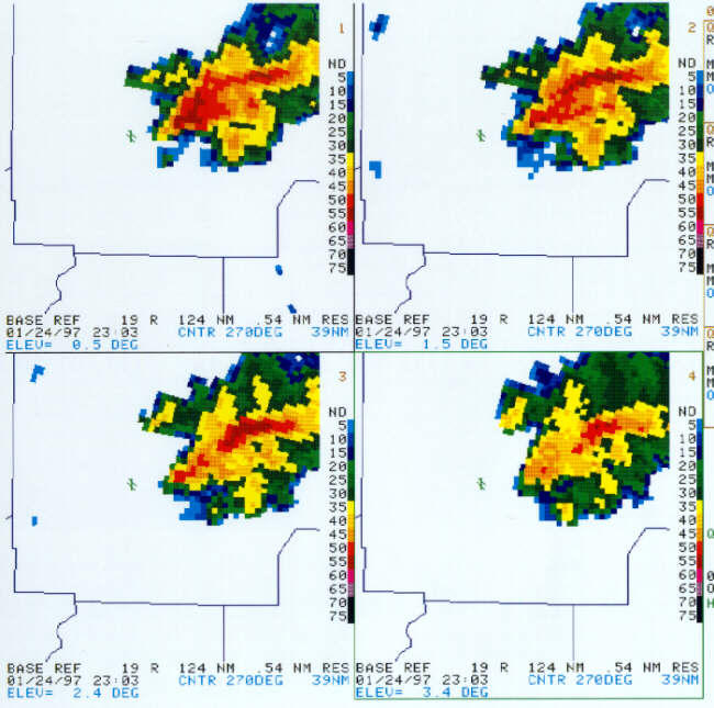
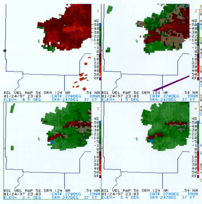
Radar Images 2303Z
 |
| At 2303Z the reflectivity data had a definite spiral look to it, as the concavity on the southern flank became sharper. 55+ dBZ was no longer detected on the southern flank as it had been. |
 |
| A velocity couplet was evident at 0.5 and 1.5 degrees, but it was up at 2.4 and 3.4 degrees that the Vr equaled 41 and 36 kts respectively (the couplet was gate-to-gate). The storm-relative inbound velocities were 50+ kts at these two higher slices. A TVS was detected with this circulation at the end of the volume scan (around 2308Z). |
Current Hazards
National Outlooks
Tropical
Local Storm Reports
Public Information Statement
Graphical Hazardous Weather Outlook
Current Conditions
Regional Weather Roundup
Rivers and Lakes
Drought Monitor
Forecasts
Fire Weather
Aviation Weather
Graphical Forecasts
Forecast Discussion
Air Quality
Climate and Past Weather
Past Events
Storm Data
Tornado Database
Daily Rainfall Plots
Tropical Cyclone Reports
Monthly Climate
Annual Climate
Warnings and Other Products
Tornado Warnings
Severe Thunderstorm Warnings
Flash Flood Warnings
Winter Weather Warnings
Special Weather Statements
Non-Precipitation Warnings
Flood/River Flood Warnings
Productos en Español
Conciencia y Preparación
Previsión de 7 Días
Weather Safety
NOAA Weather Radio
Severe Weather Preparedness
Severe Safety Rules
Tornado Safety Rules
Severe Safety w/ ASL
Awareness Weeks
Severe Weather
Hurricane Preparedness
Summer Safety Campaign
Winter Weather
US Dept of Commerce
National Oceanic and Atmospheric Administration
National Weather Service
NWS Birmingham, Alabama
465 Weathervane Road
Calera, AL 35040
205-664-3010
Comments? Questions? Please Contact Us.

