 |
Preparedness Guide for Schools
Todd Shea Warning Coordination Meteorologist National Weather Service La Crosse Last Updated: 10/19/15 |
 Introduction
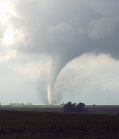
Severe weather preparedness is essential for ALL schools and should be taken seriously. There have been numerous examples through the years of storms hitting schools (including loss of life!).
These guidelines were developed for school administrators or Emergency Management personnel to help develop a preparedness plan that fits their specific scenario. There are a few "disclaimers" that should be noted up front:
A unique plan should be developed for your school using these guidelines in cooperation with your experience and local considerations.
If there is one phrase, that works in nearly all scenarios, it is - "Put as many walls between you and the storm as possible".

 Before the Storm (Prepare / Practice)
Probably the most important part in this process is being ready BEFORE severe weather strikes. Be pro-active and take it seriously.
1) Educate yourself
Preparedness is easier when you understand the possible threat(s) and "lingo" used in the business. Do you know what a "WATCH" or "WARNING" are? Educate yourself and your staff on severe weather and how the warning process works. This will help you understand the range of possibilities and limitations you have to plan for.
Hazardous Weather Outlooks (HWO) are available from the National Weather Service (NWS) that can alert you of expected hazards out through 7 days. Outlooks are available in both graphical form or a text format. These outlooks are broadcast over NOAA Weather Radio at the top and bottom of every hour (plus or minus a minute or two). You can also have these outlooks sent to your e-mail address. If you would like your e-mail address added to our list, send an e-mail to the La Crosse NWS Warning Coordination Meteorologist.
2) Develop an Action Plan
If you currently do not have a severe weather action plan for your school, this will be a large part of your preparedness work. In fact, this entire document could be considered part of the plan. Your local or county Emergency Management director or local National Weather Service (NWS) office can assist in this process and provide guidance. Read the "disclaimers" listed in the introduction section again. The plan for your school will have to be tailored to your particular set up.
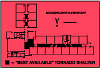
Physical Layout of School/Buildings - Closely examine the layout of your structure. You'll need to determine your designated shelter areas. Use a map of the school and physically tour the building(s) with your top school officials. You may also want to invite local fire department personnel, Emergency Management, or a member of the NWS to assist. Ideally students should be moved to the lowest level(s) possible, to interior rooms away from exterior walls and windows that may certainly fail in the event of a tornado or strong, damaging winds.
 Shelter Considerations - There are many things to consider when mapping out your shelter areas. Also take into account non-routine school activities or other times the buildings are being used.
Notification - Develop a method to notify every one to seek shelter. It could be a speaker system, special tone, or bell but ensure you have a backup method (air horn or megaphone) in case you lose electricity. Also ensure every one clearly knows what the notification signal is. Make sure the shelters are clearly marked as such, with arrows directing people to the "safer" areas.
School Bus Considerations - Include in your plan what bus drivers should do while at the school or during transportation.
 3) Practice & Review Your Action Plan
Your plan should be reviewed at least annually, and anytime changes are made to the physical building, shelters, or classroom sizes. A good chance to practice is during the annual statewide Tornado Drills held in late March or April each spring.
Inform parents of your action plan which might involve students remaining or delayed at school beyond regular hours if severe weather is threatening. Some schools will even cancel classes early on higher threat days. (NOTE: The debate on whether kids are safer at home or at school is on-going and varies on geographic area of the country and economic surroundings.)
4) Source of Weather Information
You can monitor forecasts and predicted severe weather by using a decision support page like - https://www.weather.gov/arx/dss_schools
Consider having multiple sources of weather information, including commercial radio, television, private services, a community outdoor siren, or the Internet. You can sign up to receive text messages of watches and warnings from most television stations.
You should also have a NOAA Weather Radio as a direct source of watches and warnings from the National Weather Service. A weather radio continuously monitors the issuance of these types of alerts and can give you advance notice allowing you time to plan or activate your action plan. A desktop model can be placed in a central office allowing full monitoring by administrative staff. A weather radio also has a battery back-up in case of power loss. Be sure to educate your staff on what to listen for when the radio activates its alert tones. (A weather radio can also be used during the winter months to monitor wind chill conditions during extreme cold.)
A program through Homeland Security has provided weather radios to numerous schools across the country. Check this web site for additional information on this program - https://public-alert-radio.nws.noaa.gov/proginfo.htm.
Make sure the weather radio or other source of weather information is available even during non-routine school activities. In 2002, a high school in north central Wisconsin was hit by a tornado but the school's football team that was holding a practice did not hear the warning because the weather radio was locked in the office.
Like other aspects of proper preparation, a pro-active approach is needed when monitoring local weather conditions. Although warning lead times are increasing by the National Weather Service, you should not assume you will always receive a warning or "heads up" of threatening weather. If you spot a tornado or severe weather approaching, you should follow your action plans even if a warning is not heard. Consider attending a SKYWARN severe weather spotter training class or designate staff members as spotters around your school. Bus drivers can benefit from this type of training as well so they can learn basic cloud formations that may be pre-cursors of impending severe weather. Spotter training is held in March and April each year.
5) Other Preparation Ideas

 During the Storm (Act)
1) Monitor Weather Conditions
You can monitor forecasts and approaching severe weather by using our decision support page at: https://www.weather.gov/arx/dss_schools
If your school has a designated storm spotter, have them be in position. Short range radios might be a good idea for communication between the spotter(s) and school administrator or office.
If amateur radio operators or fire department personnel do storm spotting in your community, their radio traffic can be monitored via a scanner. That may be another option for real-time storm conditions.
2) ACT!
Use your action plan by ensuring:
If time allows, take note of problems that develop while the plan is being used.
Do not go near windows if severe weather is striking. Do not try to open windows or doors to equalize pressure. The pressure difference in a storm is not what damages buildings - it is the strong wind and flying debris associated with the storm or tornado that will cause damage and could explode glass or exterior walls.
Continue to monitor weather conditions until you are sure thunderstorms have passed. Most communities do not use sirens for "all clear" notification. If the sirens continue, the threat may still be there.
School Bus Considerations -

 After the Storm (Review)
1) Damage Assessment
2) All Clear
3) Post Mortem Review
 Reference Material