This was a very lengthy event, with initial flooding beginning on April 15th. The last site finally dropped below flood stage on May 18th. Some tributaries went above flood stage more than once, and required additional warnings.
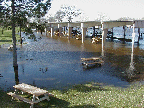 Copeland Park Pavilion in La Crosse. |
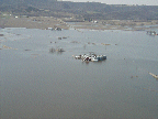
|
 Riverside park in La Crosse. |
|
|
|
| River and Station | Flood Stage (ft) | Above Flood Stages (dates) |
Crest | ||
|---|---|---|---|---|---|
| From: | To: | Stage (ft) | Date (time CDT) | ||
| Cedar River at... | |||||
| Lansing, MN | 18 ft | 4/07 | 4/08 | 18.72 ft | 4/07 at 530 pm |
| 4/11 | 4/12 | 18.77 ft | 4/12 at 830 am | ||
| Austin, MN | 15 ft | 4/07 | 4/08 | 16.40 ft | 4/07 at 500 pm |
| 4/11 | 4/13 | 16.80 ft | 4/12 at 800 am | ||
| Charles City, IA | 12 ft | 4/05 | 4/09 | 14.04 ft | 4/06 at 100 am |
| 4/05 | 4/09 | 17.79 ft | 4/08 at 500 pm | ||
| 4/12 | 4/14 | 17.31 ft | 4/12 at 700 pm | ||
| Turtle Creek at Austin, MN |
10.5 ft | 4/04 | 4/08 | 11.20 ft | 4/05 at 1258 pm |
| 4/04 | 4/08 | 12.07 ft | 4/07 at 400 pm | ||
| 4/11 | 4/13 | 11.89 ft | 4/12 at 445 am | ||
| Dobbins Creek at Austin, MN |
11.5 ft | 4/11 | 4/12 | 12.57 ft | 4/12 at 1215 am |
| South Branch Root River at... | |||||
| Preston, MN | 937 ft | 4/07 | 4/08 | 939.12 ft | 4/07 at 345 pm |
| * * * | * * * | 936.86 ft | 4/12 at 1100 am | ||
| Lanesboro, MN | 12 ft | * * * | * * * | 11.58 ft | 4/07 at 1115 pm |
| * * * | * * * | 9.72 ft | 4/12 at 430 pm | ||
| Root River at... | |||||
| Houston, MN | 15 ft | 4/08 | 4/08 | 15.00 ft | 4/08 at 500 pm |
| 4/13 | 4/13 | 15.51 ft | 4/13 at 1200 pm | ||
| Hokah, MN | 47 ft | 4/06 | 4/11 | 49.00 ft | 4/06 at 800 am |
| 4/06 | 4/11 | 51.00 ft | 4/09 at 100 am | ||
| 4/11 | 4/16 | 51.20 ft | 4/13 at 1030 am | ||
| Upper Iowa River at... | |||||
| Decorah, IA | 12 ft | * * * | * * * | 9.70 ft | 4/08 at 430 pm |
| * * * | * * * | 9.73 ft | 4/13 at 1112 am | ||
| Dorchester, IA | 14 ft | 4/07 | 4/09 | 16.15 ft | 4/09 at 600 am |
| 4/13 | 4/14 | 15.93 ft | 4/13 at 1100 pm | ||
| Turkey River at... | |||||
| Garber, IA | 17 ft | * * * | * * * | 15.07 ft | 4/07 at 1200 am |
| * * * | * * * | 16.14 ft | 4/12 at 1100 pm | ||
| Trempealeau River at... | |||||
| Dodge, WI | 9 ft | * * * | * * * | 8.05 ft | 4/09 at 900 pm |
| 4/14 | 4/15 | 9.15 ft | 4/14 at 500 pm | ||
| Black River at... | |||||
| Neillsville, WI | 18 ft | * * * | * * * | 14.60 ft | 4/07 at 1100 am |
| * * * | * * * | 13.39 ft | 4/12 at 600 pm | ||
| Black River Falls, WI | 47 ft | 4/06 | 4/09 | 48.10 ft | 4/06 at 1100 am |
| 4/06 | 4/09 | 52.08 ft | 4/07 at 900 pm | ||
| 4/11 | 4/14 | 51.48 ft | 4/12 at 1000 am | ||
| Galesville, WI | 12 ft | 4/08 | 4/11 | 13.78 ft | 4/09 at 1000 am |
| 4/13 | 4/15 | 13.81 ft | 4/14 at 500 am | ||
| Kickapoo River at... | |||||
| Viola, WI | 761 ft | 4/12 | 4/13 | 761.10 ft | 4/14 at 200 pm |
| Soldiers Grove, WI | 723 ft | 4/14 | 4/14 | 723.10 ft | 4/14 at 400 am |
| Gays Mills, WI | 698 ft | * * * | * * * | 696.50 ft | 4/09 at 715 am |
| 4/13 | 4/15 | 699.10 ft | 4/14 at 200 pm | ||
| Steuben, WI | 12 ft | * * * | * * * | 10.69 ft | 4/09 at 830 pm |
| 4/15 | 4/17 | 11.62 ft | 4/15 at 1000 pm | ||
| Zumbro River at... | |||||
| Rochester, MN | 963 ft | 4/12 | 4/12 | 963.64 ft | 4/12 at 639 am |
| Zumbro Falls, MN | 18 ft | 4/08 | 4/09 | 18.81 ft | 4/08 at 300 pm |
| 4/12 | 4/14 | 23.06 ft | 4/13 at 100 am | ||
| Theilman, MN | 38 ft | 4/08 | 4/09 | 38.50 ft | 4/09 at 400 am |
| 4/12 | 4/14 | 40.53 ft | 4/13 at 915 am | ||
| Wisconsin River at... | |||||
| Muscoda, WI | 9 ft | * * * | * * * | 8.31 ft | 4/16 at 300 pm |
| Mississippi River at... | |||||
| Lake City, MN | 16 ft | 4/11 | 5/18 | 20.13 ft | 4/16 at 1100 pm |
| 2nd | Crest | 19.87 ft | 4/28 at 600 am | ||
| Wabasha, MN | 12 ft | 4/10 | 5/16 | 18.22 ft | 4/16 at 1100 am |
| 2nd | Crest | 17.61 ft | 4/28 at 600 am | ||
| Alma, WI | 16 ft | 4/13 | 5/4 | 18.15 ft | 4/16 at 700 pm |
| 2nd | Crest | 17.50 ft | 4/28 at 700 am | ||
| Winona, MN | 13 ft | 4/11 | 5/13 | 20.08 ft | 4/17 at 200 pm |
| 2nd | Crest | 19.52 ft | 4/29 at 200 am | ||
| La Crosse, WI | 12 ft | 4/12 | 5/14 | 16.41 ft | 4/18 at 300 am |
| 2nd | Crest | 15.78 ft | 4/30 at 820 am | ||
| Lansing, IA | 18 ft | 4/16 | 5/11 | 19.93 ft | 4/21 at 100 am |
| McGregor, IA | 16 ft | 4/13 | 5/18 | 23.75 ft | 4/20 at 400 pm |
| Guttenberg, IA | 15 ft | 4/14 | 5/16 | 21.65 ft | 4/22 at 700 am |
* * *: means location did not reach flood stage, or information is not yet available.